(Government of Yukon, Historic Sites Unit)
Background
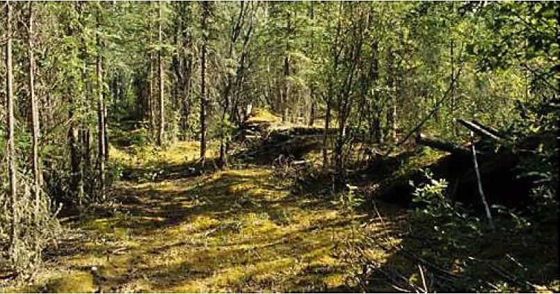
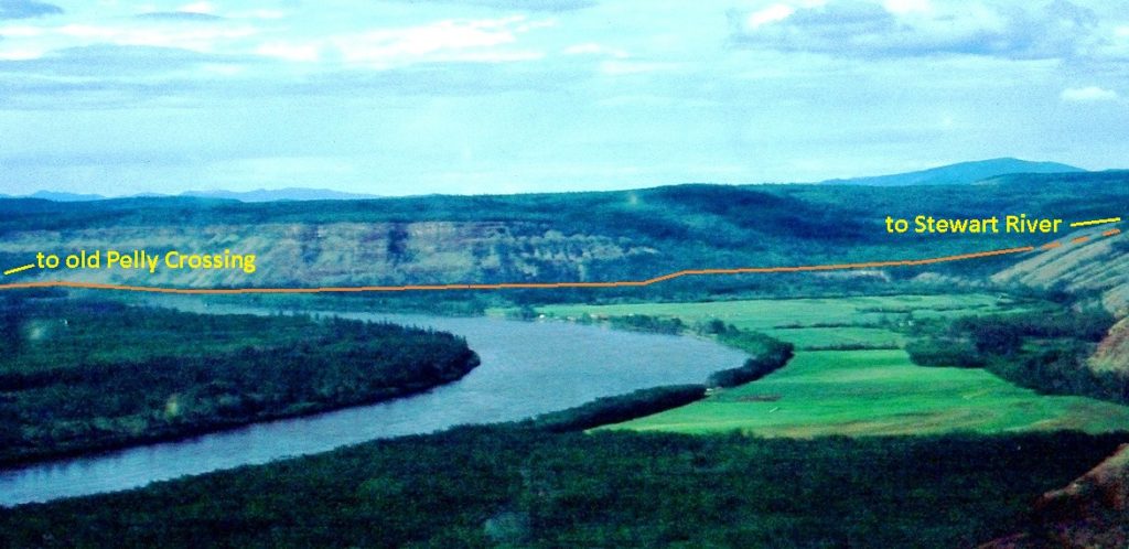
The Dawson-Whitehorse Overland Trail was a mystery road to me as a kid spending summers at the Pelly River Ranch near Fort Selkirk. Dick and Hugh Bradley, owners of the ranch, would occasionally mention the old road that crossed the river just downriver from the ranch and then went up the valley to the northwest. They talked about people travelling on it to the Stewart River and all the way to Dawson City in sleighs and wagons pulled by horses, and staying in roadhouses along the way.
Those stories were hard for a young mind to comprehend because at that time the road was all overgrown and disappeared into the bush to where there was just more bush. The mystery gradually lessened as I came to learn more about this road, that it was built between Dawson and Whitehorse in 1902 as a dependable travel route in the winter. It passed by the Pelly River Ranch, which was already established, about a mile to the west and ran for 56 miles north to the Stewart River and beyond to Dawson.
(Gord Allison photo)
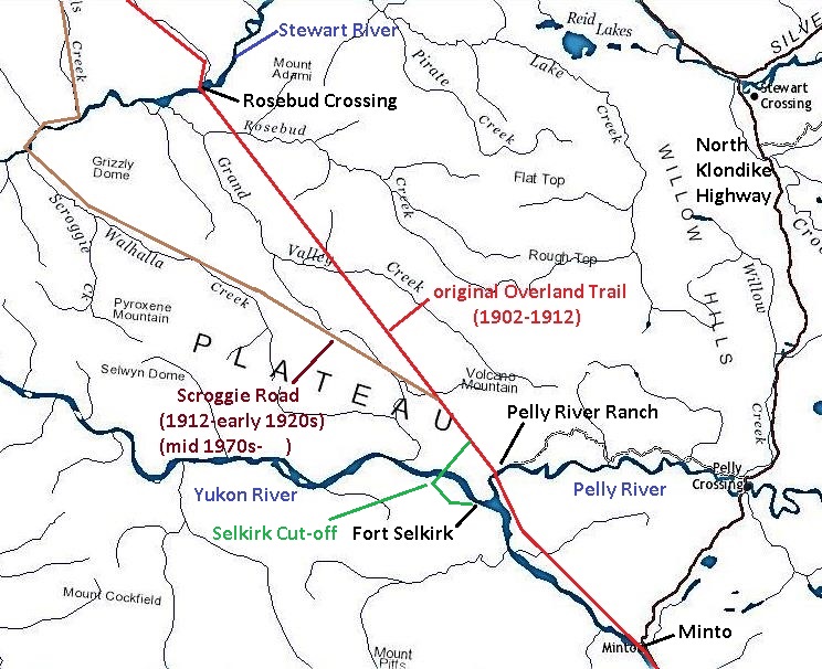
Most of this section of old road north from the ranch to the Stewart River was abandoned in 1912 when a new road was built off of it to access the Scroggie Creek area gold mining creeks. The Scroggie Road, as it was called, forked from the original Overland Trail 10 miles north of the ranch. It in turn was abandoned in the early 1920s when a new road was built from Minto to Mayo, with a later branch to Dawson.
In the mid-1970s, rising gold prices caused the Scroggie Road, including those first 10 miles of original Overland Trail from the Pelly River Ranch, to be reactivated as a winter road for hauling in mining supplies. This use of the road continues on an intermittent basis.
(GeoYukon base map)
When the Yukon Quest dogsled race ran its first event in 1984, it used the Scroggie Road route and still does. In the latter 1980s, conflicts about the lack of snow being left on the road by other users initiated a project by the Quest in 1989 to make a new route from the Pelly River, including clearing the original and overgrown Overland Trail to the Stewart River and beyond for use as the dogsled race. This would have resulted in only about a mile of the race having to travel on the Scroggie Road. However, the project was roughly half completed to the Stewart River when it was stopped, possibly due to the amount of time and work involved to clear the heavy regrowth of vegetation on the road.
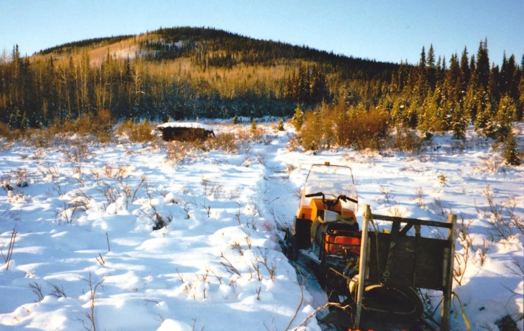
This new access onto the original Overland Trail allowed Hugh Bradley and I an opportunity in February 1989 to make a snowmobile trip to see the road and the country. We went to the end of the trail clearing a few miles north of where the Grand Valley roadhouse and North-West Mounted Police post had once been, a point about 30 miles from the ranch. 58-year old Hugh preferred standing on the back of a sled rather than riding on the snowmachine, and he did that the whole distance, both ways, in chilly weather.
(Gord Allison photo)
Near where we turned around we noticed a squared wooden post sticking up out of the ground. It had the number 28 in Roman numerals and the letter M carved sideways down one side of it. In researching the Overland Trail in recent years, I realized it had to be the 28-mile post, located at about the halfway point between the Stewart and Pelly Rivers.
The Yukon Quest clearing project was the last activity on this section of the original Overland Trail, other than by Peter Watson, a trapper who used it for a few years afterwards. However, due to continual regrowth and clearing work needed to maintain it, he found it necessary to locate a different route into his trapping area.
In today’s context the 45-mile stretch of original Overland Trail from the Scroggie Road fork to the Stewart River is relatively remote and inaccessible. More than 100 years ago, though, for a 10-year period it was alive in the winter with people riding along in stage line sleighs and wagons, staying in roadhouses, and passing by North-West Mounted Police posts.
Most parts of the Overland Trail and its associated developments are somewhat well known in the documentary and photographic record, but the section between the Stewart and Pelly Rivers is not. I have not come across any photographs of it or the developments along it during the time period the road was in use.
The remainder of this article focusses on this piece of original Overland Trail, the longest intact and undisturbed section. A previous article provided an overview and history of the whole Overland Trail between Dawson and Whitehorse (see link at end).
Planning and Marking the Road, 1902
Federal funding was received in May 1902 for construction of the Overland Trail and the Yukon government’s Territorial Engineer William Thibaudeau was tasked with planning the route and marking it out on the ground for the construction crews to follow. He and his small crew began this work in early June, working southward from the goldfields south of Dawson.
Thibaudeau found a route from the goldfields that came down Valley Creek to the north side of the Stewart River, where he selected a crossing about a mile and a half downstream from the creek mouth. This was about 45 miles from the mouth of the Stewart at the Yukon River and 40 miles down from where the river departs from the North Klondike Highway near the present-day McQuesten airstrip and boat launch.
This crossing was called Rosebud Crossing for Rosebud Creek, which comes into the river from the south, probably to differentiate it from other crossings of the Stewart. However, this was somewhat misleading because Rosebud Creek is located about five miles down the river from the crossing. The south side of the river at the crossing was briefly referred to as ‘Ross Falls’, likely in honor of Commissioner James Ross and to distinguish it from the north side of the river.
The 56-mile route between the Stewart and Pelly Rivers was through some rugged terrain in a remote area that saw little human activity other than subsistence pursuits, trapping, and perhaps some prospecting. The Overland Trail would pierce through this area to keep on a relatively straight line between Dawson and Whitehorse.
Laying out the Stewart-Pelly section presented two work scenarios for Thibaudeau because it is divided roughly in half by two different types of topography. Heading south from the Stewart River, he had to scout out and design a road through an area of fairly high and steep hills with incised creek valleys.
Through this area Thibaudeau took a direct and laborious approach, laying out a road that would be cut into the hillsides and wind its way along them for most of the 31 miles from the Stewart River to Grand Valley Creek. After the road was built, the Dawson newspaper The Morning Sun said the first impression of this section is that it “look[s] as if the trail had been seized by the cramps”, but then tempered it with “it has some beautiful curves” that allowed the road to maintain its general direction.
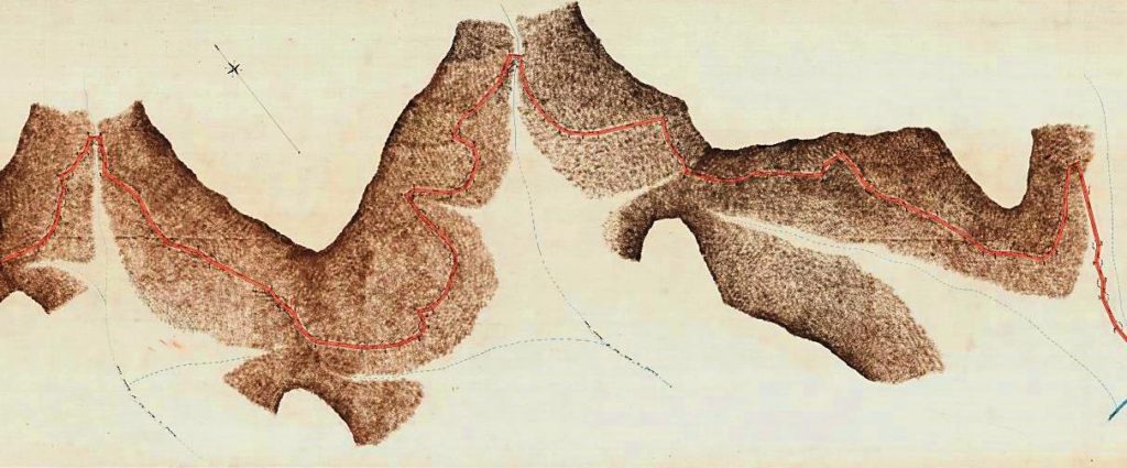
(Canada Lands Survey Records #10674)
The Geological Survey of Canada geologist Hugh Bostock, who walked many miles of this country in the 1930s and ‘40s, described this part of the road as “… up hill and down dale over six summits” and “located on northerly, shady slopes where the depth to permafrost was shallow and the ground poor”. This might suggest a questionable choice for road location, but it stood the test of time and more than 30 years after it was abandoned, Bostock also said that “being largely dug out of the hillsides, [it] was well drained, hardly grown over at all and in good shape”, and it proved very useful for his work.
Looking back nearly 120 years, the scouting, designing and marking out of a 31-mile route through this steep, rough and remote area is impressive. It must have taken very determined and difficult work by Thibaudeau and his crew to do it while travelling over this terrain on foot, hauling their camp, provisions and instruments, and ensuring their packhorses’ feed and water needs were met.
Once Grand Valley Creek was reached, the topography changed and the route followed a relatively straight and long, gradual descent through low hills and broad valleys to the Pelly River. This 25-mile stretch from Grand Valley would have presented comparatively few difficulties and was undoubtedly welcomed by Thibaudeau and his crew.
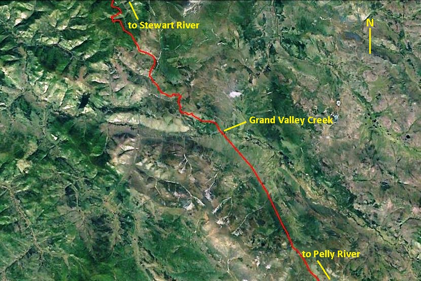
(Google Earth, with Overland Trail GIS shape file from Natural Resources Canada, Surveyor General Branch)
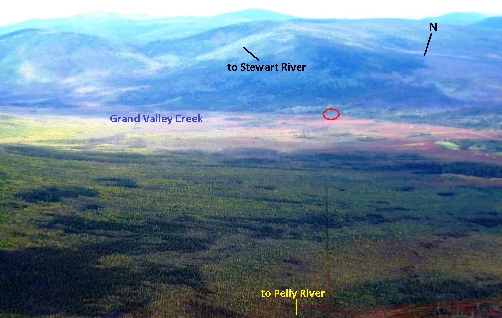
(Gord Allison photo)
The crossing of the Pelly, which Thibaudeau and crew reached in early July, was located three miles up from its mouth at the Yukon River, two miles down from Pelly River Ranch, and about five river miles from Fort Selkirk. From the crossing, the remainder of their project heading southward up the Yukon River valley took place in ‘civilization’, with steamboats, roadhouses and the telegraph service to assist them with their work.
Building the Road, 1902
On July 14, 1902, large work crews along with several horse teams and camp outfits were sent on the steamboat Prospector to the Rosebud Crossing of the Stewart River. They started work on July 16, with one crew working northward toward Dawson and the other southward toward the Pelly River. Near the end of July a similar scenario unfolded at the crossing of the Pelly River, with a crew working each direction from there.
These work crews cut out the roadway through the brush and timber, made sidehill cuts, cribbed up embankments, and built log bridges across streams. Horse-drawn implements such as scrapers and dirt-hauling buckets were used, but considerable manual labor was also expended in the road-building effort.
While the Overland Trail was being built, the citizens of Fort Selkirk, once thought a potential capital of the Yukon, protested to the Commissioner that their settlement would be bypassed. The new road was being established on the opposite side of the Pelly and Yukon Rivers and the closest point accessible to Fort Selkirk was about three miles. The government’s response was the building of a ‘Selkirk cut-off’ road from the Overland Trail 4½ miles north of the Pelly River, requiring a winter crossing of the Yukon River about five miles downriver of Fort Selkirk.
By late August 1902, ten miles of road had been built southward from the Stewart River and 15 miles northward from the Pelly River, leaving 31 miles in between. By early October, this remaining work was completed and all the work crews were returned to Dawson. The entire Overland Trail construction was finished at this time, and the final distance between Dawson and Whitehorse ended up to be 330 miles, about the same as the present highway.
Surveying the Road, 1903
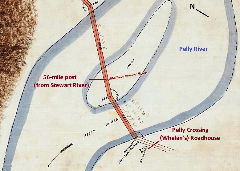
In the summer of 1903, the Stewart-Pelly section of the Overland Trail was legally surveyed by Charles MacPherson, a land surveyor based in Dawson, and his crew. They started on June 30 at the Stewart River, Mile 0 for the section, and worked their way southward, delineating a road right-of-way by placing pairs of wooden posts into the ground 66 feet apart at each corner or bend of the road. As the survey went along, mileposts were also installed, the final one for the section being mile 56 post on an island at the crossing of the Pelly River.
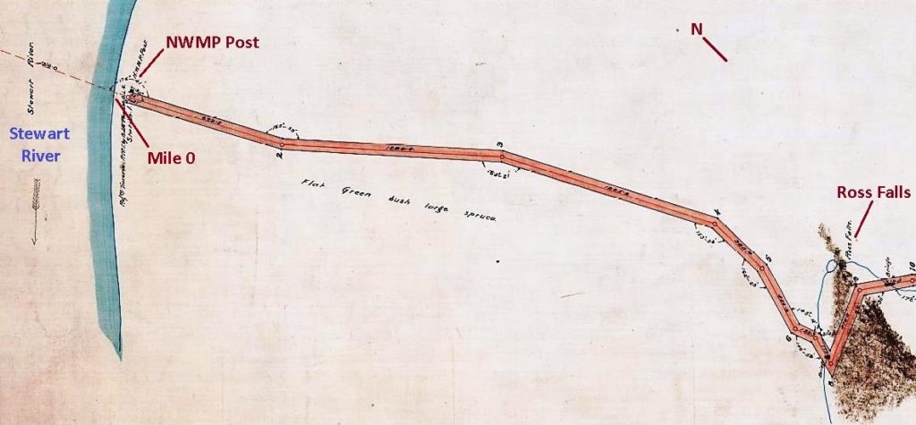
(Canada Lands Survey Records #10674)
The winding and hilly 31 miles of road in the northern part of the section was more difficult to survey, taking the crew 25 days. On the straighter and more gently sloping road through the southern 25 miles, the work went much faster and only 11 days were required to survey it. MacPherson and his crew reached the Pelly River on August 4.
(Gord Allison photo)
In addition to the road, MacPherson surveyed out 40-acre NWMP post reserves on the south side of the Stewart River crossing, at Grand Valley Creek, and on the south side of the Pelly River crossing. A 20-acre roadhouse parcel for Thomas Whelan was also surveyed on the south side of the Pelly and a two-acre parcel for White Pass on the north side of the river. These parcels, as well as roadhouses that were established along the road when MacPherson conducted his surveys, were identified on his survey plans and field books.
(Canada Lands Survey Records #10677)
Roadhouses along the Road, 1902-1912
The Stewart-Pelly section of the Overland Trail was a stretch that required new roadhouses to provide for the needs of travellers. Six known roadhouses and perhaps a seventh were established on this section, along with associated infrastructure such as stables, outhouses and other outbuildings. They were being built in the summer and fall of 1902 almost as soon as the road construction provided the access for it.
Two of the roadhouses were owned or leased by the White Pass & Yukon Route, which had the mail contract, and were designated mail stations, while other roadhouses were built and operated by entrepreneurs. These places became the winter homes and places of livelihood for several people, and perhaps year-round for some.
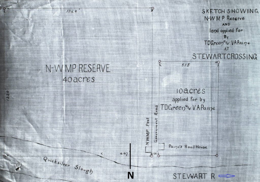
Going from north to south, the first roadhouse was established on the bank of the Stewart River at mile 0 of the Stewart-Pelly section, near the site referred to as Ross Falls. This was built by Thomas Green and Valorous Paine, and in early November it was reported that it would soon be ready to open. This roadhouse apparently ceased operating before 1908, and any remains of it washed into the river long ago.
(Yukon Archives, GOV 1633, File 6401)
At mile 10 from the Stewart River, a ‘Grant Jennings roadhouse’ is identified in Charles MacPherson’s field book for the 1903 survey of the Overland Trail. No further information has been found about this place, so perhaps it was not completed or never operated as a roadhouse. In 1907 Jennings was operating the Stevens roadhouse, the next one nine miles to the south.
The Stevens roadhouse was established near mile 19 in late 1902 by Samuel Stevens, who had previously operated a roadhouse at Coffee Creek on the Yukon River. His roadhouse on the Overland Trail was one of the mail stations and was open for business when travel began in early November.
Within a few years people other than Stevens were running the roadhouse for White Pass, including Grant Jennings in 1907. This is known from a newspaper article reporting that in early January a friend from Jennings’s childhood in Massachusetts, Anne Jones, arrived at the roadhouse. She had come by stage from Whitehorse, and the two of them carried on to Dawson where they were married, with the stage driver Joe MacDonald as best man and Bertha Hosking from the Pelly Crossing roadhouse as bridesmaid. Mr. and Mrs. Jennings then returned to Stevens Roadhouse to begin their married life.
Stevens became one of the longest operating roadhouses on this section of the Overland Trail because of its connection to White Pass as a mail station. By 1909 the Jennings were gone from there, but others were hired to run the roadhouse until its abandonment in 1912. It retained the Stevens name to the end and “Stevens Roadhouse (Loc.)” ended up becoming an official Yukon place name.
In 1946 the geologist Hugh Bostock walked by the Stevens roadhouse in the course of his work and noted that most of the buildings were in ruins, but one cabin was still usable. A visit by others in 1995 to document the site showed the only visible remains to be the outline of a building foundation.
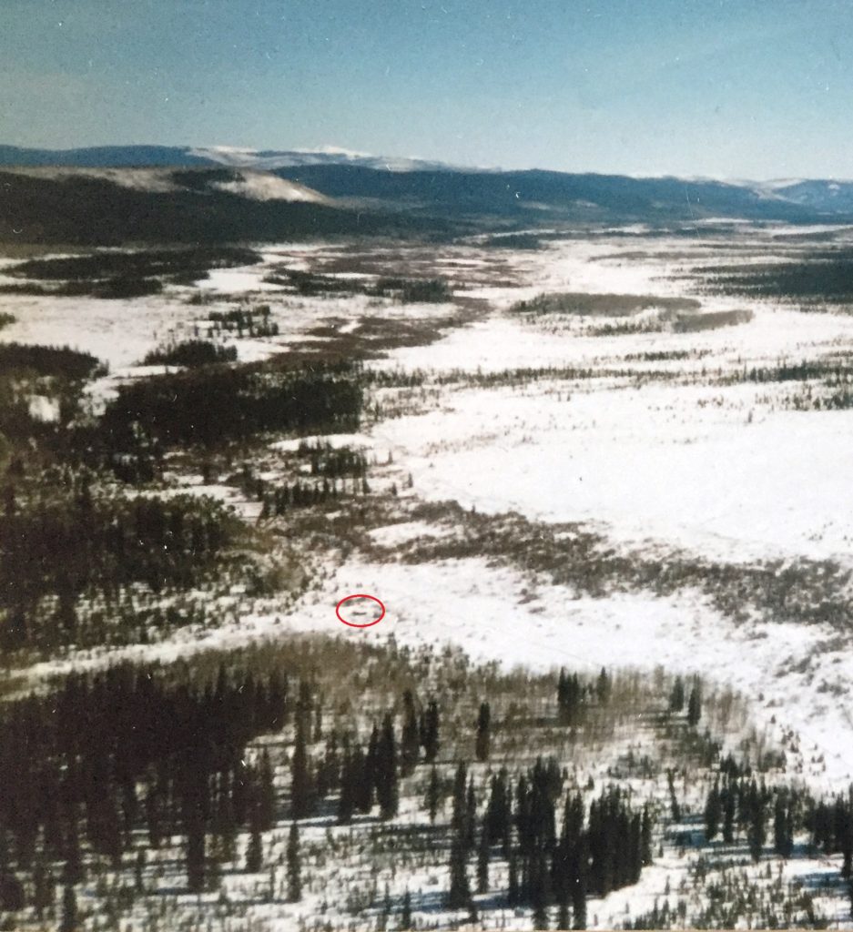
The next roadhouse south was near mile 31, where the Overland Trail left the hilly country and crossed Grand Valley Creek before going through much more level terrain. The creek was aptly named for its wide expanse of meadows containing excellent wild hay that was cut for horse feed and stored at the roadhouses. Bostock described the Grand Valley site as “[looking] out upon splendid views of great open meadows, hills, and mountains”.
(Gord Allison photo)
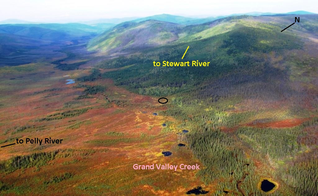
(Gord Allison photo)
The Grand Valley roadhouse and two others further south became associated with a couple named Charles and Anna Clark, although all the details of this are not certain. Charles Clark had operated a roadhouse on the Valdez trail in Alaska prior to coming to the Yukon. He and Anna, both from Ontario, came into the Yukon in 1898 and 1899, respectively, and became roadhouse keepers at Ballarat Creek on the Yukon River. Anna’s son Neal Atchison was also at Ballarat Creek as a logger in 1901.
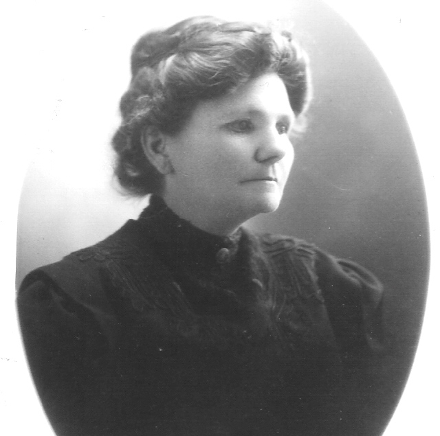
(Findagrave.com)
Charles and Anna Clark selected a site for a roadhouse on the new Overland Trail at Grand Valley Creek, and in September 1902 Anna applied for 10 acres of land there. They got busy building their roadhouse that fall, which would have meant hauling all the provisions, equipment and supplies necessary for building and operating the roadhouse overland from the Stewart or Pelly River on a newly-built and probably rough road. Their roadhouse became known as both Clark’s (or Clarke’s) and Grand Valley.
To the south of Grand Valley, two other roadhouses were also built that fall. The furthest one, 11 miles away at mile 42, was built by or for Anna Clark’s 19-year old son Neal Atchison. According to her government land record, her son’s roadhouse was “run [that] winter in conjunction” with her and her husband’s roadhouse at Grand Valley Creek, indicating that Atchison and the Clarks worked together building and operating their two roadhouses.
By the next fall (1903), Neal Atchison had departed the area and his mother applied for land at his roadhouse site, stating that she owned the buildings there. The land was granted to her and she evidently wanted to move to that location, but she later recanted on this and planned to go back to the Grand Valley site. Whether this happened is not known, but it could be that Atchison’s roadhouse at mile 42 operated for the first season only.
The other roadhouse was built by David Hume at mile 37, between the Clarks’ and Neal Atchison’s roadhouses. It was the other mail station between the Stewart and Pelly Rivers in addition to the Stevens roadhouse. Hume had a wife and two teenaged sons living with him in Dawson prior to that and they may have been involved in the roadhouse as well. He ran it for two seasons before selling it in February 1905 to Charles and Anna Clark along with 10 acres of land he had been approved for.
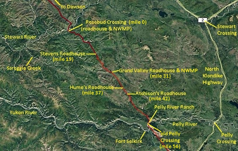
(Google Earth)
Hume’s roadhouse remained a mail station, so it is likely that the Clarks lived there for the rest of their time on the Overland Trail, rather than at their Grand Valley roadhouse. Hugh Bostock referred to it as ‘Haines and Clarke’s Roadhouse’, but he made a few errors in his notes and it should have said ‘Hume’s’ rather than ‘Haines’. A newspaper article in June 1912 said that Charles Clark “of Hume’s roadhouse” was “riding home on my horse” after a visit to Pelly Crossing, suggesting that he and perhaps his wife lived on the road year-round.
In September 1908, Charles Clark was appointed as a game guardian for Grand Valley, but that name may have been applied to the general area rather than the roadhouse site. It is not known if the Grand Valley roadhouse was operated again after the Clarks purchased the Hume roadhouse and evidently moved there. However, the name persisted and at some point “Grand Valley Roadhouse (Loc.)”, like Stevens, became an official Yukon place name.
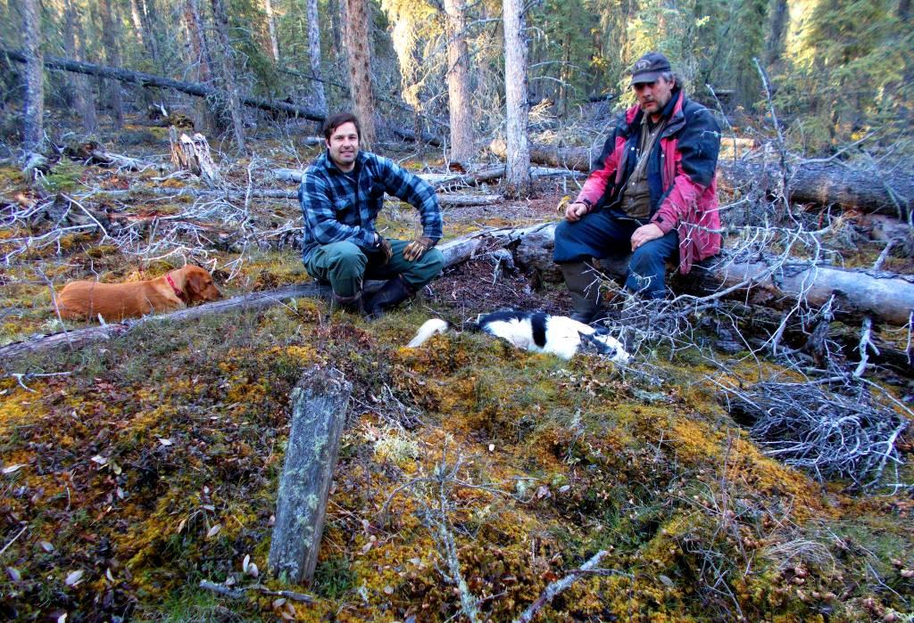
In 1946, Bostock passed by the Grand Valley roadhouse site and noted that it had been burned over by a forest fire, but he could still trace its T-shaped outline along with a large stable and two or three cabins. He also reported that there was a newer cabin there, likely built by a trapper. This situation was the same 43 years later in 1989 when Hugh Bradley and I visited the site.
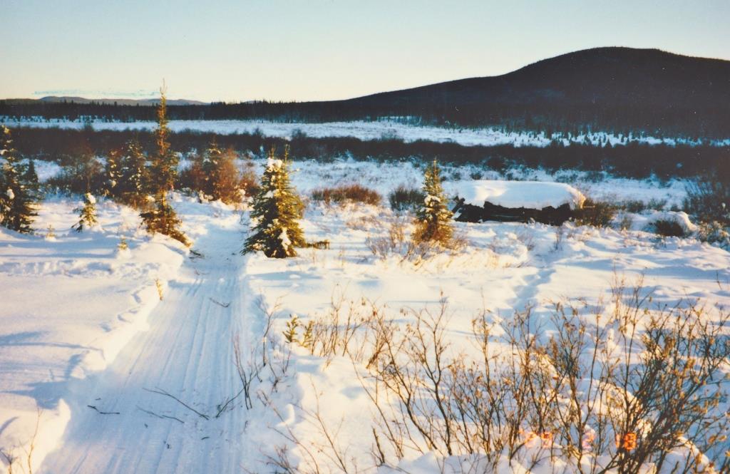
(Gord Allison photo)
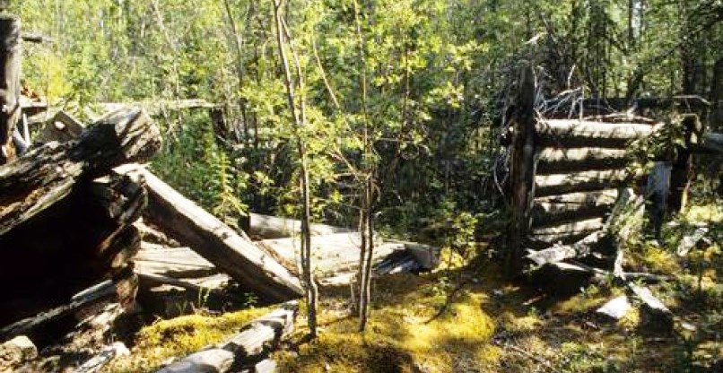
Bostock also visited the Hume’s roadhouse site in 1946 and found that the buildings were still standing but in poor condition. He reported that there was a two-storey roadhouse about 60 feet by 20 feet in size, a large flat-roofed stable with stalls for at least six horse teams, and two or more cabins. The mail stations were also where the horse teams were exchanged for fresh horses, explaining why Hume’s roadhouse had such a large capacity for keeping horses.
Bostock described Hume’s as “the best preserved, abandoned roadhouse establishment on the original road” when he was there in 1946. The 1995 site visit showed that all the buildings were collapsed and very deteriorated.
(Government of Yukon, Historic Sites Unit)
On his trips over this section of the Overland Trail, Bostock did not report on the roadhouse built near mile 42 by Neal Atchison, Anna Clark’s son, even though he would have passed right by it. Perhaps once the Clarks took over the Hume’s roadhouse, which was only five miles away, they dismantled Atchison’s abandoned building(s) and took the material to use at their location. This may also account for the relatively large complex of buildings at the Hume’s site.
Hugh Bostock made reference in 1934 to another roadhouse that he called the Lansing Roadhouse, situated about 10 miles north of the Pelly River. This location, at or near mile 46 from the Stewart River, is close to where the Scroggie Road forked from the Overland Trail. No other information has been found about a roadhouse in this area, so that one remains a mystery.
In 1912, when 45 miles of the 56-mile section of the Overland Trail between the Stewart and Pelly Rivers was abandoned in favor of the Scroggie Road, so too were the roadhouses. By then they likely consisted only of the mail stations, Stevens Roadhouse operated by White Pass employees and Hume’s Roadhouse operated by Charles and Anna Clark.
The Clarks moved to Yukon Crossing on the Yukon River to operate the roadhouse there and did this until about 1920, when they went to Washington state and bought a ranch for their retirement. By that time they had contributed 20 years of their time, energy and entrepreneurial spirit to building and operating Yukon roadhouses.
The retirement was not to last long, however, as Anna suffered a stroke in 1923 and passed away soon after in New Westminster, BC. Charles sold the Washington ranch and returned in 1924 to make Yukon Crossing his home. At some point after that he moved to Alaska and had a trapline north of Anchorage. In late December 1933 the 79-year old’s frozen body was found beside a river after he had suffered a stroke while pulling a hand sled along a trail.
North-West Mounted Police Posts on the Road, 1902-1906
In the fall of 1902, when the new Overland Trail was being readied for use that winter, the NWMP established a new post at the Rosebud Crossing of the Stewart River. It was located on the south side of the river and on the east side of the road, across from the roadhouse built by Thomas Green and Valorous Paine. It was staffed by a staff sergeant and two constables in its first year.
It was also identified in 1902 that because it was 60 miles from the Stewart Crossing post to the next police detachment at Fort Selkirk, another post was needed on the Overland Trail somewhere in between. That occurred in 1903 with the establishment of a new post at Grand Valley Creek (mile 31), across the road from Charles and Anna Clark’s roadhouse. It was staffed by a corporal, three constables, and a supernumerary constable (i.e. a cook).
These posts on the Stewart-Pelly section of the Overland Trail would not last long. An overall reduction in the police force staff meant that these two posts, among others in the Yukon, were closed by 1906. As for the buildings, the force often relocated them when a detachment was closed, but that did not occur with these ones. The Stewart Crossing post was situated in an area where the Stewart River’s course is very changeable and apparently washed into the river sometime before 1912.
The Grand Valley post was evidently left in place because in 1923 the buildings were put up for sale, according to the title of a file held in the national archives in Ottawa. Whether they were actually sold is not known, but it seems unlikely that someone would remove them from that remote location. If not removed, they undoubtedly burned in the forest fire that destroyed the nearby roadhouse buildings as reported by Hugh Bostock in 1946.
Re-routing and Abandonment of the Road, 1912 and early 1920s
The original route of the Overland Trail in the Stewart-Pelly section was used until 1912, when the 55-mile long Scroggie Road was built from a point 11 miles north of the Pelly River. It went to the mouth of Scroggie at the Stewart River and to a new crossing of the river at that point. The road was extended via Black Hills Creek into the Klondike goldfields, connecting with the existing road network there. This new route to Dawson was a better road and spelled the abandonment of the remaining 45 miles of the original Overland Trail between the Stewart and Pelly Rivers.
By the early 1920s the Mayo area silver-lead mining was growing in importance and would soon surpass Klondike gold production in value. A new road was constructed from Minto northeast to Mayo, with a later branch northwest to Dawson. This caused the abandonment of the Scroggie Road route and all of the original Overland Trail north of Minto.
The Grand Valley Emergency Airstrip, 1940
In 1939 and 1940 White Pass, which had gotten into the airline business in the Yukon in the mid-1930s, constructed a number of emergency landing fields, as they were called, along its regular routes. One of these was built between the Pelly and Stewart Rivers on the Whitehorse-Dawson route, where it was found that “this is a particularly difficult piece of country to find enough dry ground to build a field on, most of the country being swamp and muskeg”. However, a site was selected three miles to the east of the long-abandoned Grand Valley roadhouse and NWMP location.
A landing field of 2,800 feet long by 100 feet wide was built in 1940 and was reported to be “a little rough, but suitable for emergency use”. The details of how it was built are not known, but according to notes made by Bob Cameron when researching his Yukon aviation history book Yukon Wings, heavy machinery (as existed at the time) was used for the airfield construction and hauled to sites by steamboat. In the Grand Valley case, this would have also involved walking the machine overland to the site, likely when the ground was frozen.
Hugh Bostock, who walked along the Grand Valley section of the Overland Trail a little later in the 1940s, did not report any indication of a machine having used the road. If the airfield construction happened as described, it would have undoubtedly been the first and last mechanized use of that part of original Overland Trail, other than some snowmachine use for a few years.
Re-opening the Scroggie Road, 1970s
In the mid-1970s, the rising price of gold attracted miners to the Scroggie Creek area once again. The Pelly Ranch Road, built in the mid-1960s from present-day Pelly Crossing, provided access to the Overland Trail and Scroggie Road that had been built in 1902 and 1912, respectively, and then later abandoned. The old route was cleared of its regrowth of vegetation and reactivated with heavy machinery, a far cry from how it was initially constructed more than half a century earlier.
The Stewart-Pelly Section Now, 2021
The first 11 miles of the original Overland Trail north of the Pelly River and the Scroggie Road continue to be used annually (Covid pandemic excepting) by the Yukon Quest. This route is also used in some years by miners to haul equipment, fuel and supplies into the Scroggie Creek and nearby drainages, primarily in winter.
The remaining 45 miles of original Overland Trail to the Stewart River, however, have seen few people and little use in the almost 110 years since it was abandoned. As long ago as 1935, when Hugh Bostock travelled this section, he remarked that “in some burnt sections, alder and willow jungle had grown up along the roadway so that the route had to be followed on one side …”.
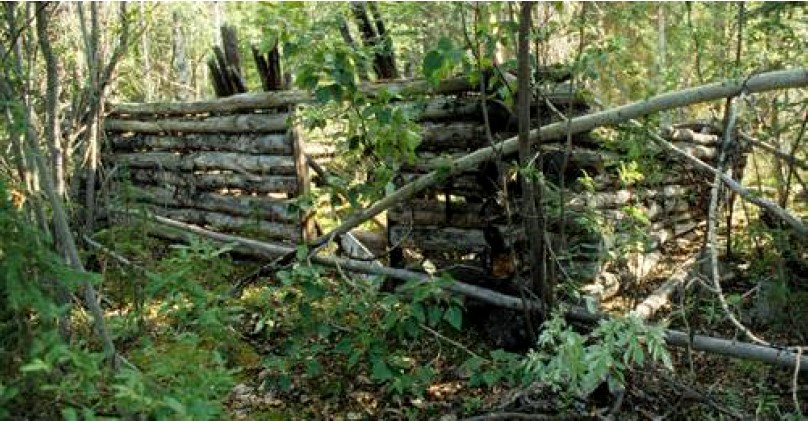
In 1950, Bostock noted that “few [roadhouse] sites any longer contain habitable buildings and some are almost overgrown and obscured”. In reference to sections of the trail such as the Stewart-Pelly, he said that “today ruins of [them] are still to be seen in some places on the abandoned parts of the roads where they are seldom visited or disturbed”.
(Government of Yukon, Historic Sites Unit)
The Yukon Quest project in 1989 and a few years of trapping access afterwards were the last uses of this piece of original Overland Trail. It has seen little motorized traffic other than snowmobiles associated with that project and some trapping. Even the latter has not occurred for many years and much of the trail has reverted back to bush. From the air or on air photos, the road is still visible in some places, while in others it cannot be seen.
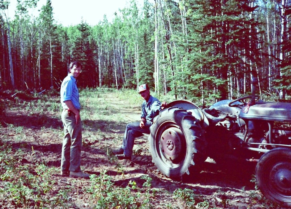
Peter Watson, a log home builder based near Haines Junction, has had a trapping concession for over 30 years in the Grand Valley Creek area that the Overland Trail passes through. His first winter of trapping was 1988-89 and he assisted with the Yukon Quest clearing project, which also helped him gain access into his area. He used the trail for the next four or five years, but the amount of work to keep it cleared required him to find a better and shorter access from the Scroggie Road that did not require so much maintenance.
Peter said that in his 30+ years of trapping in the Grand Valley area, he has never seen another person there nor any indication that anyone else has been there, aside from a survey of the former Grand Valley roadhouse site for a Selkirk First Nation land selection. This once active area when the Overland Trail was in use has reverted back to quiet wilderness.
The chance to travel with Hugh Bradley on the original piece of old road during the brief time it was easily accessible is a valued memory for me. Hugh passed away in 2012 before I had a chance to share much of my history research work with him. He played a large part in igniting my interest in this topic and many others.
(Gord Allison photo)
The most enduring evidence of the former activities and developments on the Stewart-Pelly section of the Overland Trail will be the roadbed cut into the hillsides. The log buildings along with the bridges, survey posts and mileposts have been gradually disappearing for more than 100 years. All of the remaining physical evidence of this intact piece of Overland Trail is being preserved by its inaccessibility, and if left undisturbed it will tell a history story for some time to come.
Link to related article: The Dawson-Whitehorse Overland Trail – Overview