Canadian Army Exercise Reluctant Beaver at Kloo Lake

In December 1952 Canadian military Exercise Reluctant Beaver took place at Kloo Lake in the southwest Yukon, one of a number of exercises carried out in this region in the early 1950s.  This was during the peak of the Cold War, a time of worldwide stress created by strained relations between the United Stated and the Soviet Union following World War II.

Reluctant Beaver was an 11-day exercise to familiarize and train Canadian military personnel to operate in northern winter conditions.  Specifically, it involved a newly-formed troop of airborne combat engineers, the first such unit in the Canadian Army, and the tasks entailed parachute drops of personnel, equipment, and provisions.   This was followed by the building of an ice airstrip on Kloo Lake, a bridge over the Jarvis River, a bush road, camps for personnel, and shelters for equipment.

This article had its beginning when I saw a report about Exercise Reluctant Beaver at Library & Archives Canada in Ottawa.  I was aware of a couple of military exercises that had taken place in the Kluane Lake area, but I had never heard of this one so close to where I have lived for a long time.  I subsequently found a number of newspaper articles that appeared across the country while the exercise was going on.      

The information about Exercise Reluctant Beaver at Library & Archives Canada indicates a holding of 36 photos that were taken during the event.  Some of these were shared with the newspapers and appeared in their articles, particularly in the Calgary Herald which had a knowledgeable reporter on site. 

The exercise report and the newspaper articles give the impression that the only people living in the southwest Yukon were personnel connected with the Canadian Army’s operation and maintenance of the Alaska Highway.  There was no reference to contact or communication with local people, including a Canadian Rangers unit that was active at Destruction Bay, less than 50 miles up the highway.  More significantly, there was no mention that Exercise Reluctant Beaver was conducted on the doorstep of the First Nation village at Kloo Lake.  This lack of interaction may be why there seems to be little local memory or knowledge of Exercise Reluctant Beaver.  
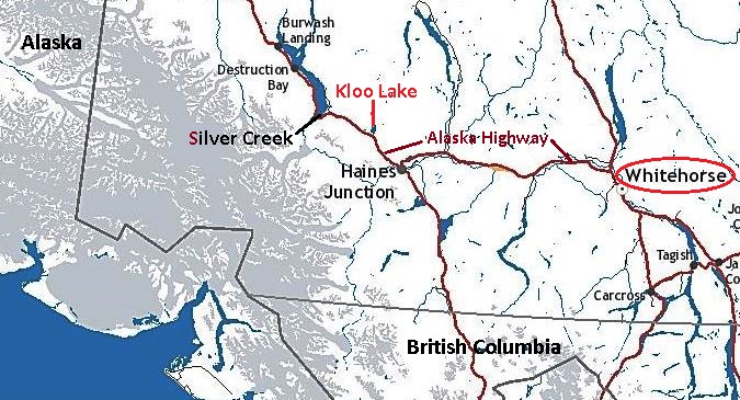
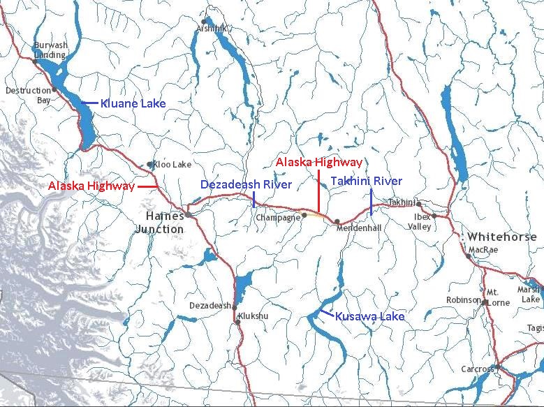
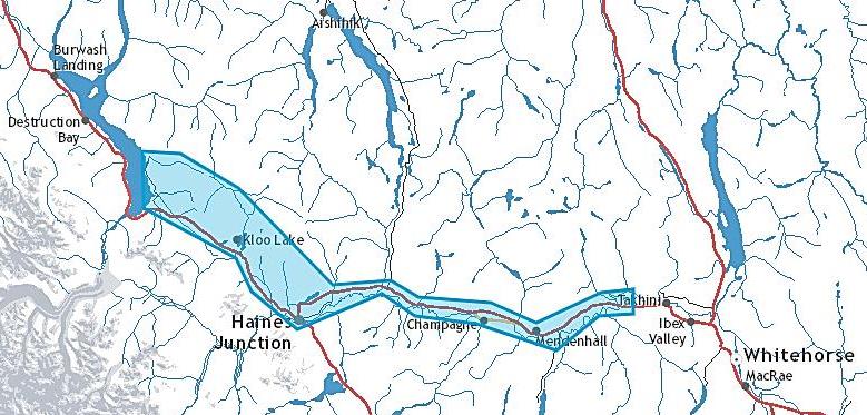
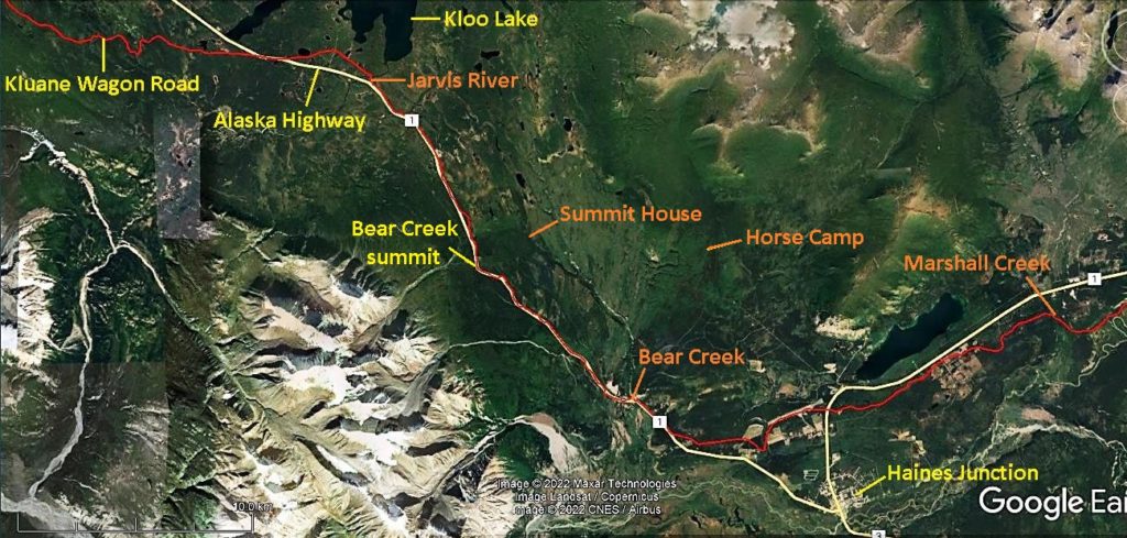
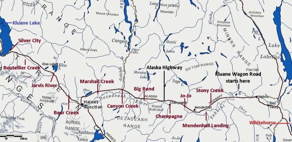
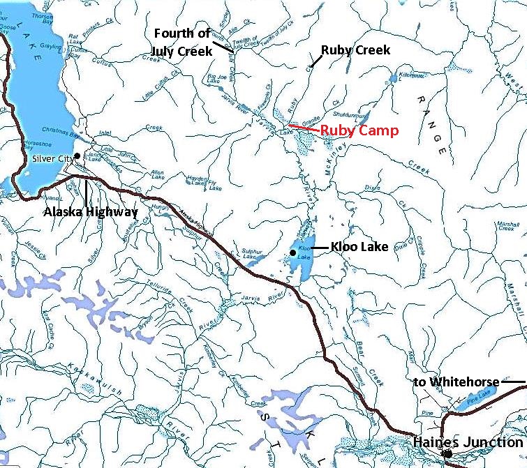
Map of southwestern Yukon showing location of Exercise Reluctant Beaver at Kloo Lake and the dispatch point of Whitehorse.
(GeoYukon)

Geographical and Historical Context

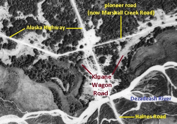
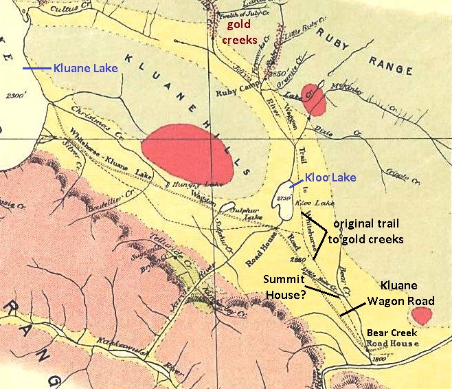
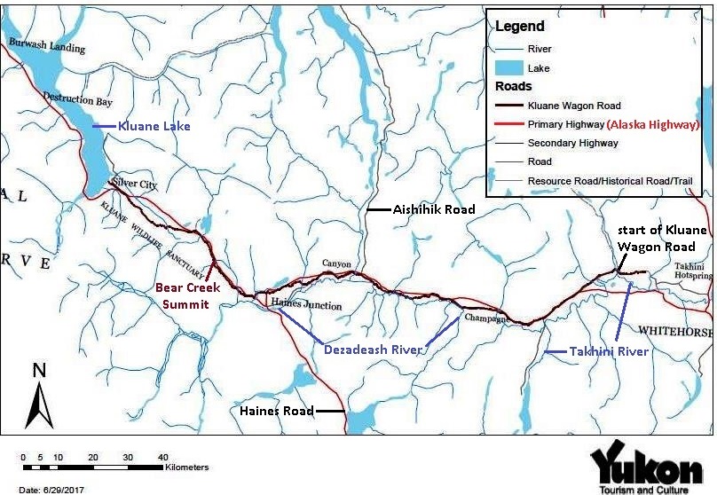
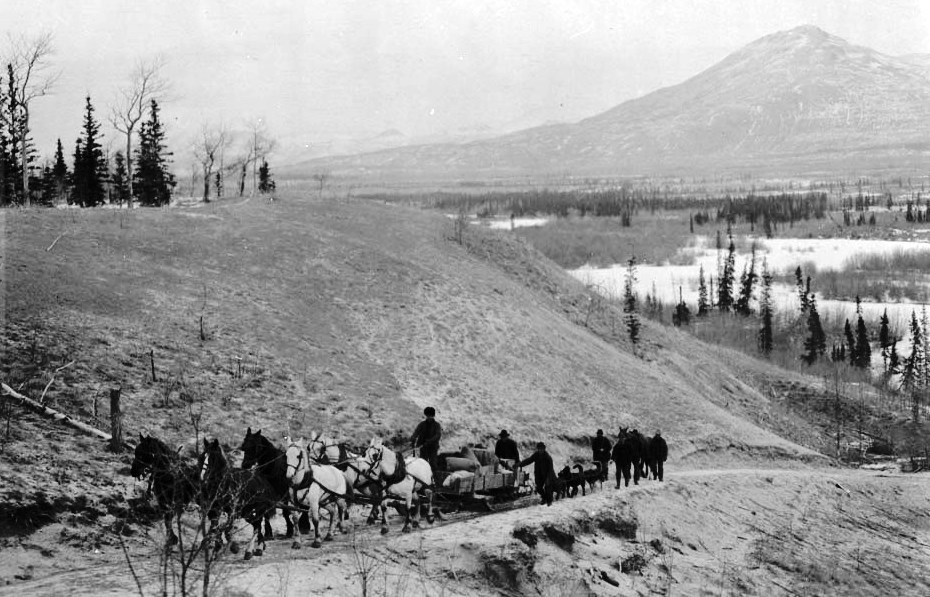
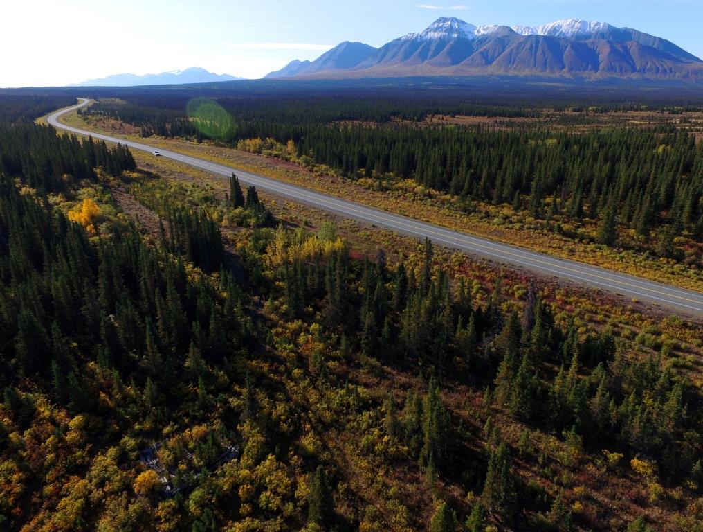
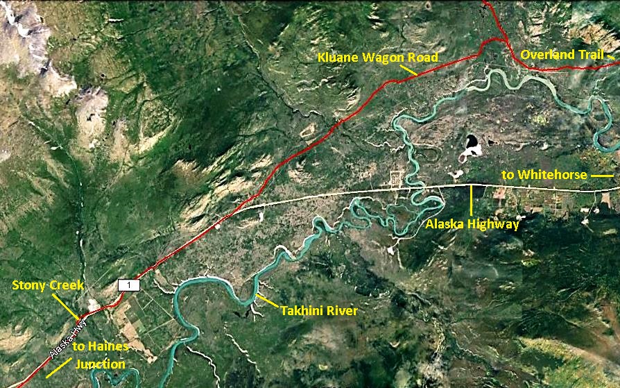
Exercise Reluctant Beaver took place at Kloo Lake, just north of the Alaska Highway 18 miles northwest of Haines Junction.  The lake is drained at its south end into the Alsek River watershed by the Jarvis River, which is bridged by the highway at what is now kilometer 1608 (mile 1034.5 in 1952).  The highway had been built through the area in 1942, more or less following the Kluane Wagon Road that was constructed in 1903 from near Whitehorse to Silver City on Kluane Lake.
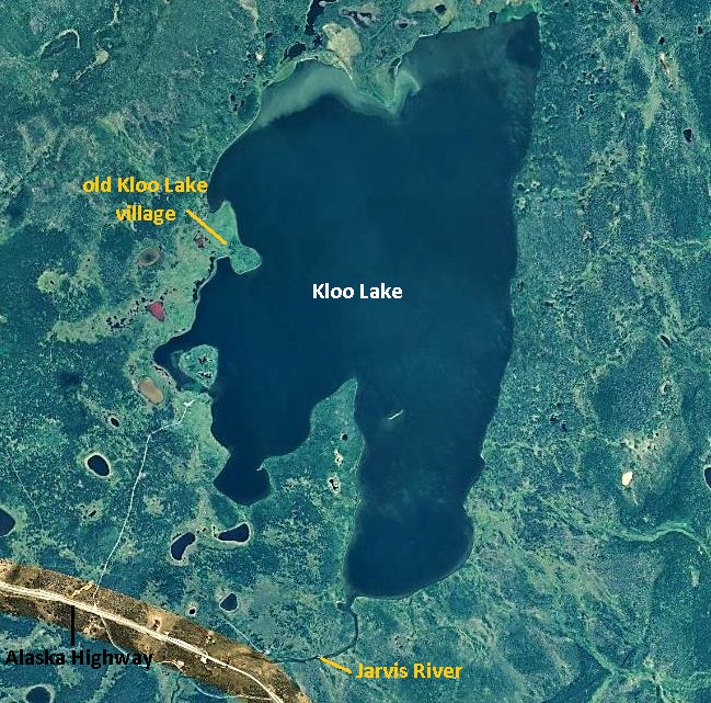
Imagery of Kloo Lake showing Jarvis River, Alaska Highway, and First Nation village site.
(GeoYukon)

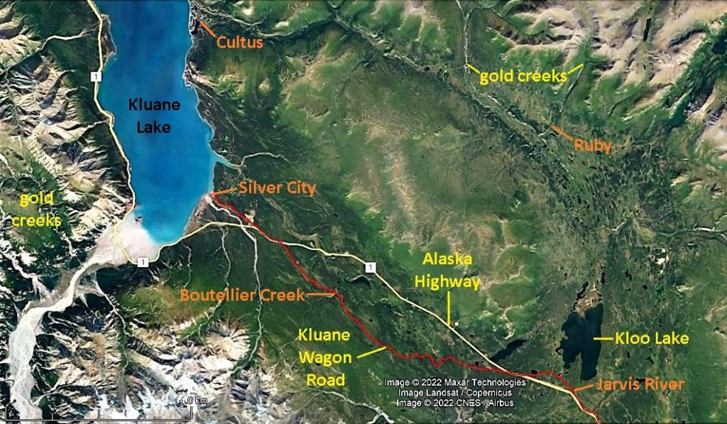
The nearest developments to the south along the Alaska Highway from Kloo Lake in 1952 were the Mackintosh Trading Post at Bear Creek, 12 miles away, and Haines Junction, 18 miles away.  The trading post had been established in 1903 on the Kluane Wagon Road, 40 years before Haines Junction got its start as a Haines Road construction camp.  By 1952 Haines Junction was developing as a community with businesses and government services.  To the northwest of Kloo Lake, the settlement of Silver City that had been recently abandoned was 18 miles distant and the highway maintenance camp at Destruction Bay was 49 miles away. 
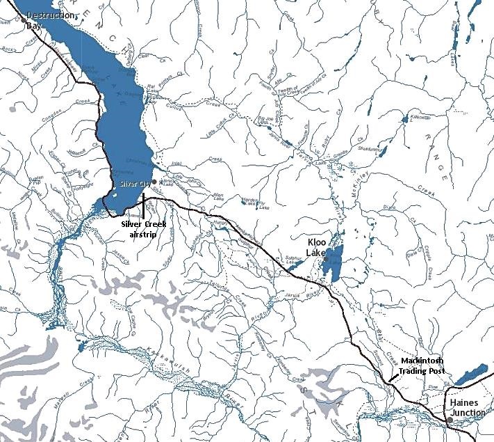
Map showing locations of other developments mentioned, including Silver City and Destruction Bay on Kluane Lake.
(GeoYukon)

Kloo Lake’s name is derived from the Champagne & Aishihik First Nations’ Southern Tutchone name of K’ùä Män, meaning ‘whitefish lake’.  The local First Nation people’s experience with outsiders coming into the country began in 1891, when explorers Edward Glave and Jack Dalton passed through with horses. 

In 1903 gold discoveries on creeks north of Kloo Lake brought many prospectors into the area and a wagon trail was constructed on the west side of the lake.  The Jarvis River roadhouse was also built at this time south of the lake, near the Kluane Wagon Road crossing of the Jarvis River.  In 1923, when automobile traffic began using the wagon road, a bridge was built over the river near where Exercise Reluctant Beaver would also build one nearly 30 years later.

Around 1917 a fur trading post was established on the trail about halfway up the west side of Kloo Lake and remained in business until 1947.  Half a mile south down the lake from the post site was the First Nation village, where in December 1952 Exercise Reluctant Beaver landed in their front yard.  
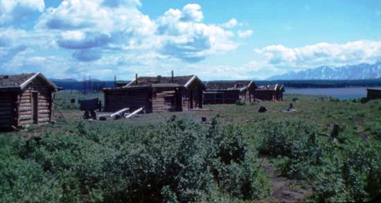
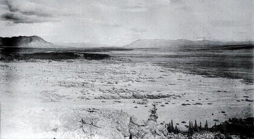
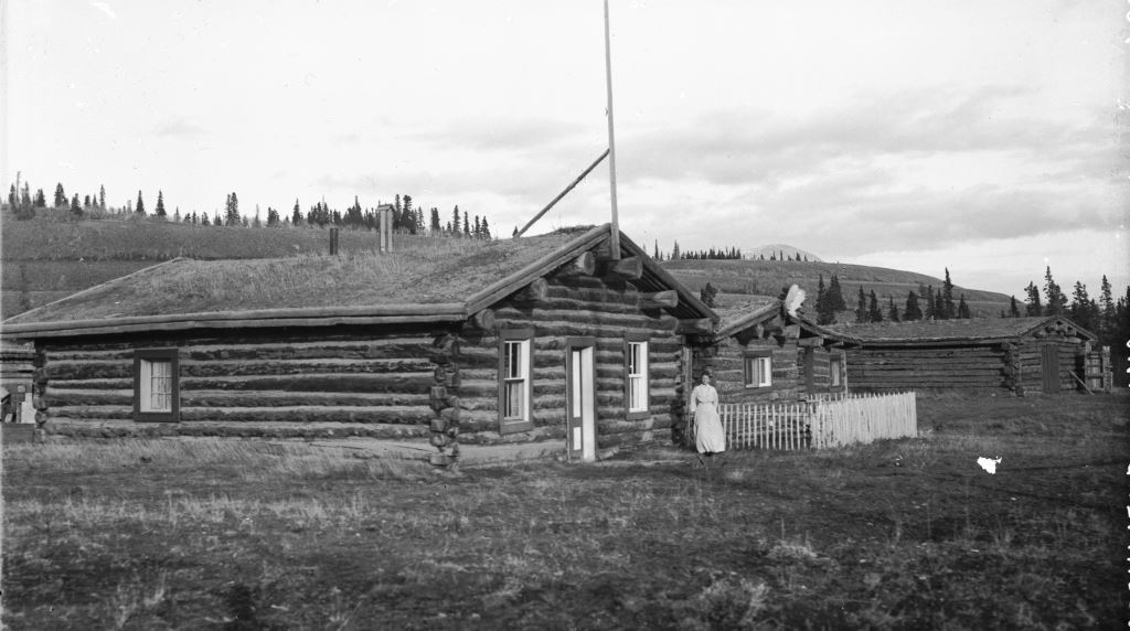
Old Kloo Lake village, looking SE from west side of Kloo Lake in 1942, ten years before Exercise Reluctant Beaver.  This site has now grown back in thick vegetation, but at the time of occupancy it had a beautiful 360° view of the surrounding mountains.
(Yukon Archives, Robert Cartter fonds, Acc. 82/281R, #1609 – photo has been cropped)

Nationally, the historical context revolved around the Cold War, a period of global tension between the United States and the Soviet Union and their respective allied countries that arose in 1945 after the end of the Second World War.  This time of strained relations due to ideological differences had its peak during the years 1948 to 1953 and started to gradually diminish in 1961, but did not end until the collapse of the Soviet Union in 1991.

The Cold War saw no direct fighting between the American and Soviet superpowers, but there were regional conflicts, particularly the Korean War that started in June 1950 when North Korea invaded South Korea.  North Korea was supported by the Soviet Union and China, while South Korea was backed by the United States and a large number of allied countries, including Canada.  While Exercise Reluctant Beaver was being held in the Yukon, Canadian soldiers were fighting and dying in Korea, where the war there did not end until July 1953.

Other Military Exercises

It was against this backdrop of the Cold War and Korean War that Canadian and American armed forces, fearing a possibility of invasion by the Soviet Union from the northwest, conducted training and familiarization exercises in the southwest Yukon (referred to as ‘frozen wastelands’ in some newspaper articles).  At least five of these were carried out in the first four years of the 1950s, some of them joint exercises and some solely Canadian.  

Operation Sweetbriar was the first and also the largest exercise, involving more than 5,000 allied personnel, 1,000 motorized vehicles, and 100 aircraft.  It was conducted over the course of 11 days in February 1950 to develop techniques for the combined Canadian and American forces to operate in sub-Arctic conditions.  The scenario for Sweetbriar was that the Communist forces had invaded Alaska from the west, and the task of the allied forces was to drive them back from advancing into the Yukon.  This exercise began three weeks after the disappearance of the US Air Force’s Douglas C-54 Skymaster #2469 in the same general area of the Yukon with 44 people aboard that has never been found.

Other exercises were conducted over the next few years, with names like Eager Beaver, Reluctant Beaver, Hot Dog II, and Mule Team.  All except Reluctant Beaver were based at the south end of Kluane Lake and carried out similar activities to become familiar with operating in northern winter conditions.  At least two of the exercises involved members of the Canadian Rangers group based at Destruction Bay.  One of them, Ken Baltimore, said that he and Gordie Atkinson participated in an exercise at the Kluane Lake camp during some cold weather, and Ken’s main memory is that the sleeping bags they were issued did not pass muster. 

Charlie Eikland Sr. from the Beaver Creek area lived in Haines Junction during his school years and has some memories related to the military exercises.  He recalled walking along the Alaska Highway to school with his sister one day when a stream of military vehicles passed by and the soldiers threw candy out to them.  He also remembered the Alaska Highway being gated at Kluane Lake during the exercises and travellers having to check in with military authorities there.  Charlie was aware of the Reluctant Beaver exercise at Kloo Lake and thought that a paratrooper was killed there, but if so I have not seen a record of it.

Participants

In 1948, four years before Exercise Reluctant Beaver, the Canadian Army had formed the Mobile Strike Force (MSF), an airborne brigade designed to respond quickly to a land and air threat arising from the Cold War.  It was realized, however, that they needed to involve combat engineers (also known as sappers), who perform tasks in support of the front-line infantry.  Combat engineers “ensure that troops can live, move, and fight on the battlefield.  They also perform construction and maintenance tasks, operate vehicles and equipment in support of engineer operations, and maintain field installations and facilities.”  

Since the Mobile Strike Force was an airborne brigade, it was recognized that the combat engineers also needed to be airborne, rather than delivery by other means of transport.  In January 1952, #1 Airborne Troop of the Royal Canadian Engineers (RCE) was formed at Chilliwack, BC, to address this need, the first such unit to be created.  Exercise Reluctant Beaver was planned as a training exercise primarily for the new #1 Airborne RCE troop later that year.

The participants in Reluctant Beaver from the Army were to be 58 parachutists of all ranks from the #1 Airborne RCE and 20 personnel from #1 Airborne of the Royal Canadian Army Service Corps for logistical support.  From the Royal Canadian Air Force there were aircraft and personnel from 435 Squadron in Winnipeg who would be based in Whitehorse for the exercise. 

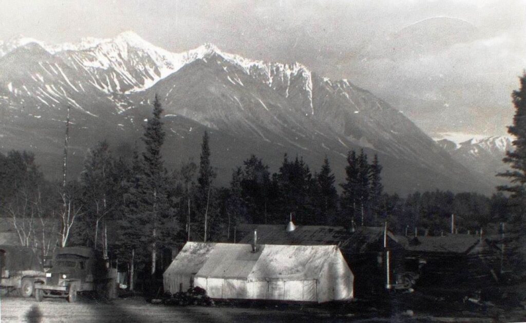
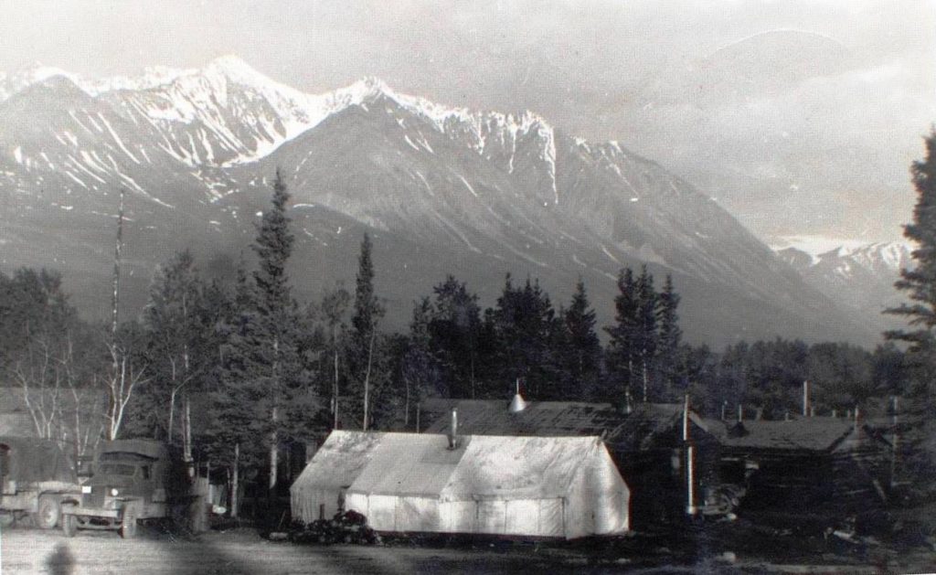
A ‘neutral camp’ was established at the Silver Creek airstrip on Kluane Lake using shelters left behind months previously by Exercise Eager Beaver.  The camp was for a medical facility, a base for ‘winter indoctrination’ training, and accommodation for supervisory and support personnel not involved at the exercise site.  Transportation including ambulance service was supplied by the Northwest Highway System maintenance personnel. 
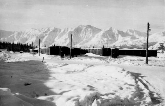
Exercise Eager Beaver buildings at Silver Creek, south end of Kluane Lake, looking SW, 1952.  Exercise Reluctant Beaver used this as a base for support of its activities at Kloo Lake.
(Sylvia Lefferson photo, provided by Marilyn Brewster)

Planning and Preparation

Planning of the exercise began in April 1952 and approval was granted in May.  This was followed by a site visit in early June and then a planning conference later in the month.  The 11-day exercise was scheduled to begin during the window of November 20 to December 7, with the starting date dependent on weather conditions.

Pre-exercise training through the fall months consisted of packing and loading of aircraft at Chilliwack, winter indoctrination training at Silver Creek, and heavy equipment operator training at Whitehorse given by Northwest Highway System personnel.  Equipment and provisions were shipped from Chilliwack to Whitehorse in October and the personnel arrived in November.

Scenario and Exercise Plan

The scenario given was that with the element of surprise, Alaska was invaded by Communist air and sea forces, which were able to dominate the region from centers at Fairbanks and Anchorage.  Some units of the allied forces were intact but cut off from their bases, severely limiting offensive action.  Enemy forces from Fairbanks were moving east on the Alaska Highway and approaching Snag.  The Canadian Mobile Strike Force based its personnel and equipment at Whitehorse and planned to mount an offensive to dislodge the enemy and establish a defensive framework at Kluane Lake.

Criteria for the area selected for Exercise Reluctant Beaver were that it had to be within logistical support of Whitehorse, which would be the marshalling area for the troops and equipment and the base for the initial air transport to the exercise site.  The location also had to be where there was a lake suitable for constructing an airstrip and an access road could be built from the Alaska Highway to it.

Kloo Lake was chosen for Exercise Reluctant Beaver, and separate drop zones on the lake were identified for airdropping of personnel and equipment (except heavy equipment) and an area of the lake was selected for the airstrip.  An additional drop zone on land was identified close to the highway near where a bridge construction camp would be established.

An assault base headquarters would be placed beside the highway and be equipped with radio and a telephone line to the base at Silver Creek.  A Bridge Camp would be set up close to the highway where the bridge over the Jarvis River was to be built, and what was termed a HQ Camp established beside Kloo Lake near the planned ice airstrip.

Objectives and Tasks

The objectives of Exercise Reluctant Beaver were:

  • to exercise #1 Airborne Troop Royal Canadian Engineers in engineering tasks in support of a typical MSF winter operation in an isolated area using only equipment which could be airdropped;
  • to test the adequacy of the equipment proposed for use by the Airborne Troop; and
  • to test the feasibility of proper maintenance of equipment using the minimum shelter requirements, either made from local resources or airdropped.

The Troop was given the following tasks:

  • to construct a temporary ice airstrip capable of use by assault phase aircraft Fairchild C-119G (Flying Boxcar) or C-123 (Provider);
  • to construct an access road of prescribed specifications to the Alaska Highway, including construction of an improvised bridge;
  • to install a water point capable of supplying water for up to a brigade (3,000-5,000 personnel); and
  • to demolish the temporary ice airstrip upon completion of the exercise.

These objectives and tasks would involve airdropping of personnel and equipment of the Airborne Troop (except special engineer equipment) and preparation of camp and bivouac areas.

Command

The command and control functions for the exercise were in the hands of representatives of the Army’s General Officer Commanding (Western Region) and the Northwest Highway System commander, both based in Edmonton.  One officer from the Engineer troop was to be Chief Umpire for the exercise and there would be a Drop Zone umpire along with four checkers/dispatchers for the initial parachute drop.

The Drop Zone umpire had the responsibility of calling off the initial parachute drop if conditions were unsuitable, particularly winds above 18 miles per hour.  The Chief Umpire had the ability to call off subsequent drops if necessary.

D-Day and D+1 – The Personnel Drops

The weather was unusually warm in the early winter of 1952 and the ice on Kloo Lake was slow to thicken in the lead-up to Exercise Reluctant Beaver.  A telegram on November 10 suggested that the event be postponed until December 10, and added that it could be shortened two or three days if necessary so that all personnel could be returned home for Christmas, which was deemed important for morale reasons.

It turned out that December 2 was the day the exercise was initiated, when the ice on Kloo Lake was only 12 inches thick with a few inches of snow on top and the temperature was relatively mild.  This was termed D-Day, and the subsequent days were called D+1, D+2, etc. (this article will use the more straightforward terms Day 2, Day 3, etc.)

At first light on December 2 (D-Day), a Douglas C-47 Dakota aircraft left Whitehorse and an hour later was 95 miles to the west over Kloo Lake.  The weather was warm with no wind and there was about three inches of snow on the lake surface.  What was termed a ‘recce’ (reconnaissance) party of 14 paratroopers jumped safely from 700 feet onto the ice of the northwestern part of Kloo Lake.  This group packed up their parachutes and hiked south for 2.5 miles across the lake and another 1.5 miles down the Jarvis River to where they set up their camp near the planned bridge site.  Along the way they scouted out the locations for the supply drop zone, the airstrip, a camp site near the airstrip, and the bridge.
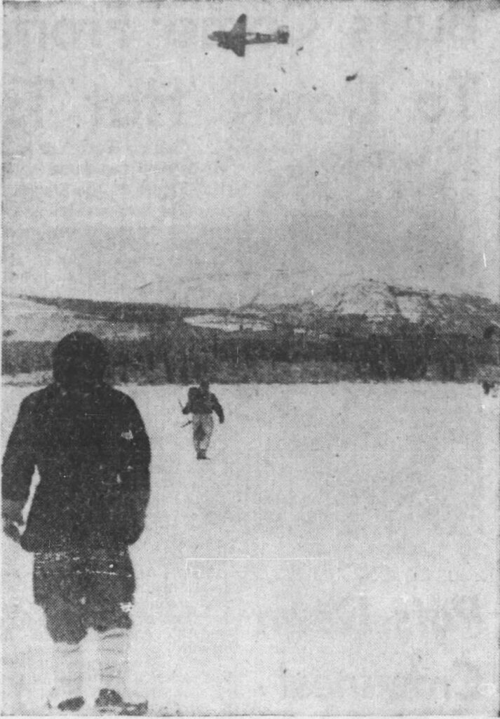
Exercise Reluctant Beaver personnel airdrop on west side of Kloo Lake, looking west, 2 December 1952.
(Canada Dept. of National Defence, in Calgary Herald, 16 December 1952)

The Dakota went back to Whitehorse and returned with a second drop of 13 troopers, who then walked south a little over a mile to a peninsula on the lake.  There they got to work clearing an area and setting up the HQ Camp in the limited daylight that would have remained.  There was no communication between this camp and the Bridge Camp, and the distance between them was about a 40 minute walk.
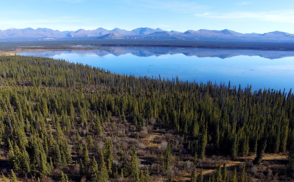
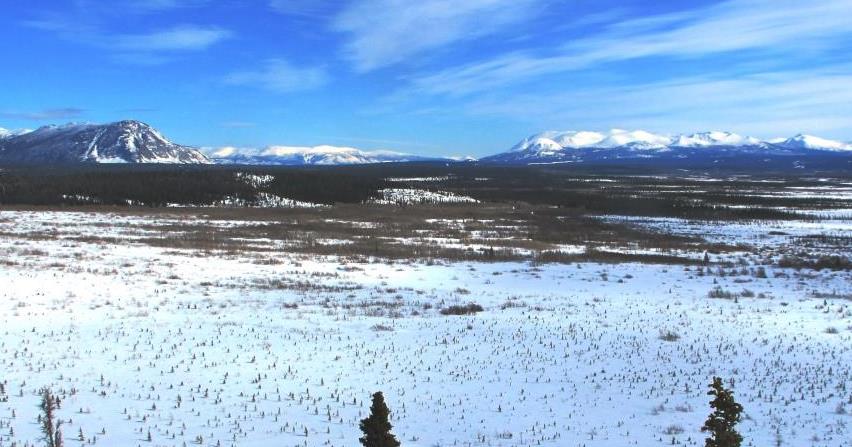
Looking NE across the northern half of Kloo Lake, October 2016.  The Exercise Reluctant Beaver personnel parachuted onto the northwestern part of the lake, above center.  The site of the Kloo Lake trading post that operated ca. 1917-1947 is the small grassy area below center.
(Neal Allison photo)

The next day (D+1, or Day 2) the weather was the same and two more drops were made in the afternoon, this time from 800 feet.  The first drop consisted of 13 men and the final personnel drop of the exercise was eight men, for a two-day total of 48 jumpers.  By the evening they were all settled in their respective camps to begin the exercise on the ground the next day.

Three men from the first day’s jumps ended up with severe bruising due to hard landings on the ice, requiring them to be taken to the medical facility at Silver Creek.  This may be the reason that the drop height for the second day was increased from 700 to 800 feet, although that day also had a jumping casualty, a twisted knee that removed that jumper from the exercise.  These injuries meant that four of the 48 jumpers were out of action. Three rifles were broken on landing, a matter that required investigation since the rifles are the first line of defense for an airborne strike force.

Day 2 – The Supply “Drops” and Drop Zones

The supply drops were also carried out on Day 2, delivered from the Silver Creek base to Kloo Lake in mid-afternoon by what were termed “simulated resupply drops” in the form of two loaded 10-ton Mack trucks to “represent” two Dakota aircraft.  The exercise report does not state if this was the plan all along, or if the ice of Kloo Lake was deemed insufficient to risk dropping heavy cargo loads onto it.  A grader and three small bulldozers were also delivered to Kloo Lake to assist in the exercise.

Additional ground personnel arrived on Day 2 at Kloo Lake by land with the simulated resupply drops, and there ended up to be a total of 62 personnel on site.  By the end of the exercise, eight had been removed, seven due to injury and one to ‘chill and shock’, but the exercise report does not state if any or all returned to work.

For the supplies, there were two designated “drop zones” (DZ), one called the ‘Bridge Site DZ’ near the highway where rations, fuel and oil, and tools required by the bridge site crew would be stored.  This was situated near where this crew had their camp.
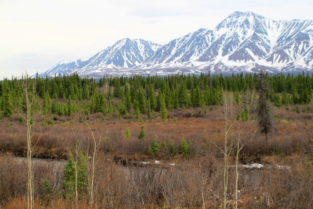
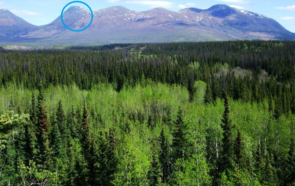
Looking south from the north side of the Jarvis river to Mt. Decoeli at upper right, 2013.  Pieces of the Alaska Highway are visible through the trees from center to the right.  The Kluane Wagon Road crossed the river here, and the Jarvis River roadhouse was located by the spruce trees to right of center.  The Exercise Reluctant Beaver Bridge Camp and the Bridge Site DZ were located somewhere in the area across the river.
(Gord Allison photo)

The other drop zone was located on the west side of Kloo Lake and called the ‘Stores DZ’, containing the supplies for what was named the ‘HQ Camp’ where the airstrip and road building crews would work from.  The sketch map in the exercise report shows this zone overlapping the lake surface and the shore at a location about a quarter-mile from the First Nation village.  The exercise report does not state if or how the supplies were planned to be delivered to the Stores DZ by truck.
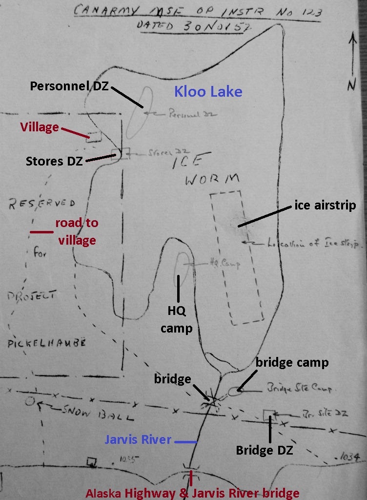
This is the rough sketch map contained in the Exercise Reluctant Beaver report.  The two camps and drop zones (DZ) are shown, along with the airstrip and bridge locations.  It is assumed that an unlabelled small box near upper left was intended to show the First Nation village, and the dashed line to it as the road.  The line marked with ‘X’’s was the telephone line.  It is not known what ‘Project Pickelhaube’, ‘Ice Worm’, and ‘Snow Ball’ are.
 (Library & Archives Canada, RG24 Vol. 35769, File 2001-91R8)
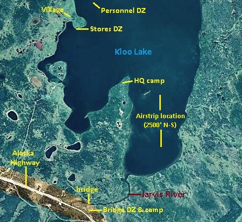
Imagery of Kloo Lake showing Exercise Reluctant Beaver locations and First Nation village.
(GeoYukon)

Whatever was the plan, it went awry when one of the trucks got stuck near the highway and its entire cargo was unloaded there.  Some of it was intended for the HQ Camp at the lake, over two miles away, leaving that camp without some essential supplies, including the wireless radio sets.  This meant there was no communication between the camps, and the personnel who were at the HQ Camp were left in the dark about where their supplies were.

The Stores DZ Snafu

‘Snafu’ is a term that originated in the military meaning “situation normal, all fouled up” (using the more politely worded version).  The unloading of supplies near the highway that were intended for the Stores DZ, located three miles away through the bush and across the lake, was the first major snafu of the exercise.  It took the remainder of Day 2 and all of Day 3 to sort it out and get the right supplies from the Bridge DZ at the highway to the Stores DZ.  This was accomplished by the grader and a small bulldozer pulling supplies loaded on a ‘stone boat’ that was constructed from logs. 
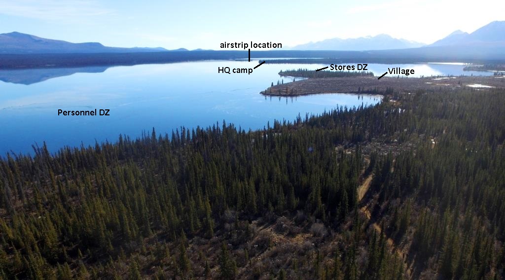
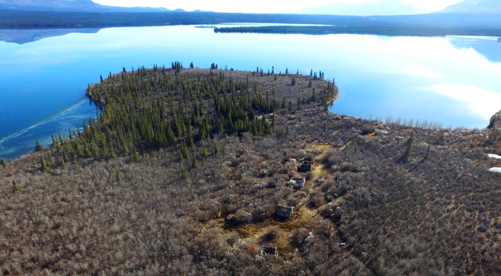
Looking SE across southern part of Kloo Lake, 2016, showing locations of First Nation village and Exercise Reluctant Beaver drop zones (DZs), HQ Camp, and airstrip.  The Alaska Highway, not visible in this photo, passes by the south end of Kloo Lake below the mountains in the top right corner.
(Neal Allison photo)
Looking ESE across southern portion of Kloo Lake, 2016, with First Nation village site in the foreground and the road leading to it at lower right.  The Exercise Reluctant Beaver ‘Stores DZ’ was above center on edge of the rounded peninsula, and the HQ Camp was on the end of the pointed peninsula at upper center.  The ice airstrip was in the bay at top center.
(Neal Allison photo)

The work involved with the movement of supplies to the Stores DZ by the machines was time-consuming and affected the rest of the exercise by delaying the beginning of the airstrip, road, and bridge construction by a couple of days.  After the supplies were finally delivered to the Stores DZ, it was soon found that the frequent retrieval of them across the mile of ice to the HQ Camp was too inefficient because it required using the grader or bulldozer, taking that machine away from its other work.   

On Day 7, all the work that had been involved in getting the supplies from the highway to the Stores DZ went for naught when the machines were again taken away from their work to haul the remaining supplies at the Stores DZ back to the Bridge DZ, where they had been hauled from five days prior.  From there, supplies for the HQ Camp would be hauled as needed by machine along the newly completed road, a greater distance than when they were being taken across the ice from the Stores DZ.  The rationale for this reversal is puzzling, but there may have been other factors not stated in the exercise report, perhaps the perceived safety of hauling across the ice being one.

The Heavy Equipment

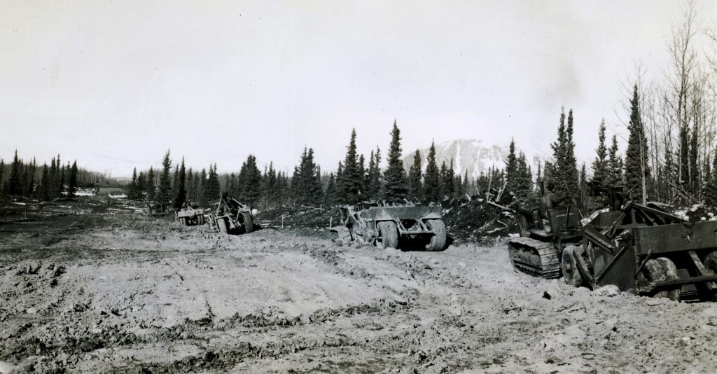
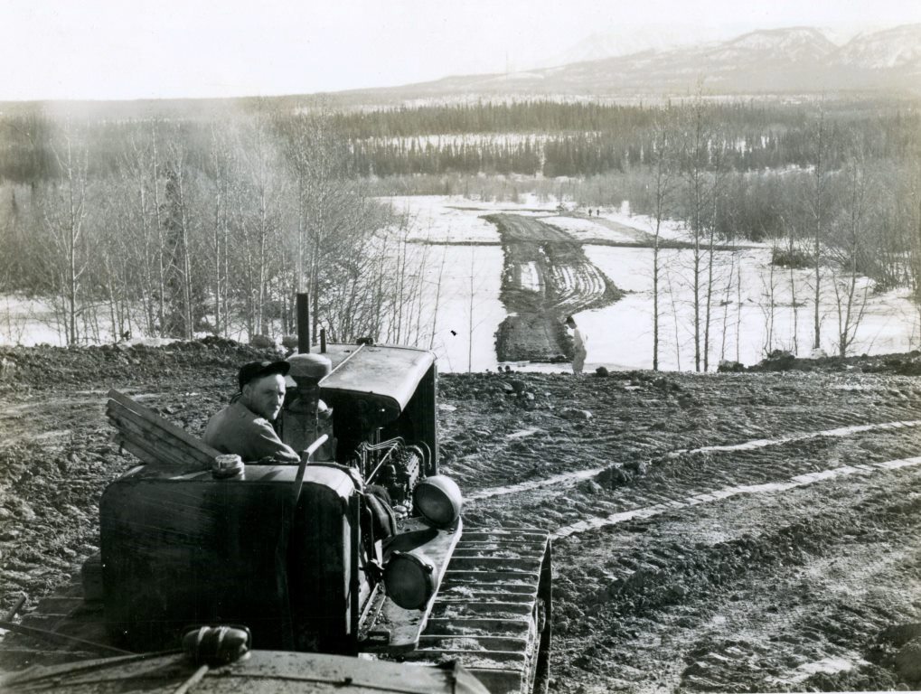
The plan for Exercise Reluctant Beaver on Kloo Lake was entirely dependent on the three small bulldozers and the grader.  The grader’s role was primarily to remove snow from the lake for construction of the ice airstrip, which entailed flooding it to thicken the ice.  This work was delayed by the supplies snafu on Day 2 that required the grader to move them to where they were intended.  The three bulldozers, also involved in the transport of the supplies, were to be used for building an almost two-mile road through the bush from the bridge site to the HQ Camp on the peninsula and for skidding and placing logs in construction of the bridge.

Two bulldozers were part of the second major snafu in the exercise.  For starters, the Allis-Chalmers HD 5G, which arrived in the evening of Day 3, was useless for helping to build the road because its tracks were configured for use as a front end loader and had virtually no traction on snow and frozen ground.  The next day would turn out to be a bad day, when it and another machine went through the ice of Kloo Lake in separate incidents, putting them out of commission, one permanently.

This started in the morning of Day 4, when the Allis Chalmers machine went to the Stores DZ on the west side of Kloo Lake and then was returning across the mile of ice to the HQ Camp.  Within 20 yards of the shore the machine broke through 12 inches of ice and into four feet of water.  The engine kept running even though the water was up to the top of it, and the machine was able to be pulled out within a few hours by a Caterpillar D-4 .  The machine was put into an improvised canvas shelter in the trees where five large heaters with fans, generally known as master heaters or Herman Nelsons, dried it out.  It was back in operation in the afternoon of the next day (Day 5), but later ended up out of service due to a mechanical issue that could not be addressed in the field.
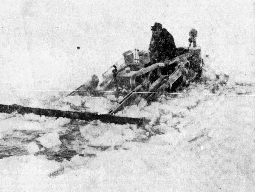
The Allis-Chalmers HD 5G tractor breaking through the ice of Kloo Lake near HQ Camp on Day 4.  This machine was rescued from the lake, dried and thawed out, and put back to work again.
(Canada Dept. of National Defence, in Edmonton Journal, 18 December 1952)

Several hours after the Allis Chalmers broke through the ice, so did one of the Caterpillar D-4s.  It left the HQ Camp on the peninsula destined for the Stores DZ across the lake to pick up a load when it broke through the ice 100 yards after leaving the shore.  In dark and nearly -30°C conditions, the driver who was fully immersed was pulled out by the valiant effort of a troop mate who was riding on the sleigh.  The driver was taken to the bush shelter, which fortunately was not far away, to warm up and dry out along with the Allis Chalmers.  He was evacuated to the Silver Creek base the next day due to chill and shock.

With two bulldozers out of commission and the load from the Stores DZ still being needed at the HQ Camp, this was considered an emergency, and Bombardiers (tracked all-terrain vehicles) that the umpires had for performing their tasks were used for it.  The main item required at the camp was fuel to keep the five heaters going in the machine shelter at the rate of 20 gallons per hour.

The D-4 had settled into more than seven feet of water, with the sleigh it was pulling still resting on the ice.  There is no information in the exercise report about any attempt to pull the machine out of the water, and one newspaper article said that it would be “left until the spring thaw”, but I have found no further information.  A Kloo Lake First Nation elder I talked with who was a boy at the time of this event has a vague recollection of it, but could not shed light on the fate of the D-4.   

The Ice Airstrip

A 2,500-foot airstrip was planned to be built on the southeast part of Kloo Lake to a thickness that would support use by Fairchild C-119G (Flying Boxcar) aircraft.  This would be done by flooding on top of the existing ice using Typhon ice drills that were being tested as part of the exercise.  This equipment was capable of drilling 9-inch holes through several feet of ice, and upon reaching water the auger acted as an impeller to pump water at 500 gallons per minute.

On Day 3 the centerline of the airstrip was marked out by the grader, but before anything more could be done it was needed for the moving of supplies to the proper places.  It was freed up later the following day to clear the rest of the snow from the proposed airstrip location.

On Day 5 the Typhon ice drills were put to work flooding the ice cleared off by the grader.  There was some difficulty encountered, particularly with starting the gas engines on them, but once going they worked fairly well.  On Day 6 a decision was made to remove the grader from the ice because cracks had begun to appear on the airstrip’s surface after repeated passes by the machine.  Water was seeping through and may have caused some nervousness after the experience of the two bulldozers falling through ice.

Pumping of water onto the airstrip continued on Days 7 through 9 with what was deemed moderate success in terms of gathering information about the technique.  From the beginning there had been no expectation that the ice could be built up from 12 inches thick to the 30 inches that would be required to support a C-119 Dakota airplane.  The exercise report does not state how much the ice was thickened by the water pumped on during the testing, but one conclusion drawn was that when air temperatures are -18° to -34°C, ice can be built at the rate of one inch per day. 

As the exercise was nearing its end, on the morning of Day 10 the ice airstrip went out with a bang when it was bombarded by explosives dropped along it from the air, sending columns of ice, water and mud shooting 400 feet into the air.  This was a test and demonstration of what would be done in real circumstances to render an ice landing surface unusable by enemy aircraft.

The Road and Bridge

The building of a bridge over the Jarvis River and a nearly two-mile road through the bush from the bridge to the HQ Camp on the southern peninsula of Kloo Lake was a training exercise for the airborne troopers.  The two linked projects would also serve the purpose of facilitating the demobilization of the camp at the end of the exercise.

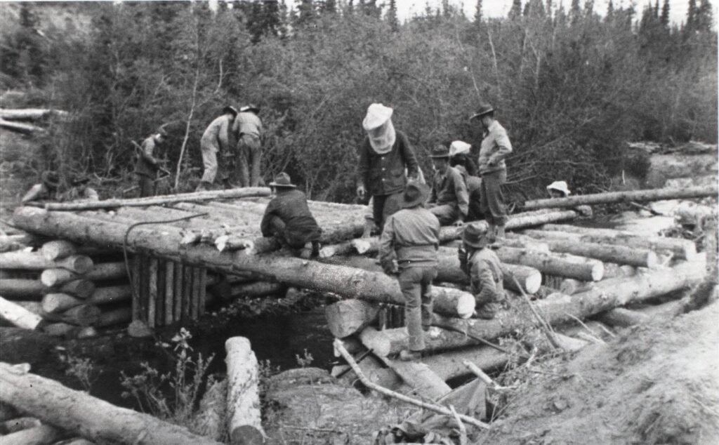
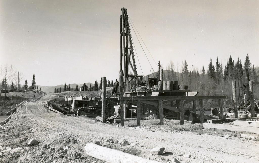
The bridge was built at a location about 100 yards upstream of where there had previously been a bridge at the Kluane Wagon Road crossing.  Work started on Day 3 with the felling of trees, and the next day preparation of the site was in full swing.  By Day 6 the bridge abutments on each side of the river were in place as well as two of the trestles.  On Day 7 the bridge was described as beautiful work, with timbers squared with adzes and of very substantial construction.  It was deemed to be fair progress, but should have been further advanced by this point.
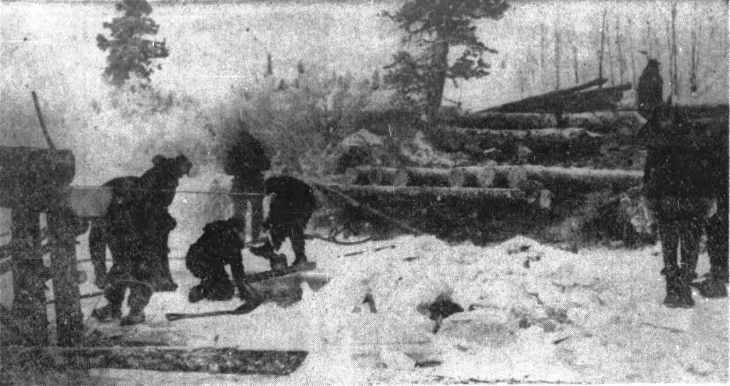
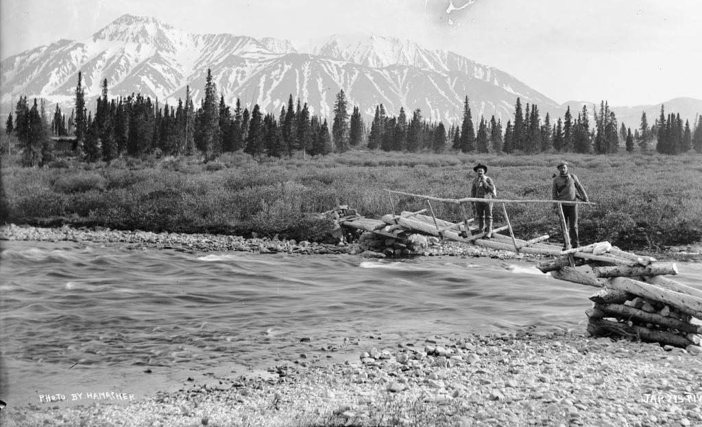
The Exercise Reluctant Beaver bridge crew and what may be sections of bridge piled up.  In the background at upper center appears to be the snowy roof of a building, which may be the old Jarvis River roadhouse still standing.
(Canada Dept. of National Defence, in Calgary Herald, 15 December 1952)

Day 8 brought about a problem for the bridge construction when river ice backed up the water so that it was flowing through and around the trestles.  This was resolved by sending a bulldozer into the river to break up the ice and relieve the back-up pressure of the water.

On Day 10 the 85-foot bridge was completed in late afternoon and crossed by a Northwest Highway System 12-ton wheeled tractor.  The following day, which was the final day of the exercise, it was crossed with a fully-loaded 10-ton truck, presumably with cargo from demobilization of the HQ camp over the constructed road.

The road construction had gotten off to a slow start when the machine(s) slated to build it were diverted for a couple of days to haul supplies to their designated places.  Then the two bulldozers broke through the ice into Kloo Lake, one permanently and the other needing rehabilitation for more than a day.  When the Allis Chalmers machine got back to work, it was found that its smooth tracks were useless for road construction, so the remaining D-4 took over. 

By the middle of Day 4, the D-4 had built 300 yards of road and by Day 6 had a rough road pushed through to the HQ camp.  On Day 7 it was deemed to be 50% of an adequate road, suitable for tracked vehicles only and too narrow for vehicles to pass.  On the final day (Day 11) the road was inspected and found to have an excellent alignment with a level and smooth surface, but it still lacked passing places.

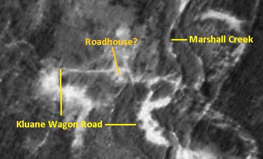
A 1956 air photo shows the road that was built from the Jarvis River crossing to the HQ camp site less than four years previously during Exercise Reluctant Beaver.  It also appears to show the bridge constructed as part of the exercise as a light line crossing the river.  This contrasts with the absence of the bridge that had been at the Kluane Wagon Road crossing of the river a short distance to the west.  The Army’s bridge is no longer in place in a 1964 air photo.
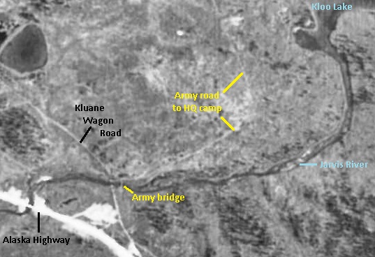
Section of a 1956 air photo showing the bridge gone from the Kluane Wagon Road crossing of the Jarvis River, and upstream from it (to the right) the Exercise Reluctant Beaver bridge shows as a thin white line across the river.  Also shown is the road built from the bridge to the HQ Camp (out of the photo).
(National Air Photo Library, A15434, #3)

There are still remnants of a bridge on both sides of the river in this area, but they line up better with the Kluane Wagon Road crossing.   In 1952 these remnants would have been somewhat more substantial and frozen into the riverbanks in December, which may have caused the Army to select a new crossing location rather than deal with the old bridge remains.
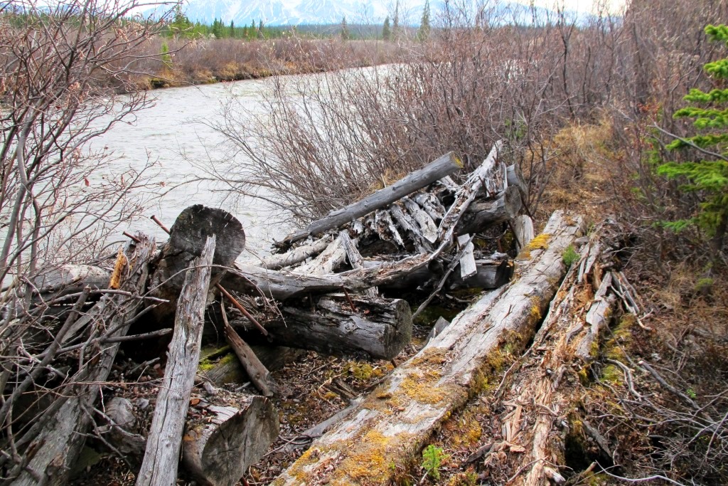
Remains of north end of bridge at the Kluane Wagon Road crossing of the Jarvis River, looking WSW, 2013.
(Gord Allison photo)

Brigade Water Point

This task with the odd name was given relative prominence in the exercise goals, although not a lot of details about it were given.  It is a means to provide a reliable supply of treated water to a large group of people from a single source so they aren’t using water from wherever they can get it.  The water point consisted of a suction pump to fill a tank with a filtration system and delivery lines to various types of outlets.

In the Exercise Reluctant Beaver scenario, the water point was assembled beside the Jarvis River near the Bridge Camp, where water from the river was readily available and vehicles could drive up to it for transporting elsewhere.  A large shelter was erected with a heater in it for storage of the water tank and lines, as well as the pump and suction hose when not in use.  Ensuring a healthy water supply is not surprisingly an important consideration in military situations, both real and in exercises.

The Exercise Results

The military personnel interviewed by the newspapers painted a relatively positive picture of Exercise Reluctant Beaver, while acknowledging some of its shortcomings.  Comments such as “we have learned all that we had hoped to” and “it has been most successful in an educational way” were offered, but at least one newspaper voiced a bit of skepticism.

A critique at the end of the exercise report probably expresses most of the truths.  There were various points made about topics such as planning and preparation, but of interest for this article are observations about the on-the-ground activities.  In short, and with some translated wording, some of these were:

  • a statement about the location of the Stores DZ on Kloo Lake, far away from the camps and work sites, was worded ambiguously, but ended with the word “unreal”;
  • the tents in the camps were well sited and well hidden, but discipline and training is required to get men to stop peeing in the snow everywhere (this is not the wording in the report);
  • recovering the sunken Allis-Chalmers bulldozer and the quick erection of a shelter to get it warming and drying was “very creditable work”;
  • repeated passes with the grader on the airstrip construction showed that transverse ice cracks (across the direction of travel) are safe and can be filled in, but longitudinal cracks (same direction of travel) are dangerous;
  • the road did not receive the time and attention it deserved because of unforeseen developments (the machinery being diverted to transporting supplies), but it turned out to be the “Cinderella of the Exercise”;
  • the bridge, using local timber, was “simple, straight-forward, and well-executed” and was considered an excellent job; and
  • the water point set-up was deemed to be adequate, although the site could have been kept cleaner

Ending

Exercise Reluctant Beaver at Kloo Lake was designed for airborne Canadian military personnel, particularly combat engineers, to get some training and experience in northern winter conditions.  They got some of this, although the coldest weather they got was -30°C and only briefly.  They also gained experience in having to adapt to things going wrong, whether circumstantial or self-inflicted.

I knew little about military exercises in the southwest Yukon where I grew up, and had no awareness of Exercise Reluctant Beaver at all until discovering the record of it in the national archives.  There was not a great deal of secrecy associated with it and other exercises because they were reported on in newspapers outside of the Yukon while they were going on.  However, as busy and obtrusive as this event must have been at the time, the lack of engagement with local people may be a factor in it not taking hold in the area’s collective memory. 

Another factor may have been that the demography along the Alaska Highway in the early 1950s consisted of a high proportion of people who grew up during the Depression of the 1930s, some of whom then went off to World War II, and emerged from that into the shadow of the Cold War.  My father, who was part of this demographic, was fortunate to find a work opportunity in the Kluane area in 1946 and would have been aware of Exercise Reluctant Beaver happening a few years later.  However, like others of the Depression and wartime background, he focussed on looking forward rather than back and may be why he never mentioned it. 

I am grateful that Ken Baltimore and Charlie Eikland Sr. were able to add some local flavor to the historical record of military exercises in this area.  I have the impression that both hadn’t talked before about their memories of the Kloo Lake and other military exercises, perhaps because they were never asked, but they seemed happy to do so decades later

The legacy of Exercise Reluctant Beaver includes remnants still visible on the Kloo Lake area landscape, mainly the road from the bridge site to the HQ Camp near the tip of the southern peninsula.  It will eventually grow in and disappear, and the only record of the exercise will be what is written, the photos in Library & Archives Canada, and perhaps a D-4 bulldozer sitting on the bottom of the lake. 
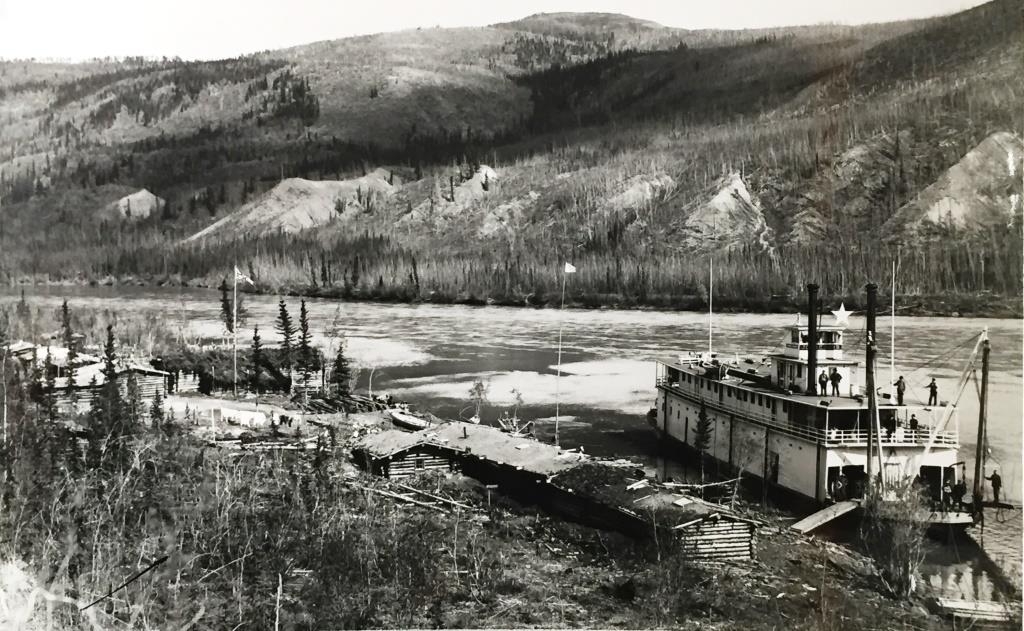
The Hootalinqua Woodcutter Murder

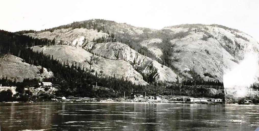
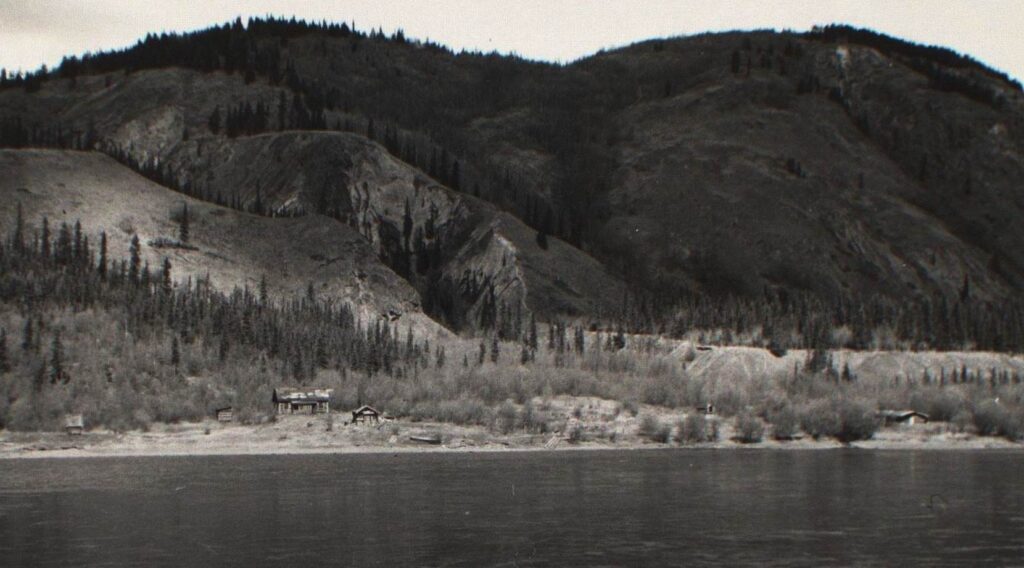
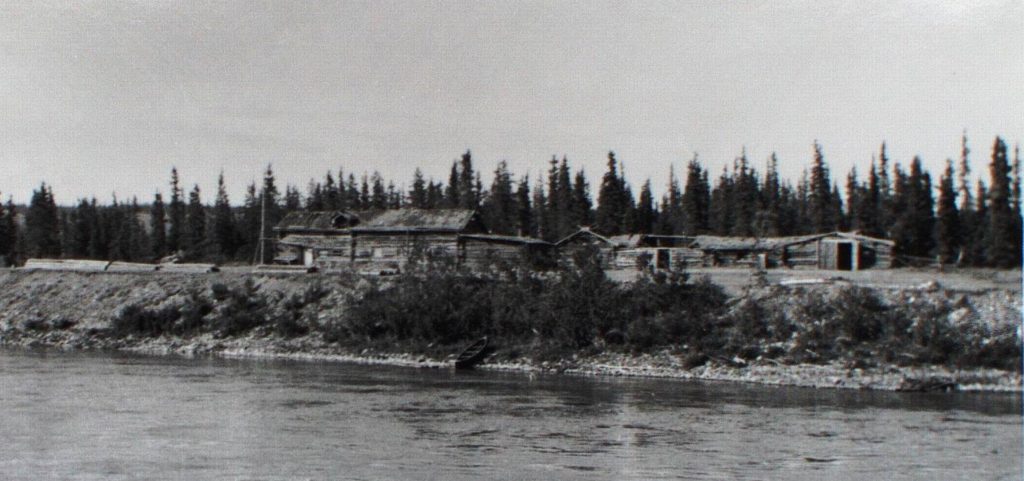
The small settlement of Hootalinqua, looking NE across the Yukon River, ca. 1900.  This photo was taken from the area of the North-West Mounted Police station. (Yukon Archives, E.A. Hegg fonds Acc. 82/290, #2689 – photo has been cropped)

Around 10 AM on November 17, 1900, on a hillside along the Yukon River eight kilometers downriver (north) of the small settlement of Hootalinqua, woodcutter George St. Cyr with his loaded rifle confronted another woodcutter, James Davis.  After a few terse words between them, St. Cyr’s rifle discharged into the chest of Davis, who slowly died on the spot.

The shooting death of James Davis led to a coroner’s inquest at Hootalinqua, followed by a trial in Dawson City that resulted in George St. Cyr spending the rest of his life in prisons and asylums.  A peripheral witness to the shooting, William Clethero, went on to have a family and make the Yukon his permanent home.

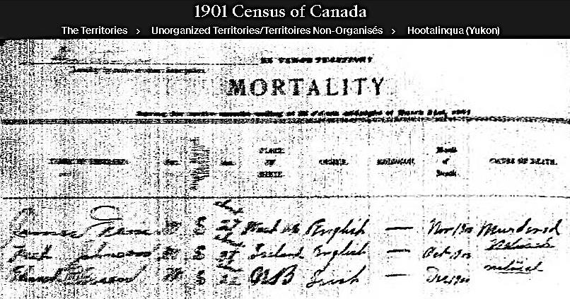
James Davis’s death is recorded in the 1901 Canada census, even though he died in late 1900.  There were 49 living people listed in the census for Hootalinqua, most identifying themselves as miners or woodcutters, along with a few merchants and North-West Mounted policemen.  The last page of the census is titled ‘Mortality’, where three men who did not live to see 1901 are recorded.  The first entry is for Davis, noted as a 27-year old single man (he was actually 33) from Washington, USA who was murdered in November 1900. 

The Mortality page from the 1901 Canada Census for Hootalinqua.  The top line of writing is the entry for James Davis, showing he was murdered in November 1900.
(1901 Canada Census on Ancestry.com)

The line on the census mortality page records James Davis’s death, but does not show that he had a life eight kilometers down the river from Hootalinqua where he cut fuelwood for the steamboats that plied the Yukon River.  There is not a lot of information about his life, but a semblance of it can be told and about what led to its ending. 

It is unfortunate that other news events captured Yukoners’ attention at the same time, taking the focus away from Davis’s life and senseless death.  In addition, newspaper coverage of the trial of George St. Cyr provided virtually no information about Davis and sometimes even got his name wrong.  As a result, the murder of the woodcutter James Davis on a hillside overlooking the Yukon River near Hootalinqua has gotten little attention in Yukon history. 

Background

Hootalinqua

Hootalinqua is a small abandoned settlement along the Yukon River 136 kilometers north of Whitehorse, located on the left (west) bank of the river just below the mouth of the Teslin River.  This central location served as a First Nation meeting place and fish camp before prospectors travelling over the Chilkoot Pass began exploring this part of the country in the 1880s.  It began as a settlement early in the Klondike gold rush and became a year-round one in 1897 when a store and roadhouse along with a North-West Mounted Police (NWMP) post were established there. 

The main rush of 1898 resulted in considerably more people passing by on their way to the goldfields of the Klondike, both by boat in the summer and along a trail on the Yukon River ice in the winter.  A number of people remained in the Hootalinqua area, particularly once a gold strike was made in 1899 on Livingstone Creek to the southeast that was accessed via the Teslin River.  By 1900 James Davis, George St. Cyr, and William Clethero had settled in the area to cut wood in the winters to sustain themselves and possibly also to support gold mining dreams they may have had.   

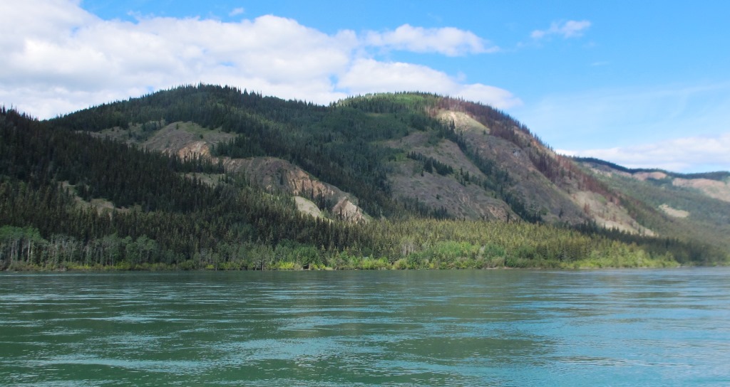
Hootalinqua, looking NW across the Yukon River in 1915.
(Yukon Archives, Christopher Everett Webb fonds, Acc. 80/87, #22 – photo has been cropped)
Similar view of Hootalinqua as above, 2022.  The few remaining buildings at the site are mostly hidden from view by vegetation now.
(Gord Allison photo) 

Two significant developments in 1899 changed things at Hootalinqua.  The first was the construction of the Yukon Telegraph Line passing through that summer, bringing improved communication with the outside world.  The telegraph service enabled the NWMP in both Dawson and Whitehorse to be notified of the murder of James Davis and for the investigative and justice wheels to be put into motion fairly quickly.  A year earlier, relaying of such news from this location would have taken many days or even weeks in mid-November, the time of year known as ‘freeze-up’ when the steamboats were no longer running and overland travel was difficult.

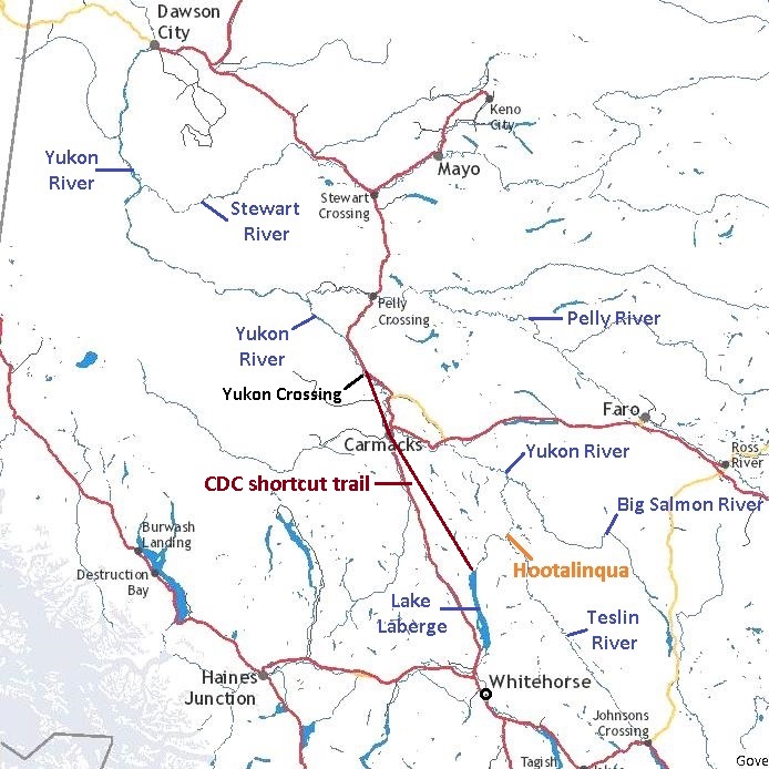
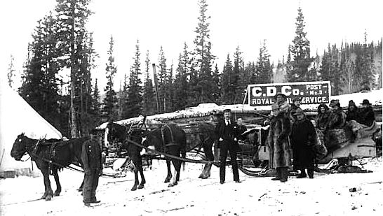
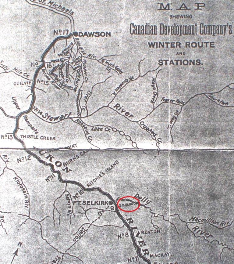
The second development in 1899 was the abandonment of a section of the Yukon River winter trail between Whitehorse and Dawson that went through Hootalinqua.  In the winters previous, this trail was on the ice of the river, but in the fall of 1899 a shortcut trail called the ‘CDC Cut-off’ (for Canadian Development Company) was cut out over land from the north end of Lake Laberge to the Yukon Crossing area north of Carmacks.  This eliminated a section of the longer and more dangerous trail along the river ice and bypassed Hootalinqua, meaning that little winter traffic now came through the settlement.  For the NWMP escorting the accused murderer and the witnesses to the trial in Dawson at freeze-up time in late 1900, the new shortcut trail provided a safer way to travel.

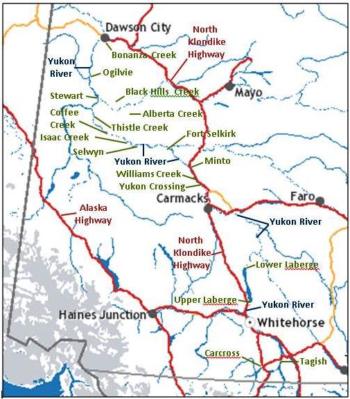
Map showing location of Hootalinqua and other locations along and connected to the Yukon River valley, as well as the CDC cut-off trail.
(GeoYukon)

As the early 1900s moved along and the Yukon’s population and activity began to decline, so did that at Hootalinqua.  By 1905 the NWMP post became seasonal, open only in the summers because the winter traffic didn’t warrant it being staffed.  The settlement was more or less abandoned in the mid-1920s with the closing of the telegraph office in 1925.  Apart from the telegraph office and another building, along with other remnants scattered about, the nearby cemetery is the lasting physical evidence of life that once carried on at Hootalinqua.

The Woodcutting Life

The Klondike gold rush gave rise to a large steamboat industry for transportation, along with a woodcutting industry to support the boats’ need for fuelwood.  Steamboat history gives captains and pilots all the fame and glory, but their professions and the industry as a whole depended on the hard labor and entrepreneurial drive of woodcutters.  Woodcutting camps sprang up all along the Yukon River and other valleys where there were good sources of timber and nearby riverbanks that could accommodate steamboats pulling into and loading on the wood. 

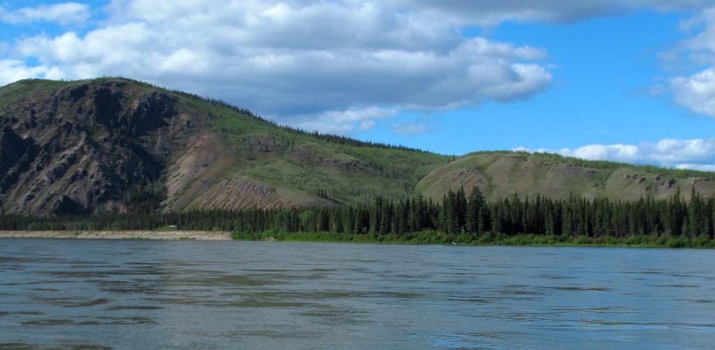
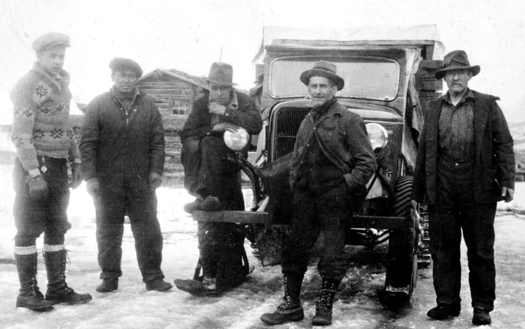
Most woodcutters cut hundreds of cords of wood over the course of the year, all by axe and cross-cut saw and handled much of it manually.  For many years they were called ‘woodchoppers’, undoubtedly due to the prevalence of axes in their work, but woodcutters became the more common term.  A range of hills to the east of the Yukon River in the Yukon Crossing – Five Finger Rapid area was named Woodcutters Range in their honor.  (see link to related Finley Beaton woodcutter article at end)

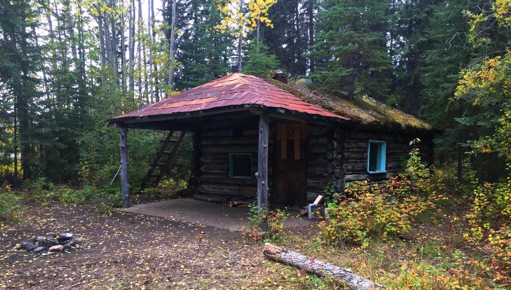
The woodcutters lived their lives in log cabins and occasionally in tents, sometimes relatively isolated from other people and in some situations in close proximity as was the case with James Davis and George St. Cyr.  They operated under contract to the steamboat companies, which from 1900 on was primarily the British Yukon Navigation Company, a subsidiary of the White Pass & Yukon Route.  Some woodcutters worked year-round at their woodyard while others appear to have dabbled in mining or other pursuits in the summers.  Some did the opposite, such as roadhouse operators who ran those businesses in the winters and cut wood in the summers. 

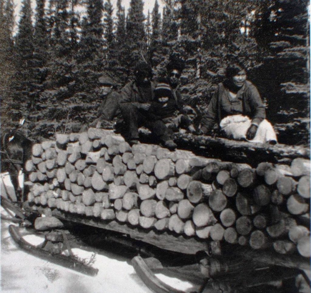
As the woodcutters moved further away from the river to access new areas of timber, horses or dog teams were used to move the wood out to the riverbank.  This was usually done in winter when the ground was frozen and the wood was easier to move, either by dragging or carting in sleighs.  The wood was cut into four–foot lengths and piled four feet high, with an eight-foot row constituting a cord, which was the basis of payment.  Long rows of this cordwood were stacked along the riverbank to be available for loading onto the steamboats, which made frequent stops for ‘wooding up’. 

The steamboat Casca ‘wooding up’ near Little Salmon, 1953.  The wood was wheeled on hand carts down the gangplanks and stacked on the bow (front) of the boat for feeding into the boiler.  This view is upriver, as boats landed facing up the river. 
(John Stelfox photo)

In the early years of the steamboats large areas called timber berths were allotted to companies that cut fairly large volumes of wood.  These areas were mapped and marked out and the companies had the exclusive rights to harvest wood within them.  Individuals were normally issued timber permits and a woodcutter could usually operate in one area for several years before having to move. 

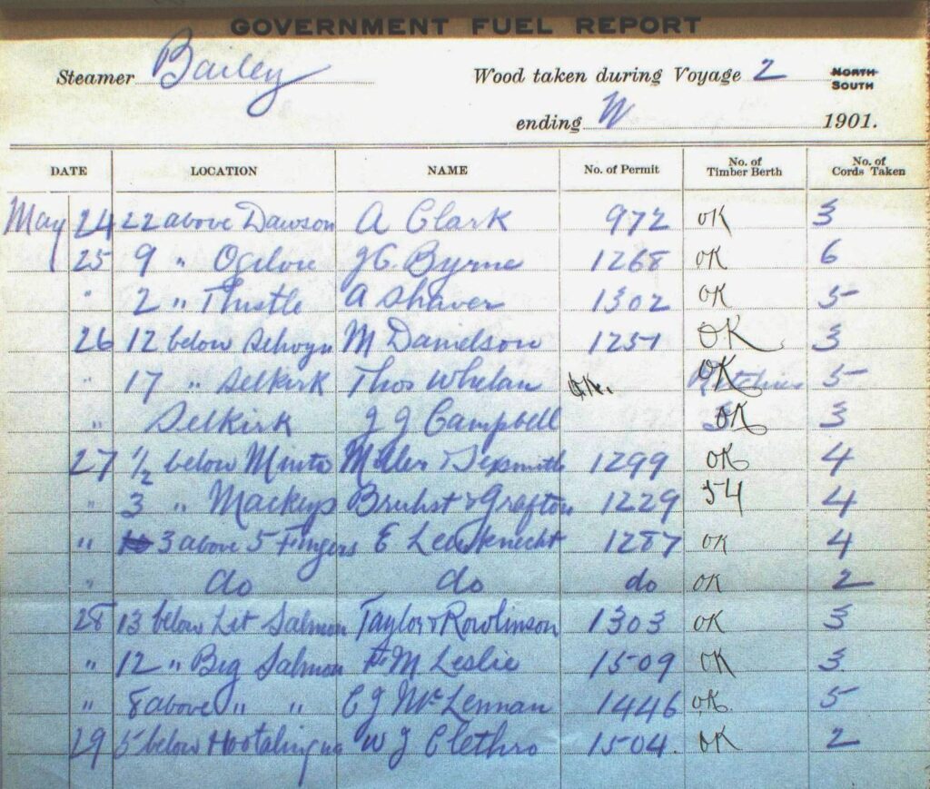
The timber permits involved no exclusive cutting rights nor permit area boundaries laid out.   A letter written by the Crown Timber and Land Agent at Fort Selkirk in February 1901 contained this recommendation: “that cordwood permits be made ‘exclusive’, that is that not more than one permit be given for any one locality … I was given to understand that if this had been law heretofore, St. Cyr would not be accused of murder, as … who had prior claim to a given locality was the original cause of the trouble arising between Davis and St. Cyr”.  While timber permit areas may have been a factor in the relationship between the two men, the records show that it would have been only one among others that led to their fatal encounter.

At the time of that encounter in November 1900, James Davis and George St. Cyr were living and working near each other along the Yukon River downriver and on the opposite (east) side of the river from Hootalinqua.  Davis and William Clethero were woodcutting partners who lived in Davis’s cabin seven kilometers from Hootalinqua.  They had an uneasy relationship with St. Cyr, who lived in his cabin a kilometer further downstream. 

James Davis

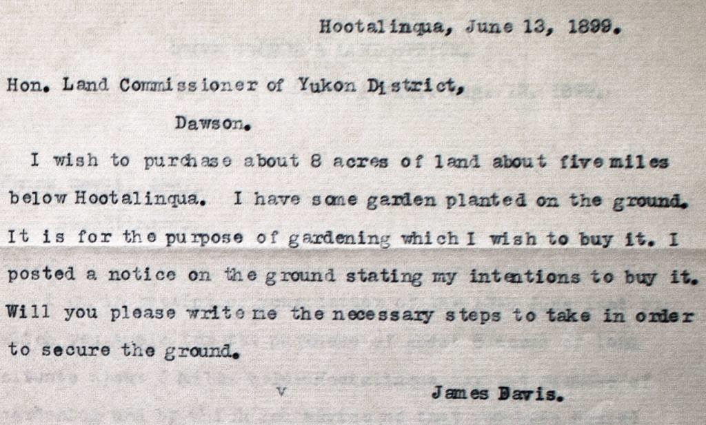
James Davis was born in 1867, the third of fourteen children born to John and Caroline Davis, a well-to-do business couple in Walla Walla, Washington.  James left that life to join the Klondike gold rush, with records indicating that he came into the Yukon in 1898 and was settled near Hootalinqua by June 1899.  On the 13th of that month, he applied for eight acres of land downriver from the settlement, in the vicinity of where George St. Cyr also obtained land.  Davis stated that he wanted the land for gardening, and had already planted some garden there.  No mention is made of a cabin, but it is likely he had built his cabin there or was working on it.

James Davis’s June 13, 1899 letter of application for land near Hootalinqua for gardening purposes.  He likely had someone in Hootalinqua, such as the North-West Mounted Police or a telegraph operator, type the letter up for him.
(Yukon Archives, GOV 3683, file 11)

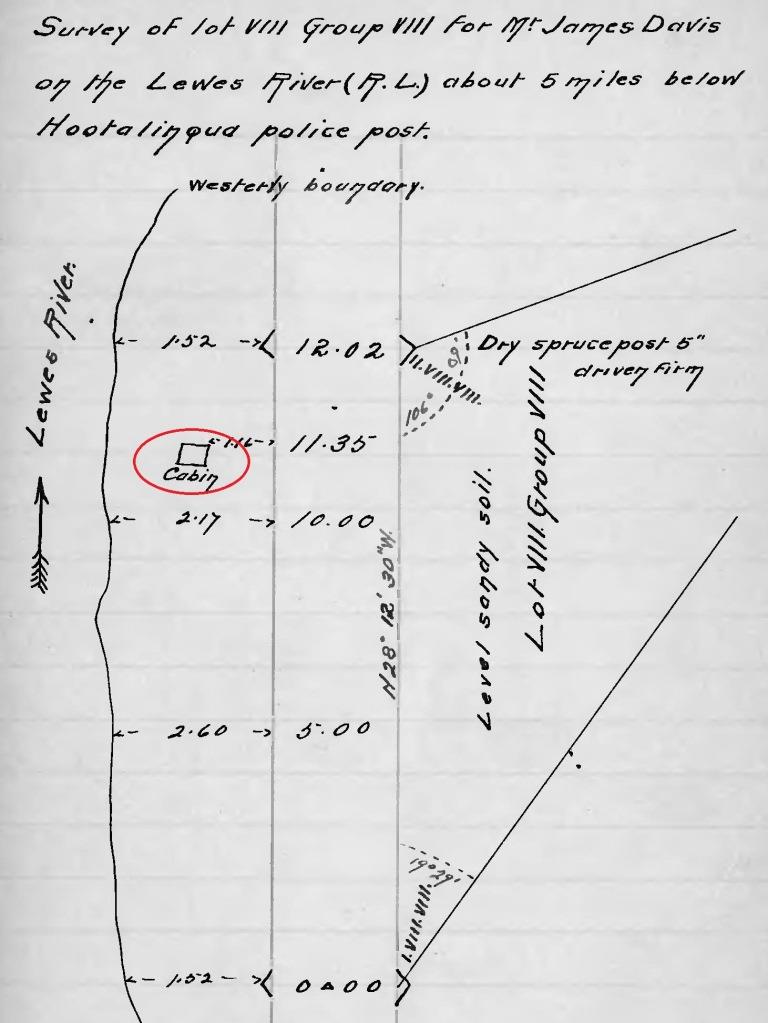
Davis ended up with only 2.84 acres of land, perhaps because the response to his letter stated that he would be required to pay $20 per acre plus the cost of survey, estimated at $100.  He asked for some time to come up with that amount of money, so at some point he likely decided to reduce the size of the parcel for monetary reasons (although in the end he only had to pay $10/acre and $50 for the survey).  His land was surveyed along with St. Cyr’s in July 1900.

George St. Cyr

George St. Cyr was born in about 1865 in Quebec, the fifth of nine children in a prominent family.  He headed west as a young man and was in British Columbia by 1891, probably because his older brother Arthur was there.  Arthur was a Dominion Land Surveyor and in the late 1890s carried out exploratory surveys in northwestern BC, the country to the north and east of Teslin Lake, and the Hootalinqua and Big Salmon Rivers.  He also was involved in the International Boundary Survey as well as the survey of sections of the Yukon-BC boundary between Teslin Lake and the Alsek River.

In 1894 and 1895 George was working on the survey of the Alaska-BC boundary between Glacier Bay and Yakutat Bay in southeast Alaska/northwestern BC.  On this and perhaps other projects, George may have been working with his brother Arthur.

In 1899 George came to the Yukon and began living in the Hootalinqua area sometime that year.  At some point he applied for and was granted two parcels of land for unspecified purposes down the river (north) from the settlement, and these were surveyed for him in July 1900.

William Clethero  

William Clethero (often spelled Cletheroe, and at the time of the murder was spelled Clithero or Clitheroe) was born in 1876 on the Falkland Islands in the Atlantic Ocean near the south end of South America.  His parents were of English origin and he had two older sisters and a younger brother.  When Clethero was 23 years old in 1899, he arrived in Canada and by the following year was at Hootalinqua, where he became a woodcutter, first as a partner with George St. Cyr and then with James Davis.

The Davis and St. Cyr Properties

This article originated from research into three parcels of surveyed land situated within a one-kilometer stretch seven to eight kilometers north of Hootalinqua on the east side of the river.  They were surveyed in July 1900 by Dominion land surveyor Charles MacPherson of Dawson for the two woodcutters who were the principals of this story, James Davis and George St. Cyr. 

The existence of these three parcels bunched together in this setting at a distance from the settlement piqued my curiosity.  Research into them and the people they were surveyed for soon revealed the story of James Davis’s murder.  It also showed that titles to the land parcels had not yet been granted to Davis and St. Cyr before the murder event disrupted everything.

The first parcel going downriver (north) was about seven kilometers from Hootalinqua, a 2.84 acre (1.15 ha.) triangular-shaped plot of land that James Davis had been granted.  It was situated on relatively flat ground on a point of land with the river on the west and north sides of it.  Davis’s cabin was located close to the river, just off his land near its northwestern corner.

Page from field book of survey of James Davis’s 2.84-acre lot and showing his cabin.
(Canada Lands Survey Records, FB 6430, p. 33)

About 500 meters to the north of Davis’s property was a 10-acre (4.05 ha.) square piece of land belonging to George St. Cyr.  It was on a gently rolling slope with a small spring creek running through it, and at the time of the survey was described as a mixture of open country, burned timber, and green bush.  It had no human developments shown on it, and the intended need and use of this parcel is unknown.

Another 500 meters further north of St. Cyr’s 10-acre parcel was the second piece of land belonging to him, this one a square parcel of two acres (.81 hectares) in size, with relatively low land on the river side that appears subject to occasional flooding.  St. Cyr’s cabin was located on this lower land and situated about 140 meters back from the river, with a small slough in between.  Behind the cabin the land rises sharply up a small hill, and a small stream of clear, cold water from the hills passes by not far from the cabin site.

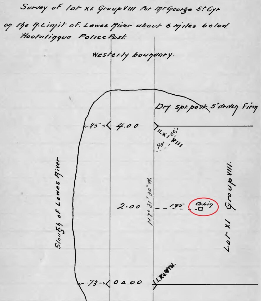
Page from field book of survey of George St. Cyr’s two-acre lot and showing his cabin.
(Canada Lands Survey Records, FB 6430, p. 42)

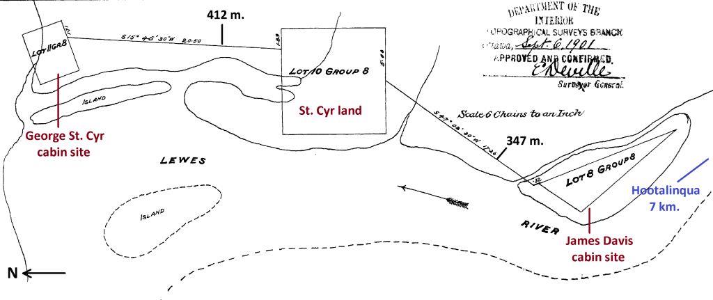
The surveyor MacPherson also produced a sketch map showing all three lots and the spatial relationships between them.  The straight-line distance between the two cabins was slightly over a kilometer.

Survey plan showing spatial relationships between James Davis and George St. Cyr’s lots north of Hootalinqua.  Davis’s land shows as an island, but by the mid-1900s it was not, according to air photos.  North (downriver) is to the left.
(Canada Lands Survey Records, #8940)

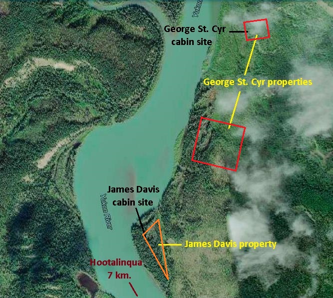
The image below shows this same spatial relationship of the lots on the Yukon River on modern imagery.

Imagery of the Yukon River valley north of Hootalinqua showing the lots and cabin sites of James Davis and George St. Cyr.
(GeoYukon)

The reason(s) for St. Cyr and Davis applying for and acquiring their land parcels remains undetermined.  They paid $10 per acre for their properties along with a $50 survey fee, which demonstrates a degree of seriousness on their part when they were paid only a few dollars per cord of wood that they cut, hauled and stacked by hand.  Perhaps both men had grander and longer-term visions for their futures in the Hootalinqua area.

Whatever reasons Davis and St. Cyr had for going through the process of applying for and paying for their land parcels and the survey of them remains unclear.  Perhaps both men had grander and longer-term visions for their futures in the Hootalinqua area.

The Murder, the Inquest, and the Trial

Lead-up to the Murder

The story of what led to the murder of James Davis and its aftermath appears to begin on February 8, 1900.  According to St. Cyr, that is when he and Clethero became woodcutting partners and stayed together in St. Cyr’s cabin.  The partnership ended fairly abruptly a few months later on May 28, 1900. 

On the day before this, Clethero told St. Cyr that he wanted to go home (presumably meaning the Falkland Islands) because it was too dull at Hootalinqua.  He was expecting a letter with money for him to make the trip, and said that he did not want to return home a pauper.  St. Cyr told him he would go to Hootalinqua the next day to get him some money to go back home, to which Clethero replied that he would work for another month.

The next morning St. Cyr poled his canoe the eight kilometers up the Yukon River to Hootalinqua and got a $300 loan from Dan Snure, the roadhouse operator.  On his way back down the river, St. Cyr stopped at Davis’s cabin to deliver him something, whereupon Davis mentioned that he had had a visit from Clethero. 

On arriving at his own cabin, St. Cyr found Clethero with his belongings packed, which he quizzed him about, as well as why he visited Davis in his absence.  Clethero replied that he went to ask Davis if he could be his woodcutting partner because of some quirks that St. Cyr had.  St. Cyr took offence at this and a physical altercation ensued between them, the details of which differed in their testimonies. 

Clethero left for Davis’s cabin a kilometer to the south and the next day walked along the river up to Hootalinqua and returned with NWMP Cst. Ferris to St. Cyr’s cabin.  Clethero gathered his belongings he had left there and was given the money St. Cyr had gotten for him, then in the company of Cst. Ferris went to his new lodging in Davis’s cabin.

St. Cyr and Clethero gave different information about their interactions in the time between the dissolution of their partnership in late May and the day of the shooting in mid-November.  St. Cyr said he ran into Davis twice and Clethero once, but did not say anything about the context or tone of these encounters.  He claimed to be aware that Clethero and Davis were “blackmailing” him, a term that he understood meant to “slander or take away a person’s character”.  He did not say in what manner they were doing this or how he knew about it.

As for Davis, St. Cyr said that he had no hard feelings toward him, even though he had once found him cutting on his land, which Davis explained was because Clethero had suggested he go there.  St. Cyr also said that he and Davis had owned a scow and a raft together, then Davis sold the raft and kept the scow, but St. Cyr had long since forgiven him for this.

Clethero’s testimony differed from St. Cyr, saying that he had never spoken with him since their partnership dissolved and bore no ill will toward him.  He surmised that St. Cyr had some sort of grievance with him because he never visited, and also believed that St. Cyr blamed Davis for taking Clethero on as his woodcutting partner.

Joseph Primeau, a camp cook and woodcutter who had met St. Cyr previously in Vancouver, stayed with him for a time in August 1900 at his cabin below Hootalinqua.  Primeau said later that he was aware of the disagreement between St. Cyr and Clethero and the dissolution of their partnership, but he could not say what St. Cyr’s disposition was toward Clethero and Davis. 

Davis and Clethero worked together from the formation of their partnership in late May and through the summer, taking out a timber permit for 150 cords of wood on August 31.  Whatever interactions they may have had with St. Cyr working in relatively close proximity to them, it all came to a head on the morning of November 17, 1900. 

The Murder and Investigation

The following account of the murder of James Davis by George St. Cyr and the investigation of it is assembled primarily from two sources: statements given at a coroner’s inquest at Hootalinqua by St. Cyr and five witnesses, the main one being William Clethero; and newspaper coverage of the trial in Dawson.  The witness statements are contained in Library & Archives Canada RG18-A-1, Volume 236, File 664-02 and the trial reporting was by the Dawson newspaper Daily Klondike Nugget in its editions of February 4, 5, and 7, 1901 (by the February 7 edition the newspaper had changed its name to the Semi-Weekly Nugget).

The testimonies and information from these processes generally agreed on what transpired on the day of the murder.  What is certain about the death of James Davis near Hootalinqua on that November day is that he was killed by the discharge of a rifle in the hands of George St. Cyr.  What is uncertain is why and how it discharged, as the only person who knew that was the one who held the rifle.

William Clethero was not a witness to the shooting, but he was within sight of where it happened and heard a shot.  He had also been involved in the circumstances that brought on the tension that led to the conflict.  The validity of some of the information provided by St. Cyr and Clethero about these events was undoubtedly influenced by their self-interest and attitudes toward each other. 

In the morning of November 17, Davis and Clethero went out to work cutting trees on the hillside straight back (east) from their cabin, a distance that the NWMP later estimated to be 600 yards.  Around 10 AM, Clethero broke the handle of his axe and told Davis he was going back to the cabin to repair it and would prepare their lunch.  While doing this he heard a gunshot, and a short time after went outside to dump out some water and saw a man walking away from where he knew Davis was working.  He thought the man was George St. Cyr.

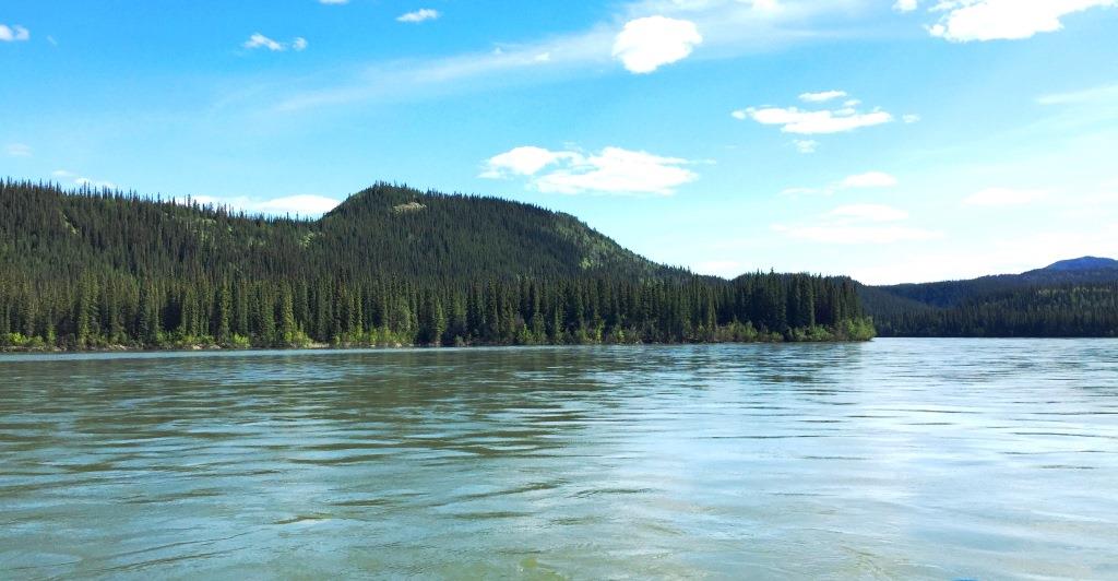
View south up the Yukon River toward the site of James Davis’s cabin, located on the point of land extending to the right of center, 2022.
(Gord Allison photo)

Earlier that morning, a kilometer to the north, St. Cyr also left his cabin after breakfast to go cut cordwood.  After working for a while, he heard some chopping sounds from the southeast direction and thought that someone might be cutting on ‘his land’.  He wondered if perhaps Davis and Clethero “were still contemplating some further outrages”.  St. Cyr laid down his axe and started toward where the sound came from, “fully intending to have some kind of explanation from them on their past behaviors”.

View southeast up the Yukon River to the site of George St. Cyr’s cabin, located back off the river at about center and near the bottom of the small pointed hill, 2022.
(Gord Allison photo)

St. Cyr walked in the direction of the chopping until striking the south boundary of his 10-acre parcel of land and followed the survey line to the southeast corner post of the property.  He continued in a southerly direction that took him uphill into a ravine and when he got to the far edge of it, the cutting noises stopped.  He was by then close enough to the two men that he could hear them talking and said he heard Clethero make a derogatory remark about him.  He also said he heard Davis tell Clethero not to worry about St. Cyr, as they will soon have him out of the country.  St. Cyr said they then proceeded to call his parents offensive names.

Under later cross-examination questioning why he continued going toward the chopping sounds even after he had determined they were not coming from his land, St. Cyr said he wanted to ask Davis why he had stopped coming for visits.  He also wanted to know if he and Clethero were plotting to cut timber on his (St. Cyr’s) land.

When St. Cyr “could endure [the insults] no longer”, he walked back to his cabin and put some cartridges in his .30-.40 Winchester rifle, including one in the chamber.  At the inquest he said the gun was “to make Davis and Clethero apologize for past and present insults”, but at his trial he also said he feared Clethero, suggesting that the rifle was also taken along for potential self-defence. 

St. Cyr saw on the clock in his cabin that it was now 9:30 AM and began the walk back the way he had come, following the ravine up to a place he could cross it, then continued on an uphill angle a few hundred feet more to another ravine.   When he got near the top edge of it, he heard somebody chopping and saw the back of a man’s head.  He went further to within 25 or 30 feet of him on the uphill side, then stood there watching him.  The walk from his cabin had taken about 20 minutes and it was now approaching 10 AM.

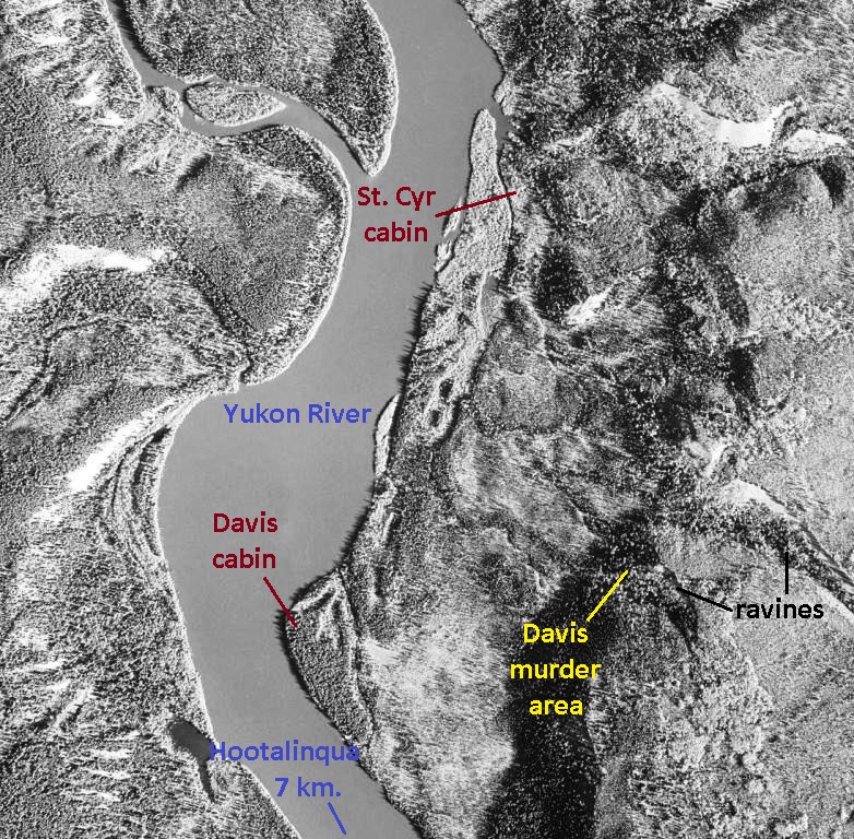
2007 aerial imagery showing the James Davis and George St. Cyr cabin sites, along with the ravines and approximate area where Davis was killed.
(National Air Photo Library, A28543, #71)

According to St. Cyr’s testimony, after several minutes the man chopping wood turned and it was Davis, who was startled upon seeing St. Cyr.  He gave a terse acknowledgement before starting to chop the tree from the other side.  St. Cyr asked Davis “why he and [Clethero] had been aggravating him the past months and insulting him?”  Davis didn’t answer, so St. Cyr asked him to repeat what he and Clethero had been saying about him and his parents earlier, to which Davis uttered something that St. Cyr did not understand. 

St. Cyr said he had the gun under his right arm, not at his shoulder, and in his nervousness and “the excitement of the moment”, it went off.  Davis’s arms went up and he fell back into a sitting position facing out over the river valley.  St. Cyr said he thought Davis was ‘shamming’ (faking), so walked closer to him and asked if he was hit.  There was no answer, but he noticed a few drops of blood on the snow and asked where he was hit, but again got no answer.  Davis sat there rocking and moaning with his arms crossed over his chest, saying only “my God” a few times.   St. Cyr told him he was sorry this had happened.

From the elevated site of the shooting on the hillside there was a clear view to Davis’s cabin, as the timber in the valley below had already been cleared for fuelwood.  St. Cyr could see Clethero outside the cabin and shouted at him a few times, but he didn’t seem to hear.  He then fired a shot into the air to get Clethero’s attention in the hope that he would come and help get Davis off the hill and to his cabin.  St. Cyr said that Clethero left the cabin and “ran away”.

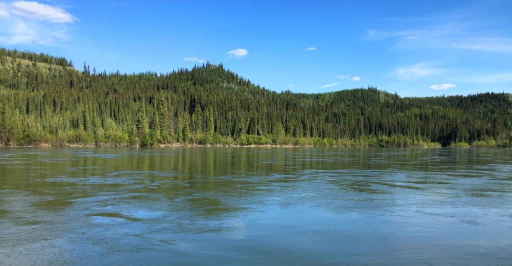
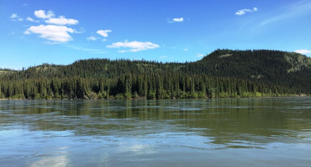
View southeast across the Yukon River at the site of James Davis’s cabin just off the river near center, 2022.  Davis was shot and killed by George St. Cyr somewhere on the hillside above and left of center.  The ravines mentioned by St. Cyr in his testimony are likely the two breaks between the small hills at left.
(Gord Allison photo)

St. Cyr said he remained with Davis for about 30 minutes, occasionally hollering for Clethero.  During this time Davis changed his position to lie on his stomach with his left hand under his chest and right hand stretched out on the snow.  St. Cyr went and lifted the exposed hand up and it was limp, but Davis was still breathing.  St. Cyr tried to lift him up to see if he could carry him, but he was too heavy.  St. Cyr put him back down as he was, then walked the kilometer back to his cabin, gathering up his woodcutting tools on the way. 

Clethero had heard a gunshot while preparing lunch in the cabin, but his testimony does not indicate he heard two shots as St. Cyr claimed to have fired.  When Clethero went outside to dump some water, he saw a man with a rifle that he thought was St. Cyr walking away from where he and Davis were working.  Clethero put some wood on the fire and said he heard the faint cry or moan of a man, which he thought could be Davis in distress.

About 15 to 20 minutes after hearing the gunshot, Clethero armed himself with a rifle and set out to where Davis was and found him lying down and bleeding.  Upon asking him what the matter was, Clethero claimed that Davis said St. Cyr had shot him and he didn’t know why, and that he would kill him (Clethero) too.  Clethero later testified that he took the rifle for protection because the cry of distress he heard might have been the result of St. Cyr shooting Davis.  He said Davis had feared that St. Cyr might “lay waiting” for him sometime.

There was a hand sleigh at the site, but Davis was a heavy man and the fallen timber all around and lack of a trail in the 14 inches of snow prevented Clethero from being able to move him.  Later when asked why he didn’t seek out St. Cyr for assistance, Clethero said he would not do that because of what Davis had told him about being shot by St. Cyr. 

Clethero told Davis that he would go get help, but noted that his eyes were sunken back in his head and he appeared to be dying fast.  Clethero wrapped Davis’s parka around him and then departed directly on the seven-kilometer walk to the Hootalinqua NWMP station to report what had happened.

Back at his cabin, St. Cyr unloaded his rifle and put it in the gun rack without cleaning it, then locked up the cabin.  He began to walk the eight kilometers to Hootalinqua to give himself up to the NWMP for accidentally shooting James Davis.  He was on the trail behind Clethero on the walk that would take about two hours.

At first neither Clethero nor St. Cyr would have known that the other was on the trail.  St. Cyr would have realized it when he came upon tracks in the snow heading south toward Hootalinqua, and Clethero may have thought that St. Cyr could be coming behind him.  It was likely a very stressful walk for both of them, knowing what the other knew, and not knowing if the other was packing a gun. 

Across the river from Hootalinqua, NWMP Corporal Charles Stewart and Constable Frederick Gardiner were cutting firewood for the police post when a man named William Mason summoned Stewart to his nearby house.  There Stewart found William Clethero, who told him about what had happened downriver.  The two NWMP members took Clethero across the still ice-free river in their boat, got some arms from the NWMP post, and then Stewart along with Cst. John Richardson and Clethero headed down the river to Davis’s cabin. 

From the cabin the three men walked to the scene of the shooting and found Davis lying on his back deceased and his body beginning to freeze.  Stewart observed that Davis had been in the act of cutting down a tree on a steep slope when shot and he and his axe fell where he had been standing. 

Stewart and Richardson went to check out St. Cyr’s cabin and found it locked up.  They cut the lock off with an axe to get inside, where they saw three guns hanging on the wall, two that were well-oiled and one that appeared to have been used. 

They then went and caught Davis’s horse and used it to carry his body back to his cabin to thaw out.  Upon examining it, they found that the bullet had entered to the left of the breast bone just below the collar bone and travelled back and down, coming out below the shoulder blade.  The NWMP surgeon Dr. Hurdman in Dawson later testified that the described injury would likely rupture the aorta and other arteries, resulting in death within half an hour.  Stewart and Richardson wrapped the body in a tarpaulin and put it in an outbuilding, then went into the cabin to spend the night along with Clethero.

Back at Hootalinqua, St. Cyr reached the point across the river at about 12:30 PM and went to the tent of an acquaintance, Louis Johnson, who was eating lunch and invited St. Cyr to join him.  St. Cyr said he had no time because he was going across the river to give himself up to the police for shooting James Davis accidentally.  Johnson was not aware of this, indicating that his tent must have been some distance from where Clethero had met up with the NWMP members a short time before.  

Johnson then ferried St. Cyr across the river in a canoe, and when he got out of the canoe at Hootalinqua, the roadhouse and store operator Dan Snure along with others were on the shore.  St. Cyr expected that Snure wouldn’t come and shake his hand under the circumstances, but he did as usual.  St. Cyr said to him and the others that he would rather not speak with them right now and went to the NWMP post where he gave himself up to Cst. Gardiner and was fed lunch.  This was three-quarters of an hour after Cpl. Stewart, Cst. Richardson, and Clethero had departed for the scene of the shooting.  For St. Cyr, lunchtime in the Hootalinqua jail was the beginning of the rest of his life in custody.

The Inquest at Hootalinqua

The death of James Davis on November 17, 1900 occurred at a time of year when travel usually ceases where rivers are involved.  The large rivers and lakes of the Yukon were its highways in 1900, even in the winters, but at the time of year in the late fall known as ‘freeze-up’, travel on the waterways stopped until the ice was solid enough to be safe.  In mid-November, depending on the year and location, the large rivers of the southern and central Yukon usually have ice running in them or are frozen over but not yet safe for travelling on. 

The Davis murder appears to have happened in a year of a late freeze-up, with the river still ice-free enough to be navigable by small watercraft.  However, the murder investigation and the inquest held at Hootalinqua, along with the subsequent transport of the alleged murderer and witnesses to Dawson, all took place during the period when the river would be freezing over but not entirely suitable for travel.  This factor is not mentioned in the records of the murder and follow-up events, but for the police it must have posed considerable challenges that had to be overcome in the pursuit of justice and respect for a murder victim.

NWMP Superintendent Philip Primrose in Dawson received word of the murder by telegraph later the same day it happened, and the following day wired Inspector John McGibbon in Whitehorse to go to Hootalinqua to investigate.  McGibbon likely left Whitehorse the next day, November 18, but there is no record of his trip there or by what means.  He would have had to travel north on or beside the 37 kilometers of Yukon River to Lake Laberge, then along the 50-kilometer long lake that was probably recently frozen, and down or beside the 50 kilometer section of Yukon River from Lake Laberge to Hootalinqua that may have had ice running in it. 

A hint about the difficulty of McGibbon’s trip to Hootalinqua is contained in a Dawson Daily Klondike Nugget newspaper article ten days later, which said that as of the evening of November 28, Inspector McGibbon had not yet arrived there.  The article said the NWMP believed “the cause of the officer’s not yet having reached [Hootalinqua] is due to the bad travelling between Whitehorse and that place”.  It appears that it took McGibbon around 10 days to travel the 136 kilometers from Whitehorse to Hootalinqua, an average of only 14 kilometers or so per day, undoubtedly due to ice conditions.

When he finally arrived at Hootalinqua, Inspector McGibbon assumed the role of coroner and impanelled a jury of six local men on November 29.  The jury observed McGibbon’s questioning of six witnesses: the prisoner George St. Cyr; William Clethero, who had been in the vicinity of the shooting did not directly witness it; Louis Johnson, the woodcutter who was the first person St. Cyr talked to after the shooting; and the Hootalinqua-based NWMP members who investigated the incident, Corporal Charles Stewart and Constables John Richardson and Frederick Gardiner. 

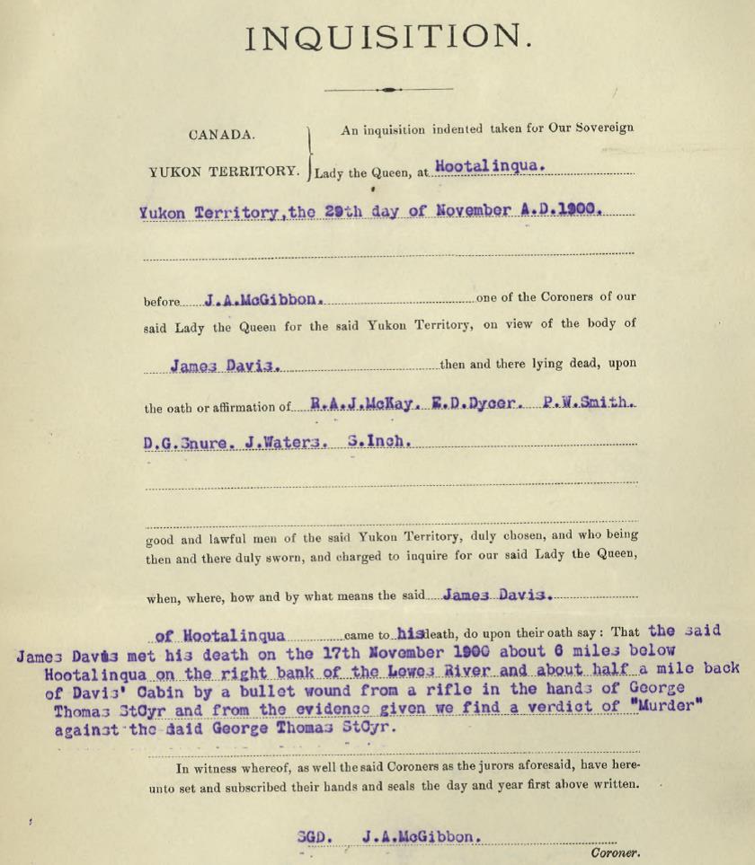
Summary of ‘inquisition’ (inquest) into the death of James Davis held by NWMP Inspector McGibbon and six local jurors at Hootalinqua, including the viewing of Davis’s body, on November 29, 1900.  The jury rendered a verdict of murder by George St. Cyr, which was their recommendation that he should stand trial for murder.
(Library & Archives Canada, RG18-A-1, Vol. 239, File 664-02)

At the end of each interview (other than St. Cyr’s) is the notation “No cross questions by Prisoner”, meaning that St. Cyr had the opportunity to cross-examine the people providing their information.  This included the testimony given by William Clethero, who was near the shooting of James Davis and with whom St. Cyr had some animosity.  Clethero would have had to answer Inspector McGibbon’s questions in St. Cyr’s presence in the confines of a relatively small room in the Hootalinqua NWMP detachment.

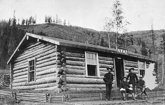
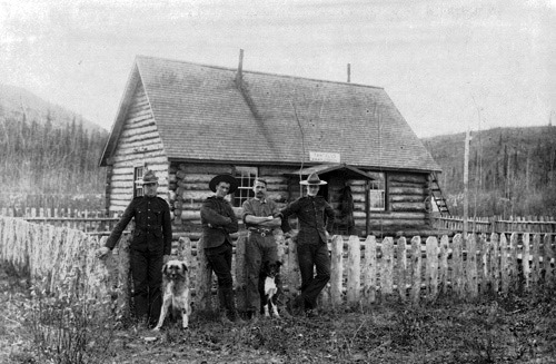
The Hootalinqua North-West Mounted Police post, ca. 1901.  One or more of the members pictured may have been involved in the murder investigation, transport of St. Cyr and witnesses to Dawson, and the trial.
(Library & Archives Canada, #A202192)

The coroner’s jury found that “James Davis met his death … by a bullet wound from a rifle in the hands of George Thomas St. Cyr and from the evidence given we find a verdict of murder”.  This finding by the jury was direction that a murder charge should be laid against St. Cyr, and it was followed by instructions from the NWMP to bring him to Dawson to stand trial.  The wheels were promptly set in motion to get St. Cyr and the necessary witnesses to Dawson for a murder trial.

To Dawson for the Trial

The first step in bringing George St. Cyr to trial for murder was getting him and four witnesses the 550 kilometers from Hootalinqua to Dawson during the freeze-up.  The witnesses, all of whom had also given evidence at the coroner’s inquest, were William Clethero, Louis Johnson, Cpl. Charles Stewart and Cst. Frederick Gardiner.  The only records of this journey are the NWMP annual report for 1901 simply stating that “the prisoner was removed to Dawson to stand his trial” and a news article saying that St. Cyr was brought to Dawson in the charge of Cpl. Stewart.  It is reasonable to assume that Stewart and St. Cyr travelled apart from the other three men to maintain separation between the accused and those witnesses.

The trip to Dawson probably commenced not long after the inquest at Hootalinqua held on November 29.  Two weeks had elapsed since the murder of James Davis and in that time the Yukon River ice had likely formed and perhaps thickened enough that some or most of it could be travelled on.  The method of travel may have been by dog teams if there were enough dogs available at Hootalinqua, otherwise they would have gone on foot and perhaps were later able to get onto a horse-drawn stage.

The route the men are most likely to have taken was southerly along the Yukon River to Lake Laberge, then westward across the north end of the lake to the northwest corner of it.  There they would have joined onto a new 150-kilometer trail known as the ‘CDC Cut-off’ that had been constructed the previous year for the Canadian Development Company mail service.  This trail, from the north end of Lake Laberge to near Yukon Crossing, north of Carmacks, had been built as a safer and shorter route by eliminating travel on about 265 kilometers of Yukon River ice.

When the Hootalinqua travellers came onto the cut-off trail at the north end of the lake, if they were on foot they may have been able to get a ride with a mail stage or one of the small independent stage line companies that were providing this service between Whitehorse and Dawson.  They also would have had the option of staying in some of the many roadhouses that had been established along the trail, rather than camping out.

By whatever means they were travelling, near Yukon Crossing they would have reached the end of the cut-off land trail and got onto the Yukon River winter trail for the rest of the journey to Dawson.  In the Minto area they would have passed by the spot on that trail where one year previous, on Christmas Day 1899, Frederick Clayson, Linn Relfe and Lawrence Olsen were ambushed and killed by George O’Brien and perhaps an accomplice.

Cpl. Stewart and St. Cyr arrived in Dawson at the end of the last day of 1900.  They had been on the trail the better part of a month, meaning that they averaged around 18 kilometers of travel per day, which is slow and indicative of poor trail conditions.  Stewart turned St. Cyr over to the NWMP detachment in Dawson, then in true Canadian style he went looking for the hockey rink.

The Trial at Dawson

The trial of George St. Cyr got some newspaper coverage, but it was overshadowed by other news happenings in Dawson, particularly the ongoing story of the investigation and pending murder trial of George O’Brien.  There was also the killing of Pearl Mitchell in October by her purported husband James Slorah in a room above a saloon and the disappearance and search for Dr. Joseph Bettinger along the Yukon River winter trail in December.

In addition to these stories, the upcoming murder trial of St. Cyr focussed on him because of his family connections and being known in Dawson.  This meant that little attention was given to James Davis, the undeserving victim of murder, but there was likely little known about him to write about.   

In the days leading up to the trial, one newspaper reported that George St. Cyr was in good spirits and expected to show that the shooting was in self-defence.  The paper also stated that because of his good character and family reputation, public sympathy would be with him.  On January 4, 1901, St. Cyr was taken before the court, where he pleaded not guilty to the murder of James Davis and elected to be tried by a jury.  His attorneys, George Black and C.M. Woodworth, requested more time to gather evidence, and the trial eventually began on February 4 and wrapped up three days later.

William Clethero was the first witness to testify and the primary one because of his history with St. Cyr and Davis and being near the shooting when it occurred.  Both he and St. Cyr, who testified later in his own defense, described the events more or less as they had related them at the coroner’s inquest in Hootalinqua.  There were a few inconsistencies between them, but the only issue that St. Cyr particularly refuted was Clethero’s testimony about the details of the physical altercation they had in the evening their partnership ended.

When he took the stand in his own defence, George St. Cyr was described by the Dawson newspaper as under medium height but strongly built, 45-50 years old (he was actually around a dozen years younger than this), bald with grey hair and mustache, and speaking with a slight German accent (being from Quebec, this would more likely have been French).  The newspaper said he appeared to be nervous and spoke rapidly when answering questions. 

NWMP Cst. Gardiner testified at the trial because he had taken the first statement from St. Cyr at Hootalinqua, but also because he had sold St. Cyr the rifle that had been used to kill Davis.  St. Cyr’s attorneys asked him some questions that explored the possibility of the rifle being fired by the hammer being drawn part way back and released, without it being actually cocked and the trigger intentionally pulled.  Gardiner responded that he had no experience in that regard, but he would not like to stand in front of the rifle to test that theory.

There were other references at both the inquest and the trial about things that could have caused the discharge of the gun, such as a sudden jarring of it or folds in St. Cyr’s clothes that pulled the trigger.  St. Cyr also said he had his mitts on at the time, implying that he couldn’t have pulled the trigger with his finger.

A number of witnesses were called to testify to George St. Cyr’s character, with the result a somewhat mixed bag, some contradictory, but generally in his favor.  Jean Coté, a Dominion land surveyor, said that he worked with St. Cyr on a surveying trip in 1894-95, where he had a good reputation and got along well with other party members.  He was a nervous man, but “not of a melancholy or brooding nature”, and was “frank and jolly, and very talkative”. 

Joseph Primeau, the camp cook and woodcutter who had lived with St. Cyr for a time in Hootalinqua, said St. Cyr was nervous and excitable at times, but his reputation was good.  He said he couldn’t shed any light on St. Cyr’s relationships with others.  A man named John Hale said he had met St. Cyr a few years previously in Victoria and knew him for about a year, and that he had a good reputation.

The most scathing comments came from Commissioner William Ogilvie, who testified that he met St. Cyr in the spring of 1894 when he was working on a survey party for the international boundary under Ogilvie’s direction.  Ogilvie said that St. Cyr had a reputation of being a “crank” and “intensely disagreeable in camp, resenting things said to him, seeming to brood over them for days afterwards”.

During this part of the trial related to St. Cyr’s character and reputation, there was a discussion about insanity.  While it appears to have been raised by Black, St. Cyr’s attorney, he did not want to show insanity as a defence.

In the trial summation, the Crown prosecutor reviewed the evidence and advanced his view that the accidental shooting claimed by St. Cyr was improbable, and used a rifle to demonstrate.  This was followed by Justice Dugas’s instructions to the jury, and also his expressed opinion that St. Cyr, “in the telling of his story, impressed him very favorably”.

The jury deliberated for about 1½ hours in the evening of February 6, returning a verdict of guilty with a recommendation for mercy.  This came as a surprise, as most people following the trial were expecting not guilty, or at least a reduction to manslaughter.  There was no obvious reaction from George St. Cyr.

On the following morning of February 7, 1901, Justice Dugas sentenced St. Cyr to death.  This was another surprise, but Dugas stated that the guilty verdict for murder left him no alternative.  He asked St. Cyr if he had anything to say, to which St. Cyr replied that the gun went off by accident.  Dugas said that was information the court had already heard, and sentenced St. Cyr to hang on June 7.  George Black made an immediate formal motion to suspend the sentence for an appeal to be undertaken “on the grounds that the verdict of the jury was against the weight of evidence”.

The Aftermath

James Davis‘s Burial

After Cpl. Stewart and Cpl. Richardson retrieved James Davis’s body from the murder site and stored it in a cache at his cabin for the night, they took it back to Hootalinqua, likely the next day.  This would have involved one or more of poling, rowing, and lining their boat (the latter meaning pulling with a rope) against the Yukon River current with the body of a large man in it.  Once at Hootalinqua, they would have had to preserve the body as well as possible for a coroner’s jury to be able to view it.  They would not have known when that would occur, and as it turned out it would not happen for another 11 days.

James Davis was buried in the Hootalinqua cemetery, located on an open ridge about a quarter of a mile to the north of the settlement.  It was carried out by some local men who were paid $30 for the work, which in late November or early December would have involved keeping a fire going to thaw the ground for digging the grave.

Hootalinqua and its remaining buildings in 1936, looking NW.  The cemetery is on the ridge in the lower right portion of the photo.
(Yukon Archives, Geological Survey of Canada fonds 90-36, #117 – image has been cropped)

On the 1901 census Mortality page, the line below the entry for James Davis shows that a Fred Johnson, also in his 30s, died of natural causes the month before Davis.  Johnson was buried in the Hootalinqua cemetery and in 1972 his grave marker was still legible. There is a good chance that a grave close to Johnson’s that either never had a marker or it was gone or illegible by 1972 is Davis’s burial site.

Grave markers in the Hootalinqua Cemetery, 1972.  The further marker is for the grave of Fred Johnson, and perhaps the unidentified one in the foreground is for James Davis.
(Yukon Archives, Yukon Waterway Sites fonds Acc. 88/18, #164 (1-17) – image has been cropped)

At some point the Public Administrator advised James Davis’s family in Walla Walla, Washington by telegraph or letter of his death and burial, adding them to the list of the many families who saw one of their own go off to the Klondike and not return.  In July 1901, James’s mother Caroline Davis wrote back about the possibility of her son’s remains being sent back home and was informed that the cost would be $250 to $300 to have the body exhumed and shipped to Vancouver, plus the cost of its transport to Walla Walla. In a further letter in November 1901 she said that they were still undecided about this, but in the end it did not happen.

A legacy of James Davis’s life is the unofficial name of Davis Point on the Yukon River, where his cabin was located and near the site of his tragic death.  It appears on a river chart sketched by long-time steamboat pilot Emil Forrest, which I became aware of thanks to Mike and Jocelyn Rourke.  The 2022 edition of the Rourkes’ Yukon River guidebook contains a summary of Davis’s murder and George St. Cyr’s trial and sentence along with a map label for Davis Point.    

Page containing Davis Point from Emil Forrest’s Yukon River strip maps produced in 1957.
(Yukon Archives, Emil Forrest fonds, Map H-720)

George St. Cyr, Inmate

George St. Cyr was an inmate from the time of his arrest for the murder of James Davis until his death.  Three days after he was found guilty of murder in February 1901 and sentenced to hang in June, he attempted to commit suicide twice in the same day by jumping off of his bunk onto his head to break his neck.  The reason was apparently because of the shame he had brought onto his family, but the only results were severe bruising and a special guard placed in his cell day and night.  One newspaper reported that George’s brother Arthur never came to assist or support him during or after the trial, even though he was in the country surveying the Yukon-BC border that year.

In March, when St. Cyr was serving the few months he had left until his scheduled execution date, Justice Dugas went to bat for him in a letter to the federal Minister of Justice in Ottawa.  Dugas included a report summarizing the details of the murder case, along with his opinion that St. Cyr’s “evidence was such to impress strongly that he was telling the truth”.  He pointed out that St. Cyr had surrendered immediately, had not gone near the only witness (Clethero), and had given consistent accounts of the shooting.  Dugas said these factors left some doubt in his mind about St. Cyr’s guilt and he had communicated this to the jury, to no effect, but he said he wanted to support the jury’s recommendation for mercy in St. Cyr’s sentence.

The result of Dugas’s appeal was that on March 18, 1901 St. Cyr’s death sentence was commuted to imprisonment for life in the guard room of the NWMP in Dawson.  The Order-in-Council for the commutation was signed by the Governor General Lord Minto, who had passed through the Hootalinqua on a trip to the Klondike the previous August, just three months before the murder.  A telegram pronouncing the reduced sentence was read to St. Cyr, who listened intently and had no reaction other than nodding and was taken back to his cell. 

The newspaper reported that St. Cyr’s appearance had changed in the two and a half months since his trial, from being clean-shaven with neatly trimmed hair and “a glowing cheek”, to a gray-bearded old-looking man.  The paper also made the observation that St. Cyr’s new sentence meant his life would change from sitting and waiting for his meals to toiling in the prison yard for the rest of his life.

St. Cyr’s time at the prison in Dawson was only to last to the end of the year, however.  In the intervening months he had shown signs of what was deemed to be insanity and had become increasingly violent, so it was decided to transfer him to an asylum in New Westminster, BC.  In late December and early January he was taken by dog teams in relays to Whitehorse, then on the White Pass train to Skagway, and by steamship to Vancouver, where he and his escort arrived on January 5, 1902.  The escort was NWMP Cst. Robb, and St. Cyr was said to have been “only at times giving the officer any difficulty”.  

St. Cyr’s tenure at New Westminster lasted less than a year, similar to his time in the Dawson jail.  By December 1902 he was pronounced sane and was transferred to the Kingston penitentiary in Ontario to serve out the rest of his life sentence.  At some point in his time at Kingston, St. Cyr was transferred to an asylum at Guelph, Ontario, presumably because he was deemed to have lost his sanity again. 

The details of this transfer to a Guelph asylum are not known, but it had happened by 1923 because St. Cyr was there when he became entitled to an inheritance from the death of his brother Arthur in Mexico.  The other heirs (his siblings and their children) contested that because George was insane, the $14,000 left to him should be distributed amongst them.  The case went to the Supreme Court of Ontario, which ruled that his share should be left in the hands of the public trustee because St. Cyr might someday recover his sanity and be capable of administering his own estate.  That is the last record I have found about George St. Cyr, and have not determined when he died and where he is buried.  He does not show up in a search of the 1931 Canada census.    

William Clethero‘s Yukon Life

Following James Davis’s death, his partner William Clethero provided a listing of what was in the cabin they had shared, such as tools, cooking equipment and utensils, and food provisions.  He purchased everything except personal items such as clothing and bedding that had belonged to Davis. After the trial in Dawson, Clethero returned to the Hootalinqua area and resumed his previous life there, presumably living in the same cabin.

After the trial in Dawson, William Clethero resumed his previous life in the Hootalinqua area.  A few months afterward when the ice went out of the Yukon River in May 1901, he sold steamboat fuelwood from a location eight kilometers north of Hootalinqua.  This would have been the wood that he and Davis, and perhaps also St. Cyr, had cut the previous year. He had a horse to assist him in his work, perhaps the same one that carried the body of James Davis down off the hill from where he was killed.

Wood report of May 1901 for the Canadian Development Company steamboat Bailey.  William Clethero is shown on the last line as selling two cords of wood from his location five miles below Hootalinqua.
(Yukon Archives, GOV 1683, file 53)

Clethero went on to live in the Yukon for more than 50 years, raising a family and engaging in a number of endeavors including mining in the Livingstone Creek area and the Whitehorse copper mines, working on big game hunts, and working in the trading post business at Champagne.  William Clethero died in 1953, leaving many descendants in the Yukon, and is buried in the Pioneer Cemetery in Whitehorse.

The Properties

James Davis’s estate consisted of very little after various expenses were paid out, such as his burial and the amount owing on his land and the survey.  The Public Administrator put Davis’s Lot 8, Group 4 up for sale in hopes it would give a boost to the estate that could be passed along to his family.  His mother wrote three more letters, the last almost two years after her son’s death, asking about the sale of his land, but in October 1902 she was advised by the Public Administrator that they had been unable to dispose of it.

Lots 10 and 11, Group 4 that were surveyed for George St. Cyr in July 1900 were not registered in the Yukon Government’s Land Titles Office, so they never went to title and reverted to the Crown.  After James Davis’s death, Lot 8 that had been surveyed for him was registered in the name of the Yukon Public Administrator, evidently as part of settling Davis’s estate, but is also now in the name of the Crown.  The three lots sit out on the landscape as surveyed land parcels that serve no current purpose.

Visiting the Sites

In July 2022 Ron Chambers and I visited the area near Hootalinqua where George St. Cyr, James Davis and William Clethero lived and worked in 1900.  The survey plans for the lots enabled the locations of the cabin sites to be approximated and searched for to see if evidence of them could be found.  It was also to gain a better understanding of the geography and setting where these woodcutters worked and one of them died.

James Davis’s cabin site was in a somewhat more prominent place than St. Cyr’s, located not far off the river on a small rounded point.  There was not much to see there, but a sizable hole in the ground was likely a cellar under his cabin for keeping things cool in the summer and some protection from freezing in the winter.  Encircling the hole was a berm of dirt that would have come from the roof of the cabin.  The building had probably been removed for rebuilding elsewhere or for firewood, but various pieces of rotting lumber, some with nails in them, were scattered around the site as more evidence of occupation there.

Site of James Davis’s cabin where he and William Clethero lived at the time of Davis’s death.  A sizable tree is growing from the hole that would have been the cellar for the cabin, and the berm of dirt around the hole was likely the roof covering.  This view is toward the SW, with the Yukon River located through the slightly cleared area to the right of center.
(Gord Allison photo)

A kilometer downstream (north) from Davis’s site was where St. Cyr’s cabin location was found, farther back from the river and close to a hillside rising not far behind it.  There was even less evidence than at Davis’s cabin site, primarily in the form of tin cans and some bottles lying around.  The site showed that the abnormally high water of the Yukon River earlier in the summer had flooded over the site, scattering much of the human evidence around and depositing a layer of silt across the area.  An exact determination of where the cabin sat was difficult to ascertain.

Site of George St. Cyr’s cabin, located a couple of hundred meters into the bush off the Yukon River.  This view is toward the north, with the river being to the left of the photo.  This silty area from high water flooding contains tin cans and some glass containers scattered about.
(Gord Allison photo)

Ending

A seemingly innocuous look at survey plans from 1900 led to researching the murder of James Davis and visiting the area along the Yukon River north of Hootalinqua where he and two other men lived and worked.  The research revealed that Davis met his untimely and senseless death from a number of combined factors, including: men working in an isolated bush setting but in relatively close proximity to each other; no identifiable boundaries on the ground to mark the limits of their timber rights; a history of increasing tensions and bad feelings; and perhaps a developing mental health issue referred to at the time as ‘insanity’ or ‘lunacy’.

The dedication of the North-West Mounted Police in pursuing justice for James Davis was commendable, especially considering the circumstances.  From the start of the investigation of the shooting near Hootalinqua to the handing down of the murder sentence 550 kilometers away in Dawson took about two and a half months.  Much of the force’s work required considerable physical effort to travel on the land and water at a difficult time of year.

The murder trial of George St. Cyr was relatively well covered in the Dawson newspaper, but it gave no glimpse into the life or background of the victim.  The sad tale of James Davis’s death might have garnered more attention and sympathy had it not taken place in the shadow of the more sensational O’Brien murder case that gripped the country for a year and a half. 

George St. Cyr died in either a prison or an asylum as a convicted murderer.  His sentence may have been justified or he may have been the second victim of a confrontation that went terribly wrong.  The shooting death of James Davis may not have been his intended outcome, but it happened because he chose to bring a loaded rifle to a conversation with Davis and to keep it pointed at his chest. 

John and Caroline Davis in Walla Walla, Washington saw their eldest son set off on an adventure and possibly a new life in the Yukon, but would never see him again.  For James Davis, his final resting place is on a peaceful ridge overlooking the beautiful Yukon River valley he had ventured to and acquired some land where he may have envisioned his future.

Link to related article: Finley Beaton, Yukon River Woodcutter

Updated 18 April 2024

Haines Junction and Area History, 1890 to 1950 – Part 3

The Beginning of Haines Junction

Looking west along the ‘pioneer road’ of the Alaska Highway, now called Marshall Creek Road, to Haines Junction, ca. 1977.
(Gord Allison photo)

The highway and bridge construction site known as Camp Mile 108 that was established in 1943 beside the Dezadeash River at the junction of the Alaska Highway and Haines Road would gradually evolve to a permanent highway maintenance camp and ultimately a community.  This evolution, however, was not assured until July 1946 when restrictions placed on development along the Alaska Highway were lifted and an agreement was made between Canada and the US to maintain the Haines Road.  It would take a few more years after that for the Canadian government to implement its process to get land into the hands of people wanting to establish businesses and residences at the site.

Before the Second World War and the building of the Alaska and Haines Highways, the Canadian and American governments were already interested in setting aside the southwest Yukon and an adjacent area in Alaska for preservation and recreation.  For its part in this vision, the Canadian government set aside 10,160 square miles adjacent to the two highways, land that now constitutes Kluane National Park and the Kluane Game Sanctuary. 

In 1942 the Canadian government also placed a crown land reserve of one mile on either side of the Alaska Highway that prohibited any land development for townsites, private enterprises, and homesteading until at least after the end of the war.  People were therefore not able to stake land at the highway junction immediately after the highways were completed, but had to wait for the prohibition to be lifted.  This did not appear to apply to government functions, such as the Royal Canadian Mounted Police, Yukon Forest Service, and an Experimental Farm that was established near Haines Junction.  

For the first couple of years after the highway construction, the maintenance camp was all that was located at the highway junction.  After that other developments started to arrive, beginning with government services and followed by private enterprises, both commercial and residential.  This was the beginning of the community to be known first as Mile 1016 and then as Haines Junction, a place that became a home to people over the past 80 years.

The Junction at Mile 1016 (1944)

The northern wilderness wartime road project that had started out as the ‘pioneer road’ in March 1942 was officially named the Alaska Highway on July 19, 1943. It was a much different road by the end of 1943, and the two weeks needed to travel from Dawson Creek to Whitehorse a year previously was reduced to a few days.  An accurate mileage measurement was made along the highway from Mile 0 at Dawson Creek, BC to its end at Mile 1422 at Delta Junction, Alaska, and by March 1944 white mileposts had been placed at every mile along the length of the highway. 

In the Haines Junction area, the abandonment of the Bear Creek Cut-off route in mid-1943 had determined that the junction of the Alaska Highway and Haines Road would be where it is today.  The two highways and the remnant pioneer road (now called the Marshall Creek Road) formed a simple crossroad at the time, but the pioneer road arm is now somewhat smaller. 

The junction of the Alaska Highway (marked by the Whitehorse and Fairbanks directional signs) and the Haines Road (marked by the Haines directional sign), looking NE, 1948.  The pioneer road enters the intersection from lower right.
(Natural Resources Canada, #1994-507)

From this intersection the nearest milepost was 1016, placed a little over a quarter-mile to the north in front of where Our Lady of the Way, the iconic Catholic Church made from a US Army quonset hut, would be located a decade later.  The construction camp at Mile 108 of the pioneer road was now a permanent maintenance camp at Mile 1016 of the Alaska Highway.

The Mile 1016 Army Camp (1943 – 1946)

By the end of 1943 the Alaska Highway and Haines Road were deemed to be completed, although they would require further construction and reconstruction to bring them to a final highway standard.  The end of the initial construction meant a transition to highway maintenance, which remained an American responsibility.  The agreement with Canada stated that the US would maintain the highway for the duration of the war and six months afterwards (this transfer date turned out to be April 1, 1946).

Most of the camps that had been built for the construction of the Alaska Highway transitioned to maintenance camps, with a reduction in personnel and some of the construction equipment moved out.   American firms were first contracted to do the maintenance work under the supervision of the US Army and using Army equipment. This function was later assumed by the Canadian Army, so this history resulted in many of the camps being referred to as ‘Army camps’.  At the future site of Haines Junction, the Alaska Highway Maintenance Camp at Milepost 1016 was locally referred to as the ‘Army camp’ for many years.

Milepost 1016 Maintenance Camp sign near the highway intersection, looking west along the Alaska Highway, ca. 1944.
(Yukon Archives, Harry Howells fonds, Acc. 2014/40, #6 – image has been cropped)

The wooden buildings shown in Glen Chapman’s 1943 photo below of Camp 108 appear to be the same buildings that are in a 1945 photo, also shown below, and they remained in use for many years after that.  The 1945 photo is labelled as ‘Mile 108’, indicating that this name still had some carry-over into the time that it was becoming more commonly known as Mile 1016. 

Camp 108, looking SW, summer 1943.
(Yukon Archives, Glen F. Chapman fonds, Acc. 2013/121, #153 – image has been cropped)
‘Mile 108’, as labelled on this photo, looking west, 1945.  Many of these buildings can be identified in the 1943 photo above and in a 1949 preliminary survey of Haines Junction. The large garage at right burned down in 1954.
(Yukon Archives, Berta Fraser fonds, Acc. 93/114R, #4 – image has been cropped)

The typical construction camp buildings consisted of unpartitioned dormitory-style barracks, a combination kitchen and eating hall, an office building, a field shop (garage), a storage warehouse, a bathhouse, and a meat storage facility.  The buildings in the 1945 photo above remained as the permanent camp and can be matched up with those shown below in a preliminary survey field book from July 1949.  The two buildings cut off at the left edge of the photo are the long (121 feet) living quarters shown on the sketch. 

Mile 1016 Army Camp buildings drawn to scale on a 1949 preliminary survey plan of Haines Junction.
(Canada Lands Survey Records, FB23258, p. 15)

Twenty feet seems to have been a standard width for many buildings, perhaps sized to what the roof trusses could handle without requiring internal support.  A report in September 1944 showed that the Mile 1016 camp buildings had wiring and plumbing, stove oil space heaters, and water piped in from the river, but there was no phone service at the camp.

The configuration of buildings in the above sketch can be seen in an air photo from the previous year of 1948.  This air photo below shows the location of the Mile 1016 camp (formerly Camp 108) in relation to the Alaska Highway, Haines Road, pioneer road, and the Dezadeash River.

Mile 1016 Army camp beside the Haines Road and Dezadeash River in a 1948 air photo.
(National Air Photo Library, A11539, #133)

A March 1944 inspection of camp buildings along the highway described them to be “of a quite temporary nature”, perhaps built in a hurry with no thought of permanency.  However, in the case of Mile 1016 they ended up being used for about 15 more years.  This ‘temporary nature’ may be why a teacher living in one of the barracks buildings in the mid-1950s said that “with the freezing and thawing of the ground, the partitions would shift, leaving a space at the roof or floor”.  Charlie Eikland Sr., who lived in Haines Junction from 1949 to 1955 and sometimes cut firewood with his father Pete, said that many cords were hauled to the Army camp because the oil space heaters in the buildings could not keep up in the colder weather.

The Alaska Highway maintenance camps were on average about 40 miles apart with 11 employees.  Every second camp was a ‘hotel camp’ that provided room and meal services and a fuel dispensing facility to authorized travellers (at this time the highway was not yet open to the travelling public from the ‘outside’).  These camps had on average another eight employees for the accommodation and fuel service. Mile 1016 was a hotel camp, but one of the smaller ones, and in September 1944 it had a total of 16 people, comprised of 11 men, three women, and two boys aged nine and six.

John Backe at Fuel Outlet near Haines Junction, undated.  Mr. Backe may have taken over this outlet when he established a fuel station.
(Yukon Archives, Backe Family fonds, Acc. 2004/70, #11 – image has been cropped)

By early 1944 the US Army had developed a plan for a smooth transition of the maintenance program to the Canadian government.  The plan had two primary personnel elements: recruiting Canadian workers to replace the American contractor employees to avoid a wholesale turnover in personnel; and establishing a stable and permanent workforce by encouraging and assisting married men with families to live at the camps. 

It was believed that remodeling the existing camp buildings and furnishing them to accommodate families would more than offset the expense incurred in personnel turnover. At Mile 1016, the barracks were partitioned off for living quarters and furnished, while other spaces served different purposes, including a school in 1949 that served the community for most of a decade.

At Mile 1016 on August 31, 1945, there were four families with a total of six children, four of whom were school-aged.  A school service was not provided there, but it was at larger camps such as Destruction Bay, which had 16 school-aged children.

The war officially ended on September 2, 1945, and on April 1, 1946 the control and maintenance of the Canadian portions of the Alaska Highway and Haines Road was transferred to the Canadian Army.  For the most part the maintenance camps were by then staffed with Canadian personnel and the transition was relatively seamless.

The Mile 1016 Army camp carried on its highway maintenance function for many more years.  The first foreman after the transfer of the highway to the Canadian Army was Al Bock and there were six equipment operators working under him.  From 1947 to 1952 the foreman was Ray Russell, who had his wife and three children living at the camp with him.

Men near Haines Junction army maintenance camp, 1950 – left to right, Ray Russell (highway maintenance foreman), Harold Babcock (highway equipment operator), Rusty Martin (RCMP Corporal), and Bill Scott (highway equipment mechanic).
(Bertram Arthur Deer collection)

The first Haines Junction school opened in 1949 in one of the barracks buildings, as shown below in a 1950 survey plan.  At first it was a one-room school, with Alene Darnall as the first teacher.  She boarded in a hotel room at John and Sally Backe’s Haines Junction Inn until a section of the school building was renovated for teachers’ accommodations.  This created a two-room school, with grades 1-4 in one end and grades 5-8 in the other and the teacher accommodations in the middle.

Mile 1016 Army Camp buildings on a 1950 survey plan of Haines Junction, showing one of the barracks buildings now as a school.
(Canada Lands Survey Records, FB23257, p. 21)
Haines Junction highway maintenance camp, 1950.  This view is toward the SE, with the Haines Road behind the buildings to the left.  At left is the garage/workshop, there are two houses at center, and a laundry building is at right.
(Bertram Arthur Deer collection)

Over the years the Army camp in its original location served more than just a highway maintenance role .   In addition to the first school space, it provided the first recreational facilities as the town started to develop, including a skating rink, curling rink, and a canteen and room for showing movies.  The camp was part of the community center for many years until it was relocated across the highway in 1960.  

Haines Junction Begins – Government Developments and Area Activities (1945-1950s)

There is no definitive moment in time when the name Mile 1016 changed to Haines Junction.  Previously, ‘Haines Road Junction’ and ‘Haines Cut-off Junction’ were commonly used, but ‘Haines Junction’ seemed to start standing on its own in the late summer of 1945.  However, it was used interchangeably with ‘Mile 1016’ for many years after that. 

Haines Junction Mile 1016 Maintenance Camp sign, late 1940s.  The small Haines Junction part of the sign appears to be an add-on, after the name became more commonly used for the community.
(Yukon Archives, MacBride Museum collection, Acc. 82-59, #16 – image has been cropped)

Following the establishment of the Army camp in 1943, the next known developments in the Haines Junction townsite were governmental ones.  The Royal Canadian Mounted Police (RCMP) set up a station in 1945 on the southwest corner of the highway junction.  By 1950 they had a 20’x40’ building on the site, with the back part of it possibly serving as quarters for the member(s), and a 22’x49’ garage.

Betty Karman, an early and long-time resident of Haines Junction, said that the RCMP first had a metal building called a quonset hut as an office.  This would have been a US Army building that was moved to the site, and according to Betty it is now located behind the Source Motors garage on the Alaska Highway a mile west of Haines Junction.

A parcel of land on the Alaska Highway that was applied for in 1946 was described as being “directly across the highway from the present RCMP Checking Station”.  This is indicative of the role of the police in monitoring traffic on the Alaska Highway during the periods it was closed to public travel and permits were required.  There is also information indicating that the RCMP here issued permits for travel on the Haines Road in the later 1940s.

Haines Junction RCMP station in 1948 at the highway intersection, taken from where the Alaska Highway turns right to head toward greater Alaska (indicated by the Fairbanks arrow on the post). To the left is looking south down the Haines Road.  This RCMP building apparently was moved in the late 1950s to become the first liquor store, and currently functions as the Alsek Renewable Resources Council office under ownership of the Champagne & Aishihik First Nations.
(Yukon Archives, Rolf & Margaret Hougen fonds, Acc. 82/346, #20 – image has been cropped)

The first police officers were Corporal Russel (‘Rusty’) Martin and Constables Raymond Johnson and Joseph Romain.  They all started in 1945, with the first two staying until January 1949 and the third is uncertain.  Cpl. Martin was to have a somewhat deeper connection to the community, including a second posting.

In July 1949 Constable Bertram Arthur (“Art”) Deer was posted to Haines Junction and took a number of rare photos of the community in its infancy and of the area while on his patrols on the Alaska Highway.  These photos are contributions to the area’s historical record and some have been provided by his son Peter for this article.  Cst. Deer served in Haines Junction until being transferred to Watson Lake in 1951, and went on to become an accomplished photographer and instructor in photography.

RCMP Cst. Art Deer at Christmas Creek on the Alaska Highway, 32 miles NW of Haines Junction, looking west, 1950.  The ‘NWHS’ on the sign is for Northwest Highway System.
(Bertram Arthur Deer collection)

Sometime in the latter 1940s, before the summer of 1949, the Yukon Forest Service also established a presence at Haines Junction in the same area as the RCMP.  At first there was a 20’x24’ patrol cabin and a small garage, but a larger house was built a few years later, with Joe Langevin becoming the first Forestry official to be stationed there.

RCMP and Forestry buildings on a 1950 survey plan of Haines Junction.
(Canada Lands Survey Records, FB23257, p. 19)

A Government of Canada project that was exempted from the 1942 one-mile non-development reserve on either side of the Alaska Highway was the 800-acre Dominion Experimental Farm at mile 1019, three miles northwest of Haines Junction.   It had been identified in 1943 as a site for expanding the northern agricultural knowledge base, with the thought that the Yukon might be able to feed itself. 

Mile 1019 Experimental Farm buildings, looking NW, 1952.
(Hugh Bradley collection)

In the summer of 1944 employees arrived to construct buildings and clear land, and a number of local people were also hired to work on the farm, some of them living and working there for many years.  The Experimental Farm became an important part of the Haines Junction community until its closure in 1970. 

Jack Allen was one of the local people who came to work at the Mile 1019 Experimental Farm in the late 1940s, and he did it for 17 years.  He is shown here loading oat bundles from stooks onto a truck, September 1952.
(Hugh Bradley collection)

There were other activities around Haines Junction, one of them a couple of miles to the north that is familiar to this area almost 80 years later.  A March 1944 highway inspection trip reported passing 21 trucks between Whitehorse and Kluane Lake, and 11 of them were hauling firewood to Whitehorse from “near the Haines Junction”.  This was fire-killed wood from a forest fire that went through the Haines Junction area in 1938, according to late long-time resident Ed Karman.  Charlie Eikland Sr. said that he sometimes worked with his father cutting wood near the airport for a man named Percy Thompson, who hauled a lot of wood to Whitehorse in the late 1940s and early 1950s.  The area it was harvested from is shown in a 1964 air photo below, where there is a multitude of what were undoubtedly woodcutting roads.

Woodcutting roads and Mickey Blackmore’s sawmill site beside Alaska Highway north of Haines Junction in a 1964 air photo.
(National Air Photo Library, A18400, #246)

A short distance south from the woodcutting area, across the highway from the present Haines Junction landfill, is an old sawmill site where lumber was cut from the burned wood.  It was owned and operated by Mickey Blackmore, who advertised in 1946 that he was milling three-sided dry logs at Bear Creek (Mile 1022).  Either before or after this he had the mill set up at the site north of Mile 1016 (see location on air photo above).  Charlie Eikland Sr. said that his family lived in a shack at the sawmill site in 1949, but the mill was gone by then.

Mickey Blackmore’s advertisement for milled logs, 1946.
(Whitehorse Star, 19 July 1946)

In July 1946 a 160-acre homestead 2½ miles east of Haines Junction along the pioneer road was staked by Harvey Brooks under the Veterans Land Act.  He established a small farm there and later developed another piece of land as a potato field about a mile west of Haines Junction along the Alaska Highway.   He sold hay and vegetables from these properties to Haines Junction residents and others for many years.

Harvey Brooks with his mules harrowing a garden plot for RCMP Corporal Rusty Martin, 1950, probably just north of the highway maintenance camp.
(Bertram Arthur Deer collection)

Land Staking and the 1949 & 1950 Land Surveys (1946 – 1950)

Interest in acquiring land at Haines Junction began in the summer of 1946 when the restrictions on development along the Alaska Highway were about to be lifted.  Six land parcels for business and residential purposes were staked out on the ground in the area of the highway junction that year, followed over the next three years by the staking of an additional 14 parcels for a variety of sizes, ranging from one acre to 160-acre homesteads.  Of these 20 total parcels staked, only eight amounted to anything and four of them were to cover existing developments, including the Army camp.

After taking over control and maintenance of the Alaska Highway on April 1, 1946, the Canadian government lifted the prohibition on land development along the highway two months later so that private enterprise would invest in establishment of facilities.  However, the highway was still closed to unauthorized public travel, so it was a Catch-22 situation.  Part of the reasoning for restricting travel was the scarce accommodation and repair services in place to look after the safety and well-being of travellers, but entrepreneurs were reluctant to establish these services with few potential customers. 

At Haines Junction, there had been an additional uncertainty that would further hinder land acquisition and development.  This was to do with the future of the Haines Road because of ambivalence by both the American and Canadian governments about maintaining it.  In August 1944, the US Army announced that it was abandoning its interest in the road, and as late as January 1947 the Canadian government was waffling about keeping the road open at all. 

These positions were not sustained and the road continued to open every summer, at first only for relatively short periods, and it was not until 1963 that it became a year-round highway.  However, the uncertainty during those first few years kept the Yukon land management process from effectively dealing with the demand for land.  In the meantime a few land applicants forged ahead with their developments, despite having no tenure to the land nor certainty about how much business might come their way.

In January 1947 a government land official stated that “development at this site is entirely dependent upon whether or not the Haines Road will be maintained and operated.  There would appear to be every likelihood that the Canadian government will not maintain [it] … even during the summer months”.  He went on to say that without the Haines Road, Mile 1016 would be just another spot along the Alaska Highway.

Continued internal discussion led to the determination that as an interim measure, applicants could be granted land of appropriate sizes for their needs on a ‘permission to occupy’ basis, but not to purchase.  The government’s hesitancy to release land due to the uncertainty about the Haines Road continued into 1948, when in January it stated that “the Department … is not at present favorably inclined towards a subdivision of land adjacent to Mile 1016, Haines Road junction”.

It was not until the end of 1948 that the Canadian government finally came to the conclusion that “in view of the interest displayed in the acquisition of lands … it will be advisable to have the lots properly laid out by a surveyor as a subdivision”.  It was stated that this survey would be included in the 1949 Yukon survey program, which would have come as the second piece of good news that year to the business hopefuls.  On February 25, 1948 the Canadian Army had been ordered “to tear down the huge gate … at Blueberry [in BC at Mile 100 of the Alaska Highway] so traffic may flow freely”.

The 1949 survey was intended to produce a subdivision of legally surveyed lots, but only a preliminary survey was undertaken.  A surveyor from Ottawa spent 10 days with a crew in July 1949 measuring and mapping the relative locations of all the land applicants’ stakes and recording the data written on them.  This data included the name, date of staking, distance and direction to the next stakes, and proposed purpose for the property. 

Example of what the first land stakers at Haines Junction wrote on their stakes.  This is the surveyor’s handwriting in his fieldbook to record who staked where and when. ‘Fd Wo’ means he found a wooden stake with those markings.  This example is from a stake put up by William Drury of the long-time Yukon mercantile company Taylor & Drury, but he did not follow through with this venture.
(Canada Lands Survey Records, FB23257, p. 1)

The surveyor and his crew returned in September and October of the following year to lay out a townsite of 13 blocks containing 258 lots, the vast majority of them 50’x100’ in size.  He also surveyed out two large lots totalling 11.5 acres that covered the Army camp area beside the Dezadeash River. 

This is the 1950 survey of the first Haines Junction town lots.  There are 258 of them, almost all 50’x100’, plus larger Parcels A and B for the highway maintenance camp.
(Canada Lands Survey Records #41519)

Both the 1949 preliminary survey and the 1950 final survey produced fieldbooks that are very valuable for documenting the early history of developments at Haines Junction.  They contain information about the locations, sizes and ownership of the buildings that were in place by the fall of 1950. 

The small (50’x100’) Haines Junction lots, though surveyed in the fall of 1950, did not become available for sale to individuals or businesses until 1952, six years after the staking of land began.  By that time, the government had a list of 18 land applications, some of them from people who had already put up buildings, and some by people who had since left the area.  The government’s direction was that “all the above applications should be resubmitted to conform to the approved and confirmed plan of survey”. 

When the lot sale finally happened, the applicants who had come in the latter 1940s to stake land and erect buildings were rewarded for their risk and faith that the community held a future for them and their families.  Three of the entrepreneurs proved this correct and were successful, but one was not, and another who started out at the junction relocated after a year to Canyon Creek to build a business there. 

A Haines Junction voters list for the 1949 federal election provides information about the early residents of the community, at least those eligible to vote.  There are 42 names on the list, but the 11 married couples and another known married man whose wife is not included would have added a number of children to the population figure. 

The list shows 12 names that are associated with the highway maintenance operation and up to seven more that may also be.  There are three businessmen, three Experimental Farm employees, two placer miners, two RCMP members, and others such as students and a farmer.  There is no employment shown for the women, but three were known to be involved in businesses, two of them alongside their husbands and one a widow. 

1949 federal voters list for Haines Junction, even though Whitehorse is listed for each person.
(Ancestry.ca, Canada, Voters Lists, 1935-1980 for Yukon-Mackenzie River, Alberta)

Building a Community – the First Private Developments (1946-1950)

The following sections profile the first businesses along with the first private residences at Haines Junction.  After the town lots were released for sale, the community started to grow with gradually more residential, commercial and institutional developments.

O’Harra Bus Lines

The first known private entity to use, stake and apply for land at the junction of the highways was the Alaska-based O’Harra Bus Lines, owned by Kenneth O’Harra.  On May 6, 1946 the company wrote to the Canadian government that for the bus service it had been running between Whitehorse and Fairbanks since August 1945, it wanted to establish “proper overnight stopping places” along the highway.  One of these locations was at the junction of the Alaska Highway and Haines Road, where three to five acres of land on the northwest corner of the highway intersection across from the RCMP station were requested to establish facilities for accommodation, food, and bus maintenance.

O’Harra Bus Lines route map showing ‘Haines Cut-off Junction’ in lower right, 1946.
(Fairbanks Daily News-Miner, 2 April 1973)

On June 20, 1946, land was staked by O’Harra employee Harvey Perrin for a “bus depot and maintenance camp” at this location, but he staked a much larger parcel of 12.4 acres.  Perrin and his wife Lillian were living in tents on this land and were serving lunch to the O’Harra bus passengers.

On the Labor Day weekend, O’Harra initiated a weekly Haines Road service with an inaugural trip to Haines, and on September 12 extended it to Juneau by connecting with a boat service from Haines.  O’Harra made its last trip in mid-October before the Haines Road was closed for the season, and it turned out to be the company’s final trip on that road.

The name ‘Kuskanaw’ began to appear in connection with O’Harra Bus Lines’ business at Haines Junction.  A tariff sheet produced by the company for its Haines Road operation showed ‘Kuskanaw’as its name for Haines Junction.  It also appeared on a map in a New York newspaper article showing the bus lines’ routes in Alaska and the Yukon.  The Kuskanaw name appears to derive from a word in the Koyukon language of western Alaska that means ‘community dance hall’. 

O’Harra Bus Lines Passenger Tariff for Haines Road route, showing ‘Kuskanaw”, 1946.
(Yukon Archives, GOV 1674, file 35959)

After submitting its application for land, O’Harra was advised that it could not erect permanent buildings at the site, but by late October it had some in place that the government accepted as “temporary occupancy” because they were on skids.  They were 28’x52’ and 24’x28’ in size, built of logs that Kenneth O’Harra said he helped to cut himself, and were evidently put together into a U-shape at some point.  They appear to have been milled on three sides, so it is probable they were produced by Mickey Blackmore’s sawmill north of town. 

The building was called Kuskanaw Lodge, and in a government report of early January 1947 it was referred to as a “small hotel”.  By March it was reported that meals were obtainable there, but no accommodations were being offered until a regular bus service on the Haines Road was established.  At some point an 11,000-gallon fuel tank was installed on the property, presumably underground as it does not appear in photos of the site.

Kuskanaw Lodge at Haines Junction, looking NW, 1946.
(Yukon Archives, Backe Family fonds, Acc. 2004/70, #2 – image has been cropped)

Along with the name Kuskanaw for his lodge, Kenneth O’Harra’s tariff sheet and the map in the New York newspaper showing Haines Junction as Kuskanaw give the impression that he hoped to influence the naming of the tiny place that still had no firm name in 1946.  The Kuskanaw name did not last because neither did his company, but one can wonder what might have happened had he established a foothold and become an economic player early in Haines Junction’s history.

Map of O’Harra Bus Lines routes, showing Kuskanaw Lodge at Haines Junction, 1946.  Note that the meals are served with meat.
(New York Daily News, 20 October 1946)

O’Harra’s land file in the national archives indicates that communication with the government ceased for almost all of 1947 and into 1948.  The company had continued its Whitehorse-Fairbanks bus service, but its last advertisement in the Whitehorse Star was in late August 1947, and a year later the company filed for bankruptcy. 

Kenneth O’Harra acted as receiver for his company and had not surrendered his holdings at Haines Junction, at least in his mind.  In April 1949 he wrote to the magistrate in Whitehorse to express his dismay upon learning that “action had been taken to dispose of the O’Harra Bus Lines property known as Kuskanaw Lodge”.  The details of this are not known, and the last mention of O’Harra in the Yukon was in March 1950, when he was in Whitehorse to clear up aspects of his bus operation and to withdraw his land application at Haines Junction. 

John and Sally Backe

A few of the people who staked and applied for land at Haines Junction followed through on building and operating businesses in the new community.  The first were John and Sally Backe, who had immigrated to Canada in the 1920s from Norway and Russia, respectively.  John came to placer mine in the Mayo area in the 1930s before marrying Sally Bergen in Vancouver and bringing her to the Yukon in March 1942.  After a couple of years they moved from Mayo to Whitehorse and in 1946, with their two young daughters Rosemary and Sally Jr. in tow, they set their sights on an opportunity at Haines Junction.

According to Backe family lore, John and Sally entered into an arrangement with O’Harra Bus Lines to operate a fuel station and rest stop for the bus passengers.  John was said to have conducted business on conversations and handshakes, and it is believed that this was a ‘grubstake’ arrangement made with O’Harra to develop and operate its facility.  

The Backes set up a hard-walled tent in the summer of 1946 to live in while they helped to build the Kuskanaw Lodge.  John also pumped fuel and repaired tires while Sally sold canned goods and made meals.   A newspaper article indicates the Backe family may have moved back into Whitehorse for that first winter or part of it.

Kuskanaw Lodge building at Haines Junction, looking SW across Alaska Highway late 1940s.  The tent at left was the Backe family’s first home while the Kuskanaw Lodge was being built. 
(Yukon Archives, Bob & Edna Hayes fonds. Acc. 2003/122, #6 – image has been cropped)

A list of services along the Alaska Highway put out in March 1947 showed that Haines Junction had a store, meals, and gas and oil, but no beds.  This would have been the Kuskanaw service, being provided by this time by John and Sally Backe because O’Harra had no need of this facility for its Whitehorse-Fairbanks service.  It had been planned as accommodation for a bus service to Haines and Juneau that was not destined to happen.

Rosemary Backe in front of Kuskanaw Lodge, looking north, ca. 1947.  The sign above the door says ‘Kuskanaw’, and the one to the right of the door says ‘Meals, Lunches, Gas & Oil’.
(Yukon Archives, Backe Family fonds, Acc. 2004/70, #4 – image has been cropped)
John and daughter Rosemary at gas pump beside Kuskanaw building, 1948.
(Yukon Archives, Backe Family fonds, Acc. 2004/70, #3 – image has been cropped)

The Kuskanaw building became the Backe family’s home for a year or two while they were building a new place for themselves across the highway, where in April 1947 John had staked an acre and a half parcel for a “gas filling station and auto camp”.  A spring 1948 photo shows army buildings on this property being put together to form what would become the Haines Junction Inn.  The photo indicates that the Haines Junction Inn would not have been ready in time to conduct business during that first summer that the Alaska Highway was opened to tourist traffic.

The Haines Junction Inn being constructed, spring 1948.  It was being built of army buildings put together into a U-shape.  This is looking NE from the corner of the Alaska Highway and is on the site now occupied by the Kluane Park Inn.
(Yukon Archives, Jack Abbott Whitehorse Substation Experimental Farm photographs fonds, Acc. 2019/35, #1 – image has been cropped)

A government report of April 1, 1948 showed the available tourist services at Mile 1016 as being a restaurant and gas and oil, which the Backes would have still been providing at the Kuskanaw site.  The next year, on March 1, 1949, a government report listed a restaurant, a store, gas and oil, vehicle repairs, and 26 beds for accommodations in Haines Junction, most of which would have been provided by the Backes at their new Inn.

Haines Junction Inn, looking east across Alaska Highway, probably early 1950s.
(Yukon Archives, Backe Family fonds Acc. 2004/70, #15 – image has been cropped)

The July 1949 preliminary land survey shows their development to be a 48’x70’ hotel and store building, along with two 20’x20’ garages in the back and three small ‘tourist cabins’.  By the following year (1950), when the area was legally surveyed into lots, the Haines Junction Inn was shown to consist of hotel, café, and tavern sections.

Preliminary survey plan of 1949 shows land John Backe staked on April 7, 1947 as marked out by posts, and the buildings he had placed on the land by July 1949.
(Canada Lands Survey Records, FB23258, p. 5)

In June 1949, with O’Harra Bus Lines having gone bankrupt, Sally Backe staked an acre and a half of the O’Harra land for a “roadhouse”.  The staked land included the Kuskanaw building, which is understood to have been turned over to John and Sally as wage compensation for their role in developing and operating the O’Harra business there.   When they moved into their new Inn across the highway, they leased out the Kuskanaw building to Bill and Frances Theriault to operate as a store.  The proposed roadhouse on the property Sally staked never happened, but in later years she and John operated a gas station and garage on it.

Preliminary survey plan of 1949 shows land Sally Backe staked on June 30, 1949 on the NW corner of the highway junction.  It included the Kuskanaw building, which was being operated as a store by Bill Theriault.
(Canada Lands Survey Records, FB23258, p. 1)

John and Sally Backe did not wait for things to be done for them to advance their business.  In addition to investing time, energy, and money into buildings on land that they did not yet have tenure for, John installed services for the business that also benefitted his neighbors.  One was the purchase of two large generators for the Inn, and the excess power was provided to the nearby private residents. 

In 1955 John along with Ed Karman, who operated the neighboring Wayside Garage, undertook to dig a sewer line of more than half a kilometer from their businesses to a lagoon of sorts constructed near a wetland area beside the Dezadeash River.  This was done with the assistance of an engineer who was working on the Haines-Fairbanks pipeline that was being built through the area.  The installation of a private sewer line like this could obviously not happen now, but at the time it served the businesses as well as a number of residences along the route that were able to connect into it.

John Backe’s presumed sewer line route in red from Haines Junction Inn to a lagoon site built near Dezadeash River, shown on 1956 air photo.
(National Air Photo Library, A15517, #8)

John and Sally Backe were true entrepreneurs, risking a move from the security of Whitehorse to a tiny spot on the Alaska Highway with an uncertain future.  After having two more children, John Jr. and Margaret, when they were living in Haines Junction, John and Sally remained in the community running their businesses for almost all the rest of their lives.  Their children continued the enterprise for varying lengths of time for years afterwards.

John died suddenly in Vancouver in 1970 and Sally died in Whitehorse in 1977.  Their many community contributions were honored by the naming of Backe Glacier on the east side of Mt. Wood in the St. Elias Mountains, Backe Street in Haines Junction, and the John Backe curling rink in Haines Junction that was built on land he and Sally donated to the town for recreational purposes.

Harvey and Lillian Perrin

Employment on the Alaska Highway brought Harvard (‘Harvey’) Perrin and his wife Lillian north in 1943, and in 1944 twin sons were born to them.  At some point they came to the Mile 1016 highway maintenance camp, where Harvey may have been a mechanic.  In June 1946 as previously noted, he was an employee of O’Harra Bus Lines, staking the 12.4-acre parcel of land for the company and, along with Lillian, providing meals to the bus passengers. 

In September of that year they both staked two 160-acre homesteads to the west of the O’Harra site, but did not follow through with land applications.  In the end they did not develop anything more than a tent restaurant in Haines Junction, but must be regarded as early entrepreneurs in the area. .

Lillian was said to be running the restaurant in a large army tent on the western edge of Haines Junction in 1945 and perhaps even 1944, and a story recorded in 1991 establishes that she also did this in the winter of 1946-47.  The story was told to the MacBride Museum in Whitehorse by Bonnie Piper, who was staying alone at Mackintosh Lodge while Dorothy Mackintosh was away.  The weather had turned very cold, and when it got to -58°C she decided she had to leave, and walked with her dog the six miles to Haines Junction.  She stopped at a restaurant in a tent with wooden walls and floor that was being run by Lillian Perrin, where on fancy English china Bonnie was served the best restaurant meal she had ever eaten. 

Lillian’s tent restaurant business came to an end in 1947 when she and Harvey and their young sons moved 20 miles east to establish the Canyon Creek Lodge.  Tragically, Lillian was killed on Christmas Eve 1955 on her way home from Whitehorse when her car hit a horse near the Takhini River.  In 1958 Harvey Perrin sold the lodge to Bob and Emma MacKinnon and lived the rest of his life in Whitehorse, passing away in 1987.

Bill and Bertha Scott

Bill and Bertha Scott were living in Haines Junction by 1945, where Bill was a mechanic at the highway maintenance camp. On April 7, the same day that John Backe staked his land, Bill Scott staked one acre next to him, near the northeast corner of the highway junction.  On August 8, he submitted an application for ‘Permission to Occupy’ the land for the purpose of erecting a garage.

More than a year later, while the government was pondering what to do with such applications, an inspection of the land Scott had staked was carried out on September 16, 1948.  The land inspector noted that it had no timber because it had been cleared by highway workers for a ball park, and that a small store had been erected and a rough lumber building moved onto the area. 

A month and a half later the land supervisor in Whitehorse stated that Scott’s application for Permission to Occupy would be recommended pending a survey of a subdivision there.  Bill Scott was already occupying without permission, so it appears that like others, he was not going to let the bureaucratic process hold him up.  When the preliminary survey of the Haines Junction townsite was conducted in July 1949, Scott had a 20’x41’ garage erected on the property.  By the following fall of 1950 he had a 19’x32’ house built, a 14’x16’ addition on the garage, and two small sheds.

Bill and Bertha Scott’s business and residential development near the NE corner of the highway intersection in Haines Junction, on Lots 3-5, Block 12 of the 1950 lot survey.
(Canada Lands Survey Records FB23257, p. 4)

Bill and Bertha Scott sold their garage and house to Ed and Betty Karman and moved to Edmonton.  In May 1953 he wrote to the government that he wished to withdraw the land application he had made in August 1947.  Further information in his land file states that he had sold his rights to the land to William Theriault and Edward Karman, both of whom went on to own the surveyed lots that covered their respective developments. 

Ed Karman operated the Scotts’ Wayside garage until it burned down in 1954, but he and Betty remained to spend the rest of their lives at Haines Junction and area.  Karman Street in Haines Junction is named in their honor.

Bill and Frances Theriault

Bill and Frances Theriault were in Haines Junction by at least the summer of 1949, when they were operating the general store in the Kuskanaw building under an arrangement with John and Sally Backe.  At Christmas of 1949, the store caught fire and Bill and Frances had to carry their two young sons across the highway to the Backes’ lodge.  There was no fire department, so the available people in town formed a bucket brigade, but the store burned down and the Theriault family had to stay for a time with the Backes. 

By June 1950 Bill and Frances had a new 20’x48’store building in place next door to Bill Scott’s garage, on the northeast corner of the highway junction on land that Scott had staked.  The Theriaults had enlisted the help of Bun Beloud, who had a highway lodge at Dezadeash Lake on the Haines Road, to haul in old army buildings to create the store.    

Bill & Frances Theriault’s new store location on the NE corner of the highway intersection in Haines Junction, on Lot 2, Block 12 of the 1950 lot survey.
(Canada Lands Survey Records FB23257, p. 4)

The Theriaults named their business the Fairdale Store and it included a post office, with Frances becoming Haines Junction’s first postmaster in July 1950, and living quarters in the back. The Theriaults operated the store for another eight years before selling it in 1958 to Al and Gloria Allison and moving to Vancouver Island.

On the steps of the Fairdale Store, 1953 – three early residents of Haines Junction from left, Glen Theriault, Shirley Hume, and Ed Karman.
(Hugh Bradley collection)

The Fairdale Store, the Scotts’ house and garage, and a bit of the Backes’ lodge were captured in June 1950 photographs taken by RCMP Cst. Art Deer when he was stationed at Haines Junction.  The photos of a group of people from Juneau at the highway intersection provide a rare view of some of these early business-related buildings that had been erected or placed there within the previous two years.  The details of these photos are provided in the captions.

The highway intersection at Haines Junction, looking east, June 1950.  Bill Scott’s garage is at left and the newly-built Fairdale Store has the white front.  The smaller building in front of the store was temporary, as it was gone by the time of the survey in the fall, and the round quonset hut at center may have been temporary as well.
(Bertram Arthur Deer collection)
The highway intersection at Haines Junction, looking NE, June 1950.  Bill Scott’s garage with the open door is at right, his two-story house with porch is to the right of the man’s elbow, and part of John & Sally Backe’s Haines Junction Inn is visible to the left of the man standing.
(Bertram Arthur Deer collection)

Rusty and Genevieve Martin

Royal Canadian Mounted Police members are generally transient in small communities, but Cpl. Rusty Martin seemed to have a little more attachment to Haines Junction.  He was posted to the community in 1945, where in 1947 he married Genevieve Kenny.  By the summer of 1949 they had put up a 25’x32’ house and 12’x14’ garage beside the Haines Road, about 600 feet south of the highway intersection.

The Martins’ residence and garage on Lots 1 & 2, Block 5 of 1950 survey plan (this was an error, as they were actually located on Lots 2 & 3).
(Canada Lands Survey Records FB23257)

A small building known as the ‘Rusty Martin cabin’, which was likely his garage, was moved next to the Fairdale Store sometime by 1956.  There it was used and looked after by all the store owners over the years, gradually becoming an unofficial heritage building until the Village of Haines Junction took over the property and removed it.  Martin Street in Haines Junction is named for Rusty Martin. 

View NE across the Alaska Highway/Haines Road intersection to Fairdale Store. early 1960s.  The small dark building with the pointed roof was the ‘Rusty Martin cabin’.
(Gord Allison collection)

Dave and Hazel Hume

Dave Hume and Hazel Pringle were born and raised in the Shäwshe (Dalton Post) area and married in 1939.  They had a large family by the time they, along with Dave’s father and Hazel’s mother, moved to the community of Haines Junction.  Dave had previously worked on the building of the Haines Road and then in the latter 1940s took employment as a heavy equipment operator at the Haines Junction highway maintenance camp.

The family established itself in an area on what was then the west edge of the town, to the west of the Kuskanaw Lodge site.  The 1950 survey shows that they had a 16’x20’ cabin on their property at that time, but more buildings were soon to follow to accommodate the family as well as the elderly parents.

The Humes’ building shown on Lots 2 & 3, Block 7 of the 1950 survey plan.
(Canada Lands Survey Records FB23257, p.7)
View west across Alaska Highway to the Hume family home, 1962.   This was one of the first residences in Haines Junction.
(Gord Allison collection)

Dave and Hazel Hume continued to live in Haines Junction until Hazel died in Whitehorse in 1968 after a lengthy illness.  Dave went on to have another family and passed away in Whitehorse in 1996.  Most of his and Hazel’s many descendants remain in the Haines Junction area.  Hume Street in the community is named for Dave and Hazel Hume.

Pete and Mary Eikland

Pete Eikland came from Norway as a teenager in the early 1900s and ended up in the Beaver Creek area.  He married  Mary, who was living in a First Nation village on the Yukon-Alaska border, and they had five children together.  Their son Charlie said that when they were living in Snag, Catholic Church officials would occasionally come and try to get the kids to go to residential school.  To avoid that possibility, Pete and Mary moved the family to Haines Junction in 1949 so the kids could go to school at the Army camp.

They first moved into what Charlie termed a shack at Mickey Blackmore’s sawmill site a mile and a half north of the community, from where he and his sister Nellie walked to school.  Pete staked land in Haines Junction along what had been the pioneer road, about 800 feet east of the highway intersection, and had an 11’x11’ building on it at the time of the 1950 survey.  He later built a log house that the family lived in until 1955, when they moved back to Beaver Creek.  Most of Pete and Mary’s descendants still live in the southern Yukon, some in Haines Junction.

Pete Eikland‘s staking and building on Lot 8, Block 13 as shown on 1950 survey plan.
(Canada Lands Survey Records FB23257, p. 10)
Log house in Haines Junction built by Pete Eikland in the early 1950s.  The original pioneer road is in front of the house to the left.  This photo was taken in the early 1970s.
(Roberta Allison collection)

Haines Junction Milestone Developments after 1950

A number of events at various times after the first town lots became available for purchase influenced the growth and development of Haines Junction.  There were many that could be listed, but the more significant ones were:

  • 1954 – the Haines – Fairbanks pipeline, including the Mile 1026 pump station
  • 1960 – the resettlement of First Nation people to new housing on the east side of Haines Junction
  • 1972 – the establishment of Kluane National Park & Reserve
  • 1995 – the Champagne & Aishihik First Nations Final and Self-Government Agreements

Ending

Haines Junction was not at a natural place for a Yukon community to develop.  It is not at a strategic point on a waterway or in a mineral-rich area, but a number of factors related to roads fell into place for it to happen.  The summer route of the Kluane Wagon Road through the site determined the route of the pioneer road, which determined the route of the Alaska Highway.  The spot that became Haines Junction resulted from two highway routing decisions, the location of the Haines Road crossing of the Dezadeash River and the abandonment of the Bear Creek Cut-off that would have bypassed the site of the future town.

The highway junction that resulted led to the founding of the community, and the economic opportunities, particularly in the travel, tourism, and service sectors, kept it growing.  Once firmly established, the natural beauty and recreational values of the area along with the spirit, volunteerism, and hard work of early residents to make it a good place to live attracted others to come and do the same.  The result has been 80 years so far of a place where people have chosen to live some or all of their lives.

Acknowledgements

Many people who were involved in the early development of Haines Junction still have a presence in the community in terms of descendants who are either still here or retain a sentimental connection to this place, even from afar. A number of people in both categories have contributed to this article.

I would like to thank Sally Hogan, Rosemary Gute-Greuning, John Backe, Charlie Eikland, Tom Eikland, Carol Buzzell, and Nora Martin for their family information.  Bill Karman, Phil Bastien, Brad MacKinnon, and Rod Watson also contributed knowledge and information about early Haines Junction. The Backe family, Tom Buman, Mark McPherson, Peter Deer, Nora Martin, and Brian Langevin contributed photos.

Previous work has recorded some of the history and stories of Haines Junction’s beginning and growth.  The first was Ellen Harris’s paper called “A History of the Development of Settlements in the Shakwak Valley Area”, written for a university course in 1981.  Ellen was a school teacher in the early 1950s at Haines Junction and her paper contains a wealth of information, much of it from interviews and conversations with old-timer informants about the early history of the community and area.  Her paper can be found at the Yukon Archives.

In 2007 some of the history of Haines Junction and the area was compiled in a book of stories called From First We Met to Internet: Stories from Haines Junction’s First Sixty-Five Years as a Settlement, 1942-2007.  This informative and entertaining book was a History Project produced by the Haines Junction Campus of Yukon College.  The driving force behind the project and the book was its designer, coordinator and editor, Elaine Hurlburt. It is available at the Yukon Public Library.

Updated January 3, 2024

Haines Junction and Area History, 1890 to 1950 – Part 2

Why Haines Junction is here – Alaska Highway and Haines Road

Vehicles associated with Alaska Highway construction near the Dezadeash River at the future Haines Junction site, looking SW, early summer 1943.
(Yukon Archives, Glen F. Chapman fonds, Acc. 2013/121, #152 – image has been cropped)

The Kluane Wagon Road of 1904 in the southwest Yukon provided a path for the ‘pioneer road’ construction in 1942 and its upgrade to the Alaska Highway in 1943.  This path was through the future site of Haines Junction, but that fact alone did not determine that a town would grow at this location.

A potential place for development was where the Haines Road, also built in 1943, would connect with the Alaska Highway, but where this connection would be was in question for many months during that year.  It would take a couple of hastily-made highway routing decisions to determine where this junction and the community that was to follow would finally be located.

The Pioneer Road (1942)

The Alaska Highway was initially called the Alcan Military Highway, and “in 1942 the objective was to force through the wilderness with some sort of a passable trail during the short road-building season”.  This was deemed necessary to get military vehicles through to Alaska as quickly as possible, but also to provide follow-up highway construction forces with an access for staging out their equipment and materials along the length of the road.  This first phase of construction, known as the pioneer road, began in early March 1942, with haste as the driving force. 

The pioneer road was built by seven regiments of the United States Army Corps of Engineers along with 47 road contractors working under the US Public Roads Administration (PRA).   In monetary terms, these agencies contributed an equal effort to the building of the pioneer road with expenditures of about $9.5 Million each.

The US Army’s Eighteenth Engineers Regiment, consisting of over 1,500 men, was assigned the road-building task in the southwest Yukon, from Whitehorse to the Alaska border north of Beaver Creek.  The Regiment consisted of six companies, each broken into three platoons that carried out the construction work, with an additional platoon for support functions such as administration, medical, mapping, and mechanical work. 

Unlike most other areas that the pioneer road was to be built through, the Eighteenth Engineers were not going into a roadless wilderness, at least for the first 150 miles or so.  They would begin their work by following and fixing roads that had seen automobile traffic for the previous 20 years and horse and wagon use for 20 years before that. 

Local vehicle that would have been used on the Overland Trail and Kluane Wagon Road now driving on the pioneer road after construction in 1942  – it has a Yukon licence plate.
(Yukon Archives, Robert Cartter fonds, Acc. 82/281R, #1509 – image has been cropped)

In early April 1942 the regiment headed northwesterly from Whitehorse following the Whitehorse-Dawson Overland Trail, which had been built in 1902, and then at about the 32-mile mark branched off onto the Kluane Wagon Road of 1904.  Fred Rust, the regimental historian for the Eighteenth, said that “the old wagon trail to Kluane provided a valuable access road for the group moving into new territory.  It was two ruts to nowhere and a damned hard thing to ride over, but it served our purpose well”.

The companies were assigned a five to 15 mile section of road, which they built at an average rate of 2½ miles per day, and on completion they would leap-frog past the others to a new section further along.  At any one time the regiment was working out of 10 to 15 camps spread out over 100 miles.  They built camps and bivouacs (short-term camps) at sites such as Marshall Creek, Bear Creek, and a spot two miles east of the future Haines Junction, but no camps were put up at what would become the site of Haines Junction. 

Sign erected by US Army personnel at junction of Overland Trail (to Dawson) and Kluane Wagon Road (to Champagne), 1942.
(Yukon Archives, Robert Cartter fonds, Acc. 82/281R, #1506 – image has been cropped)

Rust wrote that the southwest Yukon was “like building a road in any rolling, wooded country with streams, [and] just enough trouble spots to broaden our experience without overwhelming our innocence”.  He described their experience with permafrost this way: “small muddy spots … in otherwise perfectly dry road … developed from below, from the slow thaw of sub-surface frozen ground [and] long stretches of dry road slowly [turned] to mud under the summer sun”.  He remarked that mud in other parts of the world is caused by rain, but in the Yukon it is produced by sunshine. 

Soldier working in mud on the pioneer road in the Mendenhall area, looking west, 1942.
(Collection of Ian McPherson, US Army soldier from Michigan with 18th Engineers Regiment, #082)

Fred Rust said that the pioneer road “followed the line of least resistance and … had many curves [because] … it was faster to build around a hill than through it”.  The bridges were temporary and made of local materials, with “not a piece of manufactured lumber [in] these structures” and built with “axes, saws and sledges, picks, shovels and muscle”. 

Construction of the Sweeny Bridge at Cracker Creek, 28 miles east of Haines Junction, 1942.
(Yukon Archives, Robert Hays collection, Acc. 82/305, #5702 – image has been cropped)

When the US Army began building the pioneer road, the US Public Roads Administration (PRA) became involved as well.  Its initial role included laying out the road alignment ahead of the Army construction crews, and for that work they set up 16-man camps for themselves as they went.  One of these was six miles to the northwest of the future Haines Junction site at Bear Creek, where they could enjoy the comfortable accommodation and home cooking at Dorothy Mackintosh’s roadhouse and trading post.    (see link to related Mackintosh Trading Post article at end)

Mackintosh Lodge (also previously known as Bear Creek Lodge), looking SW into the Alsek Pass, at the time the Alaska Highway was being built through the area (photo taken on August 14, 1943).
(National Archives & Records Administration, #44-859-A)

The PRA also established larger camps in preparation for its own contractor crews that would be following to improve the pioneer road to a higher standard.  Camps such as this were built at Canyon Creek and Silver City, but not at the future site of Haines Junction, meaning that neither the Army Engineers nor the PRA selected this spot for a camp during the construction of the pioneer road. 

The 1,422-mile pioneer road was completed in less than nine months and it was officially opened on November 20, 1942 in a ceremony at Soldiers Summit near the south end of Kluane Lake.  The rough standard that resulted was passable only by four- and six-wheel drive military vehicles, and it took at least two weeks to travel from Dawson Creek to Whitehorse. The conclusion of a post-war US House of Representatives Committee looking back at the Alaska Highway construction was that “the pioneer roadway was of great assistance … and the Alaska Highway could not have been completed in 1943 but for the work done on the pioneer road”.

The Alaska Highway (1943)

1942 was the year of the pioneer road, and 1943 was the year it became the Alaska Highway. As the pioneer road was being pushed through, the Public Roads Administration was following it up using 77 civilian Canadian and American contractors with almost 16,000 employees to transform it into an all-weather, gravelled highway. 

The PRA work was divided into six construction sections that each had a management contractor overseeing other contractors.  One of these segments, called Section B, spanned 308 miles from Whitehorse to the Yukon-Alaska border, with the Dowell Construction Company of Seattle as the primary management contractor.  Each section had its own mileage system, and Whitehorse was mile 0 for Section B. 

A company called Haas-Royce-Johnson from San Francisco was the contractor assigned a 27-mile stretch of Section B that began at about Mile 96, 12 miles east of present-day Haines Junction.  The company widened, graded and gravelled the pioneer road as it angled down toward and along the Dezadeash River to present-day Haines Junction. This part of the road, however, would be abandoned within the year.

Section of upgraded pioneer road along the Dezadeash River, about five miles east of Haines Junction, looking west, June 1943.  This road is now called the Marshall Creek Road.
(National Archives & Records Administration, #44-0496)
Pioneer road after upgrading by Public Roads Administration, 3½ miles east of Haines Junction, looking west, June 26, 1943.  The Dezadeash River is out of the photo to the left.
(National Archives & Records Administration, #44-0500)

Upgrading of the pioneer road by the Public Roads Administration carried on for most of the remainder of 1943, and it was officially named the ‘Alaska Highway’ on July 16, 1943.  There was no grand opening of the Alaska Highway as there had been for the pioneer road the previous November.

The US House of Representatives Committee on Roads Interim Report on the Alaska Highway in March 1946 gave six conclusions, most of them negative.  The only positive conclusion was the first one, that “the breaking through of the pioneer road (Alcan Highway) was an outstanding and praiseworthy performance”.  The remaining five were not complimentary, and the final recommendations were for changes in leadership for whatever ongoing role the US government would have in connection with the Alaska Highway.  

The Haines Road (1943)

At the same time the pioneer road to Alaska was being transformed into an all-weather highway, a connecting road from Haines, Alaska was also being built.  This undertaking is not well known as a part of the overall Alaska Highway project, but the Haines Road played a role in the war effort and was an unplanned contributor to the founding of Haines Junction.

In the latter part of 1942 as the pioneer road was being completed, difficulties were brewing in the transport of equipment and supplies into the Yukon.  It was all being handled by the White Pass & Yukon Route railroad from Skagway, Alaska to Whitehorse, but it was being overtaxed and creating a delivery bottleneck.  This situation was affecting not only the highway construction project, but also Yukon people and businesses that depended on the railway for provisions and supplies. 

The best solution to this problem was determined to be a road from the seaport at Haines, Alaska to connect with the pioneer road, soon to be called the Alaska Highway.  This decision led to construction of a road and development of a town, both containing the Haines name.  This name originated from Francina Haines, who was Secretary of an American church women’s society that funded the establishment of a Presbyterian mission and school in 1881 at what is now Haines.

On October 29, 1942 a directive was issued to the Public Roads Administration “to construct a two-way road … from Haines, Alaska to Champagne, Yukon or some point west of Champagne where a satisfactory line intersects the Alcan Highway”.  It was termed a ‘feeder road’ to the Alaska Highway, but was to be built to the same standard. The order specified that work was to start from each end, and as quickly as possible.

It is evident that when this directive was issued, possible routes for the road had not been studied and an assumption made that it could follow the old Tlingit trading trail north from Haines.  Known more widely by then as the ‘Dalton Trail’, it intersected the pioneer road at the settlement of Champagne, established as a trading post in 1902 by Harry and Annie Chambers.  It is interesting to speculate how the history of settlement and development in the southwest Yukon would be different if the ‘Haines-Champagne Cut-off’, as it was called for a short time, had actually been constructed.

Map showing ‘Haines Cut-off’ going to Champagne, more than three years after this route was discarded as an option.
(Chicago Tribune, September 17, 1946)

The planned road had a number of names for a while, most using the word ‘cut-off’.  The ‘Haines Cut-off Road’ ended up being a name that stuck until the end of the 1970s, although long before then local people were calling it simply the ‘Haines Road’, and still are.

By early December 1942 there were three Public Roads Administration survey parties laying out the Haines Road route, one from each end and one in the Chilkat Pass area.  Their reconnaissance surveys and perhaps some local knowledge soon showed that the terrain and route direction favored joining onto the pioneer road 42 road miles west of Champagne at Mile 108 from Whitehorse.

Sleigh camp of Haines Road survey crew about three miles south of Mile 108 of the pioneer road (later the site of Haines Junction), looking NW to Mt. Decoeli, farthest mountain at upper right, February 24, 1943. 
(National Archives & Records Administration, #43-1492)

Similar to the Alaska Highway, a ‘pioneer trail’ was first built by the US Army Corps of Engineers, with the addition of PRA contractors taken from the Alaska Highway project to build bridges and perform grading work.  The plan was to have the PRA personnel replaced early in 1943 by a new project management team with its own force of 2,000 employees.  However, when it began to look like the Haines Road might not be completed during the 1943 season, it was given priority over the Alaska Highway and the PRA crews were directed to continue working on it before being returned to Alaska Highway work in the spring. 

Construction on Haines Road south of Haines Junction, looking NNW, February 24, 1943.  Paint Mountain is right of center.
(National Archives & Records Administration, #43-1496)

By early May 1943 the roadwork from the north end had proceeded about 45 miles to south of Klukshu village, although it was not passable by highway vehicles.  The final route beyond that point had not been marked out, so local First Nations men Dick Fraser, Oliver Jim and Dave Hume were hired as guides and packers to assist in finding and blazing the route southwards.  This work on horseback took them until mid-June, when after 70 miles of route locating they linked up with the line that had been marked out from the Haines end. 

At the end of November 1943, the Haines Road met its targeted completion date as an all-weather gravelled highway connecting the coast with the Alaska Highway.  The last link of this connection was forged by a new trestle bridge over the Dezadeash River at the site on the pioneer road (by then called the Alaska Highway) that was known as Mile 108.

Looking back at the building of the Haines Road, the US House of Representatives Committee’s review of the Alaska Highway construction said this: “the importance of the Haines lateral road as a feeder road to carry supplies to the Alaska Highway project, taking the load off the already overstrained White Pass & Yukon Route, cannot be overstated”. 

The above statement appears to be meant to justify the hurried implementation of the Haines Road project.  Following its completion, the road was not kept open that winter due to landslides and heavy snow, and neither was there a need for it because incoming freight was greatly reduced as the Alaska Highway construction was being completed.  The road was used more for taking heavy equipment out than bringing anything in, and was not open to any other traffic.  To this day the Haines Road has not met the expectations that were touted for it during its construction, and it remains a well-kept secret scenic drive with an expensive history. 

Camp Mile 108 (1943)

The decision about the routing of the Haines Road in late 1942 or early 1943 had determined that it would cross the Dezadeash River at Mile 108 of the pioneer road.  Before the end of February 1943, a bridge site was already being prepared at this location.

Preparation of approaches to the bridge site on the Dezadeash River for the Haines Road, looking south, February 24, 1943. 
(National Archives & Records Administration, # 43-1497)

By May the bridge construction was well under way by the Angeles Gravel & Supply Company of Port Angeles, Washington.  The decision to cross the Dezadeash River at Mile 108 would have led to the need for a camp at that point, particularly for the bridge workers.  It is not known when Camp Mile 108 was established, only that it was sometime after January 1943 and on the north bank of the river near the bridge.

Dezadeash River bridge construction, looking north with a temporary crossing at left and Paint Mountain in the distance to the right of the piledriver, May 22, 1943.  Camp Mile 108 would have been established by this time just out of sight on top of the riverbank at left.
(National Archives & Records Administration, # 43-3933)

References to ‘Camp Mile 108’ (or Camp 108 or Mile 108) are few and photographs of it are even rarer.  The photo below was taken in the summer of 1943 by Glen Chapman, a worker with the Dowell Construction Company, the management contractor for Section B.  On the reverse of the photo is written “2:30 AM”, indicating it was taken sometime around the June 21 summer solstice.

Camp 108 (future site of Haines Junction), looking SW, summer 1943.
(Yukon Archives, Glen F. Chapman fonds, Acc. 2013/121, #153 – image has been cropped)

The establishment of this highway camp could rightly be called the beginning of Haines Junction, though at that time there was probably little thought of a town developing there.  Camp Mile 108 is now a name long forgotten, but it is immortalized in a painting by the famous Group of Seven artist A.Y. Jackson, a unique record of a town’s beginning.

In October 1943 Jackson and another artist, Henry Glyde, were commissioned by the National Gallery of Canada to record the construction of the Alaska Highway in art form.  One of A.Y. Jackson’s paintings from this trip is called Camp Mile 108, West of Whitehorse, a piece depicting a camp with a mountain backdrop that is easily recognizable as Haines Junction.  (see link to related A.Y. Jackson & Haines Junction article at end)

Photo of a print of A.Y. Jackson’s Camp Mile 108, West of Whitehorse, painted in 1943 and held at the National Gallery of Canada in Ottawa. Print is at Village of Haines Junction office.
(Gord Allison photo, 2020)

The site was called Camp Mile 108 when Jackson and Glyde visited in October 1943, but that name was nearing its end.  Rerouting of sections of the highway between Whitehorse and Camp Mile 108 reduced the distance between these points to 98 miles, rendering the Mile 108 name irrelevant.  While this name had come from the camp’s location on the pioneer road/Alaska Highway, the future name of the place would be derived instead from the Haines Road.

The completed Dezadeash River Bridge, looking SW, August 14, 1943.
(National Archives & Records Administration, #43-3943)

The junction of the new Haines Road with the upgraded and newly-named Alaska Highway at Camp Mile 108 ended up determining the site of Haines Junction.  This had not been the intent, however, as only a few months previously the plan was that the highway junction would be 3½ miles to the north at what locals have long called the ‘Pine Creek corner’ (or ‘Pine Lake corner’).  This was because a new section of road called the ‘Bear Creek Cut-off’ was being constructed to provide a straighter route toward the northwest.

The Bear Creek Cut-off and Pine Creek Corner (1943)

The Alaska Highway runs more east-west through the Yukon than north-south, but there was a time when Haines Junction people and others living along the highway west of Whitehorse were said to be on the ‘North Highway’.  This term, along with the similarly termed ‘South Highway’ east of Whitehorse, has faded away for the most part, perhaps to avoid confusion when the North and South Klondike Highways were named.

Looking from this North and South Alaska Highway perspective, an interesting quirk at Haines Junction is that to travel south on the highway, you drive north out of the community.  Residents rarely or never give this a thought; it’s just the way the road goes. 

Present Alaska Highway and Haines Road layout in the Haines Junction area.
(GeoYukon)

The above map view of this situation shows that while the Alaska Highway is generally oriented east-west through this area, it makes an awkward jog to the south to pass through Haines Junction.  It also shows that the highway makes a sharp turn in the town, while the section of it that comes from Whitehorse is in a straight line with the Haines Road.  For decades until the highway signage was substantially improved, many travellers bound for greater Alaska breezed through Haines Junction and found themselves heading down the Haines Road.

This routing oddity at Haines Junction is due to the abandonment of most of a planned section of Alaska Highway called the ‘Bear Creek Cut-off’.  As early as August 1942, it was determined that the future path of the permanent highway through this area would be a few miles to the north of the pioneer road that ran through Camp Mile 108 and northwestward to the Kloo Lake area. 

Diagram ca. 1943 showing the proposed Bear Creek Cut-off Road that would have bypassed the Camp 108 site (Haines Junction) and Mackintosh Lodge at Bear Creek if completed.
(US House of Representatives Report #1705 – Committee on Roads Interim Report on The Alaska Highway, 13 March 1946, Exhibit 12c)

The Bear Creek Cut-off if completed would have been almost 30 miles long and a more direct route than that of the pioneer road.  The cut-off started at a point about 13 road miles east of Camp 108 near km. 1557 of the present highway and went west, paralleling Pine Lake and curving around its west end. It then headed northwest toward Kloo Lake to rejoin the existing road near there.  This route would go around (north of) the Bear Creek drainage, rather than across the creek as the pioneer road did, presumably giving rise to its name.   

A photo taken on August 18, 1943 shows the cut-off road from its starting point east of Marshall Creek where it deviated from the pioneer road.  The photo is labelled as “section of completed highway on Bear Creek Cut-off”, and while this section remained as part of the present highway, construction further along had already ceased, long before being completed to its planned end near Kloo Lake.

Start of the Bear Creek Cut-off east of Marshall Creek, looking west, with Paint Mountain at center, August 18, 1943.  The pioneer road is to the left.  This is at km. 1557 of the present Alaska Highway, 21 km. east of Haines Junction.
(National Archives & Records Administration, #43-3060)

By early May of 1943 the cut-off construction had progressed at least 10 miles to the west end of Pine Lake.  At this point it was bypassing Camp 108 by more than three miles and was swinging around Pine Lake to take a course toward the northwest. 

Clearing for Bear Creek Cut-off at crossing of Pine Creek near center, Mt. Decoeli behind trees at left, looking NW, 1943.  This is looking from near km. 1573 of the present Alaska Highway.  The building at center became the site of the Pine Creek campground for many years, before the campground was relocated to Pine Lake. 
(Yukon Archives, MacBride Museum collection, Acc. 82/59, #12 – image has been cropped)

A section of a 1948 air photo below shows a completed portion of the Bear Creek Cut-off with a beautifully engineered curve around the west end of Pine Lake, indicating it was intended to be the permanent highway.  The road was planned to go for another 13 miles beyond the end of the road in the upper left of the photo.

This 1948 air photo shows a section of the Bear Creek Cut-off near Pine Lake, five years after it was constructed and the western part was abandoned.
(National Air Photo Library, A11539, #64)

Photos taken on June 26, 1943 of equipment working on the cut-off construction west of Paint Mountain show that the road had advanced about 14 miles from its starting point, almost halfway to the planned end of it.  Evidence that this road was a serious endeavor can still be seen in the large amounts of fill placed in some sections to build up the grade.  However, construction ceased soon after this, having gone not much further other than clearing the vegetation ahead for about another mile and a half and some apparent exploratory wandering with a bulldozer for a few miles more.

Construction on the Bear Creek Cut-off with Paint Mountain at left, looking ESE, June 26, 1943.
(National Archives & Records Administration, #44-0522)
View of Bear Creek Cut-off from near same place as above photo, 2023.  The roadbed here has been built up with fill and is elevated above the adjacent land.
(Gord Allison photo)

At some point a 3½-mile piece of new road was built to connect the pioneer road at Camp 108 to the Bear Creek Cut-off road near the west end of Pine Lake.  This likely occurred not long after the cut-off construction started to provide shorter access for workers and equipment to and from the camp.  This connection created the relatively sharp ‘Pine Creek corner’, as it became known by locals and truckers, but it is now a much gentler corner than the original.

Recent aerial imagery showing original and present-day Pine Creek corner and the remnant Bear Creek Cut-off.
(Yukon Land Viewer)
The original Pine Creek corner at left and remnant clearing of the Bear Creek Cut-off at center, looking NW, 1948.  Mt. Decoeli is in the background.
(The Robert S. Peabody Institute of Archaeology, Andover-Harvard Yukon Expedition, #2018.0.0549)
Present Pine Creek corner at lower left and original corner arcing through center, looking NW, 2023.  The old clearing for Bear Creek Cut-off is to right of center, now the road to the Pine Lake Subdivision.  Mt. Decoeli is at upper center.  This photo is taken from km. 1573 of the Alaska Highway.
(Gord Allison photo)

For a short time at least, the Pine Creek corner was where the Haines Road was planned to end, and would therefore become the highway junction.  In a Royal Canadian Mounted Police report from May 1943, a constable sent from Whitehorse to investigate a death near Dalton Post was driven to “Pine Creek, YT”, which was undoubtedly the Pine Creek corner.  He then caught a ride on a US Army truck “four miles down the Haines Road” to an Army Engineers camp, which would have been Camp 108. This shows that for a few months in 1943, the section of highway from the Dezadeash River to Pine Creek was part of the Haines Road.

There is also mapped evidence that the planned terminus of the Haines Road was to be at the Bear Creek Cut-off.  It is contained in an undated Public Roads Administration highway route map that shows the proposed route at the time the map was produced.  The map has the Haines Road as staying on the east side of the Kathleen River, rather than crossing it near its outlet from Kathleen Lake as actually happened.  It also shows the Haines Road crossing over the pioneer road before connecting to the Alaska Highway, rather than terminating at the pioneer road as it actually did.  On the map this junction appears to be somewhere in the vicinity of Marshall Creek, which may account for it being indicated as 100 miles from Whitehorse rather than 108 miles. 

Undated US Public Roads Administration map showing the Haines Road staying on the east side of the Kathleen River and then crossing over the pioneer road to connect with the Alaska Highway further north. The green line represents the actual route of the north end of the Haines Road, terminating at Camp 108 on the pioneer road.
(Yukon Archives, Map H-1179, Alaska Highway Route Map)

This concept map would have been produced very early in the Haines Road planning process and was obsolete soon afterwards.  The planned route shown for the northern end of the Haines Road did not come to fruition once the final routing was determined in late 1942 or very early 1943.  By February 1943 the crossing of the Dezadeash River at Mile 108 was already being prepared for construction of a bridge.  This location was probably chosen over the one shown on the map due to difficult terrain on the east side of the Kathleen River and/or lack of a suitable crossing point of the Dezadeash River in that area.

The Bear Creek Cut-off was planned to bypass Camp 108 as well as the long-established trading post, store and roadhouse run by Dorothy Mackintosh at Bear Creek, six miles to the west.  This was a popular place amongst the highway workers and its bypassing may have given another meaning to the term ‘cut-off’. 

The previous year Mrs. Mackintosh had not been keen on the idea of a new highway running past her door, but she evidently came to the realization that she would lose all her business if it was to miss her by several miles.  She told a newspaper in July 1943 that she would “be worse off than I was before … because then I was on a [First Nations] trail, at least … but now [the First Nations people] won’t come here anymore”.  It is not known if she voiced her objections to any authorities.

A letter dated April 18, 1944 in the Mackintosh land file at the Yukon Archives states that the Bear Creek Cut-off route had been abandoned by then, but includes no information about when and why this was done.  Dorothy Mackintosh may have made her concerns known, but it is hard to imagine the American war road machine changing its plan back to the longer pioneer road route to appease her.  A photo from August 14, 1943 shows a quarrying operation in a pit on the hill just above Dorothy’s place for highway construction work now being carried out past her door. 

Quarry operations at Bear Creek gravel pit for highway construction, looking west toward Mackintosh Lodge (buildings near center, many hidden by the shovel’s boom), August 14, 1943.
(National Archives & Records Administration, #44-0860)

I have not found details about the decision to abandon the Bear Creek Cut-off after the investment that had been put into it.  Perhaps when the engineers studied the terrain ahead, they realized there would be a significant amount of wet country to deal with in the wide, flat valley bottom on the way to Kloo Lake.  This reality combined with already having the upgraded pioneer road in place along higher, solid ground on the west side of the valley as a fallback may have contributed to the decision.

The only part of the Bear Creek Cut-off that became permanent is the 10-mile section from where it started and went west to the Pine Creek corner.  The abandonment of the remainder resulted in the Haines Road junction with the Alaska Highway being where it is today, rather than where it might have ended up more than three miles north at the Pine Creek corner. 

Other Related Projects in 1943

The Alaska Highway was the centerpiece project in the Yukon in the American response to the Japanese attacks in the Pacific, but other projects associated with it came to the Haines Junction area.  In addition to the Haines Road, these included the Canol #4 pipeline, the highway telecommunications system, and a new airstrip, all of which were built near or paralleling the highway.

An American Army major-general, in being questioned about the costs of all these projects, explained and defended them this way: “[they] were forced by the war situation … and war projects cannot be compared to other projects undertaken during periods of normal activity.  All the projects in [northwestern Canada and Alaska] … are interdependent and serve one common war effort”. 

The Canol project was comprised of four components all or partially within the Yukon and referred to as Canol #1 through #4.  Canol #1 was a huge and well-known project unto itself, consisting of the development of the following: the oilfield near Norman Wells, NT; the 499-mile Canol Road; a 577-mile crude oil pipeline from Norman Wells to Whitehorse; and a refinery at Whitehorse.  Three distribution pipelines from Whitehorse called Canol #2, 3 and 4 were also constructed, with Canol #4 being a 3-inch line (inside diameter) that followed along the Alaska Highway for 596 miles to Fairbanks.

The Canol #4 pipeline was laid on top of the ground adjacent to the pioneer road/Alaska Highway in 1943 and came into the Haines Junction area along the south side of the road.  It passed through where the center of the town would be in a few years, and a number of residences and other buildings now overlie where the pipe had been.  The pipeline also had pumping stations, with the nearest ones to Haines Junction being located 17 miles to the east near Canyon Creek and 20 miles to the west near the Jarvis River.  The line carried petroleum products to points along the Alaska Highway until the Canol project ceased operations in March 1945, less than a year after crude oil started flowing from Norman Wells. 

Section of abandoned Canol #4 pipeline serving a recreational purpose along pioneer road four miles east of Haines Junction, 1963.  On the pipe from left to right are Gord Allison, Mirl Marvin, and Bob Allison.
(Gord Allison collection)

A second project along the Alaska Highway that came through the highway junction area in the busy summer of 1943 was the Northwest Communication System (NCS), an inland communication link to Alaska.  Built in 11 months from Edmonton to Fairbanks, it involved the installation of 95,000 telephone poles and more than 14,000 miles of wires, “the longest open-wire communications line in the world”.  The line was generally built close beside the highway, but took shortcuts through the bush where feasible, requiring a new path to be cleared.  This was the situation near the highway junction, where the line passed by about 2½ miles to the north and a spur line was put in to Camp 108. 

The Canol #4 pipeline and telecommunications poles and wire installed along the Alaska Highway.  This photo is in Alaska.
(Canol – The Sub-Arctic Pipeline and Refinery Project  1942-1944 by Richard Finnie, 1945, p. 87)

The telecommunications system had a series of repeater stations at approximately 100-mile intervals to boost the communication signal.  These were also known as booster or relay stations and the nearest one was at Canyon Creek, 20 miles to the east.  This station along with the First Nation settlement there and the Canyon Creek Lodge that was soon established became part of the greater Haines Junction community.

Another project associated with the Alaska Highway was a series of small local airstrips constructed in 1943 at points between the larger airfields of the Northwest Staging Route.  Known as intermediate or emergency landing strips, they were built to provide safety and support for aircraft along the flight corridor to Alaska.  One of these airstrips, now the Haines Junction airport, was built in the fall of 1943 at a location three miles north of Camp 108 and west of Pine Lake.  The strip was called Pon Lake, the origin of this name not known, but perhaps to distinguish it from a Pine Lake airstrip that was along the highway between Teslin and Watson Lake.

Path of the Northwest Communication System line through the Haines Junction area and the Pon Lake airstrip, 1948.
(National Air Photo Library, A11539, #64)

Summary

The spot along the Dezadeash River on the pioneer road of 1942 that was to become Haines Junction was never chosen as a site for a camp during the road construction.  It only became one because of two decisions, to bridge the river at that point and to abandon the Bear Creek Cut-off route that had been partially completed.  These had the effect of the Camp Mile 108 location becoming the highway junction and a permanent camp at an attractive site for future development.

It is interesting to consider what might have transpired at a highway junction near Pine Lake if the Bear Creek Cut-off had been completed.  A settlement probably would have grown there, with some advantages such as higher land and proximity to the recreational values that Pine Lake, Pine Creek and Paint Mountain have to offer.  The mountain views would be equally spectacular, a little more distant but broader in scope, and there would be more winter sunshine.  What would be missing from this location, though, is the feeling of coming around the last corner near the airport and the familiar mountain panorama opens up to welcome you home.

Alaska Highway view of the mountains looking south from two miles north of Haines Junction.  This is how it looked in the early 1970s, when the 1943 telephone line was still in place, the highway was still gravel, and there were no highway signs.
(Gord Allison photo)

Link to Part 3:  The Beginning of Haines Junction

Link to related article: Mackintosh Trading Post

Link to related article: A.Y. Jackson and Haines Junction

Haines Junction and Area History, 1890 to 1950 – Part 1

The junction of the Alaska Highway (marked by the Whitehorse and Fairbanks directional signs) and the Haines Road (marked by the Haines sign), looking NE, 1948.  This intersection was to become the core of Haines Junction’s first private developments.
(Natural Resources Canada, #1994-507)

The town of Haines Junction in the southwest Yukon is relatively new, having its beginning in 1943 with the construction of the Alaska Highway and Haines Highway through the area.  In the 80 years since, the community and surrounding area has gradually grown to a population around the 1,000 mark.  It owes its existence primarily to roads, the first built for access to goldfields and two more for wartime measures.

The future site of Haines Junction was determined, in part, long before the town came into being by two related events, the Kluane gold rush of 1903 and the Kluane Wagon Road of 1904.  The Kluane Wagon Road eventually became the route for much of the ‘pioneer road’ of 1942, including through the site that became Haines Junction.  The location was made permanent in 1943 by two more related events, the upgrading of the pioneer road into the Alaska Highway and the building of the Haines Road (now officially called the Haines Highway).

The junction of these two highways resulted in the start of the town built around it and gave it its name.  The location of this junction, however, was not determined very far in advance.  Had different decisions been made in the routes of both highways, the junction of them and perhaps the community may have ended up 40 miles to the east at Champagne or three miles to the north near Pine Lake. 

This article provides historical and geographical context for how and why Haines Junction came to be where it is.  It also documents the early developments in the community up until the first survey of town lots in 1950.  By that time, the first government services, businesses, and residences had been established and the town had a population of around 100.

The article is divided into three parts:

Part 1:  Before Haines Junction – the Area History to World War II (starts below)

  • the general history of the southwest Yukon along the Whitehorse to Kluane corridor from 1890 to the beginning of the Second World War.

Part 2:  Why Haines Junction is here – the Alaska Highway and Haines Road (link)

  • how the building of the pioneer road, the Alaska Highway, and the Haines Road came together to establish a camp at the site that would become Haines Junction.  It had not been planned this way and is the result of some fortuitous decisions. 

Part 3:  The Beginning of Haines Junction (link)

  • the establishment of Haines Junction as a community and its first developments up until 1950, when the first lots were surveyed in the new town.

Part 1:  Before Haines Junction – Area History to World War II

Camp along Kluane Wagon Road in Dezadeash Valley, looking SW at Haines Junction’s mountain view from seven miles to the east, early 1900s.
(Yukon Archives, E.J. Hamacher fonds (Margaret and Rolf Hougen collection), Acc. 2002/118, #487 – image has been cropped)

Haines Junction is unlike many other Yukon communities.  Some were established trading centers, some were built in areas of mineral resource discoveries, some were transportation hubs along the Yukon’s waterways and early roads, and some were combinations of these.  Haines Junction, on the other hand, was a product of a modern road intersection and grew to provide highway maintenance and other government functions as well as to serve tourist and local needs.

Haines Junction is situated in a geographic feature called the Shakwak Trench, a wide valley that runs northwest along the frontal ranges of the St. Elias Mountains from the elbow of Kusawa Lake to the Kluane Lake area and on into Alaska.  Joining into the trench are other valleys, the most notable one in the Yukon running east-west from near Whitehorse to Haines Junction and includes parts of the Takhini and Dezadeash Rivers. 

Location of Haines Junction in Shakwak Trench (Kusawa Lake to Kluane Lake and beyond) and the Alaska Highway corridor from Whitehorse to Kluane Lake.
(GeoYukon)

Before the Kluane Gold Rush (pre–1903)

Haines Junction is located where valleys merge and cross and are natural movement and transportation corridors.  The area is called Dakwäkäda, meaning ‘high cache place’, by the Southern Tutchone people who have used it for a long time.  This central location with its intersection of trails was a good place for camping, getting gophers, and staging from to hunt in the valley and nearby mountains.  The products of the hunts, such as furs and dried meat, were stored in the caches, structures built above the ground to provide protection from scavengers until the goods could be taken elsewhere, usually to winter quarters.

Non-First Nations people did not enter this part of the Shakwak Valley until the 1890s, and the early ones skirted around the Dakwäkäda area.  On an 1891 exploratory trip with horses northward from the Shäwshe (Dalton Post) area, Edward Glave and Jack Dalton passed by about seven miles west of present-day Haines Junction on their way through the Kloo Lake area and beyond to Kluane Lake.  A few years later, Dalton began commercial use of a coastal Tlingit trading trail going north from near Haines, Alaska, and its closest point was 27 miles southeast of what is now Haines Junction.

In July 1900 J.J. McArthur, a Dominion of Canada topographic surveyor, made a trip from Shäwshe along some of the same trails used by Glave and Dalton nine years earlier.  From a location seven miles to the west of Haines Junction, where the Dezadeash River turns to flow south, McArthur took the first known photo of the valley area where Haines Junction would later be located.

J.J. McArthur photo looking east up Dezadeash River valley to Haines Junction area, 1900.  Paint Mountain is at the left.
(Library and Archives Canada, Acc. 1969-095, #6834)
Photo from approximately same location as above, 2017. 
(Gord Allison photo)

These early expeditions came into the region from the south and bypassed the site where Haines Junction would later be located.  There is no record of any east-west travel by newcomers through the Whitehorse-Kluane Lake corridor, and therefore the site, until after the discovery of gold in creeks to the north of Kloo Lake in the summer of 1903.

The Kluane Gold Rush and Kluane Wagon Road (1903–1904)

Gold was discovered on Fourth of July and Ruby Creeks north of Kloo Lake in early July 1903 by Dawson Charlie and Skookum Jim of the Klondike gold discovery fame.  Acting on information from First Nation people of the Kloo Lake area, they headed west from Whitehorse with horses and staked the first placer gold claims.  These discoveries, along with later ones near Kluane Lake, sparked a stampede of prospective gold miners into the area over the rest of that summer and fall.  Initially they all would have followed a First Nations foot trail which passed through or near where the townsite of Haines Junction would be established 40 years later. (see link to related Ruby Camp article at end)

In the fall of 1904 the Kluane Wagon Road was built from a point on the Whitehorse-Dawson Overland Trail 32 miles northwest of Whitehorse.  It went for 122 miles to Silver City on the southeast shore of Kluane Lake, with a side branch to north of Kloo Lake to provide better access for the gold miners.  In many sections it appears to have deviated from the original walking trail to go where it could better accommodate horses pulling loaded wagons. 

Most of the Kluane Wagon Road was a single route, but for a 16-mile stretch between Marshall Creek and Bear Creek there came to be separate summer and winter routes.  The future site of Haines Junction was between those two points and located on the summer route, which can be seen in a 1948 air photo when the community was in its infancy.  For almost 40 years there was traffic through this site, but nobody during that time would have had a reason to think there might someday be a community there.   (see links to related Kluane Wagon Road articles at end)

1948 air photo of Haines Junction showing Kluane Wagon Road summer route through the new townsite. 
(National Air Photo Library, A11539, #133)

The Traffic Before the Town (1904–1942)

For 40 years before a community was established at Haines Junction, there was traffic through the site for a variety of purposes.  While the rush to the gold creeks of the Kloo Lake and Kluane Lake areas subsided fairly quickly, a level of mining activity persisted over the years along with other economic and governmental endeavors that also arose.

Among the earliest people to use the Kluane Wagon Road on a regular basis and for the longest period of time were Gene and Louis Jacquot, who established themselves at Burwash Landing in 1904.  They built and operated a trading post, store, roadhouse, and later a big game outfitting business, all of which required considerable travel and freighting over the wagon road throughout the years of its existence. 

Beginning in 1904 with Richard McConnell, parties with the Geological Survey of Canada used the Kluane Wagon Road to study and map the geology and topography of the Shakwak Valley and beyond.  Many of the early and good quality photos that document this area and its history, particularly during the 1910s, were taken by these government scientists.

View south from Kluane Wagon Road one mile west of Haines Junction, taken by Geological Survey of Canada geologist William E. Cockfield, 1918. 
(Natural Resources Canada, #44174)
Photo from approximately same location as above, 2013. 
(Gord Allison photo)

In 1909 a crew for the proposed Alaska Midland Railway project from Haines to Fairbanks conducted a survey of the route, which was the same as that taken decades later by the Haines Road and the northern 400 or so miles of the Alaska Highway.  The survey crew took photos along the way and passed through very close to the location of Haines Junction, but unfortunately no photos from this area resulted.  This was one of the more serious of many railway proposals that arose following the Klondike gold rush and would have altered the course of history in the southwest Yukon had it advanced.   

Alaska Midland Railroad proposed route (dashed red line) passing near Haines Junction.
(The National Geographic Magazine Map of Alaska, 1914)

From 1909 through 1913 the Alaska-Yukon boundary survey parties used the Kluane Wagon Road to access the southwest Yukon section of their work.  By 1910 the big game hunting industry began in the upper White River area, meaning increased traffic on the wagon road in the summers and falls.  A few years later the development of a fur farming industry in the southwest Yukon added to the activity along the road.  For a couple of years beginning in 1913, a small gold rush to Chisana, Alaska, just over the border in the White River area, created a significant spike in use of the Kluane Wagon Road as well as a new wagon trail to the White River country.   

Travel on Overland Trail and Kluane Wagon Road with big game outfitting wagons, 1920.  One is having a wheel replaced.
(William A. Buman Family Photo Collection)

These local industries and government projects over the decades supported the operation of a number of roadhouses, most of which were short-lived, opening and closing as circumstances dictated.  The ones at Champagne and Bear Creek, though, persisted for the duration of the wagon road’s existence and on into the time of the Alaska Highway.

Champagne, looking west in 1939, a few years before the Alaska Highway went through to the right of the photo.  Harry and Annie Chambers’ roadhouse is the building near center, beside the windmill.
(Yukon Archives, Nicholas Balke fonds, Acc. 2013-46R, #38 – image has been cropped)

Life along the Kluane Wagon Road and through the area of mixed grassland, aspen and spruce that would one day become Haines Junction carried on with the ebb and flow of these various activities.  From Takhini River to Kluane Lake, the constants through all these years were the businesses and settlements at Champagne, Canyon Creek, Bear Creek, Kloo Lake, Silver City and Burwash Landing.  As a new decade began in 1940, however, a new and larger road through the southwest Yukon was on the horizon that would bring big changes to these places and create new ones.  

World War II and the Southern Yukon (1939 – 1942)

Kluane region people would have been aware of the onset of war in 1939 on the other side of the world and followed news of it when they could.  For most people it likely had little direct effect on their lives, but that would begin to change at the end of 1941, brought on by events far away at an island paradise in the Pacific.

The bombing of Pearl Harbor in Hawaii on December 7, 1941 led to a call to action that was explained this way in a 1946 US House of Representatives review of the Alaska Highway: “military ground and aerial forces and navy strength in [Alaska] were believed to be too weak to withstand a direct Japanese assault” and “an overland supply route to supplement and, if necessary, replace marine transportation to Alaska was held to be a military imperative”.

A road to Alaska from southern Canada had long been contemplated and discussed by the Canadian and American governments, but the threat to Alaska and beyond from the Japanese aggression in the Pacific spurred the decision to do it.  The “overland supply route” would be the Alaska Highway and its related projects in the southern Yukon, a ripple effect of the war. 

By February 14, 1942 the decision had been made to proceed with the construction of the road.  The route selected was from Dawson Creek, BC to Big Delta, Alaska to tie in a series of airfields that was in place from Edmonton to Fairbanks, some having just been built in 1941.  The existence of this airfield system, known as the Northwest Staging Route, would have a military purpose by supporting the transport of supplies to Russia for its war effort against Germany.  In turn, the highway would support the airfields by providing ground access between them. 

The plan was for US Army engineer troops to quickly punch through a ‘pioneer road’, which would then be followed up by contractors working under the US Public Roads Administration (PRA) to improve it to the standard of a highway.  Three months after Pearl Harbor, personnel and machinery were on their way north by land and sea to points where they could begin building the new road. 

The story of the influx of thousands of US Army personnel and civilians along with tons of equipment and supplies into northern British Columbia, the Yukon, the Northwest Territories and Alaska to build the Alaska Highway and associated projects is very familiar to Yukoners.  The pushing of the Alaska Highway through the northern wilderness by southern people in terrain and weather conditions they were unaccustomed to is well captured in print, images and some video. 

Bell tents of the 18th engineers regiment at Whitehorse base camp in an April 1942 snowstorm before heading west into the Kluane region. 
(Collection of Ian McPherson, US Army soldier from Michigan with 18th Engineers Regiment, #030)

The common perception of the Alaska Highway is that it was built by US Army soldiers.  They got it started, but this view overlooks the large contribution made by civilian workers under the employ of the US Public Roads Administration (PRA) and its contractors.  The pioneer road construction in 1942 involved a little over 11,000 US Army personnel, assisted by 7,500 people working under the PRA.  By early 1943, most of the Army people were gone and during the remainder of that year a peak PRA force of 15,900 people (3,700 of them Canadians) transformed the pioneer road into a highway.  Of the $138 Million spent on building the pioneer road and Alaska Highway, $122 Million (88.5%) of it was PRA work (there are different dollar figures used in various sources, but the point here is to show the proportion of work contribution by these two entities).

A project connected with the Alaska Highway that was mostly carried out by the PRA was the building of the Haines Road in 1943.  This road did not achieve a high profile in the Alaska Highway story, but as will be shown it played a role in the war effort by providing an alternate transportation artery from the coast that also benefitted Yukoners at the time. 

Summary

For the first four decades of the 1900s, the people of the Kluane region in the southwest Yukon lived relatively quiet lives close to the land.  They engaged in hunting, trapping, fishing, fur farming, big game hunting, mining, freighting, and operating trading posts and roadhouses.  The travel and transportation means to carry out these activities was enhanced by the Kluane Wagon Road when it was built in 1904.

Automobiles and horse & wagon on the Kluane Wagon Road at Bear Creek Roadhouse, looking NW, 1920.  This is six miles NW of the site that would become Haines Junction.
(Yukon Archives, Harbottle fonds, Acc. 82/345, #6154 – image has been cropped)

The Second World War resulted in thousands of outside people coming into the region in 1942-43 to build the pioneer road, Alaska Highway and Haines Road.  This brought profound change and effects on existing communities and populations that had never known such a scale of activity.   Another effect of these highways was the creation of a new Yukon community on the Dezadeash River that for many people is ‘home’. 

Link to Part 2:  Why Haines Junction is here – the Alaska Highway and Haines Road

Link to related article: Ruby Camp

Link to related article: Kluane Wagon Road

Link to related article: Roadhouses of the Kluane Wagon Road

Steamboat Slough and the Grave of Robert Dougan

A number of places along the Yukon River have the unofficial name of Steamboat Slough, where steamboats could be parked for safe storage, particularly over the winter.  These backwater channels afforded protection for the boats from the ravages of ice during break-up of the main river in the spring. One of them is located a few miles upriver (southeast) of Fort Selkirk and is not now well known, but it was a small hub of activity that started before the Klondike gold rush.  Now the only evidence of what once occurred there is some old building debris and the grave of Robert Dougan.

View SE from the entrance to Steamboat Slough (at lower right) across the river to Split Mountain, a local name for an old volcanic cone, 2014.
(Gord Allison photo)
Location of Steamboat Slough near Fort Selkirk, at confluence of Yukon and Pelly Rivers.               
(GeoYukon imagery)

Finding Dougan’s grave hidden in the bush along the Yukon River gave rise to a seemingly simple question – why is it there?  Searching for the answer raised more questions, and required delving into a number of Yukon River history topics to understand how Dougan came to be at Steamboat Slough, and unfortunately dying there. 

These related topics included the early traders Jack McQuesten and Arthur Harper and their small steamboat New Racket, Ben Moore’s mail trips from Dyea to Fortymile, John J. Healy and the North American Trading & Transportation Company, the Canadian Development Company, and the British Yukon Navigation Company.  In the end these told the story behind the grave, and revealed the larger story of Steamboat Slough.   

View WNW down Yukon River valley from Steamboat Slough and Robert Dougan’s grave site to Fort Selkirk, 2019.
(Gord Allison photo)

The Steamboat Slough Site

This story began with looking at some survey plans and a river chart that indicated some sort of activity had taken place at Steamboat Slough in times past.  The first of these was a 1900 land survey plan for a Lot 5, Group 4, located along the Yukon River a few miles from Fort Selkirk.  It was a simple plan of a square 10-acre parcel of land with a slough running through it, having a bank on the west side and lower land to the east that is likely an island in high water.  There was nothing striking about this plan, but I was curious why a parcel of land was surveyed at this location.

Survey Plan CLSR #8890 for Lot 5, Group 4 at Steamboat Slough, surveyed in 1900.  The heavy black line indicates a relatively steep bank rising from the slough.
(Canada Lands Survey Records)

The plan showed no human features, but the field book for the survey was much more interesting.  It referred to the site as Steamboat Slough and showed a ‘cabin’ on the bank and a smaller ‘storehouse’ to the east across the slough.  

Steamboat Slough Survey of Lot 5, Group 4 in CLSR Field Book #6502, showing cabin and storehouse.  Note that north is to the bottom left.
(Canada Lands Survey Records FB6502)

A more modern (1998) survey plan of Selkirk First Nation settlement land that includes Lot 5, Group 4 does not show the small storehouse that is on the 1900 plan, but has ‘foundation remnants’ marked at the spot where the older plan shows a cabin.  The 1998 plan also contained another feature, a grave located about 70 meters into the bush from the cabin remnants.  Curiosity about both the grave and the label of Steamboat Slough is what ultimately drew me there.

1998 survey CLSR #83794 including Lot 5, Group 4 as Selkirk First Nation settlement land, and showing foundation remnants and a grave.  Note that the surveyor found wooden survey posts (‘Fd. Wo.’) from the 1900 survey at the east and south corners of the lot.  North is at the top.           
(Canada Lands Survey Records #83794)

A look at an old Yukon River channel chart with information compiled from 1913 to 1950 shows this slough with a ‘house’ along it at the site of the cabin shown on the survey plans.  These river charts denoted most buildings along the river as cabins, so the noting of this one as a house may indicate that it was larger than the many woodcutters’ cabins and/or had some other significance.

Captain Newcomb’s Yukon River channel charts, compiled 1913-1950, showing ‘house’ at Steamboat Slough and a woodpile symbol, indicating it was an area for steamboat fuelwood. Fort Selkirk is at the bottom, the Pelly River joins the Yukon River near bottom left, and north is to bottom left.
(Library of Congress: Book of running charts of the Yukon and Stewart rivers, 1913-1950)

The information from these survey records and the old river chart led me to visit the site in the late summer of 2014, accompanied by Ron Chambers.  We did not find any evidence of the storehouse on the east side of the slough that was shown on the 1900 plan, but on the west bank of the slough there were metal remnants including old tin cans and a wood stove where the cabin/house had been.

We went back into the bush away from the slough and found the grave marked by a fence, mostly collapsed, but the lumber it was built with was still in good condition.  There was a well-made headboard, also in good condition with the lettering very legible.  It revealed that a Robert Dogan, a 26-year old native of Victoria had died at the slough on November 10, 1898 (it turned out that his surname is actually spelled Dougan and he was 24 years old).

Grave of Robert Dougan at Steamboat Slough, 2014.                 
(Gord Allison photo)
Headboard for Robert Dougan, 2014.  The year appears to be 1888, but when zoomed in it becomes more legible as 1898.
(Gord Allison photo)

(A biography and remembrance of Robert Dougan is provided at the end of this article.)

The information on the headboard provided some good clues for further research.  A database of Yukon River basin deaths and burials showed that an employee of the Canadian Development Company named Robert Dougen (again misspelled) died of typhoid at Fort Selkirk on the date that was on the headboard.  The location of the grave was not specified in the record.

The headboard information led to more questions.  If Robert Dougan was working there for the Canadian Development Company when he died, what was the Company doing at this location so close to Fort Selkirk, yet isolated from it?  I thought it must have something to do with Steamboat Slough.

Steamboat Sloughs

The various Steamboat Sloughs along the Yukon River were good locations as winter quarters for steamboats that could not be pulled out of the water, as they were at Whitehorse onto the ‘ways’.  Boats that got caught in the main river by the fall freeze-up could sustain significant damage during the break-up of the ice in the spring, but boats that could be put into sloughs were afforded better protection from ice damage.  The hulls were often filled with water so that pressure from the ice was equalized on both the inside and outside of them.

Known and regularly-used Steamboat Sloughs were located across and slightly up the river from Dawson City (Sunnydale Slough), near the mouth of the Stewart River, near Kirkman Creek (100 miles upriver from Dawson), near the present-day Carmacks airport (Raabe’s Slough), and near the upper (south) end of Lake Laberge.  There were likely other sloughs used on an emergency basis when it was obvious the boat was not going to reach its destination, usually either Whitehorse or Dawson, before the ice halted river travel.

Seven steamboats parked for the winter in Steamboat (Sunnydale) Slough across the river from Klondike City (Dawson), early 1900s.  There is an island just out of the photo to the right that forms the slough.
(Library & Archives Canada, Henry J. Woodside, PA-016362)

The Steamboat Slough near Fort Selkirk is a small slough that would not have been able to accommodate the large passenger and freight steamboats that plied the Yukon River.  History records show, though, that it was suitable for storage of the smaller working steamboats used by various companies and was connected to the developments there.

Two small steamboats in a small Alaska slough, awaiting clearing of the Yukon River ice, 1883.  In front of the
larger Yukon is the New Racket.  This scenario would be similar to Steamboat Slough near Fort Selkirk, where
the New Racket and other boats were occasionally parked.
(Alaska State Library, Schieffelin Album, ASL-P277-017-031)

Before the Gold Rush – the Yukon River scene

Finding the background behind the developments at Steamboat Slough above Fort Selkirk required stepping back into Yukon history to understand how this nondescript place came to serve the purpose it did.  It all has to do with the fur trade and gold mining centers and the river transportation system that supported them.   

After Robert Campbell and the Hudson’s Bay Company departed Fort Selkirk in 1852 following four years of trying to build up a fur trading business there, it took 21 years for the next newcomers to establish a presence in the Yukon.  They came from the west up the Yukon River in 1873 and are familiar names in Yukon history such as Jack McQuesten, Arthur Harper, and Al Mayo, along with Joe Ladue nine years later.  These men were also pursuing a fur trade and established trading posts and sawmills, relying on small steamboats to bring their goods and supplies up the Yukon River from Alaska. 

Beginning in 1880, after access to the Chilkoot Pass was agreed to by the coastal Tlingit people, prospectors and miners came into the Yukon River basin from the south in increasing numbers.  McQuesten and his partners began adapting their operation from one of fur trading with First Nations people to also provisioning and accommodating miners.

In 1883 McQuesten, Harper and Mayo purchased the 42-foot New Racket, a small steamboat that had begun its working life on the Yukon River the previous year, one of the earliest to operate on the river.  This boat, most often piloted by Al Mayo, is fairly well-known in Yukon history due to its association with these early traders, and perhaps more so because of its unique name.  They used the boat to assist prospectors in their activities and for their own trading businesses, which included Harper establishing a trading post at Fort Selkirk in 1889.

The partners obtained their supplies from the Alaska Commercial Company, but for the most part were ‘free traders’ rather than agents or employees of the Company.  They were able to carry on this enterprise for two decades with little competition, but that began to change in 1893.

That year saw John J. Healy, who had established a trading post on the coast of southeast Alaska at Dyea in 1886 to serve miners going over the Chilkoot Pass, came into the Yukon River valley to manage a Chicago-based company he helped form called the North American Trading & Transportation Company.  They established their headquarters near the settlement of Forty Mile, 55 miles down the Yukon River (north) of Dawson City, and planned to set up trading posts in competition with McQuesten and company.  One of Healy’s planned posts was to be at ‘Pelly’, a name commonly used for the Fort Selkirk area, where the Pelly River joins the Yukon River.

The activities of these individuals and companies operating along the Yukon River before the Klondike gold rush set the stage that led to the Steamboat Slough near Fort Selkirk having a place in Yukon history.  Telling this story required tying together a number of relatively obscure historical references about the slough.

Map of southwestern and west-central Yukon, showing Steamboat Slough location and places mentioned in this article. The modern highway system is shown by red lines.
(Portion of Elections Canada Yukon electoral district map)

Steamboat Slough in Historical Records

The Steamboat Slough near Fort Selkirk is not as well known or documented as other sloughs, such as the ones at Dawson and Kirkman Creek, primarily because its main period of use was before the Klondike gold rush and it accommodated smaller and fewer boats.  The earliest documentation I have found of is connected to a notation by North-West Mounted Police (NWMP) Inspector Constantine in his 1894 report.  He noted that Arthur Harper had a trading post at Pelly (meaning the Fort Selkirk area) and that J.J. Healy also planned to open one there in the fall (of 1895) for the North American Trading & Transportation Company Other information to follow shows that when Healy established this post, it was located at Steamboat Slough.

In 1895 McQuesten and Harper acquired a 59-foot steamboat called the Beaver, and that fall a man named Stewart Menzies brought it up the river from Alaska and parked it in Steamboat Slough for the winter.  Also in the slough for the winter was the New Racket, sitting there out of service and needing repairs.

James Bernard (“Ben”) Moore was a son of Captain William Moore, a steamboat captain, mail carrier, and “the founder of Skagway”.  In 1887 and again in 1896, Ben Moore made mail trips for his father by foot, raft and boat from Dyea to Forty Mile and return.  The 1887 trip saw him extend his trip by going on the New Racket as assistant pilot from Forty Mile to St. Michael, near the mouth of the Yukon River in western Alaska, and return.  He completed the trip back to Dyea in early September, arriving there two days after his 22nd birthday.

In 1896, Ben Moore made his second trip for his father carrying Canadian mail to Forty Mile.  Just before reaching the mouth of the Pelly River near Fort Selkirk in late July, Moore saw on the left (west) bank of the Yukon River “Healy’s house and the mouth of the slough where he and Harper and McQuesten winter their steamers”.  He also saw a small steamer in the slough that, in his words, “I understand is the New Racket”, but further information indicates he would have been in error about that.

NWMP Inspector Scarth’s report of a trip he made down the Yukon River in the early summer of 1897 records that his party camped near the mouth of the Pelly River by a deserted log house, with a small steamer called the Pelly parked in a backwater there.  The next day, after stopping at Harper’s trading post in Fort Selkirk, Inspector Scarth learned that the log house was the trading post that had been established, and then abandoned, by John J. Healy for the North American Trading & Transportation Company.

In late October 1897, four and a half months after Scarth’s visit, the journalist and author Tappen Adney was travelling on the river to Dawson just ahead of the ice floes, and shortly before reaching Fort Selkirk noted “a small steamer drawn out of the water, then a cabin”.  The unidentified steamer was undoubtedly in Steamboat Slough, put there for storage in advance of the oncoming freeze-up of the river, and the cabin was likely Healy’s building.

In the summer and fall of 1898, the White Pass & Yukon Route carried out a preliminary route survey from the Whitehorse area to Fort Selkirk, which at that time was planned to be the terminus of the railroad.  The drawing produced for this survey includes the Steamboat Slough near Fort Selkirk, showing it as a through channel.

Fort Selkirk area on map of 1898 survey of potential White Pass & Yukon Route railroad extension along the Yukon River from Whitehorse, showing Steamboat Slough circled in red.  Also shown are the extinct volcano at lower left known locally as Split Mtn., mouth of Pelly River at bottom center, and the Fort Selkirk townsite, including Arthur Harper’s land that contained his trading post (he had died the previous year, therefore it is labelled as the ‘Harper Estate’).  North is to the lower right.
(From map of White Pass & Yukon Route 1898 survey provided by the company to Lew Johnson)

All these bits of information demonstrate that this small slough near Fort Selkirk served a purpose of storing small steamboats for a number of years leading up to the Klondike gold rush.  Along with its proximity to Fort Selkirk, this was evidently a strong enough reason for J.J. Healy and the North American Trading & Transportation Company to select it as a place to set up a trading post in 1895.  It was another company, however, that was to take it over as a base for business ventures during the Klondike gold rush a few years later.

The Canadian Development Company and the Klondike Gold Rush

The location of Steamboat Slough in relatively close proximity to Fort Selkirk was evidently a strong enough reason for J.J. Healy and the North American Trading & Transportation Company to select it as a place to set up a trading post in 1895.  They soon abandoned it, but another company would take it over a few years later as a base for business ventures during the Klondike gold rush.

Though the big gold discovery on Bonanza Creek happened in August 1896, the main rush into the Klondike region did not begin until late May of 1898, when the Lake Bennett ice broke up and watercraft of all sorts began making their way down the Yukon River.  The year 1898 also saw the arrival in the Klondike of a plethora of companies seeking to take advantage of the business opportunities afforded by the large influx of people into a relatively remote area.  Included in this were companies with steamboats to serve the transportation needs.  One of these, the Canadian Development Company, became the biggest steamboat player in the Yukon, although its name lasted for only a few years.

Canadian Development Company advertisement for its steamboat service. 
(The Daily Klondike Nugget, 8 July 1899)

This company, often referred to as the CDC, was formed in Victoria, BC, financed by backers in New York and England, and managed by H. Maitland Kersey.  The company established a large floating warehouse on the Dawson waterfront and a shipyard across the river, now the site of the sternwheeler graveyard.  It had arrangements in place with coastal steamship companies and allied itself with the White Pass & Yukon Route railway in order to offer assured service from Skagway through to Dawson.  By the end of 1900 CDC owned 14 steamboats, four of which operated on the southern lakes until the railway was completed to Whitehorse that summer.

Canadian Development Company warehouse and wharf on Dawson waterfront, ca. 1899.
(Eric Hegg photo in Yukon Archives, Roy Minter fonds, Box 23, file 40)

Kersey may also have envisioned business opportunities in the Fort Selkirk area because in September 1898, he applied on behalf of the CDC to purchase land encompassing the site of Steamboat Slough that became the 10-acre lot known as Lot 5, Group 4.  Perhaps Kersey viewed the slough, located roughly halfway between Whitehorse and Dawson, as potentially useful for the parking and overwintering of small steamboats.  The site also had the abandoned North American Trading & Transportation Company building as a base to work from.

The parcel of land was legally surveyed by Dominion land surveyor Charles McPherson of Dawson in August 1900, almost two years after Kersey applied for it.  It would take almost another two years for CDC to be granted the title to the lot on June 18, 1902.

There are hints from at least one source that by the summer of 1898 Steamboat Slough was the site of a business providing meals, if not other services.  This information comes from a journal kept by Mark Odell, one of a small party of prospective gold miners who stopped at “Stmbt Slew Ft Selkirk” in late July 1898.  The partners ended up spending part of the winter prospecting on Wolverine Creek, south of Fort Selkirk, and Odell recorded three instances in his journal of going to Steamboat Slough to eat.

In the summer and fall of 1898 the Yukon Field Force, a 203-man militia sent from Ottawa to provide an enforcement presence in the Klondike, established a compound at Fort Selkirk.  One of the members, Edward Lester, kept a journal and on December 1, 1898 recorded that he and another man walked up from Fort Selkirk as far as the Steamboat Slough, where “we found they had a man down with typhoid, from which, we learned, one of their men had died a few weeks ago”.  This would have referred to the death on November 10th of Robert Dougan. 

The journal evidence of people such as the miners and Yukon Field Force members going to Steamboat Slough to eat and visit suggests that it had a connection with the Fort Selkirk community.  Dougan’s death record showing him to be a CDC employee is a strong indication that CDC was the company conducting business there.  An eating place for travellers on the winter trail between Bennett and Dawson may have been a way for the CDC to maintain and fund a presence there while it considered larger plans for the site.  As it turned out, activity was to increase significantly at Steamboat Slough the following year when CDC was awarded the contract to transport the mail between Bennett and Dawson.

Canadian Development Company and the Winter Mail Service

The mail contract granted to the CDC in the early summer of 1899 was for year-round mail delivery and an important revenue source for maintaining its river operations.  The summer mail service, from spring break-up to fall freeze-up, lasted generally for about five months from May to October and was the easiest for the company to assume because it already had steamboats in operation.       

For the 1899-1900 winter mail delivery, however, CDC was challenged with getting a transport system organized to fulfil that part of its contract.  For the first winter at least, the company planned to use horses and sleighs between Bennett and Fort Selkirk and then dog teams from there to Dawson.  All the animals along with the necessities for sustaining them and putting them to work had to be purchased and distributed along the route to provide the service.

The CDC planned to establish 18 combined mail stations and roadhouses along the route from Bennett to Dawson, averaging about 26 miles apart.  Eight would be constructed by the company, primarily along the new sections of trail, and the remainder would be in existing buildings owned by others that the company entered into arrangements with to use.  Two other stations were also built at Tagish and Atlin, which were not on the main trail but required mail service.

CDC issued a bright pink folded pamphlet to advertise its new 1899-1900 “Yukon Winter Express Service”, including “twenty completely equipped and provisioned Station Houses” where “accommodations for travellers will be provided”.  The pamphlet also contained a map of the route and a listing of the 20 stations and the distances between them.  The stations were also numbered, with #1 being at Bennett and increasing northward to #18 at Dawson (#19 and 20 were at Tagish and Atlin).   CDC Post #12 was at ‘Selkirk’.

Canadian Development Company pamphlet for its 1899-1900 winter service (a map of the route was on the reverse). ‘Selkirk’ is shown as Post #12.
(Library & Archives Canada, RG20, Vol. 1199, File 6620)

By the following winter of 1900-01, the White Pass & Yukon Route railway had been completed to Whitehorse, and the mail between there and Skagway was being carried by train.  For the Canadian Development Company, its part of the mail service now began at Whitehorse and there was no longer need for the three stations south of there.   A few others were also eliminated in favor of new ones that were built.  The station numbering sequence was changed to begin with #1 at Whitehorse, and ‘Selkirk’ became #9.   A new pamphlet was produced outlining the service for this winter, referring to their accommodations as ‘station-hotels’.

Canadian Development Company pamphlet for its 1900-1901 winter service (a map of the route was on the reverse). ‘Selkirk’ is shown as Post #9.
(Yukon Archives, PAM 1900-0047)
One of the Canadian Development Company stations in the winter of 1900/01 – this is Post #3 at Lower Laberge, with a four-horse team transporting the mail and passengers.
(Yukon Archives, H.C. Barley fonds, #4919)

CDC Post #12/9 at Steamboat Slough

It would be natural to assume the ‘Selkirk’ post #12, later #9, was located at historic Fort Selkirk (Huchá Hudän), by this time a community with a store, hotels, two churches, a NWMP post, and a telegraph station.  Unknowing travellers may have thought they would be visiting and perhaps overnighting at the community, but they would have found themselves staying at a solitary cabin about three miles away in the bush beside a slough.

Until I began researching Robert Dougan’s grave, I had also assumed CDC Post #12/9 to be located at Fort Selkirk.  There was nothing obvious to indicate otherwise until finding a few bits of evidence of it actually being at Steamboat Slough.

An unspecified newspaper clipping dated October 8, 1900 in the Roy Minter fonds at the Yukon Archives referred to CDC Post #9 as “Steamboat Slough, Selkirk”.  In December 1900 Dawson beef merchants Chris and Grace Bartsch recorded the roadhouses that were operating during their trip on the winter trail to Whitehorse and noted that CDC Post #9 was four miles south of Fort Selkirk.  In January 1901 Dawson photographer Jeremiah Doody provided the Whitehorse Star newspaper with a similar list of roadhouses, where he noted CDC Post #9 to be three miles south of Fort Selkirk.

Perhaps the strongest indicator of Post #9’s location is on a route map contained on CDC’s 1900-1901 promotional pamphlet.  The numbers and names of each of their stations are shown on the map, with #9 appearing just beneath the label for Ft Selkirk.  Just to the right of that, in smaller lettering that would be easy to miss, is written ‘S.B. Slough’, a notation that did not appear on the previous year’s pamphlet.

Map on Canadian Development Company’s 1900-1901 winter service pamphlet, showing “S.B. Slough” for Post #9 south of Fort Selkirk.
(Yukon Archives, PAM 1900-0047)

British Yukon Navigation (White Pass) takes over

The Canadian Development Company would only operate the mail service for two years, ending in the spring of 1901.  The White Pass & Yukon Route delivered railway passengers and freight from Skagway to Whitehorse, from where various steamboat companies including the CDC provided the transport on to Dawson.  However, White Pass had come to be frustrated with this arrangement, and in the words of its president Samuel Graves, “at White Horse, we turned [passengers and goods] over to an irresponsible mob of river steamers … Innocent passengers were fought over … and in short perfect anarchy prevailed … Before the end of the season of 1900, it was obvious that in self-defence we must organize our own river service”.

This happened a few months later when White Pass, operating under its new subsidiary British Yukon Navigation (BYN), bought out the CDC steamboat fleet and those of some smaller companies.  This gave White Pass virtual control over the waterways within the Yukon and a transportation monopoly from Skagway through to Dawson.  The company also started building its own boats in Whitehorse and by the end of 1901 was the owner of 25 steamboats.  The acronym CDC has become long forgotten in Yukon history lore, but that of BYN, which operated from 1901 to the last running of the Klondike in 1955, is still known by many Yukoners.

White Pass also took over the mail service contracts, both summer and winter.  I have not found information about the company using Steamboat Slough or the other CDC stations during its first winter of 1901-02, but even if so it would have been the last.  In the late summer and fall of 1902 the Overland Trail was built between Whitehorse and Dawson, rendering the winter river trail obsolete for most purposes.  The new road ran along the opposite side of the Yukon River from Steamboat Slough and a new mail station and roadhouse was built about five miles away at the Trail’s crossing of the Pelly River.  This would have spelled the end of Steamboat Slough as a hub. 

On June 18, 1902 the title to Lot 5, Group 4 at Steamboat Slough was finally granted to the Canadian Development Company, which no longer existed in the Yukon.  The same day, the title was transferred to British Yukon Navigation, who held it until 1965 before it eventually reverted to the Crown.

Steamboat Slough Recollections

After the Overland Trail bypassed Steamboat Slough, the site ceased to be a place of accommodation and mail service, and the only remaining activity was woodcutting for steamboat fuel.  In the 1930s, if not earlier, it began to serve another purpose, that of a playground for Fort Selkirk kids and a picnic getaway spot for families.

Ione Christensen spent her childhood in Fort Selkirk, from age two to sixteen (1935-1949), when her father G.I. Cameron was stationed there for the Royal Canadian Mounted Police.  Steamboat Slough became one of her favorite places, a nice walk or bike ride from Fort Selkirk along Alex Coward’s wood road, usually with one or two of her friends from the community.  They would go there in the spring after the ice was out of the river, but there were still ice pans floating in the slough.  They would ride up and down the slough on the pans, propelling themselves along with long poles and occasionally falling in the water.  In the spring and summers Ione and her parents would also go to the slough for outings and picnics.

When friends from Dawson were travelling up the river to Whitehorse on the steamboats, they would stop at Fort Selkirk and Ione and her mother Martha Cameron would get on board.  That enabled them to have a visit with their friends on the hour-long ride to Steamboat Slough, where the boat would pull in and let them off.  Ione’s memory of those times includes getting off the boat on a plank that would bounce as she walked down it, which was fun for her but not her mother.

Ione’s recollection of the Steamboat Slough site is that it was much more open than it is now because of all the woodcutting activity, and that Alex Coward kept a wood pile there.  The building(s) that had been the Canadian Development Company post had disappeared by then, marked only by outlines on the ground.

It was not long after Ione’s time at Fort Selkirk that residents began relocating to Minto and Pelly Crossing to be near the new highway that had been built through those communities in 1950.  A few years later the steamboats stopped running and Steamboat Slough became just another slough, without even a woodpile to mark it.

Ending

Seeing Robert Dougan’s grave at Steamboat Slough near Fort Selkirk and wondering why it was there was in the back of my mind for several years. Then reading Ben Moore’s 1896 observation about ‘Healy’s post’ and the wintering of steamboats at the slough, including the New Racket, was a revelation.  It led to finding and tying together other fragments of related information to form a story of Steamboat Slough that seemed to be little known.

The Anglican Church records tell of a death at Steamboat Slough, but not of it as a burial place.  The grave of Robert Dougan is now the only marker for the activities that once occurred there.  It is thanks to somebody taking the care to make him a good headboard, still legible many years later, that his tragic death enabled both his story and that of Steamboat Slough to be told.  

* * * * * * * *

Robert Dougan – a Biography and Remembrance

Robert Alexander Dougan was born in 1874, the seventh of fifteen children in an Irish family that settled into the Cowichan Valley area of Vancouver Island, primarily Cobble Hill, in the late 1860s.  Most of his siblings were born in that area, but Robert’s birth was in California when his family went there to seek treatment and better weather for his ailing one year-old sister, unfortunately to no avail.

The only biographical record I have found about Robert, other than his family history, is from 1898 when he was listed in a directory as a carpenter in Victoria.  He went to the Yukon that year, so he perhaps was already gone by the time the directory was published.

Robert Dougan’s name does not appear in the listings of people registering upon entering the Yukon via the Chilkoot Pass in 1898.  The Canadian Development Company that employed Robert at the time of his death was based in Victoria, so he may have hired on with them there.  The company had steamboats built in Victoria that sailed up the Yukon River through Alaska and into the Yukon in the summer of 1898, so perhaps he travelled on one of them as an employee.

Nothing is known about Robert’s time in the Yukon, only about his death.  He evidently was sent to work at Steamboat Slough, perhaps using his carpentry skills on J.J. Healy’s abandoned post building, and/or perhaps providing meals and accommodation to travellers who stopped there.

On November 10, 1898 Robert Dougan died there of typhoid fever and was buried back from the river, about 70 meters from the post he had worked at.  Two days later a funeral service was conducted by Archdeacon Thomas Canham, who had established the Fort Selkirk Anglican mission in 1892.   At some point afterwards a simple but well-done headboard and fence were installed at the grave site.

Typhoid fever is an infectious disease most often caused by the ingestion of fecally-contaminated water.  It is not considered a disease of significance in developed countries now, but it was a common cause of death during the Klondike gold rush.  It accounted for 13.3% of all deaths in the Yukon between 1896 and 1904, second only to accidental fatalities.  This statistic is mostly attributable to Dawson, where there were crowded conditions and poor sanitation resulting in contaminated water, until a town water system was installed.  How at least two men contracted typhoid fever at Steamboat Slough in the relative wilds of the Fort Selkirk area is a matter of speculation.

Robert Dougan’s family on Vancouver Island was notified of his death, but whether by the NWMP, the Church, or the Canadian Development Company he worked for is not known.  The telegraph line would not be built through the Fort Selkirk area for another 10 months, so his family may have been notified by letter. 

Robert was the only one of his siblings to leave Vancouver Island, with all the rest remaining there for the rest of their lives.  This suggests the family was very tight-knit, but Robert may have had more of an adventurous spirit, or as one living relative wondered, he may have been a ‘lost sheep’.  In any event, his death must have left a hole in the large family, with most of his siblings going on to lead relatively long lives.

Robert had no descendants, but his living relatives have always been aware of the uncle who went off to join the Klondike gold rush and never returned home.  In the 1960s some family members made a trip to the Yukon and hoped to go to Fort Selkirk, where they knew Robert had died and was buried, but they couldn’t find a way to get there.  If they had, they would likely have been directed to the Field Force cemetery, where non-First Nation people were buried, but they would not have found his grave there.  His burial place is marked by his headboard, and his family now knows where it is located.

©Yukon History Trails – Gordon Allison 2022

The Old Pelly Crossing Roadhouse

In the 1960s when I went on occasional boat trips with the Bradley brothers of the Pelly River Ranch to Fort Selkirk, they would point out things of interest along the way.  One was an old road that ran along the north edge of the Pelly River at the foot of a basalt cliff a couple of kilometers down from the ranch.  Just after that was a short stretch of mildly swift and choppy water called ‘Schaeffer’s Riffles’ that they said was named for people who ran a roadhouse near there on the Overland Trail from Whitehorse to Dawson City.  They explained that where the roadhouse used to be was now under water because of the river current cutting away the riverbank there.

These things the Bradleys talked about were difficult to understand at my young age, but they left enough of an impression to remain in my memory.  Decades later I tried to learn more about the history of that place and endeavored to piece together its story. This article describes the historical and geographical setting for the Old Pelly Crossing roadhouse, followed by information about the people who operated it and made it their home.

Whelan’s Roadhouse at Old Pelly Crossing, with a White Pass & Yukon Route Royal Mail sleigh and passengers, looking NW, undated.  The Pelly River flows right to left between the roadhouse and the basalt (lava) cliff on the other side.  Steamboat Captain Thomas Whelan and his wife Norah were the first owners and operators of the roadhouse.
(Yukon Archives, Robert Coutts fonds, Acc. 86/15, #37 – photo has been cropped)

The Setting

The Old Pelly Crossing roadhouse was located about 53 river kilometers down the Pelly River (west) from the present-day community of Pelly Crossing, and about seven river kilometers from Fort Selkirk.  The site is where the Dawson-Whitehorse Overland Trail crossed the river during the years 1902 to about 1924 when that section of the Trail was in use.  On the left limit (south bank) of the river was the large roadhouse, operated by a number of different people over those years, beginning with Thomas and Norah Whelan who established it and ending with Alexander and Margaret Shaver who ran it the longest. 

Location of Old Pelly Crossing roadhouse on lower Pelly River, 53 kilometers by river from Pelly Crossing and five kilometers from the Yukon/Pelly confluence near Fort Selkirk. The Overland Trail passing through the roadhouse site is also shown.
(GeoYukon)
View NE over Fort Selkirk/lower Pelly River area, 1988.  The Yukon River flows right to left in lower part of the photo, and the Pelly River flows into it at right center.  A portion of Fort Selkirk is in bottom right corner and Pelly River Ranch is near upper left.  The Old Pelly Crossing roadhouse site is indicated in orange at left.  The Overland Trail came to the roadhouse from the south near right center along the base of the hills.
(Gord Allison photo)

The Overland Trail (1902)

During the Klondike gold rush, winter travel between Whitehorse and Dawson was along the 450 miles (725 kilometers) of Yukon River ice.  This river trail was travelled in both directions by people using various modes of human-, dog- and horse-powered transport.  It was used from when the river froze solidly enough in late fall for travel until it became unsafe at spring break-up. 

In May 1902, Yukon Commissioner James Ross secured federal funding for an overland trail between Dawson and Whitehorse to provide a safer and more reliable winter connection between the communities.  That same month, Territorial Engineer William Thibaudeau set out from Dawson with a small crew to lay out the route for the road.  The White Pass & Yukon Route was given the contract to build the road, and later in the summer work crews were sent out from Dawson and Whitehorse to carry out the construction.     

The road construction was 530 kilometers of manual labor, with the assistance of horse-drawn equipment, to cut the road through the timber and brush, make sidehill cuts across hillsides, and bridge over streams and gullies.  The work was completed in October and the road officially opened later that month. 

The first traffic on the road left Dawson on October 28, 1902 with provisions for new roadhouses.  The first mail stage left Whitehorse on November 2, but didn’t arrive in Dawson until November 12 due to ice issues at the Stewart River and some bare roads.  Light wagons were used until the road had enough of a snow base that they could be replaced by sleighs.

More information about the Overland Trail can be found in previous articles at The Dawson-Whitehorse Overland Trail – Overview and The Overland Trail: Stewart River to Pelly River .

The Overland Trail Roadhouses

Right behind the Overland Trail construction came the building of roadhouses, horse stables, and associated infrastructure, and eventually North-West Mounted Police posts.  Most of the roadhouses and stables were built in the late summer and fall of 1902 so that they were able to provide their services during that first winter the road was in operation.

Overland Trail (orange line) in central Yukon, showing Old Pelly Crossing near Fort Selkirk at the confluence of the Yukon and Pelly Rivers.  Other roadhouses along the Overland Trail are shown by white dots.
(Yukon Government, Dept. of Tourism & Culture, “The Overland Trail: Whitehorse-Dawson City”, p. 14)

Hugh Bostock, a geologist with the Geological Survey of Canada who spent many years working and travelling in the central Yukon in the 1930s and ‘40s, described the function and importance of roadhouses: “here board and lodging as well as fresh teams of horses and drivers were provided for the travellers and the mail stages.  The [roadhouses] contained all the necessities of life and the comforts of those days for winter travel and were a welcome and vital refuge for man and beast from the intense cold”.

There were over two dozen roadhouses that operated at various times during the life of the original route of the Overland Trail.  Fourteen of them were White Pass & Yukon Route roadhouses and mail stops, and they were operated consistently and to a high standard.  Other roadhouses were independently owned and operated, and most didn’t last for many seasons.

The White Pass roadhouses, of which Old Pelly Crossing was one, were on average 38 kilometers apart.  They operated under a variety of arrangements, some being owned by White Pass with hired employees or leased out, and some privately owned with their services contracted to the company.

There was an additional arrangement that had White Pass’s steamboat captains engaged in operating roadhouses during the winter off-season. This was to encourage the captains to stay in the Yukon and reduce the risk of losing their expertise and knowledge of the river if they went ‘outside’ for the winter and did not return.  What financial or other agreements may have been made to facilitate this arrangement is not known. 

In at least two cases, the captains rather than White Pass came to own the land their roadhouses occupied, suggesting that they also owned the buildings, perhaps with the company subsidizing or assisting them in some way.  One of these captains was Thomas Whelan, who applied in July 1902 for 20 acres of land for a roadhouse five kilometers up the Pelly River from its mouth at the Yukon River near Fort Selkirk. 

Running a roadhouse in the winter was not easy work, especially during very cold weather with the low daylight hours.  Firewood had to be cut and packed inside and water hauled from a hole cut in the river ice or, if lucky, a well.  Inside the roadhouse there was food and bed preparation, keeping fires and lanterns going, doing dishes, and cleaning to be done.  Most of this work was required every day regardless of the numbers of customers stopping in. 

The roadhouses also generally had a few outbuildings for various purposes, the most important of which was a stable for horses to rest and recover.  There was a change of horses at the roadhouses so that each new leg of the journey was started with fresh horsepower.  There was no schedule for the roadhouse stops as the road and weather conditions dictated how far the stages could go in a day.

The roadhouses at the four major river crossings of the Overland Trail (Takhini, Yukon, Pelly and Stewart) had an additional stable located on the opposite side of the river from the roadhouse.  At freeze-up and break-up of the river when horse teams and stages could not cross, the mail, freight and passengers would be transported by boat or canoe to the other side where horses and a stage kept at the stable enabled the trip to carry on. 

Later, ferries powered by the river current were installed at the crossings to carry the horses and stages across when the river was mostly free of ice and the road was solid enough for use. These ferries ran along a cable that was suspended between wooden towers on each side of the river at a height that would allow boats to pass under.

A good synopsis of the Overland Trail and the operation of the roadhouses along it can be found in a Yukon Government publication at The Overland Trail | Government of Yukon.

The Old Pelly Crossing Roadhouse Site and Area (1902 – ca. 1924)

The Old Pelly Crossing roadhouse was an important one because of its location at a river, where additional infrastructure and sometimes personnel were required to deal with difficulties and delays often caused by river and ice conditions.  For a time the roadhouse also served as the post office for Fort Selkirk, which was a few kilometers off of the Overland Trail, and occasionally housed North-West Mounted Police members who patrolled the Trail.

In the area of the Pelly River crossing, the Overland Trail approached from the south along the east side of the Yukon River valley and up about four kilometers of the Pelly River.  The final 1,200 meters of the road ran through a timber-covered river flat of not great height above the river level and emerged at the river where the roadhouse was located. 

Photo taken by Hugh Bostock of the Geological Survey of Canada in 1932, looking NW at confluence of the Yukon River (flows from lower left to upper left) and the Pelly River (flows in from right).  The large flat area and basalt cliffs above center are the result of a lava flow from Volcano Mountain (out of the photo to the upper right).  The sites of Fort Selkirk and Old Pelly Crossing roadhouse are indicated.
(Natural Resources Canada, #75748)
Photo taken by photographer Jeremiah Doody in early 1900s of the area just east of the confluence of the Yukon and Pelly Rivers, looking NNW.  The white line to right of center is the newly constructed Overland Trail.  The photo was taken from what is locally called 4-mile Hill for its distance from the roadhouse at Old Pelly Crossing.
(Yukon Archives, Robert Coutts fonds, Acc. 86/15, #99 – photo has been cropped)
Photo from similar location as Doody photo above on 4-Mile Hill of Overland Trail east of the confluence of the Yukon and Pelly Rivers, looking NNW, 2017.
(Gord Allison photo)

From the roadhouse location at the river, the winter road crossed over to an island and then to a river flat on the north side that also contains the Pelly River Ranch.  This route went around the impenetrable basalt cliff across from the roadhouse that was formed by a lava flow from Volcano Mountain, 11 kilometers to the north.  The road continued northward up a small creek valley away from the Pelly River valley and on toward the Stewart River. 

Route of Overland Trail (red line) through the lower Pelly River area, including the winter road crossing of the river using an opportunely-placed island.
(Google Earth)

During the shoulder seasons, the Pelly River was crossed with a boat or the ferry at a different location than the regular winter route over the island.  This crossing was where the river narrowed below the island and necessitated the cutting of a connector road into the base of the basalt cliff.  This road followed along the edge of the river and joined the normal route near where the latter came off the river and onto the bank. It is the remains of this road that the Bradleys of Pelly River Ranch would often point out on boat trips.

Overland Trail winter road (red line), ferry and boat crossing (blue line), and shoulder season connector road (black line) at the Pelly River crossing. This diagram is intended to show the placements of the roadhouse, ferry/boat crossing, and riverbank relative to each other.  In actuality they would have been situated a couple of hundred meters upriver (north) from these locations before the river channels cut back the riverbank at the roadhouse site to its present position as shown in this image.  This change is explained in the next section.
(Google Earth)
Looking ENE up the Pelly River valley toward Pelly River Ranch (not visible behind spruce trees near upper left), 2019.  The connector road was dug into the slope at left and followed along the riverbank within the grey fringe of trees.  Only a few traces of it can still be found.  This photo was taken in early May, just after break-up, with abnormally low water.
(Gord Allison photo)

The End of Old Pelly Crossing Roadhouse

In the early 1920s a new road was built to Mayo from the Overland Trail at Minto, 40 kilometers south of Old Pelly Crossing, in response to the increased silver mining activity in that area.  This road headed northeast from Minto to present-day Pelly Crossing and beyond to near present-day Stewart Crossing, where roads then branched northeast to Mayo and, later,  northwest to Dawson. 

These roads soon became the busier routes, bringing about the abandonment of the Overland Trail north of Minto and therefore the need for the roadhouse at Old Pelly Crossing. Its last operators, Alex and Margaret Shaver, relocated to the new crossing of the Pelly River, likely in 1924, and ran a roadhouse there.

The Old Pelly Crossing roadhouse had been built on an outside bend of the river where the bank was being continually eroded away by the current against it.  The remnants of the roadhouse and associated buildings were gone within a decade or a little more of it being abandoned, washing into the Pelly River in the 1930s. 

In 1932 the geologist Hugh Bostock camped on the site and reported that “the Pelly had already cut away some of the bank and taken some of the buildings”.  In a 1985 letter to Lew Johnson, former resident of Stepping Stone about two kilometers south of the roadhouse site, Bostock said that he believed the roadhouse had burned down, but the ruins of where it had been were still apparent in 1932.

This photo was taken in 1935 by geologist Hugh Bostock from the top of the basalt, looking SW down the Pelly River.  The area on the far side of the river that appears to have some snow on it is what is left of the clearing for the roadhouse.
(Natural Resources Canada, #79333)
Looking south down the Pelly River toward the Yukon River in the distance, 2014.  This is a similar view to Hugh Bostock’s 1935 photo above, but taken from a slightly different location and 79 years later.  The remaining part of the roadhouse clearing in his photo is now covered by a younger stand of spruce trees (left of center in this photo) than the adjacent forest.
(Gord Allison photo, 2014)

Bostock also recorded in 1932 that the ferry cable across the river was still up, supported by the high wooden towers on each side of the river that kept the cable suspended above the river.  The stable on the north side that was for housing horses during the freeze-up and break-up season was also still there.  In 1949 on a return visit, he noted that the clearing that had marked the site of the roadhouse and the ferry cable tower, the stable, and much of the road along the north side of the river had all been washed away.  In his letter to Lew Johnson he included a portion of a topographic map with notations he made of the approximate locations of these structures.

Portion of topographic map of the lower Pelly River sent by Hugh Bostock to Lew Johnson in 1985, with his notations in red.  It shows where the cable for the ferry crossing was located in the 1930s, as well as the stable for keeping horses during the shoulder seasons.  The black dashed line on the map leading south from the roadhouse site is the Overland Trail.  It also appears that the connector road on the edge of the river just above the large island is marked by a smaller dashed line.  The triangle symbol is where Bostock’s Geological Survey of Canada crew camped in about 1938.
(Gord Allison collection, from Lew Johnson)

Bostock said that there was a major flood in 1935 that changed much of the course of the lower Pelly River.  This may have been the year when a lot of loss of riverbank in the area of the roadhouse occurred.  That year Alex Coward, a resident of Fort Selkirk, took the cable down, perhaps because it was a hazard to navigation or soon would be. 

By comparing the oldest air photo available (1949) with the present condition, I estimated that the riverbank has been cut back about 150 meters in that time.  This is in line with the Yukon Government’s land mapping tool (diagram below) showing that the north ends of the lots surveyed in 1903 for the roadhouse and the North-West Mounted Police reserve are now well into the river by a similar distance. 

Locations of 1903 surveyed lots for the Old Pelly Crossing roadhouse and the North-West Mounted Police, showing the extent of riverbank bank erosion and island building since then.  The roadhouse location was near the north end of its lot, so the site is well under water now.
(Yukon Government Lands Viewer)

The northern boundaries of these lots were also set back 30 meters from the ordinary high water mark (OHWM) of the river at the time, so the riverbank location when the survey was carried out may have been on the order of 180 meters north of where it now is.  That would put the 1903 riverbank in the vicinity of the present downstream ends of the islands in the diagram. 

Hugh Bostock observed in 1949 that the main channel cutting its course southward into the riverbank where the roadhouse had been was also allowing the islands to ‘grow’ on their downstream ends.  What all this means is that the roadhouse site is now far out into the river, and any metal remnants that may have settled onto the river bottom will likely be overtaken by further island development.

The Roadhouse Operators

The Old Pelly Crossing roadhouse had a number of operators over its years, three of them couples and the others single men.  During the tenure of two of the women, the roadhouse seemed to be the party place for the Fort Selkirk/lower Pelly area.  Hugh Bostock, who spent many years traversing the central Yukon in the 1930s and ‘40s in the course of his geological work, remarked that “the ladies of the roadhouses were quite remarkable characters”.

Thomas and Norah Whelan  (1902-1904)

The Old Pelly Crossing roadhouse was established by Thomas Whelan, captain of the White Pass & Yukon Route steamboat Victorian.  He was born in England in 1869 and began his mariner career there on the Thames River before immigrating to the United States.  In 1892 in Washington state he married Norah O’Leary and they had a son Jack the following year. 

The Whelans moved to British Columbia where Thomas became employed with the Canadian Development Company and began a decade-long association with the Victorian.  When the Klondike gold rush began he was aboard the vessel for the “epic journey for flat-bottomed sternwheeled river steamboats” to St. Michael, Alaska, and then up the Yukon River to Dawson City.  At some point in the Yukon, Whelan became captain of the Victorian.

Captaining a steamboat was seasonal work when the rivers were open, so for winter occupation he established Captain Whelan’s roadhouse (also known as Canadian Development Company Post #10 and Uncle Tom’s Cabin) on the Yukon River winter trail connecting Whitehorse and Dawson.  His roadhouse was on an island in the river 17 kilometers downriver (north) from Fort Selkirk and was operational by at least 1900, when it appears to be a fairly new building in a photograph. 

Captain Whelan’s roadhouse on the Yukon River winter trail, on an island about 17 kilometers downriver of Fort Selkirk, 1900.  The building looks fairly new in this photo, which was probably taken in the spring of 1900.  A two-horse light sleigh carrying a man, woman and child is parked by the building.  The sign near center says ‘CDC Post No. 10’ and ‘Whelan’s’, and the sign above the horses rump says ‘Uncle Tom’s Cabin’.  The man standing at left may be Captain Whelan, as a similar looking man with a heavy black moustache is in a photo of the Old Pelly Crossing roadhouse.  He also appears to be wearing an unusual hat, perhaps a mariner’s type.
(Yukon Archives, H.C. Barley fonds, Acc. 82/298, #4924)

In 1901 Whelan became a White Pass & Yukon Route employee when that company bought out the Canadian Development Company and its fleet of steamboats, as well as taking over the year-round mail contract.  In 1902 White Pass was contracted to construct the Overland Trail between Dawson and Whitehorse, and along with it established new roadhouses to support its mail, freight and passenger service.   Where the Canadian Development Company had used dog teams for mail delivery on the Yukon River winter trail, White Pass’s service on the Overland Trail would be with the use of horse-drawn sleighs and sometimes wagons (the term ‘stage’ was used for both).  

The construction of the Overland Trail meant the end of the river trail, other than for local traffic, and therefore the end of most of the roadhouses along it. This included Captain Whelan’s Yukon River island roadhouse, and he prepared to move with the times.

Whelan’s application in July 1902 for land for a roadhouse (likely selected with advice from White Pass) was on a moderately high spruce-covered bank on the outside of a bend on the Pelly River.  It seems odd that a river man would pick a site that would be subject to erosion by the river, but perhaps the potential for that wasn’t as severe or evident at the time. 

The land application was approved in August, and given Whelan’s summer employment on the river, it is assumed the roadhouse was built for him, perhaps with the support of White Pass.  It nevertheless must have been a busy summer for the captain moving what was needed from his island roadhouse and making plans and arrangements for running the new place once the river froze over. 

On top of this, Whelan’s wife Norah was expecting their second child, but this took a tragic turn on September 20, when their baby daughter Mamie contracted an illness after birth and died at two days old in Whitehorse.  She was buried in the Pioneer Cemetery there.

Thomas and Norah must have had to put their misfortune behind them fairly quickly and get on with their winter preparations.  This was normally facilitated by White Pass, which delivered horse feed and other supplies to the roadhouse locations by steamboat in the fall. 

The Whelans were presumably operating their roadhouse when the first White Pass & Yukon Route Royal Mail stage on the new Overland Trail passed by a few days and 317 kilometers after it left Whitehorse on November 2, 1902.  Two months later, on January 13, 1903, the roadhouse was a polling place for the Yukon general election.

‘Whelan’s Roadhouse’ at Old Pelly Crossing with a passenger-filled White Pass stage pulled by a four-horse team, looking SW.  This photo is undated, but it is an early one of the roadhouse because the building is very new, and in other photos it has been added onto on the right side.  The taller man standing on the right side may be Whelan because a similar looking man is in the photo of his previous roadhouse on the Yukon River.  If so, the woman beside him is likely his wife Norah.
(Yukon Archives, Emil Forrest fonds, Acc. 80/60, #10 – photo has been cropped)

The Overland Trail was a winter road only, as the Yukon River became the highway between Whitehorse and Dawson after it was free of ice in May.  Most of the roadhouses shut down at this time and the operators usually went elsewhere for the summer.  Thomas Whelan went back to captaining the Victorian, but it is not known where Norah and their son Jack went for the summer.

In early August 1903, the Dominion land surveyor Charles MacPherson arrived at the roadhouse in the course of his survey of the Overland Trail.  He surveyed out the 20-acre roadhouse lot for Whelan, which would allow him to apply for the patent (title) to the land.  McPherson also surveyed out an adjacent 40-acre parcel for the North-West Mounted Police, who planned to establish a post there. 

The police reported that year that Whelan had a telephone line put in from the roadhouse to the telegraph office at Fort Selkirk in order to have contact with the outside world.  Later, in about 1909, Frank Chapman of Pelly Farm extended this line from the roadhouse across and up the river to his farm in order to have communications there as well.

In December 1903 Whelan was notified that the remainder of the purchase price of his land was overdue, and so Norah sent the payment on the next stage, signing her covering letter as ‘Mrs. Capt. Thos. Whelan’.  The next month they were requested to pay $1.75 in interest for the late payment and she again signed the letter the same way, adding that the Captain was ‘outside’ (of the Yukon).  She was likely not on her own at the roadhouse, as there was normally a man stationed at the White Pass roadhouses to manage the stable and horses.  She would also have had regular contact with North-West Mounted Police members who provided a daily mail service between Fort Selkirk and the roadhouse.

The break-up of the Pelly River ice in the spring of 1904 brought troubles to the Old Pelly Crossing roadhouse.  On April 30 stage driver Ernie Burwash arrived from Dawson at the stable across the river from the roadhouse, where he left his team and came across by boat so that the mail could be taken south on another stage waiting at the roadhouse.  That evening the ice running in the Pelly River jammed up at the junction with the Yukon River, backing the water up.  The roadhouse was flooded to several feet deep and the people had to scramble out, including the Whelan family who went and camped on a nearby hill.  The stage drivers went across the river to the stable and tried to release the horses, but seven ended up drowning. 

Whether this incident was a turning point for the Whelans or their departure was already planned, the flooding event is the last record of them at the roadhouse they had established.  Thomas Whelan did not get his Certificate of Title to the land until July 1905, and it was a full year after that before he transferred it to the next operator of the roadhouse.

Whelan remained working on the steamboats for the next four seasons and may have spent the winters in Victoria with his wife and son, where they had a house.  He left the Yukon for good at the close of the steamboat season in the fall of 1907, moving to BC where he worked the summer of 1908 on the Skeena River.

Norah Whelan was dealt her second blow in February 1909 when her husband’s body was found floating in Burrard Inlet in Vancouver.  There were no witnesses to what happened to Thomas Whelan and his death was ruled to be accidental drowning.  He was 40 years old when he died and said to be a genial and popular steamboat captain.

Harry and Bertha Hosking  (1904-1908)

The next record of the Old Pelly Crossing roadhouse after the Whelans is from the Royal Northwest-Mounted Police in July 1905, when members on a trip up the Pelly River stopped to check on ‘Hoskins Roadhouse’ that was closed up for the summer.  This suggests that Harry and Bertha Hosking, who followed the Whelans, had operated it for the 1904-05 winter season.

Bertha Faas from Michigan was a young mother separated from her husband when she and her 8-year old son Joseph were living in Whitehorse in late 1901.  In September 1902 she and Bud Harkin took out a marriage licence, but tragedy struck the following May of 1903 when Bud drowned on a canoe ride through the Whitehorse Rapids.  Bertha later met Harry Hosking, an Englishman who had come to the Yukon in March 1900 and was employed as a miner in the Klondike goldfields.  In September 1904 Harry and Bertha applied for a marriage licence in Dawson, but whether they actually married is uncertain. 

Later in the fall of 1904 Harry and Bertha appear to have taken on the operation of the Old Pelly Crossing roadhouse.  Her son Joseph, who was then almost 11 years old and had changed his surname from Faas to Harkin, was recorded at the roadhouse at least once, but whether he lived there with Harry and Bertha is not known. 

In July 1906 the ownership of the roadhouse lot was transferred from Thomas Whelan to Bertha Hosking.  The following month, the Royal North-West Mounted Police again stopped in on their trip up the Pelly River to check on ‘J. Hoskins’ roadhouse and found all to be well. 

In mid-November 1906, soon after the winter road operations had started up again, a mail stage broke through the Pelly River ice shortly after leaving the roadhouse.  The rig stayed afloat and swung around with the current, the two lead horses getting tangled in the harnesses and drowning.  The sleigh and other horses were able to be saved, and in the commotion of it all Harry Hosking had to be rescued from being swept under the ice.

Old Pelly Crossing roadhouse, looking NW, undated.  Two four-horse teams pulling empty sleighs that perhaps just had freight unloaded from them.
(Yukon Archives, Charles Coghlan fonds, Acc. 83/19, #47 – photo has been cropped)

For the winter of 1907-08, the Royal North-West Mounted Police noted in its annual report that the constable stationed at Fort Selkirk moved to the Old Pelly Crossing roadhouse for the winter to be located on the Overland Trail where most of the traffic was.  This may have occurred in some other winters as well.

Newspaper articles from late 1907 and early 1908 show that Bertha Hosking was quite an entertainer, with any event seeming to be a reason for a party.  She hosted a Christmas 1907 dinner at the roadhouse, with almost 40 people attending from Fort Selkirk, Pelly Farm, the Swinehart Farm, and Carpenter’s roadhouse up the Yukon River.  Included were her 14-year old son Joseph, eight girls from the Horsfall and Breaden families of Fort Selkirk, and a couple of the White Pass stage drivers who found themselves at the roadhouse on Christmas Day.  Bertha had ordered in turkeys from Vancouver and served these in addition to moose and caribou.  The partiers danced until long after midnight before returning over the ice (or in the Carpenters’ case, south via the Overland Trail) to their respective homes.

Less than a month later on January 20, 1908, the Hoskings held a Leap Year dance at the roadhouse, with many of the same attendees and a number of First Nations people.  A dinner and a midnight lunch were served, with dancing that went on through the night until daylight, which would not have been until the late morning.  The Fort Selkirk farmer William Swinehart was the caller for the square dancing, with his son Guy and daughter Leta Stillman providing mandolin and guitar music.  When the guests departed for their homes, the temperature was -63° F (-53° C).

In February the Hoskings hosted two birthday parties, one for Bertha’s 33rd birthday and the other for farmer and miner Guy Swinehart’s 26th.  Many of the usual attendees were there and a few White Pass stage drivers were as well, raising the question if the drivers timed their trips to arrive at the Hoskings’ roadhouse on the party nights.  The newspaper article about the birthday parties concluded with: “the Crossing has eclipsed all previous winters for festivities and good cheer …  another party is planned to commemorate the going out of the ice”.  Harry and Bertha Hosking obviously did their part to shorten up the long winter for their friends and neighbors.

The good time parties over the winter of 1907-08 were to be the last ones thrown by the Hoskings at the Old Pelly Crossing roadhouse.  In August 1908 Bertha was in Whitehorse on her way out to Vancouver and said that she would not be back in the fall.  In October she transferred her title in the roadhouse lot to John McFarlane and George Brown. 

Bertha did return and she and her son Joseph Harkin lived in Dawson with Harry, who had resumed his involvement in mining.  In October 1917, at about the same time Joseph was being discharged from World War I service in Europe, Harry and Bertha left the Yukon to settle in Seattle.  By the time of the 1920 US census, Bertha appears to have separated from Harry, but in 1922 they were back together and were married in Vancouver.  This means that either they had never legally married before or had gotten divorced at some point.

Harry Hosking died in Edmonton in 1937 at the age of 62, and in 1941 in Vancouver 66-year old Bertha married George Howes, a 65-year old bachelor who had been an Overland Trail stage driver. He had attended at least three of the described parties that Bertha had thrown at the Old Pelly Crossing roadhouse more than 30 years previously.  Bertha died a widow in Seattle in 1950.   

George Brown and John McFarlane  (1908-1910)

After Harry and Bertha Hoskings’ tenure at the Old Pelly Crossing roadhouse, information on its operation is sketchy for a few years.  George Brown and John McFarlane gained title to the Old Pelly Crossing lot from Bertha Hosking in October 1908 and presumably ran the roadhouse that winter.  Four months later, in February 1909, the title was solely in Brown’s name, so perhaps McFarlane didn’t stay there long, if he had at all.

Old Pelly Crossing roadhouse, looking NNE.  This photo of the back side of the roadhouse with four ladies in it was apparently taken in 1909, when George Brown and possibly John McFarlane were operating it.
(Dawson Museum, #1984.115.6)

In January 1910 the ownership of the lot was transferred to Edward Menard of the Pelly Farm, and that same month a newspaper article referred to George Brown as “formerly roadhouse keeper at Pelly River”.  From the bits of information available, it can be inferred that Brown and/or McFarlane ran the roadhouse for the 1908-09 winter and Brown for perhaps part of 1909-10.

George Brown married Hazel Mack from an early Carmacks area mining family in 1913.  Hazel operated the roadhouse in Carmacks, and when she died in 1925 George took over running it.  He also went on to establish a successful farming enterprise near Carmacks growing vegetables and raising livestock.  He died in Whitehorse in 1943.

Edward Menard  (1910-1912?)

Edward Menard was in his early 20s in June 1899 when he arrived in Dawson from Quebec .  He ended up at Fort Selkirk and by 1901, along with George Grenier, started the Pelly Farm (now known as Pelly River Ranch) two kilometers up the river from the Old Pelly Crossing roadhouse. 

In January 1910 the roadhouse land title was transferred from George Brown to Menard, so perhaps he wanted a change or some winter work away from the farm.  This was also the time that the farm was beginning to transition to new owners.

William Watson, a brother of Matthew Watson of the general store in Carcross, was a telegraph operator at Fort Selkirk from the fall of 1910 to the fall of 1911.  He said that he spent many enjoyable evenings at the roadhouse with Ed Menard, who would proclaim ‘open house’ for any reasonable occasion. 

Menard stayed in the area for the summer, when the 1911 census for ‘Pelly Crossing’ was taken.  This was for the lower Pelly River area and included people living at the Pelly Farm, so it cannot be determined if Menard was also at the farm or at the roadhouse.  It is likely that once the roadhouse closed in the spring he went back to the farm for the summer work there.

Menard may have run the roadhouse for the following 1911-12 winter or it may have been the subsequent operators, Alex and Margaret Shaver.  The title to the roadhouse property was not transferred to the Shavers until 1916, but it appears that they started operating it around 1912.

Edward Menard went on to do other things in the area, including working as a stage driver for White Pass.  During the winter of 1917-18 he was the stable man at the Old Pelly Crossing roadhouse, then being run by the Shavers.  Menard left the Yukon in 1921 and returned to St. Johns, Quebec, his prime years being spent in the Yukon and making a significant mark in establishing a farming enterprise that still operates to this day.

Alexander and Margaret Shaver  (1912?-1924?)

 ‘Schaeffers Riffles’, the short section of faster water near the Old Pelly Crossing roadhouse site, is a local name I have never seen written, but my writing of it is based on how it sounds when locals say it as well as the common spelling of that surname.  It undoubtedly derives from a well-known couple who operated the roadhouse for a decade, and whose name appears in a variety of spellings.  The most common seems to be Shaver, perhaps because it is the simplest. 

Whenever Alex and Margaret Shaver took over the Old Pelly Crossing roadhouse, it was the beginning of a tenure that lasted for half the time the roadhouse was in existence.  ‘Mrs. Shaver”, as she was most commonly known, also made it a colorful time.  

Alex and Margaret were born in 1866 and 1868, respectively, and were from Richibucto, New Brunswick.  They left there as a young couple and took more than a decade to work their way west across the United States and north to the Yukon.  Along the way they had three daughters, one born in 1887 in New Hampshire and two in Washington state in 1890 and 1892.

Alex came first to the Yukon in 1898, leaving his wife and daughters behind.  He is listed in the Biographies of Alaska-Yukon Pioneers 1850-1950, where it says that he worked on building the Hepburn Tramway and Pioneer Hotel near Whitehorse.  By the time of the 1901 census the remainder of his family had been in the Yukon for a year and a half and all were living about 150 kilometers up the Yukon River (south) from Dawson at Carlisle Creek, where  Alex was a woodcutter for the steamboats.

Around this time the Shavers were also known to be operating a roadhouse at Thistle Creek, five kilometers downriver (north) from Carlisle Creek.  That setting may be where Margaret began to establish her lively reputation.  In his book After Big Game in the Upper Yukon, Nevill Armstrong of Russell Creek on the MacMillan River wrote about meeting the Shavers at this time: “one night … when paddling down the Yukon [River] … in bitter cold with a snowstorm blowing, we were thankful to strike the [Shaver] house where we found a hot stove and a drink of hot rum, and one of the pretty daughters beguiled us with tunes on her violin while we enjoyed a hearty meal”. 

The Shavers ran the roadhouse at Thistle Creek for about the next decade, by which time they appear to have been looking for a change.  In October 1909 Alex and Margaret along with their youngest daughter, also named Margaret, were in Whitehorse and the newspaper there reported that they were on their way to New Brunswick to reside. 

Whether the Shavers actually went to New Brunswick and resided there for a while is not known. They do not show up in a search of the 1911 Canada census, but information has them in the Yukon in 1912. Perhaps their married daughters, Lina McNeill and Maud Edwards, and their families remaining in the Yukon were a factor in the Shavers not leaving or returning. That they did this led to future stories to come from the Old Pelly Crossing roadhouse and later the roadhouse at present-day Pelly Crossing.

A couple of pieces of information indicate that the Shavers’ move to the Pelly River occurred by 1912.  That year the Yukon government issued Alex ‘Shafer’ a winter licence for the Pelly Crossing roadhouse.  Also, in the summer of 1912 Shaver entered into an agreement with George Grenier of the Pelly Farm for rights to some coal property Grenier had staked near the Yukon River about 12 kilometers south of the roadhouse.  This then would appear to be the beginning of the Shavers’ time at the Old Pelly Crossing roadhouse that would last for about 12 years. 

Old Pelly Crossing roadhouse, looking NNE.  This photo is apparently from 1914, when the Shavers would have been running it.  This view is of the back side of the roadhouse and shows the opening out to the river and a bit of the river itself, which the other photos don’t show.
(Glenbow Archives, #NA-1786-24)

If the Shavers did start operating the Old Pelly Crossing roadhouse in the winter of 1912-13, they would have witnessed and probably hosted the people making the first motorized trip from Dawson to Whitehorse that December.  A Guggenheim syndicate car that included Commissioner George Black as a passenger made this trip in 35½ hours of travelling time.   In August 1918 a summer automobile trip on the winter road from Whitehorse to the Old Pelly Crossing roadhouse was undertaken by Isaac Taylor of the Taylor & Drury stores and his family, but it is not mentioned if the Shavers were there at the time.

In 1987 Lew Johnson, then owner of Stepping Stone on the Pelly River about two kilometers from the roadhouse site, interviewed Leta (Van Bibber) Israel in Sydney, BC.  Leta had worked for the Shavers for five years, beginning in 1918 when she was 11 years old, until the roadhouse was abandoned and the Shavers moved to a new location at what is now called Pelly Crossing. 

Leta described the roadhouse as a one-story building with a big kitchen and dining room, one wing that had rooms, and another section with two more rooms.  She said that most of the people who came to the roadhouse were passengers on the White Pass stages, which would have been in the winter.  In talking about her first summer there (1918), she said that the ferry ran, which presumably was for the few people who travelled the Overland Trail by foot. 

Leta also said that in the summer of 1918, Alex was gone from the roadhouse. His absence was likely due to his summer activities, as described by Nevill Armstrong in 1914: “[Shaver] is well known on the upper Yukon [River] as roadhouse keeper in the winter and cutter of, and dealer in, rafts or cordwood in the summer”. 

The rafts refer to tree-length wood totalling many cords that were tied together and floated down the river to Dawson to meet the demand for firewood there.  Much of this firewood came from the Pelly River, and Mrs. Shaver may have watched her husband float by their Old Pelly Crossing home on his rafts bound for Dawson.

Large wood raft on Yukon River, undated.  The long paddle-like apparatus is called a ‘sweep’, with one on the bow and the stern of the raft.
(Yukon Archives, Kenard Knott fonds, Acc. 97/54, #46 – photo has been cropped)

The cordwood business that Shaver was also involved in was fuelwood for steamboats that was cut and hauled to the riverbanks and piled where the boats could pull up and load on large quantities of it.  There were many such wood camps on the Yukon River and Shaver may have operated his in the vicinity of the Pelly River where he was close to home.

Steamboat cordwood on riverbank, mid-1920s.  The photo was taken from a steamboat, with the cable assembly being part of the boat’s hoisting mechanism
(Yukon Archives, Stuart & Edna Tompkins fonds, Acc. 84/12, #248 – photo has been cropped)

Leta Israel’s noting of Alex’s absence from the roadhouse in the summer of 1918 indicates that she and Mrs. Shaver stayed there during that time.  Mrs. Shaver may have remained at the roadhouse most or all summers, unlike many other operators who went elsewhere when the roadhouses were closed in the off-seasons.  In the 1921 census, taken in the summertime, the Shavers were enumerated on the Yukon River in the Fort Selkirk area, not the Pelly River as others such as the Pelly Farm people were.   Perhaps she was staying or visiting at Alex’s wood camp when they were enumerated.    

Leta told Lew Johnson a story related to her by RCMP Corporal Howard Cronkhite about stopping at Shavers’ roadhouse.  Mrs. Shaver had a gramophone and loved to dance with whoever showed up there, including the Corporal.  When the stage drivers came in, they would call her out of the kitchen to dance.  She liked to chew tobacco and as she and her partner danced around the room, she spat into the spittoon as they passed by it.  Cpl. Cronkhite’s period of service in the Yukon indicates that his experience with Mrs. Shaver would have been in her later roadhouse at present-day Pelly Crossing, but similar scenes undoubtedly played out at the Old Pelly Crossing roadhouse.

John Scott, a Yukon mining engineer and hydroelectric developer in the middle decades of the 1900s, related a couple of stories he heard about Mrs. Shaver, “a large, tough, good-hearted woman”.  She would get the stage crews and guests mobile in the mornings at the roadhouse by hollering things like “hurry up and come alive!  I’ve got to have that sheet you’re sleeping on for a tablecloth!”.

In 1914 Alex Shaver applied for a 160-acre homestead about three kilometers south of the roadhouse, near the mouth of the Pelly River.  It is unknown how much work he put into it, but in 1921 he gave it up because he felt he couldn’t comply with the homestead requirements.  In the meantime, in 1916, the Shavers had the title to the Old Pelly Crossing roadhouse lot transferred to them from Edward Menard.  In 1921, after he had relinquished his homestead land, Shaver wrote to the government expressing interest in leasing some hay meadows to the east of the Yukon River between Minto and Fort Selkirk.  All these actions suggest that he liked the area and wanted to stay there, but a new road to the east of them would soon draw him and Margaret away.

Sketch drawn for Alex Shaver’s 1914 homestead application near confluence of Yukon and Pelly Rivers.  North is to the right.  The comment on the bottom left says that the 20-acre roadhouse parcel is used for timber, which might explain the large clearing at the roadhouse site.
(Yukon Archives, GOV 1654, file 29589)

In 1921 the White Pass & Yukon Route gave up the mail contract and ended its Overland Trail operations, running its last stage that spring.  The mail service was taken on by a smaller local contractor that soon shifted to mechanized equipment for hauling the mail and other freight, with passengers being a lesser priority.  It appears that the Shavers remained at the Old Pelly Crossing roadhouse for the next couple of years, perhaps running it independently.

A late April 1923 newspaper article about a trip from Mayo involving both horse teams and ‘cat’ trains tells of the drivers staying at Shaver’s roadhouse.  They had come on the road from Mayo to Minto to get onto the Overland trail for Dawson.  One of the men reported that “coming down, we had fine roadhouse accommodations after hitting Pelly, and especially enjoyed the fresh milk and the phonograph concert which Mrs. Shaver gave us at Pelly roadhouse.  She certainly is a royal entertainer.”  The fresh milk was undoubtedly a benefit of the proximity of the roadhouse to Pelly Farm. 

In 1924 a new road to Dawson from near present-day Stewart Crossing was completed and the mail service planned to use this route for the following winter season.  This would have spelled the certain end of the roadhouse at Old Pelly Crossing, and if there was an exchange of money in the previous transfers of the roadhouse and its land title, the Shavers would have had no such opportunity.

Alex and Margaret Shaver after Old Pelly Crossing

It is not known exactly when the Shavers vacated the Old Pelly Crossing roadhouse and relocated the 55 kilometers to the east up the Pelly River to where the new road to Mayo and Dawson crossed it.  By September 1924 they had moved into a building on land owned by Ira Van Bibber on the north bank of the river and were having it transferred into their names.

In late September 1925 Nevill Armstrong, travelling down the Pelly River from Russell Creek, stopped at the Shavers’ roadhouse at the new Pelly Crossing.  There he found the Shavers and two of their daughters, 24 years after he had first met them at Thistle Creek on the Yukon River.  Just as Armstrong and his companions had been entertained at that time, after dinner the gramophone was turned on and Mrs. Shaver invited them to dance with her. 

New Pelly Crossing roadhouse on the north bank of the Pelly River at present-day Pelly Crossing, looking NE, ca. 1924 or ’25.  The people are captioned as Shavers and Sullivans.  The lady in white may be Mrs. Shaver along with her son-in-law and daughter John and Margaret Sullivan and grandchildren.
(Yukon Archives, Bill Hare fonds, #6749 – photo has been cropped)

In October 1928 Alex Shaver was one of a number of Yukoners who lent the mysterious Russian cross-country traveller Lillian Alling assistance when he gave her a ride across the river at Pelly Crossing. Another notable event occurred the following January when an airplane piloted by the well-known Everett Wasson landed on the Pelly River in front of the Shavers’ roadhouse due to poor weather. It was the first landing of an aircraft at Pelly Crossing and Mrs. Shaver “was very pleased with the unique visit”.

Two months prior to that visitor from the sky, Margaret Shaver’s life had taken an unfortunate turn. On November 21, 1928, her husband was at the riverbank working on his boat motor when he collapsed into the boat from the effects of a stroke and lost consciousness.  He was a large man and Margaret and another man who was there could not lift him out, but fortunately Ira Van Bibber came along and they managed to get Alex to the roadhouse.

Margaret was not able to get word out until the next day, and her husband passed away the following day, on November 23.  Assistance in the form of an RCMP constable from Keno along with the Shaver’s son-in-law from Mayo travelling by dog team didn’t arrive until two days after the death.  Alex’s body was put on the northbound stage for Mayo, where he was buried in the cemetery near the airport a few days later.  He was 62 years old and had spent half of his life in the Yukon.

Mrs. Shaver continued to operate the roadhouse for a time with the help of her daughter Margaret Sullivan of Mayo. Another of Mrs. Shaver’s daughters, Maud Edwards, and her husband later ran the roadhouse for a number of years.

In 1932, at the age of 64, Margaret Shaver married Henry “Cy” Detraz (pronounced as ‘Detraw’), a farmer at Coffee Creek, 105 kilometers down the Yukon River (north) from Fort Selkirk.  The geologist Hugh Bostock watched a large wood raft floating down the Pelly River one day and observed that “a large woman in a grand hat and luxurious fur coat sat in a rocking chair near the bow”. He later learned that this was Mrs. Shaver catching a ride to Coffee Creek to start her new life there.  He said that “Mrs. [Shaver] was a well-known character of the country and it was some years before people were reconciled to using her new name … and to stop calling Detraz “Mrs. [Shaver’s] husband.””

John Scott, mentioned previously, had a story about Margaret at Coffee Creek when her husband and others were trying to load a bull onto a steamboat for delivery to Pelly Farm.  The captain, hoping to amuse his passengers, yelled down to her “Mrs. Detraz, has that bull of yours got a pedigree?”, to which she held up her arm and replied “when that old bull gets excited he has a pedigree that big!”. 

By the mid-1940s Margaret was in poor health due to diabetes and other ailments, and Cy had to do most of the domestic chores as well as the farm work.  On February 15, 1946, his 78th birthday, he went out to fork hay and when he didn’t come in for lunch, Margaret made her way out to where he was working and found him lying on the ground, deceased as a result of a heart attack.  Cy Detraz was buried on a bench overlooking the homestead at Coffee Creek he had established 35 years before.

Henry ‘Cy’ Detraz and his wife Margaret at their Coffee Creek homestead on the Yukon River, 1930s.
(Yukon Archives, Van Bibber Family fonds, 87/80, #43 – photo has been cropped)

After a couple of days wait, a plane came in and took Mrs. Detraz to Dawson where her daughter Lina McNeill lived.  After a few months staying in Dawson she went to Carcross where her daughter Maud Edwards was then living.

The 1940s was not a kind decade to Mrs. Shaver/Detraz.  It brought the deaths of her youngest daughter Margaret Sullivan in Vancouver in 1942 at the age of 50, her 36-year old grandson Alexander McNeill in Dawson in 1945, and then her second husband Cy Detraz in 1946.  She would soon follow them all when she passed away on April 23, 1947 in Carcross at the age of 79.  She was buried in the Pioneer Cemetery in Whitehorse, where her headstone spells her name Margarete, and her Findagrave.com information includes the name ‘Shaffer’, from an unknown source. 

‘Mrs. Shaver’ dedicated almost 30 years to accommodating and entertaining people in Yukon roadhouses, and as Mrs. Detraz another 14 years as a Yukon River homesteader’s wife.  This legacy is left for her descendants, a few of whom I believe are still in the Yukon.

The Closing

Schaeffer’s Riffles still bubble away in the Pelly River, and shortly before entering them going downstream you might boat over a few remains of the Old Pelly Crossing roadhouse on the river bottom beneath you.  On the nearby land, there are only a few physical indicators of where the roadhouse once stood.  One of these is a patch of younger trees marking the roadhouse lot that was cut out for timber.  This is difficult to observe from river level, but is fairly evident from above.

Another indicator is the footprint of the Overland Trail on the south side of the river, adjacent to the roadhouse lot.  When you pass by there on the river, for a brief instant you may spot a narrow opening through the trees heading away from the river.  This was the Overland Trail that came to the roadhouse from the south, and as the years go on this opening is becoming increasingly harder to see.

Old Pelly Crossing roadhouse area, looking south, 2014.  The area of smaller trees marking the remaining clearing for the old roadhouse lot is shown, as well as an approximated position of the Overland Trail. 
(Gord Allison photo)

The Old Pelly Crossing roadhouse was a hub of activity along the Overland Trail during the winters for over two decades in the early 1900s and the home for several people who operated it.  The site where it stood is now Pelly River bottom and any remnants that are left of it lie there.  Many river travellers who pass through the area may be unaware of this history, but the stories remain for those interested in seeking them out.

My thanks to Lew Johnson and Dale Bradley for providing information and feedback for this article.

Links to related articles: The Dawson-Whitehorse Overland Trail – Overview and The Overland Trail: Stewart River to Pelly River

©Yukon History Trails – Gordon Allison 2022

Finding the Roadhouses of the Kluane Wagon Road

Remains of Boutellier roadhouse on Kluane Wagon Road, about 12 kilometers SE of Kluane Lake, 2016.
(Gord Allison photo)

A few years ago I put out an article on the Kluane Wagon Road in the southwest Yukon, which led to researching the roadhouses along the road as well as routes connected to it.  Archival information about these roadhouses is relatively sparse, but local knowledge and on-the-ground work have helped me to document the existence of 15 of them.

The roadhouse operations provided travellers with food and sleeping accommodation, stables and feed for horses, and respite from harsh weather.  In the early days especially, they played an important role in the safety and well-being of people in an unfamiliar and wild region of the Yukon.

The first roadhouses were built on the heels of a small gold rush initiated by discoveries on creeks in the southwest Yukon in the summer of 1903.  They served the miners, freighters and other travellers that entered the Kluane region, primarily from Whitehorse.  The mining activity declined within a couple of years, causing most roadhouses to be relatively short-lived. 

Some roadhouses had a short revival during the 1913 Chisana gold rush just over the border in Alaska, for which the wagon road was one of the main access routes.  Other roadhouses were established at this time along a connected winter road that was built to Cultus Bay on Kluane Lake to support this gold rush.

Almost all of these roadhouses were abandoned after a couple of years of service, but the ones at Champagne and Bear Creek persisted more or less continually into the coming of the Alaska Highway era that began in 1942.  Some of the abandoned roadhouses continued to be used by travellers until too badly deteriorated. 

There is no evidence left of most of the roadhouses now, but the remnants of the few that still exist are reminders of the hard work and aspirations of their builders and operators.  Except for a few sites, the human stories associated with running these roadhouses are unfortunately lacking after almost 120 years.

The 15 roadhouses were established along three related routes: a First Nations foot trail into the region from the Whitehorse area; the Kluane Wagon Road itself, which followed much of the foot trail; and a winter road that was built off of the Kluane Wagon Road a few years later.  These routes will be examined in more detail in the next section.

The following table shows the roadhouses on the original trail and/or Kluane Wagon Road, and on the Kluane winter road, with their known or surmised dates of establishment.  The available information and research will look at all these individually in the sections to follow.

(Coming from Whitehorse, there were also three known roadhouses on the stretch of Overland Trail before the start of the Kluane Wagon Road was reached.)

The Routes

The following explanations and descriptions of the routes involved are to provide locational and historical context for the roadhouses described in the later section.  The map below shows the general area covered by these routes, from the starting point of the Kluane Wagon Road northwest of Whitehorse, to Kluane Lake.

Map with blue shaded area in Southwest Yukon that contains the original trail, Kluane Wagon Road, and Kluane winter road routes and later Alaska Highway (red line).
(GeoYukon viewer)

The Original Trail

The First Nation foot trail, one of many in a network of such trails, provided the initial access into the Kluane region following the discovery of gold.  It was upgraded over the summer and fall of 1903 to enable some limited use by horses and wagons to the gold creeks in the Kloo Lake area.  Most of the early roadhouses were established along this trail.

There is no map of the original trail, but much of it is believed to have been followed by the Kluane Wagon Road when it was constructed in 1904.  There are some places where this did not happen, however, and a map from 1904 geological fieldwork by R.G. McConnell of the Geological Survey of Canada shows one such section.  This deviation from the trail started at the Bear Creek roadhouse, located six miles northwest of present-day Haines Junction.

1904 map showing the deviation of the original trail and the Kluane Wagon Road routes from Bear Creek roadhouse, and the location of possible Summit House on the trail.  The various colors on the map represent geological formations.
(from Geological Survey of Canada: Sketch map of Kluane Mining District, Yukon Territory, #894, R.G. McConnell, 1904)

While the trail followed a northerly course along the west side of Bear Creek and the east side of Kloo Lake toward the gold mining creeks, the wagon road took a slightly more northwesterly direction.  It passed over the Bear Creek summit about a mile and a half west of the trail and at a higher elevation, and upon reaching the Jarvis River turned westward toward Kluane Lake.  This had the effect of bypassing a probable roadhouse (using the term broadly) that was located on the trail.

This piece of original trail may have continued to be used on occasion, perhaps in different seasons and/or to access different parts of the Kloo Lake area.  A book about a 1914 big game hunting trip in the region describes following “a course parallel to the noisy Bear Creek”.  This could not have been the Kluane Wagon Road, which is far removed from the creek other than where it crosses it at the Bear Creek roadhouse.  The hunting party had to have been using the trail, which follows along a high bank on the west side of Bear Creek, from where the sounds of the creek are very audible.

Kluane Wagon Road

In the fall of 1904 the Kluane Wagon Road was built, following many sections of the original trail, to provide improved  access for horse-drawn wagons.  Most of the early roadhouses ended up being located on or near the Kluane Wagon Road, perhaps their existence being a factor in the road’s route planning.

The Kluane Wagon Road branched off from the Dawson-Whitehorse Overland Trail, which had been constructed in 1902, at a point about 32 miles northwest of Whitehorse.  It was built westward along the Takhini and Dezadeash River valleys and then northwest over the Bear Creek summit to Silver City on Kluane Lake.  The total distance to Silver City from Whitehorse, the transportation hub and supply center for the southern Yukon, was 148 miles.  (A previous article on the Kluane Wagon Road can be found at Kluane Wagon Road.)

The Kluane Wagon Road (black line) and Alaska Highway (red line) follow the same general route from the Takhini River area to Kluane Lake.
(Yukon Government, Dept. of Tourism & Culture, Historic Sites, 2017)

A description of the new Kluane Wagon Road was included in the North-West Mounted Police annual report for 1904: “this new trail has been well and carefully located, and as the country is naturally an easy one in which to build a trail, as might be expected the trail is good, all creeks, rivers and deep gullies being well bridged, and hills, of which there are uncommonly few, considering the length of the trail, are graded with easy ascents”.

While many other roads of the early 1900s, including the Dawson-Whitehorse Overland Trail, were only used in the winter, the Kluane Wagon Road could be travelled most of the year due to the topography and relative dryness of the country it passed through.  However, most heavy freighting, particularly for mining activities, was undertaken when the ground was frozen.

Tough sledding with a six-horse team up snow-free Canyon Creek hill in springtime, early 1900’s, looking NE.
(Library & Archives Canada, #PA-044645)

From the Kluane Wagon Road’s beginning in 1904 to its end in 1942, the route for the first 68 miles remained constant.  This was from the road’s starting point at the Dawson-Whitehorse Overland Trail westward to Marshall Creek, about 10 miles east of present-day Haines Junction.  West from the Marshall Creek area, other trails and roads connected with the wagon road for various purposes.

At a point less than a mile east of Marshall Creek and north of the Dezadeash River, the Kluane Wagon Road split into two routes, one for summer use and the other for winter, until coming back together near Bear Creek.  This information came from two late Champagne & Aishihik First Nations elders, Moose Jackson and Marge Jackson.  This is the only known section of the wagon road where there were separate routes based on season. 

Eastern end of split of Kluane Wagon Road into summer and winter routes near Marshall Creek.  The white line that is the summer route was more or less followed by the ‘pioneer road’ in initial construction of the Alaska Highway to Haines Junction.  It is now known as Old Alaska Highway or Marshall Creek Road.
(Google Earth)
Western end where Kluane Wagon Road summer and winter routes rejoined near Bear Creek.  The summer route is a somewhat overgrown trail now and does not show up well at this scale of imagery.
(Google Earth)

The 14-mile winter route went north from the Dezadeash River and up the Marshall Creek valley about a mile before crossing the creek and heading west.  This was made clear by Marge Jackson, who said that the Marshall Creek roadhouse, which she played in as a child when her family camped in the area, was on the winter route of the wagon road.

The 15-mile summer route stayed closer and more or less parallel to the Dezadeash River, passing through the future site of Haines Junction before rejoining the winter route near Bear Creek.  Early photos by Whitehorse photographer E.J. Hamacher and others show travel on this route in the valley bottom lands along the river.  There were no roadhouses established along this summer route.

Summer route of the Kluane Wagon Road in the Dezadeash River valley, looking SW toward Haines Junction, about seven miles away.
(Yukon Archives, E.J. Hamacher fonds (Hougen collection), Acc. 2002/118, #377 – photo has been cropped)

In 1915 the Dominion Land Surveyor H.G. Dickson surveyed most of the Kluane Wagon Road.  For the section of the road between Marshall Creek and Bear Creek, he surveyed the winter route, indicating it was the one most commonly used.

Kluane Winter Road

In 1908 a beautiful hand-drawn sketch map titled “Diversion of Whitehorse-Kluane Road” was produced by H.G. (Harry) Dickson, a Dominion Lands Surveyor who had done all of the legal surveying in the Kluane region.  It shows a road branching from the Kluane Wagon Road at Marshall Creek and going northwestward to the creeks east and north of Kloo Lake.  It carries on via the Jarvis River and Cultus Creek valleys and onto the surface of Kluane Lake.  There is no information or context accompanying this sketch.

Land surveyor Harry Dickson’s 1908 sketch of what was probably a proposed new road (shown by the faint green dashed line) from the Marshall Creek area to Cultus Bay on Kluane Lake. The Jarvis River, the stream shown draining into the north end of Kloo Lake, is unlabelled and Cultus Creek is labelled as Ryley Creek.
(Yukon Archives, Map H-86)

The country between upper Marshall Creek and the area east of Kloo Lake is quite hilly, much of it above timberline, and would be difficult to travel by horses pulling loaded wagons or sleighs.  Dickson’s ‘diversion’ was likely a proposed route when it was sketched and the section between Marshall Creek and Kloo Lake never came to be, but it requires mentioning here in case future research indicates otherwise.

The diversion also needs mentioning for another reason.  Over the following winter of 1908-09, Harry Chambers of Champagne built a new 50+-mile long winter road that branched from the Kluane Wagon Road near Marshall Creek and went to the Kloo Lake area and on to Cultus Bay on Kluane Lake.  It seems probable that Dickson’s sketched diversion and Chambers’ road were part of the same overall plan, but the actual work did not totally adhere to what was proposed.

The route of Chambers’ winter road isn’t known with certainty, but an indication is found in a 1914 map produced by geologist D.D. Cairnes of the Geological Survey of Canada.  It shows a winter road (in red ‘+’ symbols) starting from a point between Canyon and Marshall Creek and heading westward and then northwestward through the broad Shakwak Valley that contains Haines Junction and Kloo Lake.  North of Kloo Lake it followed the more confined upper Jarvis River valley and then the very narrow Cultus Creek valley westerly to Cultus Bay on Kluane Lake.

Portion of D.D. Cairnes’ 1914 map showing the Kluane Wagon Road (solid red line) and a winter road (red line marked by ‘+’ symbols) branching from the wagon road.  The red squares are roadhouses.
(Canada Department of Mines, Map 113A (Canadian Routes to White River District, Yukon, and to Chisana District, Alaska), 1914)

The reason for this winter road was increased mining-related activity to the northwest of Kluane Lake.  By this time Burwash Creek near the northwest end of the lake was the most consistently productive gold-producing creek in the Kluane region.  Seventy miles further to the northwest in the upper White River area, copper and gold prospecting was on the rise.  In addition, the Yukon-Alaska boundary survey project in that area was going to require freighting access for the next several years. 

The winter road was intended to support these activities by using frozen ground and the ice of Kluane Lake to provide a solid surface for freighting from Whitehorse into the western Kluane/White River region.  It was also a more direct route, saving a number of miles, particularly the difficult ones over the Bear Creek and Boutellier summits. Chambers called it a “sleigh trail” because much of the country it traversed was only suited for freighting in the winter.

The Cairnes map shows the Marshall Creek roadhouse to be on Chambers’ Kluane winter road, but it was actually on the winter route of the Kluane Wagon Road.  In the winter of 1908-09 when Chambers built the winter road to Kluane Lake, he would have branched off this winter route somewhere west of the Marshall Creek roadhouse and headed toward Kloo Lake and beyond to Kluane Lake.

A few years later in 1913, the gold rush into the Chisana area of Alaska near the Yukon border prompted the Whitehorse Board of Trade to produce an informational and promotional pamphlet to solicit the business of the goldrushers.  It contained travel information, including that “Winter Time is Travel Time in the Northland”, and touting the “Kluane Trail” (meaning Kluane Wagon Road and the winter road) as the ideal route. 

Whitehorse Board of Trade 1913 promotional pamphlet for Shushanna (Chisana) gold rush.
(Yukon Archives, PAM 1913-0013)

The Roadhouses

The Kluane area roadhouses were entrepreneurial endeavors, privately built and operated places, some of which began as tents.  They were generally single-story log buildings (30 feet by 30 feet seemed to be an average size) and often had a stable associated with them.  Some were run by couples while others appeared to have been operated by one or two men.  Some roadhouses, particularly the ones that persisted for longer, also functioned as stores and fur trading posts .

The roadhouse scenario in the Kluane region was somewhat different than that for the roadhouses of the more well-known Dawson-Whitehorse Overland Trail.  The latter were large, often two-story buildings operated by employees or contractors to the White Pass & Yukon Route for its mail, freight, and passenger services. 

Below is a set of Google Earth images of the Kluane Wagon Road and the roadhouses along it and the connected routes.  In all images, the Kluane Wagon Road is shown by the red line, the Alaska Highway is the white line, and the roadhouse locations are labelled in orange.

Kluane Wagon Road (in red) from its start at the Overland Trail in upper right corner to near Champagne.  The roadhouse locations along this section are shown in orange.
(Google Earth)
Kluane Wagon Road (in red) from Champagne to Marshall Creek.  The roadhouse locations along this section are shown in orange.
(Google Earth)
Kluane Wagon Road (in red) from Marshall Creek to west of Kloo Lake.  The roadhouse locations along this section are shown in orange, as well as the sites of Summit House on the original trail and Horse Camp on the winter road (not shown) to Kluane Lake.
(Google Earth)
Kluane Wagon Road (in red) from Kloo Lake area to Silver City on Kluane Lake.  The roadhouse locations along this section are shown in orange, as well as Ruby and Cultus sites on the winter road (not shown) to Kluane Lake.
(Google Earth)

Roadhouse on Original Trail (pre-Kluane Wagon Road)

Prior to the Kluane Wagon Road being built, a number of roadhouses were established on the original trail that was used to access the region.  This likely started to happen by the fall of 1903, and by March 1904 the following appeared in the Whitehorse newspaper: “the accommodation on the trail is first class, there being good, comfortable log roadhouses every 15 or 20 miles with log stables for horses and dogs”.

Summit House

A trail mileage chart from Whitehorse to Kluane Lake in April 1904 (six months before the Kluane Wagon Road was built) includes a place eight miles beyond Bear Creek called ‘Summit House’.  This chart is the only place I have seen this name, and that may be because it didn’t last long when it was bypassed by the Kluane Wagon Road later in 1904.

Mileage chart from April 1904 of the trail to the Kluane gold creeks from Whitehorse, showing Summit House eight miles north of Bear Creek.  Note that many of these trail distances
(however measured) changed significantly when the Kluane
Wagon road was put in.
(The Whitehorse Daily Evening Star, 13 April 1904)

About six air miles north of the Bear Creek roadhouse along this section of original trail that was bypassed by the Kluane Wagon Road are the remains of two old cabins and a low cache.  The trail mileages given in the chart reasonably fit the location of these building remnants, so I believe they mark the site of Summit House.

The faint and often absent signs of a trail through fairly dense bush lead to the site of these old building remnants, which is not in a particularly attractive building area.  The availability of firewood and water would have been primary considerations, but this location in a timbered valley likely also offered weather and travel conditions that were often preferable to the relatively heavy and drifting snows closer to timberline at the Bear Creek Summit.

Looking west at site of probable Summit House (not visible) on the original trail within the timber near photo center, 2019.  The Kluane Wagon Road route, and later the Alaska Highway, passed over the Bear Creek summit near the transition from green timber to purplish sub-alpine vegetation closer to Mt. Decoeli at top center.
(Gord Allison photo)

The building remnants are very much deteriorated, likely due a combination of the relatively heavy snow loading and ground moisture at this site, as well as lack of use and maintenance from  abandonment of the buildings early on.

Remnants of one of the cabins at the possible Summit House site, 2016.
(Gord Allison photo)
Neal Allison and Ron Chambers examining old lead-sealed tin can beside cache at possible Summit House site, 2016.
(Gord Allison photo)

Roadhouses of the Kluane Wagon Road to Silver City

A number of roadhouses were built along the original trail into the region, but unlike Summit House they became situated on the Kluane Wagon Road when it came through in the fall of 1904.  

The first roadhouse going from Whitehorse was located at Stony Creek, about 14 miles from the previous roadhouse at 31-Mile of the Overland Trail.  Stony Creek and the next three roadhouses were located within a 19-mile stretch (mile 45 to 64), meaning an average of about six miles apart.  Beyond that to the west, the distance between the roadhouses to Silver City averaged about 12 miles.

Locations of roadhouses on the Kluane Wagon Road, many of which later were also on or near the Alaska Highway (black line).
(GeoYukon Viewer)

Some land documents indicate that the Kluane Wagon Road had mileposts erected along it that showed the distance from Whitehorse, rather than from the actual start of the road.  Therefore the first one after the road branched from mile 32 of the Overland Trail would have been mile 33.  While I have found many survey posts along the road, I have never come across a milepost.

The following descriptions of the Kluane Wagon Road roadhouses proceeds from east to west, with their mileposts being the distance from Whitehorse.

Stony Creek (mile 45)

Stony Creek at mile 45 from Whitehorse is located near what is now kilometer 1485 of the Alaska Highway, on the north side.  Thomas Hinchcliffe commenced construction of it in late 1904 and it seems to have been in somewhat sporadic operation by him and others until about 1914.  The roadhouse and the buildings associated with it were still standing when the US Army established an Alaska Highway construction camp adjacent to it, but air photos indicate that the buildings disappeared within a few years after that.

ARoadhouse at Stony Creek in center foreground, with probable stable to the left and Alaska Highway construction camp behind, looking SW, November 1943. The Kluane Wagon Road in foreground was used for the initial route of the Alaska Highway.
(National Archives & Records Administration, Alaska Highway project, #44-1252-A)

The Stony Creek roadhouse is one of the few Kluane Wagon Road roadhouses that has a fair amount of information about it. I posted an article about it in 2021, and a link to that article is at Stony Creek.  

Mendenhall Landing (mile 48 + 1.25 miles south)

Mendenhall Landing (commonly called Steamboat Landing by local people) is at the junction of the Mendenhall and Takhini Rivers, and where the Kusawa Lake Road passes by.   This is a little over a mile off of the Kluane Wagon Road at mile 48, now about kilometer 1489 of the Alaska Highway.  Mendenhall Landing was an integral part of the early transportation system into the Kluane region because it could be serviced by small steamboats from Whitehorse via the Yukon and Takhini Rivers.  This enabled people, goods, machinery and working animals to be transported by boat and avoid overland travel on the first third of the Kluane Wagon Road.

Mendenhall Landing, looking NE down Mendenhall River in foreground to its junction with the Takhini River on the far side of the Kusawa Lake Road, 2020.  The apparent roadhouse location was in the timber to left of the river beyond the road.
(Gord Allison photo)

In August 1903 Nathaniel Raymond, a steamboat captain, builder and owner, applied for 25.82 acres of land for agricultural purposes on the northern side of the confluence of the Takhini and Mendenhall Rivers.  Here he constructed a relatively large roadhouse building of substantial logs and with a canvas top, which perhaps was meant to be temporary.    

Nathaniel Raymond’s roadhouse at Mendenhall Landing, ca. 1904.
(Yukon Archives, William Shuckburgh fonds, Acc. 2002/126, #1 – photo has been cropped)

Raymond’s roadhouse was still operating a year later, in August 1904, evidently by his son-in-law William Mooreside, but it is not known for how much longer after that.  There is no further information that the land he applied for was granted or what happened to the roadhouse.

Whitehorse newspaper articles in December 1903 and February 1904 refer to the now-famous Sam McGee and his partners as having a roadhouse at Mendenhall Landing and applying for a liquor licence there.  However, there is no information confirming that they actually built and operated a roadhouse at this location.

An article in June 1904 said that Harry Chambers of Champagne had “interests” at Mendenhall Landing.  It was not specified what these interests could be, but in July 1910 and again in April 1917 he was granted one acre of land in the same area where Raymond had applied several years earlier.  The reasons for these land applications were likely for roadhouse or transportation purposes, but there is no record of him doing anything there.

In the area where both Raymond and Chambers had applied for land, and presumably where Raymond had built his roadhouse, there is no conclusive evidence remaining there.  On a parcel of private land covering some of the area, there is a partial outline of logs under the ground surface that may have been a foundation for a roadhouse or associated building.  A 1948 air photo shows a cleared area in the vicinity of the apparent roadhouse. There appears to be a building in one part of the clearing, but there is no longer one at that exact spot.

1948 air photo of Mendenhall Landing area at confluence of Mendenhall and Takhini Rivers, with Kusawa Lake Road passing through.  The area circled in orange is where the roadhouse was presumably located, and the clearing there may be indicative of it.  There appears to be a building in the upper left part of the clearing.
(National Air Photo Library, Line A11539, #103)
Looking north at junction of Mendenhall River (left) with Takhini River (above and right of center), 2020.  The apparent roadhouse location was in the timber at left edge of the photo.
(Gord Allison photo)

Jo-Jo (mile 58)

About 13 miles to the west of Stony Creek and 11 miles from Mendenhall Landing is the site of the Jo-Jo roadhouse.  This is near kilometer 1504 of the Alaska Highway, where the Kluane Wagon Road crossed the Mendenhall River that flows south from Taye Lake.  The location was also referred to as Mendenhall Crossing, but the name ‘Jo-Jo’ may have been adopted to avoid confusion with Mendenhall Landing.  This must be derived from Jo-Jo Lake, located 11 miles to the south, for which the origin of the name is unknown.  A small First Nation settlement that was established near the roadhouse was also called Jo-Jo. 

The builder of this roadhouse and when that occurred is not known.  The earliest reference to it is in a June 1904 newspaper article, but no person’s name is associated with it. 

Jo-Jo Roadhouse, ca. 1904, looking SW.  The building appears very new, as the roof has not yet been completed.
(Yukon Archives, E.J. Hamacher fonds (Hougen collection), Acc. 2002/118, #397 – photo has been cropped)
Mendenhall River crossing on Alaska Highway, looking WNW, 2020.  The Jo-Jo roadhouse location was about at center of the photo.
(Gord Allison photo)

In November 1905 a Peter Hansen (sometimes shown as Hanson) took charge of the roadhouse and also operated it as a store, bringing with him a stock of merchandise to sell.  In early December 1905 he began advertising this in the Whitehorse newspaper regularly for the next two months.  

Advertisement in Whitehorse newspaper for store at Jo-Jo roadhouse by Peter Hansen, proprietor. The term ‘mushers’ was used at that time in reference to people heading out to the goldfields.
(The Whitehorse Daily Evening Star, 13 December 1905)

The last reference to Peter Hansen at the Jo-Jo roadhouse was in mid-December 1906, when one of his horses died on a trip to Whitehorse.  It was stated that Hansen was also operating a trading post.

The next piece of information about the Jo-Jo roadhouse site is from 1909, when Harry Chambers of Champagne applied for land at the site.  There is no information about the result of his application, but a 9.63-acre parcel of land encompassing the roadhouse site was surveyed for him in April of that year.  The survey shows where the roadhouse and stable were located in the area close to the river crossing (the original river course was later altered to accommodate the installation of culverts).

Portion of legal survey of Lot 188, Group 5 for Harry Chambers of Champagne, showing locations of roadhouse and stable on either side of Kluane Wagon Road, along with the Mendenhall River bridge.
(Canada Lands Survey Records, FB 10720)

In May 1912 John McCoy, who sometimes operated the Stony Creek roadhouse 13 miles to the east, signed a homestead application for land near Champagne while at the Jo-Jo roadhouse.  Whether this roadhouse was being operated by him at this time or someone else is not known.

Chambers had to apply again in April 1913 to purchase this land, and undoubtedly did so because it was the beginning of the Chisana gold rush and the Jo-Jo location would present a business opportunity for him.  There is no information about this actually taking place, nor what happened to the roadhouse buildings.  In 1942 this area became the site of an Alaska Highway construction camp, and if the old buildings were still there they may have been destroyed at this time.   

Champagne (mile 64) 

Six miles west of Jo-Jo is the village of Champagne (or Champagne Landing) on the east bank of the Dezadeash River at the point where it flows from the south and turns to head west.  Champagne was on the original Alaska Highway, but a major highway revision in 2000 means that the village is now accessed by side roads at kilometers 1504 and 1518.

Champagne is located at the crossroads of two major routes, both in pre-contact and historical times.  A First Nations trading trail that ran north-south through the Champagne area had been taken over by the entrepreneur Jack Dalton in the mid-1890s to deliver goods and livestock to the Klondike goldfields.  Harry Chambers, who had worked for Dalton, and his wife Annie Kershaw established themselves in 1902 at what was to become Champagne, a fortuitous or perhaps visionary decision.  When gold was discovered the following year to the west in the Kluane region, the Chambers’ were well situated to serve travellers when the east-west Kluane Wagon Road soon came past their door.

Champagne, looking WNW, undated.  The roadhouse is the building at center, in front of the windmill and partially hidden by another building.
(Yukon Archives, E.J. Hamacher collection, Acc. 85/75, #62 – photo has been cropped)

After the Kluane gold rush subsided and most roadhouses on the Kluane Wagon Road closed, the Chambers’ remained at Champagne and began to raise a family there.  A small community also began to grow around them, with eventual establishment of a North-West Mounted Police post, two churches, and another store.

A few newspaper articles and other accounts, including big game hunting books, indicate that the Chambers’ continued to operate their roadhouse and store for many years. While business would have been much more sporadic, there were some spikes in activity they may have been able to count on.

For at least four years from 1908 to 1913, the Chambers’ wintered horses for the Yukon-Alaska boundary survey parties that used the Kluane Wagon Road to access the border region.  Their establishment undoubtedly incurred some business in the spring of those years when the survey crews arrived to prepare and collect the horses, and then again in the fall when they were brought back for the winter.

By 1911 big game hunting began to grow as an industry in the southwest Yukon, and although seasonal it likely provided the Chambers’ with some predictable business.  Harry Auer, in writing about his 1914 hunting trip, said that Chambers had “built a large cabin for himself with many bunks for prospective travellers”.  Auer also observed that “his place looks like a very up-to-date ranch, with its windmill to pump water into the cabin; it is immaculately clean and his [First Nation] wife is an excellent cook”.

In 1913 and 1914 the Chisana gold rush brought many prospective gold miners along the Kluane Wagon Road through Champagne, and the Chambers’ would have benefitted from this as well.  Newspaper articles indicate that they ran the roadhouse for some years following, but the details are scant.  Photos from 1919 and 1920 refer to the building as both a roadhouse and a trading post, so it may have served a dual purpose or was in a time of transition.

Chambers’ roadhouse at Champagne, May 1919. 
(Watson family collection)
Champagne roadhouse/trading post in 1920, looking west.
(Yukon Archives, Harbottle Family fonds, Acc. 82/345, #6096 – photo has been cropped)

Harry Chambers died in Whitehorse in 1929 and his wife Annie, after remarrying, died in 1946.  They have many descendants in the Yukon, and there may be more information and stories about the roadhouse in the family lore.

In March 1962, the roadhouse building, by then deemed historic, burned to the ground along with most of its contents.  A newspaper article about the loss said that work had been underway remodelling the building to be reopened as a stopping place on the Alaska Highway.

Big Bend (mile 77)

From Champagne the Kluane Wagon Road followed west along the Dezadeash River valley for more than 40 miles, but there is only one point where it was right beside the river.  This is about 13 miles west of Champagne at an area known as Big Bend, a name with little meaning because it is just one of a great many bends in the river.  It is an aesthetically pleasing location in what was a large meadowed area at the time of the roadhouse.  The site is located about a quarter of a kilometer south of Alaska Highway kilometer 1532.

Site of Big Bend roadhouse on the Dezadeash River, looking ESE, 2013.  The roadhouse burned in about 1912, but some surviving remnants, visible below center, have sluffed with the riverbank.
(Gord Allison photo)

The first reference to a roadhouse at Big Bend was in February 1904, when John French of Whitehorse was issued a hotel liquor licence.  A month later he and Arthur Goodell applied for five acres of land at this location, and by early May there was a roadhouse built there, according to a newspaper article.

In June 1904, the Whitehorse newspaper advertised a ‘Dezadeash roadhouse’ for rent, located 22 miles from Steamboat (Mendenhall) Landing, which would be west of Champagne.  This could be French and Goodell’s roadhouse before their location was called ‘Big Bend’, although the 22-mile figure given doesn’t fit well with the actual distance, which is closer to 30 miles.

Advertisement in Whitehorse newspaper for rent of ‘Dezadeash roadhouse’, which may be the Big Bend roadhouse.
(The Whitehorse Daily Evening Star, 7 June 1904)

A newspaper article suggests that French and Goodell ran the roadhouse over the winter and closed it up for the summer season in early April 1905.  That may have been their last involvement at the location, and their land application was cancelled in early 1908.  Their roadhouse stood, probably used occasionally by travellers, until it burned down in about 1912.

In June 1913 Harry Chambers of Champagne applied for one acre of land at the site for a roadhouse, likely in response to increased traffic associated with the Chisana gold rush.  However, it appears he didn’t do anything there and his application was closed in July 1919.

The only remains at the Big Bend location now are the remnants of a fence and a few logs embedded in the sluffing clay bank of the Dezadeash River. 

Looking SW from Big Bend roadhouse site on the bank of the Dezadeash River.
Logs embedded in the sluffed bank are remnants of the roadhouse operation.
(Gord Allison photo)

Canyon Creek (mile 88)

About 11 miles west of Big Bend, the Kluane Wagon road crossed the Aishihik River at the foot of a hill that frequently posed difficulties for travellers.  This location, known as Canyon Creek, is near kilometer 1548 of the Alaska Highway and is now the site of a community of the same name.   

By December 1903, Sam McGee and his partners Gilbert Skelly and Edwin Gideon were putting up a roadhouse there, and in February 1904 were issued a liquor licence for it.  That spring they spanned the river with a 112-foot log bridge that has been rebuilt a few times and is now a historic point of interest.

The location of McGee and partners’ roadhouse at Canyon Creek roadhouse is uncertain.  There is only one old log building remaining in the vicinity, a large one on the west side of the river. It has only one small window in the back side and a dirt floor, making it appear more likely to be a stable than a roadhouse.  It is unfortunate that knowledge of this large old building, the roof of which has only collapsed in recent years, has slipped away.

Old log building at Canyon Creek, on west side of the Aishihik River, 1977.  Looking NE.
(Gord Allison photo)

An undated photo (likely 1904) by E.J. Hamacher, the Whitehorse photographer, shows the Canyon Creek bridge with a large canvas tent structure not far from it, and no other buildings.  Since McGee et al evidently had their roadhouse in place before they began constructing the bridge, there is a good chance this tent is the roadhouse, probably a temporary one.

Canyon Creek bridge over the Aishihik River, looking ESE, likely 1904.  The canvas structure at left may be Sam McGee and partners’ initial roadhouse.
(Yukon Archives, E.J. Hamacher fonds (Hougen collection), Acc. 2002/118, #864 – photo has been cropped)

McGee, Skelly and Gideon moved on to other ventures and I have found no information about anyone taking over the roadhouse.  Later photos of the site show a log building in about the same location as the tent had been.  This may have been built as a more permanent roadhouse by McGee and partners while still at Canyon or by somebody who came later.

Log building in 1920 beside Aishihik River in same area as white tent in previous photo, looking north.  This may be the more permanent version of the roadhouse. Note the Kluane Wagon Road angling up the hill to the left.
(Yukon Archives, Harbottle Family fonds, Acc. 82/345, #6087 – photo has been cropped)

The only other information about anyone operating a roadhouse at Canyon is from October 1923, when it was noted that Joseph Selby was doing so, but there are no details about this.  Selby was in the Kluane area for many years working at various endeavors.

It is not known what happened to the building that may have been the roadhouse, situated just off the road on the east side of the bridge.  It is still present in US Army 1942 photos during the construction of the Alaska Highway, but appears to be gone in a 1948 air photo.

Canyon Creek, with possible roadhouse above bridge, looking east. Taken in October 1942 when the US Army occupied the area during Alaska Highway construction.
(National Archives & Records Administration, #42-5033)

Marshall Creek (mile 100)

Twelve miles west of Canyon Creek along the Kluane Wagon Road is the site of the Marshall Creek roadhouse.  It is about 10 miles east of Haines Junction, less than a mile south of kilometer 1563 of the Alaska Highway.  This roadhouse was on the winter route of the wagon road in this area.  

Little is known about this roadhouse.  The first reference to it is from March 1904, when a George Allen was said to be running a store there.  The next pieces of information are from March 1915 and August 1916, when a George Duke was identified as a “Marshall Creek roadhouse man”.

Fortunately the Marshall Creek roadhouse was documented by the prolific and foresighted photographer Cst. Claude Tidd of the Royal Canadian Mounted Police on an April 1922 trip through the area.  His photo shows a two-room building with fenced areas on either side, one possibly for a garden and the other a field or pen for horses.  A helpful part of the photo was the inclusion of a mountain in the background with a distinctive pattern on it, which my son Neal was able to match up to determine the general area of the roadhouse.

Marshall Creek roadhouse, 1922, looking NE.  A mountain with a distinctive pattern of vegetation and snow on it is circled in blue.
(Yukon Archives, Claude and Mary Tidd fonds, Acc. 77/19, #7221 – photo has been cropped.)
Photo taken from small hill SW of Marshall Creek roadhouse site, looking NE up and across Marshall Creek valley, 2013.  The Kluane Wagon Road (not visible) passed by from right to left near the lower edge of the photo, and the roadhouse site is near the lower right corner.  Note same pattern on mountain circled in blue.
(Gord Allison photo)

Tidd’s information accompanying his photo refers to it as abandoned when he was there in 1922.  The elder Marge Jackson, who played in the roadhouse as a child, was born in 1918, so it might be reasoned that the building was in place until at least 1930. 

In the 1960s the area of the Marshall Creek roadhouse became occupied by logging and sawmilling operations.  If the roadhouse had not already been removed or destroyed by this time, it may have happened as a result of these operations making way for their own buildings and activities. 

Today the Kluane Wagon Road can still be traced through this area, but there is no obvious evidence on the ground of exactly where the roadhouse stood. However, I believe the Marshall Creek roadhouse shows up on a 1948 air photo.  It is difficult to see on the enlarged reproduction of the air photo below, but a building-sized object that casts a shadow is visible beside the wagon road and not far from the creek.  It also appears to be oriented in the same east-west direction that the Tidd photograph shows.

1948 air photo showing possible Marshall Creek roadhouse, where the Kluane Wagon Road coming from the south up the Marshall Creek valley makes a turn and heads west.
(GeoYukon Viewer, Line A11539, #67)
Photo taken from small hill looking NE up and across Marshall Creek valley, 2013.  The light green aspen in the foreground is regrowth in the former sawmilling operation area, and the roadhouse site is near the lower right corner.  Note same pattern on mountain circled in blue, over 90 years after Tidd’s photo.
(Gord Allison photo)

Bear Creek (mile 114)

The Bear Creek roadhouse was 14 miles west of Marshall Creek, at about kilometer 1589 of the Alaska Highway where it crosses Bear Creek.  In late 1903 Eli Proulx started building the roadhouse and he took on a partner named Joseph Beauchamp, who ended up owning and operating it for the next 25 or so years.  After that it was operated by George and Dorothy Mackintosh, with Dorothy running it for several years after George died.

Like Champagne, this roadhouse remained in operation much longer than the others on the Kluane Wagon Road.  It continued to provide service to travellers on the Alaska Highway for many years, and is still a site of private enterprise, now of a different purpose. There are no longer any original buildings at the site.

Bear Creek Roadhouse, 1918, looking NE.
(Natural Resources Canada #44078)

The Bear Creek roadhouse has the most information about it of all the Kluane Wagon Road roadhouses, and this can be seen in two previous articles about it and its successor, the Mackintosh Trading Post. The links to them are: Bear Creek Roadhouse and The Mackintosh Trading Post.

Jarvis River (mile 126)

Twelve miles beyond Bear Creek to the northwest, up and over the Bear Creek summit, is the location of the Jarvis River roadhouse, a short distance north of the Alaska Highway near kilometer 1608.  It is shown on the geologist McConnell’s 1904 map, so was in existence by that time, but I have found little information about it.  The only early reference I have come across is one short sentence in a newspaper article from November 1905: “Percy Blakie a roadhouse man at Jarvis River, is in [Whitehorse] on business”. 

Looking SSE along Alaska Highway from Jarvis River area toward Bear Creek summit at upper left and Mt. Decoeli in upper right, 2018.  The grey remains of the Jarvis River roadhouse are in the brush near bottom left.
(Gord Allison photo)

Some details about this roadhouse were contained in a newspaper article in August 1909, after a survey crew overnighted there in May that year. The writer of the article said the roadhouse was abandoned and “inexpressibly filthy and full of vermin”.  He said the roof was made of poles covered with earth and had a gentle slope, and described the interior as “like the others – a log cabin of one room, about 30 feet square, with one room partitioned off with cloth for a kitchen” and “about ten old bunks on the walls”. 

Like a few sites, the Jarvis River roadhouse had a couple of photos taken of it by photographer E.J. Hamacher of Whitehorse.  They are undated, but are likely from 1904 or ’05, when Hamacher dabbled in mining in the Kluane area.

Jarvis River roadhouse, undated (likely ca. 1904-05).  Looking south to Mt. Decoeli.  On the right are two large conjoined buildings that appear to be stables.
(Yukon Archives, E.J. Hamacher fonds (Hougen collection), Acc. 2002/118, #846 – photo has been cropped)
Jarvis River footbridge, with stable in trees at left, undated (likely ca. 1904-05).  Looking south to Mt. Decoeli. 
(Yukon Archives, E.J. Hamacher fonds (Hougen collection), Acc. 2002/118, #855 – photo has been cropped)

After 1909 there is no other information available about the Jarvis River roadhouse.  Unlike some others that were removed or destroyed, it remained in place to eventually collapse and begin its journey to rotting away and returning to the earth.

Remains of Jarvis River roadhouse, 2012.  Looking north across Jarvis River valley to Ruby Range.
(Gord Allison photo)

A few newspaper articles in the late winter/early spring of 1904 referred to roadhouses and stores being built at “Kloo Lake”, at the junction of the trails to Ruby, Bullion and Kimberley Creeks.  This location is not known, but it makes the most sense that is was somewhere in the vicinity of the south end of Kloo Lake.  This may have been at or near the site of the Jarvis River roadhouse, but there is no information or evidence that has yet determined where these developments may have been, or even if they came to be.  Future research may shed more light on this and a few other such mysteries in the area.

Kloo Lake

There is no known roadhouse site at Kloo Lake, the south end of which is less than a mile north of the Jarvis River roadhouse location.  However, a number of references to roadhouses, hotels and stores at Kloo Lake require that it be mentioned here.

In Robert Coutts’ Yukon Places and Names book there is an entry for ‘Kloo Lake City’.  It says this was “a small sawmill settlement” on the north side of Kloo Lake established in 1905 to supply lumber for the gold miners in the area.  Where Coutts got this information is unknown, and I have no knowledge of a sawmill or  settlement at the north end of Kloo Lake, though there was a small assemblage of buildings three miles north of the lake.  The only sawmill I am aware of was near Frank Sketch’s trading post about half way along the west side of Kloo Lake.
The only other reference I have seen to Kloo Lake City is a Whitehorse newspaper article in April 1904 that said “Kloo Lake City and Bullion City are growing rapidly …”, with no further details.  Other articles in the late winter and early spring of 1904 mentioned developments at a place referred to only as ‘Kloo Lake’, said to be at the junction of the trails to Ruby, Bullion and Kimberley Creeks.  One article said that two roadhouses and two general merchandise stores were located there, and a hotel liquor licence was issued to H. (Henry) Baxter, a hotel keeper from Whitehorse.  In April 1904 Ludger Roy and Edward St. Arnaud, along with Mrs. St Arnaud as the chef, ran advertisements in the Whitehorse newspaper for their ‘Kloo Lake Hotel and Restaurant’.

Advertisement for Kloo Lake Hotel and Restaurant, location unknown.
(The Whitehorse Daily Evening Star, 9 April 1904)

The location of the junction of the trails to Ruby, Bullion and Kimberley Creeks, the supposed site of ‘Kloo Lake’, is not known.  It would seem to make the most sense that it was somewhere around the south end of Kloo Lake, perhaps at or near the site of the Jarvis River roadhouse.  This is one of a few unsolved history mysteries in the Kloo Lake area that future research may shed more light on.

Kloo Lake area, showing directions of trails to Ruby, Bullion and Kimberley Creeks.  An apparent site called ‘Kloo Lake’ may have been near the south end of the lake or perhaps at or near the Jarvis River roadhouse location.
(Google Earth)

Boutellier (mile 140)

A roadhouse was apparently located at Boutellier Creek, 14 miles northwest of Jarvis River along the Kluane Wagon Road, and now about four miles to the southeast of Alaska Highway kilometer 1634.  An old building at the creek crossing is relatively large at about 30 feet square, which seems to be a typical size for a roadhouse in this area.  I have found no documentation of this roadhouse and only know of it as part of local history lore and reference to it by a knowledgeable elder. 

In a 2003 interview, late elder Josie (Jacquot) Sias of the Kluane First Nation said that when she was a child in the 1930s, her family would camp out at some roadhouse sites on trips from Burwash Landing to Whitehorse for supplies.  This is likely because they were somewhat developed spots with firewood, water, and feed for horses (when they travelled by wagon).  One of the sites Josie mentioned was Boutellier Creek.

In a photo taken in 1942 of a building at the crossing of Boutellier Creek when the Alaska Highway initially used this portion of the Kluane Wagon Road, there are only half-height walls showing.  This does not appear as a collapsed building, as there are no roof remnants inside or outside of it.  It either had not been completed, had the roof and upper parts of the walls removed for log and/or firewood salvage, or had a canvas top as some others did.  Whatever existed there, 80 years after this photo the building looks much the same, other than it has sunken lower toward the ground as the log walls slowly rot.

Remains of Boutellier roadhouse on Kluane Wagon Road, which was used as the initial Alaska Highway route for a short time.  Looking SSW across Boutellier Creek valley, with Mt. Cairnes at left.  This photo is in a ca. 1943 postcard booklet called “Souvenir of Alaska Military Highway Canada” and “Engraved by the Photogelatine Engraving Co. Ltd., Ottawa”.
Remains of Boutellier roadhouse beside Boutellier Creek, looking NW, 2020.  Kluane Wagon Road (and initial route of Alaska Highway) runs across lower left corner and then angles up the hill behind the roadhouse.
(Gord Allison photo)

Silver City (mile 148)

The Kluane Wagon Road terminated at Silver City, near the southeastern corner of Kluane Lake and accessed by a side road near kilometer 1636 of the Alaska Highway.  It soon after became a jumping off point for travel to gold creeks feeding into the nearby Slims River, later to creeks near Burwash, and still later to the upper White River and Chisana River (Alaska) areas.  Silver City became a small community with a North-West Mounted Police post, a mining recorder office, a homestead, a handful of resident cabins, and a reported roadhouse.

There are only a few references to a roadhouse at Silver City and its location is unknown.  It is therefore not included as one of the 15 roadhouses identified for this article. Further research will hopefully help to tell this story.

Roadhouses of the Kluane Winter Road to Cultus Bay

Harry Chambers’s 1908-09 winter road from Marshall Creek to Cultus Bay on Kluane Lake came into greater prominence with the Chisana gold rush that started in 1913.  The Whitehorse Board of Trade’s promotional pamphlet “Shushanna Goldfields” included a list of roadhouses to be found along this route.

List of roadhouses and mileages on Kluane Wagon Road and
Winter Road in a 1913 promotional brochure.
(Yukon Archives, Whitehorse Board of Trade, “Shushanna
 Goldfields”, PAM 1913-0013)

The first eight roadhouses listed, up to and including Marshall Creek, were on the Whitehorse-Dawson Overland Trail and the Kluane Wagon Road.  The next three, Horse Camp, Ruby and Cultus, were on the winter road to Kluane Lake, and the rest were beyond (west of) Kluane Lake on the route to the White River and Chisana (Shushanna) country.

On the winter road from Marshall Creek to Kluane Lake, Horse Camp was not a known location, but a possibility has been identified for it.  Ruby’s location is questionable and Cultus has two possible locations.

Horse Camp

The Whitehorse Board of Trade pamphlet list of roadhouses is the only place I have seen the name ‘Horse Camp’ for a roadhouse in the Kluane area.  Like Summit House on the original trail, there is a potential solution to the location of Horse Camp that may never be able to be confirmed one way or the other.

In June 2019, in the course of wildfire operations, Haines Junction resident Shane Oakley found an old building in the bush that he had previously heard about.  He brought it to my attention and we went to the site on the northern edge of the Shakwak Valley about eight miles north-northwest of Haines Junction.  I was very surprised to see such a large building, with an addition, in that relatively obscure location.

Remains of possible Horse Camp roadhouse in the bush north of Haines Junction, 2019.
(Gord Allison photo)

The building was well off of any trail or road I was aware of and it was very puzzling.  Nothing made sense until I connected it with the Whitehorse Board of Trade pamphlet for the Chisana gold rush.  The route that the Board was promoting was a winter road, which wouldn’t have left much evidence of its existence, especially more than 100 years later.

Remains of possible Horse Camp roadhouse (rectangle of grey logs) in center of photo as seen from the air, 2019.
(Owen MacKinnon photo)

Given the likely route of Harry Chambers’ winter road, the stated mileages from Marshall Creek to Horse Camp (12 miles) and from Horse Camp to Ruby (22 miles) fit very well with the location of this building.  I therefore am suggesting that the Horse Camp shown on the Whitehorse Board of Trade roadhouse list is the most plausible explanation for the large building reported by Shane Oakley.

Ruby

On the Cairnes 1914 map showing the winter road to Kluane Lake, the plotting of a roadhouse in the general vicinity of Ruby Creek is all there is to go on for the ‘Ruby’ that is listed in the Whitehorse Board of Trade pamphlet.  It might be assumed this is Ruby Camp, a small settlement near the lower (south) end of Ruby Creek that sprang up for a brief period during the gold rush into this area in 1903. It had a roadhouse, store, North-West Mounted Police post and post office, but none of these lasted once the mining activity began to decline in 1905.

Ruby Camp (labelled ‘Ruby City’ on photo) in 1904, looking E. Tent marked ‘Hotel’ may be McLean’s roadhouse.
(Yukon Archives, E.J. Hamacher fonds (Hougen collection), Acc 2002/118, #145)
Site of Ruby Camp in lower left, looking east, 2019.  Ruby Creek is hidden within trees in lower left.
(Gord Allison photo)

There is no information in the 1913 Board of Trade pamphlet or other known sources to determine if a new roadhouse was established at the Ruby Camp site or another location during the Chisana gold rush.  In this respect I cannot say that I have documented with any certainty the location of ‘Ruby’. 

A previous article about Ruby Camp provided more information about this site. A link to it is at Ruby Camp.

Cultus

There are two known building locations in the Cultus Bay area, both of which may be possibilities for the roadhouse called Cultus in the Whitehorse Board of Trade pamphlet.

In October 1913, a Burwash Creek miner named Melvin Clark made application for five acres of land on the shore of Kluane Lake for roadhouse purposes.  The location was a mile and a half north of Cultus Bay, and the sketch accompanying his application showed that it was where the winter road came out to Kluane Lake.  His application was approved in January 1914.

Sketch accompanying Melvin Clark’s land application in October 1913 for five acres on Kluane Lake, 1½ miles north of Cultus Bay and on the winter road.
(Library & Archives Canada, RG85 Vol. 1838, File 112099)

By February 1914 Clark had built a roadhouse at the site, which may be an old log building that is in the vicinity of the land he applied for.  It is relatively large and still standing quite firm with a fairly intact roof, which is not common for a sod-roofed log building over 100 years old.  It has at least seven apparent bunks built along the walls, a good indicator of a possible roadhouse, and a separate section that may have been for a kitchen.

Old log building, possibly Melvin Clark’s roadhouse, in Cultus area of Kluane Lake, looking SE, 2019.
(Gord Allison photo)

It is not known if Clark actually operated a roadhouse at this location, but his land file indicates that by the following January of 1915 he had gone elsewhere, likely because the Chisana gold rush activity had dried up.  That September he confirmed that he was no longer interested in the land and his application was cancelled.

Interior of possible Clark’s Cultus roadhouse, with seven bunks built onto the walls, 2019.
(Gord Allison photo)

If the building still standing at Clark’s location was his roadhouse, it is the most complete such structure that exists along the routes covered in this article.  It was built very well and may have had some maintenance, including a new roof or two, in the years following by other people for other purposes.

In October 1914, when the Chisana gold rush was still on but waning, a former Whitehorse baker named Robert Newson (sometimes shown as Newsom) applied for three acres of land south of Clark’s near the northeast corner of Cultus Bay.  Newson had a roadhouse on Burwash Creek and said that the land at Cultus would be used for a roadhouse and “trading station”.  

The sketch accompanying Newson’s application shows three buildings on the site, at least one of them belonging to Harry Chambers, who may have built it in conjunction with his winter road construction project five years previously.  Chambers seemed to have business interests everywhere in the Kluane region, and he was likely in some sort of business arrangement with Newson in the roadhouse endeavor.

Robert Newson’s sketch accompanying his land application at Cultus Bay, showing three existing buildings on the parcel, one of them belonging to Harry Chambers.
(Yukon Archives, GOV 1962, File 929)

It is a question why Newson wanted a roadhouse in the Cultus area within a mile and a half of Clark’s.  Perhaps Newson already knew that Clark was not going to continue operating his roadhouse (if he ever did).  What is also not known is if the Whitehorse Board of Trade pamphlet’s Cultus location on its roadhouse list was referring to only one or both of these roadhouses.

Locations of Clarks’s and Newson’s roadhouse sites in Cultus area of Kluane Lake.  The Kluane winter road came from the east through the Cultus Creek valley.
(GeoYukon viewer)

The last reference to Cultus roadhouse was in late February 1915, when a large group of men of the Kluane area gathered there to undertake a 300-mile round trip with dog teams to Whitehorse.   Their reason was to vote in the Yukon territorial election (and make a strong point of protest) after recently learning that there would no longer be a Kluane polling station.  Since Robert Newson was part of the group but Melvin Clark was not, it is assumed the gathering point was Newson’s roadhouse.

It does not appear that Newson operated his Cultus roadhouse for much longer.  By the summer of 1915 he must have vacated his Cultus home because he was by then the Kluane mail carrier for Harry Chambers, who held the mail delivery contract.

Today the site of Newson’s roadhouse is private property.  There are old cabins there, but whether any of them date back to the roadhouse time of 1914-15 or earlier is not known.

Summary

The Kluane area roadhouses were established by entrepreneurs who invested time, money and effort in trying  to make a livelihood from the opportunity afforded by the Kluane and Chisana gold rushes.  Even though most of the roadhouses did not operate for long, they played an important role in supporting the travellers and the activities associated with these gold rushes and subsequent developments.

My previous article about the Kluane Wagon Road focussed on its history and construction, as well as the locating of the surveyed road on the ground.  What was not included was the story of the roadhouses that were built along the wagon road, a story that is now approaching 120 years old.  Information about the human aspect of the roadhouse operations is scarce, but perhaps over time some will emerge to help tell their story more fully.  In the meantime, this article is my attempt to document the roadhouses with what is available and the remnants that still exist on the land.

Links to related articles:

Kluane Wagon Road

Stony Creek

Bear Creek Roadhouse

The Mackintosh Trading Post

Ruby Camp

©Yukon History Trails – Gordon Allison 2022

Finley Beaton, Yukon River Woodcutter

Finley Beaton lived for over 50 years in the Yukon, beginning with the Klondike gold rush in 1898, and spent more than 40 of those years along the Yukon River as a supplier of wood for steamboat boilers.  He was also a homesteader for a few years, developing a small farm along the river.  For most of these years, he did all this work without a right hand and lower part of his arm as a result of a gun accident.

I remember hearing about Beaton years ago when travelling along the Old Pelly Farm Road north of Minto with Dick Bradley of the Pelly River Ranch.  He pointed out a smaller side road that led to a place on the Yukon River known as Beaton’s.  When I began researching Beaton, I found out that he applied for land there in 1922, but also that the place had actually been started by Harris Welch in 1899.  Further, it piqued my curiosity when I learned that Beaton was referred to as ‘the one-armed woodcutter’.

Finley Beaton, 64-year old woodcutter at Minto, 1936.
(Yukon Archives, Louis Irvine fonds, Acc. 82/295, #1902 – photo has been cropped)

The first half of Beaton’s woodcutting career was in the area of Seventeen Mile Creek (not an official place name), about halfway between Fort Selkirk and the Selwyn River.  The latter half of his woodcutting life was in the Minto area, including the site mentioned by Dick Bradley, which is still referred to as ‘the Beaton place’ and has an old standing cabin.  My research involved visiting this place a number of times as well as finding Beaton’s cabin site from his earlier days further down the Yukon River near Seventeen Mile Creek.


Map of Yukon River from Minto to Dawson City, showing locations of Seventeen Mile Creek and Minto areas where Finley Beaton lived and worked.
(GeoYukon viewer)

Finley Beaton was born on March 31, 1872 in Inverness County on the west shore of Cape Breton Island, Nova Scotia, the youngest of a dozen children in a farming family.  His name appears as Findlay in a few places, including on his death registration and headstone, and also in some places as Finlay.  However, he signed his name as Finley where I’ve seen it, so that is what I am using. 

Beaton went to the northeastern United States as a young man and was a logger there when he heard about the Klondike gold rush in 1898.  He headed to Vancouver, outfitted himself, and joined the thousands of other stampeders going over the Chilkoot Pass, building a boat at Lindeman Lake, and sailing down the Yukon River to Dawson City.   He apparently spent some time on Eldorado Creek, but like many others he probably couldn’t get a gold claim of his own and so turned elsewhere.

Woodcutting in the Fort Selkirk – Selwyn Area, ca. 1900-1922

By 1901 Finley Beaton had returned to his vocation as a woodcutter (termed ‘woodchopper’ in those days) supplying steamboats on the Yukon River with wood for fuel.  An old steamboat channel chart shows that he had woodyards about 150 miles up the Yukon River (south) from Dawson.  These were in the area of Pingree Island, a mile and a half-long island 20 miles down the Yukon River from Fort Selkirk and 12 miles up from Selwyn River.   He had a woodyard on the island and another on the bank of the river a short distance above the island, and perhaps others.  Beaton would remain in this area for the next 20 years or so.   

Map of Yukon River from Fort Selkirk to Selwyn River, showing Finley Beaton’s locations near Pingree Island and Seventeen Mile Creek area.
(GeoYukon viewer)
Portion of Yukon River steamboat channel chart, undated, showing Finley Beaton’s woodyards in Pingree Island area. The square box symbol on the island is a cabin.
(Library of Congress, Book of running charts of the Yukon and Stewart rivers, 1913-1950)

The river channel chart shows a cabin on Pingree Island, which may be where Beaton first lived to be close to his work.  At some point he built a cabin about a mile down (north) from the island on a small knoll overlooking the river, and this is also shown on the channel chart.  It is near a prominent rock on the north side of the river that was a landmark for the steamboats.

Portion of Yukon River steamboat channel chart, undated, showing Finley Beaton’s cabin site in Pingree Island area.
(Library of Congress, Book of running charts of the Yukon and Stewart rivers, 1913-1950)

In 2017 Ron Chambers and I stopped at the cabin location marked on the chart and climbed up onto the small, steep knoll.  The cabin is no longer there, nor any remnants of it, and only a hole that would have been the cellar under it is still visible, along with a few tin cans.  The knoll is a very pleasant spot that Beaton may have chosen for its open view of the river and the river traffic, and more sunshine exposure than living at his woodyard in the dark spruce forest.

Cellar at Finley Beaton’s cabin site on Yukon River, looking SE, 2017. In the distance up the river is Pingree Island, covered with dark spruce.
(Gord Allison photo)

There are other advantages to this location, first and foremost being to get away from ice jams, high water, and bank erosion in the spring that often affect areas along the river.  The elevation of the knoll above the river may have provided him a small reprieve of a few degrees of temperature in cold spells during the winter, when the coldest place is at river level.  The exposure of the knoll would also have been more subject to welcome breezes during hot periods of the summer and as some relief from insects.  Another factor would have been a clear and cold small stream that runs in the little valley on the north side of the cabin site.

Finley Beaton’s cabin site on Yukon River, 2017, looking SW across river.
(Gord Allison photo)
Finley Beaton’s cabin site (at white arrow) on knoll beside Yukon River, looking north, 2017. In the valley to the left of it is a clear, cold stream as a drinking water source. The rock face at lower left was a landmark for navigation by steamboats.
(Gord Allison photo)

The banks of the hillside at this location are relatively steep and do not allow an easy climb to the cabin, so a road was cut into the hillside on an angle down from the cabin to the river.  Beaton likely built this road to haul his building logs up to the cabin site and to provide access afterwards for him and his horses and wagon that he used in his wood business. 

Looking SE from near Finley Beaton’s cabin site down old roadcut (mostly sluffed in) that angles down to Yukon River, 2017.
(Gord Allison photo)

Sometime by 1914 Finley Beaton had the accident that cost him his right hand.  According to Ione Christensen, who later knew him at Minto, he was in a boat hunting ducks and pulled out a loaded shotgun by the barrel and it went off.  The ordeal that must have followed for him to get medical attention can only be imagined.

Beaton was afterward called ‘the one-armed woodcutter’, but from photos and a bit of available video the term ‘one-handed’ would appear to be more apt.  He had a steel hook attached to the arm and he became known for using it to move wood around with great efficiency.  A man who worked on the steamboats for many years, Chuck Beaumont, said that “[Beaton’s hook] was an ideal thing for piling wood….  He had a great woodpile there, and he’d grab the stick with his good hand and put the hook in the other end, and bingo, he was in business”.  Beaumont also said that Beaton sold more wood than anybody else.

It is understandable how a hook could be useful for handling lengths of cut wood, but not necessarily so for the axe and saw work involved in getting the wood to that point. Perhaps Beaton had some other sort of attachment he could replace the hook with, or he had employees that took care of that aspect of the work.

The only documentation of Beaton taking a trip out of the Yukon until he left for good was in April 1914, when he returned after being gone for four months.  He went to Vancouver, where a newspaper article states that he bought property there, including on Burrard Street where the Fairmont Hotel Vancouver now sits.

Later in 1914 Beaton applied for a homestead (160 acres) near the mouth of Seventeen-Mile Creek, on the southwest side of the river, at an area that had previously been cleared of the timber.  The homestead was granted to him in June 1915 and he began living there a month later.  The exact location of the homestead has not been determined.

In the summer of 1919 a telephone line, using the telegraph system, was connected to Beaton’s cabin at his wood camp, requiring 1,000 feet of wire.  That distance indicates the line must have been put in to his homestead cabin, which was on the same side of the river as the telegraph line, and from where he may have been running his woodcutting operation.

In October 1920 the government enquired about what work Beaton had done toward meeting his homestead requirements.  He responded that he had resided continuously on the land since July 1915 and had cleared 10 acres, with five acres under cultivation.  He also said that he had built a 16’x24’ house, a 32’x32’ barn, and two storehouses of 16’x16’ each.

In 1922 Beaton sold the homestead to Ralph Blanchard, a fellow woodcutter, and at some point that year relocated to Minto, 40 miles up the river (south).  A few years later Blanchard abandoned the homestead and also moved upriver, about 30 miles to the Hell’s Gate area. 

Woodcutting in the Minto Area, ca. 1922-1950

In August 1922 Finley Beaton was living in Minto and applied for a lease of 20 acres of land three miles down the river (north) at the old homestead site of Harris Welch, which had been cancelled the previous year.  Perhaps Beaton had moved to Minto because he liked Welch’s spot and was aware that the land had become freed up.  He called himself a rancher on his application, perhaps an indication of what he intended to do there.

Imagery showing what became known as ‘the Beaton place’ at Harris Welch’s old homestead location, three miles down the Yukon River from Minto.
(Yukon Land Application viewer)
Sketch map of Finley Beaton’s 20-acre land application on old Welch homestead site, three miles downriver from Minto in 1922. Note two-acre parcels belonging to Welch and George Steele still in effect. North is to the right.
(Yukon Archives, GOV 1665, File 33609)
Area of Yukon River three miles below Minto of Finley Beaton’s 20-acre land application, looking north. The application area was in the trees from the center to the right. The grey dot to the left is a modern cabin.
(Gord Allison photo)

Beaton tried farming at the site in 1923, but he apparently was not willing to give it another try because that October he requested that the government cancel his lease. It did so, but also sent him a letter saying that his yearly rental of $15 had only been paid up to August, so he still owed $1.15 in rent plus interest of 10 cents before his file could be closed. 

This prompted Beaton to show his cantankerous side: “I suppose [the government] thinks we raise two crops here.  I think [the government is] worse than the gophers and rabbits that destroyed my crop after seeding three sacks oats and one potatoes and paying fifteen dollars for the lease.  I got nothing out of it, good investment [eh?].  Now comes this big amount $1.25 on top of all that.  I don’t [begrudge?] the final amount – pardon me for taking your time up in reading this note but I had to say something”.  This ended his tenure at the old Welch homestead site, but it would not be his last stint there.

In the meantime Beaton carried on his woodcutting activities in the Minto area, primarily upriver (south) from there.  Most of it was on islands, which often had the best timber as well as more options for steamboats to land and load up the fuelwood.  In 1925, and perhaps other years, he had nephews come from Vancouver to work in the area.  He never married and had children of his own, so he apparently put three nephews through school, one becoming a lawyer, one a Vancouver municipal official, and the other a priest.

The best picture I have found of Finley Beaton is in a group photograph from the Yukon Archives taken by Louis Irvine at Minto in 1936.  Irvine was employed by Klondike Airways, the company that had the mail contract at the time (although they owned no airplanes).  Three Klondike Airways employees are in the photo: Frank Slim of Lake Laberge, the well-known steamboat pilot; Carl Chambers of Champagne (and father of Ron Chambers); and Don Murray of Whitehorse.  They were hauling mail and freight with a ‘half-track’ type of truck, with skis on the front tires, and appear to be heading south toward Whitehorse when they stopped at the Minto roadhouse.  Joe Horsfall, who had the contract to deliver mail to and from Fort Selkirk and also ran the roadhouse at some point, is in the photo as well.  Finley Beaton was living at Minto and likely came over to the roadhouse to visit and was included in the photo.

Klondike Airways mail and freight vehicle at Minto roadhouse, 1936. Pictured left to right are Don Murray, Frank Slim, Carl Chambers, Joe Horsfall, and Finley Beaton.
(Yukon Archives, Louis Irvine fonds, Acc. 82/295, #1902 – photo has been cropped)

Through the 1930s and into the 1940s records show Beaton being issued timber permits for hundreds of cords per year.  In 1938 he took out a permit for 500 cords and in 1940, when he was 68 years old, he took out one for 400 cords.  It is worth understanding that this was all cut by axe and saw, as portable, one-person chainsaws were not in common use until the 1950s.

Beaton was just one of many woodcutters operating along the river to meet the demand for steamboat wood.  In the heyday of the steamboats, 1902 for example, over 16,000 cords were burned that year, of which he might have supplied 500.  A cord is a stack of logs typically four feet in length by four feet high and in a row eight feet long, and the cords were usually piled along the top of the riverbank at places where the steamboats could land and load.  Beaton’s 500 cords, for example, if piled in one long row would have occupied about three-quarters of a mile of riverbank.  Depending on the size of steamboats stopping for his wood, his year of work to cut 500 cords would have been used up in an average of only four round trips of a steamboat between Whitehorse and Dawson.

Beaton’s permits show that his woodyards in the Minto area were upriver (south) from there by up to 14 miles.  He would have had to establish a camp near the site for himself and the people he employed and keep it provisioned.  Wood was apparently cut all year round, but winter was best for moving the wood to the loading points by sleigh when the ground was frozen, as long as the snow wasn’t abnormally deep.  There were undoubtedly some very cold days spent keeping the fire going in a tent frame camp or small cabin and waiting for the weather to break.

Finley Beaton driving his wood sleigh, with passengers or possibly employees, from left to right Martha Silas, Richard Silas, unidentified, and Mary Sam, at Minto, undated.
(Yukon Archives, Martha Silas fonds, Acc. 87/39, #56 – photo has been cropped)

British Yukon Navigation (White Pass & Yukon Route) was Beaton’s largest customer during these years for steamboat wood, but they were not his only one.  In 1941, and perhaps other years, he supplied firewood to Dawson by means of a wood raft due to the shortage of wood in that area for decades following the Klondike gold rush.

Finley Beaton in Retirement and After the Yukon

It appears that Finley Beaton may have eased out of his woodcutting career sometime in the early 1940s.  The last record of him cutting wood was in 1942, when he was noted as the only non-First Nation man living at Minto and had sold 300 cords of wood to White Pass.

During the war years in the early 1940s, a number of newspaper articles told of Beaton’s activities at his home in Minto.  He apparently had an excellent radio, and when he heard a steamboat approaching he would sit on the riverbank and shout out an update on the war (“they’re giving Hitler hell!”) to the people on board, who had no access to news while on the boat.  These articles generally portrayed him as a somewhat eccentric old man living a lonely life at Minto, although one article said he was “… a commanding figure … with great white mustaches” and another called him “the riverbank philosopher”.

In October 1942, a number of newspapers across the country carried a story about a letter Beaton had written to the federal Minister of Finance.  He wrote to inform the Minister that he had instructed his banker to purchase $5,000 in Victory Bonds to assist in the war effort, which was in addition to $5,000 he had already loaned on each of the two previous Bond campaigns.

The fall of 1942 saw the passing of Beaton’s neighbor, Ernest Thoms, at the cabin three miles down the river from Minto.  Beaton bought or was given the cabin after Thoms’ passing and moved in there, and became the person most associated with this site because he was the last to live there.

Cabin at ‘the Beaton place’ of uncertain origin, 2021. It may have been built by Harris Welch, the first person to live at the site, or by Ernest Thoms, the next to live there. After Thoms’s death, Finley Beaton lived here. The Yukon river is through the trees at left.
(Gord Allison photo)

It appears that Beaton spent the next several years at ‘the Beaton place’ until he left the Yukon.  Ione Christensen said she and her parents would occasionally visit him there, and he would always give some of his home-made dandelion wine to her father, RCMP Cpl. G.I. Cameron.

Finley Beaton left the Yukon in about 1950 and first went to Kitimat to live with family.  From there he moved on a few years later to Abbotsford, where he lived with Michael Beaton, one of his nephews that had come to see him in the Yukon.   

Beaton was said to have owned several houses in Vancouver that he had bought unseen.  What happened with these and other investments he may have had from his decades of hard work handling cordwood is not known.  His obituary only stated that he was survived by four nephews in BC, even though he came from a large family in Nova Scotia.  Beaton died of bladder cancer in the Matsqui hospital on May 16, 1960 at the age of 88.  He was buried in the Hazelwood Cemetery there and his headstone inscription reads “In loving memory of our dear uncle”.

Finley Beaton was a very successful woodcutter for decades in the Yukon despite (or perhaps because of) losing a hand.  He was another ‘character of the country’ and was generous with the fruits of his labors.  The mark he left here is fading from the landscape and from people’s memories as time goes on, but recording his story can help to preserve it.   

Link to related article: Finding Welch’s Fields

Finding Welch’s Fields

Harris Benjamin Welch and his Yukon roadhouse and farm near Minto have a place in Yukon history that is not well known.  The information from archival records combined with the use of aerial imagery and other technology help to reveal his story, but it is the evidence on the ground that brings it to life.  An attractive and well-constructed old log cabin is one tangible piece of the story about the area where Welch started a 17-year life in the fall of 1899 .

Cabin located on the Yukon River three miles down (north) from Minto, 2021. The river can be seen through the trees at left.
(Gord Allison photo)

Minto is an old settlement located roughly halfway between Whitehorse and Dawson City on both the Yukon River and the North Klondike Highway.   When travelling north, it is a pleasant stop where the river and highway diverge and do not meet again until Dawson is reached.

The Welch location is three miles down the Yukon River (north) from Minto and may be familiar to river travellers, but those travelling on the highway are likely not aware of it.  It is commonly referred to as ‘the Beaton place’ or ‘Beaton’s Cabin’ for the last person to live there.  Its modern history began with a Klondike gold rush era roadhouse and a farming operation that were started and run by Harris Welch.  Before that, it was an area of use and occupation by First Nation people for an unknown period of time.

Image of the Minto area showing the location where Harris Welch established a roadhouse and base for his farming operation. It later became what is most commonly known as ‘the Beaton place’.
(Yukon Land Application Viewer)

Near the old cabin is a campsite that is well-used by river travellers.  In the surrounding bush are remains or outlines of other buildings, while nearby a solitary grave of a later resident of the site sits on an open bench overlooking the river.  A few hundred meters to the north is a modern privately-owned cabin that is visible for some distance along the river.  Beyond that is the start of the Minto Bluffs that border the river for several miles.  

Looking NNW down the Yukon River and at the Minto Bluffs three miles below Minto, 2019. The ‘Beaton place’ (not visible) is just off the river in the trees near lower right. The white dot on the riverbank at right is a modern cabin.
(Gord Allison photo)
Looking north down the Yukon River and at the Minto Bluffs three miles below Minto, 2020. The ‘Beaton place’ (not visible) is just off the river in the trees below and left of photo center. The grey dot on the gravel riverbank at left is a modern cabin.
(Gord Allison photo)

Welch’s roadhouse is long gone, but the old cabin by the campsite may have been built by him and served as his base for many years of his activities there.  I learned of Welch from archival research, but the only place I have seen anything written about him is in the Yukon River guidebook by Mike Rourke.  It wasn’t until I found the evidence of Welch’s farm fields on the landscape that I became more interested in him and what he did there. 

A Site with Many Names

This location was first documented in writing and visually in July 1883 by Lt. Frederick Schwatka of the US Army on his raft expedition down the Yukon River.  Shortly after passing by the mouth of a small creek that he named Von Wilczek for an Austrian arctic explorer, he came upon a deserted First Nation village on the same (east) side of the river.  It consisted of a log house about 18 feet by 30 feet and a number of brush houses.  The party camped nearby and a photograph was taken of the village as well as up and down the Yukon River from the riverbank.  These photographs enable the approximate location of the village to be determined.

Photo of First Nation village from Lt. Frederick Schwatka’s 1883 Yukon River expedition for the US Army.
(Schwatka, A Summer in Alaska, 1893, p. 197)
Approximate location of First Nation village on Yukon River, looking NE, 2017. Modern cabin on riverbank, and ‘the Beaton place’ is out of photo to the right.
(Gord Allison photo)

Schwatka was told the site was called Kitl-ah’-gon by his Tlingit guide, and was said to mean ‘the place between high hills’.  According to a 1994 report on the archaeology and history of the Minto area, the site also has two Tutchone names, Eh tzu hutslat and Haanayan, the latter meaning ‘place where people come together’.

This site was used by First Nation people for a number of reasons, including as a meeting place for trading with the Tlingits from coastal Alaska.  A trail to Tatlmain Lake, an important fishing lake about 30 miles to the east, led from this point on the river.  It was also the location of an important river eddy used for catching salmon.

The site’s non-First Nation history started around the time of the Klondike gold rush, when Harris Welch built a small roadhouse to serve people travelling overland in the winter between Dawson City and Whitehorse.  It was known as the Hay Cache roadhouse, and this name appears to have been applied to the general location for a time.  Over the years it took on other names related to two people who later lived there, one of them being Finley Beaton.  The Yukon Government Historic Sites unit calls the site ‘Old Tom’s Cabin’ and Mike Rourke’s guidebook refers to it as ‘Thom’s Location’, both for Ernest Thoms.   

Harris Benjamin Welch

Harris Benjamin Welch was born in Ohio in 1853, the eldest of eight children in a farming family, and turned out to be a big man for the times at about six feet tall.  He was a teenager when the family moved west to South Dakota, and by 1888 he was married with a daughter and the three of them moved to California.  Welch was at first a carpenter, but then became a primary school and grammar teacher and was sometimes referred to as Professor Welch.  His handwriting and written language attest to this type of training and background. 

In 1898, the 45-year old Welch left his wife and daughter in California and joined the Klondike gold rush.  In a letter he wrote almost 30 years later, in 1927, Welch said that he “joined the stampede for Dawson and the gold diggings and landed there in the spring of ’99 [but] most everything of value was taken” (meaning gold mining property).  He then “decided to try farming and went up the Yukon River [from Dawson] a considerable distance where I found some land and meadows”.  This place was near Minto, 191 river miles from Dawson and 248 river miles from Whitehorse.

In a land application Welch made in February 1903, he stated that he had been living at the site for four years.  A petition by area residents supporting his application said that they had known Welch to reside there since the fall of 1899.  These pieces of information establish that he settled at that location sometime in 1899.

Welch had probably travelled up the river from Dawson on a steamboat, bringing with him an outfit of basic food staples, hand tools, rifle, tent and living gear to get him started.  Once he chose this site, he may have flagged down a steamboat occasionally and made a trip to Fort Selkirk, where there was a store, or even to Dawson to get more supplies and perhaps some building materials.  He would have had to locate and clear an area, build a cabin, and lay in enough provisions and firewood to get through the first winter.  

Welch had neighbors a few miles in each direction at other roadhouses along the river that he might have shared and exchanged with as needed during the winter.  He would have made some trips on foot to Fort Selkirk for supplies and might also have been able to bring some in on small stage lines that were operating on the river trail.  He could order things by mail with the Canadian Development Company that started freight and mail service during his first winter, and he could send telegrams (at a cost) on the telegraph line that had become operational that fall.  It was not until his fourth winter (1902-03) that the Overland Trail was built through his area, enabling him to have more reliable service for mail and supplies that could be brought in on the winter stages. 

During Welch’s first winter in 1899-1900, one of the most cold-blooded murder events in Yukon history occurred in his neighborhood.  Eleven miles up the river (south) from his place, three innocent men were ambushed and killed on Christmas Day 1899 by George O’Brien and an accomplice, who may have been a fourth victim.  These two men had come from Dawson on the river trail and stopped at other area roadhouses in the days prior.  They would have passed by Welch’s, but it is not known if they stopped at his place or if he encountered them in any way. (see link to related article at end)

In early 1900 a young woman who was part of a group travelling on foot along the Yukon River winter trail to Dawson kept a diary of her trip.  She recorded that on February 19, they stopped for the night at the Hay Cash (Cache) after walking for a few hours north from Minto (this would have been what is now known as Old Minto, located on the opposite side of the river and about two miles upstream of present-day Minto).  She described the roadhouse as “a cabin, 12 foot square, and an old man keeps it”. 

In November 1901 Welch was in Fort Selkirk and registered as a guest at the Seattle Hotel there, giving his residence as “Hay Cache, Y.Ter.”.  This confirms that he was living at the site of the ‘Hay Cash’ roadhouse described in Myrtle Ryan’s diary, and that he was undoubtedly the ‘old man’ (at 47 years old) who was operating it.  It further suggests that ‘Hay Cache’ may not only have been the name for the roadhouse, but also for the location, at least for a time.

Section of page from register of Seattle Hotel at Fort Selkirk for October and November 1901. The entry at the bottom is for H.B. Welch from “Hay Casche [Cache], Y.Ter.”
(Yukon Archives, Seattle Hotel, Acc. #80/95 – page has been cropped)

The 1901 Canada census showed Welch (listed as Walsh) as living on the right limit of the Lewes River six miles below Minto.  This means on the east side of the Yukon River, which had been called the Lewes, and six miles downriver (north) of Old Minto, a description that fits for the Hay Cache site.  He was also shown as having two horses there.   

Immediately below Welch’s name in the 1901 census and living in the same area was that of a 25-year old man from Oregon named George Steele.  Steele may have established himself there to access the trail to Tatlmain Lake to catch fish for commercial sale in Dawson, an activity carried out by a number of people during and following the gold rush.  Despite being each other’s only close neighbor in a sparsely populated landscape, Steele and Welch would later have a dispute over land because of a monetary relationship they entered into.

In the fall of 1902, the Dawson-Whitehorse Overland Trail was built through the area where Welch and Steele were living.  This ended the need for people to travel on the ice of the Yukon River, and instead allowed them to travel faster and safer and in relative comfort in horse-drawn sleighs and wheeled stages.  It also meant an end for most of the small roadhouses, including the Hay Cache, that had served winter travellers on the river trail.

Looking NW down Yukon River valley, with Overland Trail in foreground on hill below Minto, 2017. The Minto Bluffs are at upper right corner, and Welch’s original building location is shown by black arrow.
(Gord Allison photo)

Welch’s Land Dispute

Harris Welch had been working since 1899 to develop his farm and the buildings, and in 1902, evidently short of money, he granted a chattel mortgage on his house to George Steele.  The agreement was that Welch could continue to live in the house until such time as Steele were to sell it, but that Welch would have the first right of purchase if he could match the price. At that time, neither Welch nor Steele had applied for tenure to any land in the area.

Image of Welch’s original building location about 350 yards upriver (south) of the old cabin now known as ‘the Beaton place’.
(Yukon Land Application Viewer)

Sometime after that, Welch changed the mortgage to a bill of sale, later saying that he did not think that Steele would also have an interest in owning the land on which the house stood.  Welch said that he had entered into this arrangement “in one of my worst moments”.

The dispute began in early February 1903, when they both applied to the government for land containing the house and barn Welch had built.  Welch attached a letter saying that “I have put in much time and expense here and am still in debt for work done building.  It is my only home”. 

It didn’t take long for the river community from Minto to Fort Selkirk to learn about this, likely facilitated by the telegraph line that ran along the river.  Very quickly a petition arose in favor of Welch and was signed by 11 area residents, including notable people such as the farmer William Swinehart, merchants in Fort Selkirk, roadhouse operators, and the steamboat captain John Fussell.

The petition contained the following statements: “We … have known Mr. H.B. Welch since the fall of 1899 and know that he has been a continuous resident [there]”;  “He … has been cutting wood, clearing land, making hay and fishing … and in different ways trying to earn an honest living.  We know him to be an honest, temperate and law-abiding citizen”;  “We believe that he has become involved in debt through failure to sell his products (chiefly wood) and has been unable thereby to protect his buildings and improvements … by making application for a few acres of land”; and “We believe that he is liable to lose the labors of the past 3½ years … and we hereby petition … that our friend and neighbor Mr. H.B. Welch be given the first privilege of applying for said lands …”.   

The government acknowledged that Welch had built both the house and barn, but decreed that the land in question should be divided.  Steele would be granted the portion with the building he held a bill of sale on and Welch the part with the barn.  Both applicants, however, said they “want all or none”, until the government added the threat that if they did not apply to purchase their respective parcels of land within three months, the buildings would be confiscated by the Crown.  This was agreed to by the two parties.

Steele applied to purchase his two-acre parcel fairly quickly and had it approved and paid for by early July.  He staked out his land, putting the dividing line between the two parcels along one side of Welch’s barn.  Perhaps this gave Steele the last laugh, enabling him to have control of the entire 80 feet between his building and the property line.  Steele disappears from the records after this, although his ownership of his two-acre parcel remained for several years.  It is not known if he remained a neighbor of Welch’s for long, and if so what their relationship was following the land dispute.

Sketch submitted with George Steele’s application in April 1903 for two acres of land covering Welch’s house that he had a bill of sale for. Note the boundary line up against Welch’s barn. North is to the left.
(Yukon Archives, GOV 1633, File 6562)

Welch appealed to the Commissioner of the Yukon, even though he had accepted the decision that he and Steele each be granted a two-acre parcel with a building on it.  The Commissioner expressed some empathy for his arguments, but also admonished him: “the whole cause of grievances lies in the fact that you did not do your work in a business-like way … [and] you would not be left at the mercy of everyone who chooses to take advantage of your work”.  Welch wrote back that he was satisfied with that response and applied for his two acres of land in August 1903, which he was granted that same month.

Sketch submitted with Harris Welch’s application in August 1903 for two acres of land covering his barn. North is to the left.
(Yukon Archives, GOV 1630, File 4738)

Welch’s Endeavors

Harris Welch had scouted out the country north of Minto and realized its potential to provide him with a farming future.   In a letter to the Commissioner of the Yukon in June 1903, he wrote: “I have had all along great faith in this country’s adaptability to the growth of such products as rye, oats, [etc.] … and have had my eye on this piece of country in particular as the best I have seen …”.  He was by then in the process of applying for two land parcels, which were in addition to his two acres adjacent to Steele’s.  It could be that the experience with Steele spurred him on to apply for the land he had found before someone else did.

One application was made in late April for 20 acres of meadow land along the Tatlmain Lake trail about three miles inland, to the northeast of his residence on the river.  It was approved not long after and Welch had the land paid for in early 1905.  

He next applied in June 1903 for 160 acres of meadows and small trees about three miles further north than his 20-acre application, and thereby about six miles by trail from his place at the river.  It was located beside a 40-acre application filed earlier by William Atkinson, a fellow farmer and Welch’s neighbor about eight miles downriver (northwest).  Welch’s application was soon approved and he paid it off by August 1906 after some hounding by the government.

Sketch submitted with Harris Welch’s application in June 1903 for 160 acres of land about six miles from the Yukon River along the trail to meadows. It also shows his application in April 1903 for 20 acres about three miles from the river along the trail to Tatlmain Lake. North is at the top.
(Yukon Archives, GOV 1634, File 7799)

At this same time in 1903, Welch wrote to the Commissioner suggesting an 18-mile alternate route for the Overland Trail in the Minto area to avoid some rough country on the original route that was posing problems.  His letter included a well-drawn map that showed the proposed route passing by his 20-acre and 160-acre land parcels.  There was undoubtedly some self-interest to this proposal, as it would provide him with good access to his land, but it also made enough sense that it later became the new route of the Overland Trail.

Sketch submitted by Harris Welch in June 1903 of his proposed re-routing of the Overland Trail to the east of the Minto Bluffs to avoid bad sections on the original route. North is at the top.
(Yukon Archives, GOV 1630, File 4738)

In March 1909, after Yukon homesteading regulations were in effect, Welch applied for a 160-acre homestead along the Yukon River in the area of his two-acre parcel.  His sketch map for the application does not mesh real well with the situation on the ground and no accurate mapping or surveying was done to plot it with any precision.  His homestead was granted in July 1909.

Sketch submitted with Harris Welch’s homestead application (160 acres, outlined in red) in March 1909 in the area of his residence by the river. It excluded the two-acre parcels previously granted to him and George Steele. North is to the right.
(Yukon Archives, GOV 1645, File 24551)

Of interest on the sketch map accompanying Welch’s homestead application is the location of his residence outside (north of) the two-acre parcel he had been granted in 1903 and had presumably lived on for some time.  This new residence appears to be in the proximity of the old cabin (‘the Beaton place’) beside the campsite used by river travellers.  The cabin has a metal roof made from flattened metal fuel cans and the logs appear to have been treated with copper sulphate, two things that extend the life of a log building.  These improvements may have been done sometime later, but nevertheless it could be that this existing cabin was built by Welch, and if so would be well over 100 years old in 2021. 

Welch’s homestead application was the fourth and last piece of land he applied for in the area to the north of Minto.  They were spread out from the Yukon River to meadows six miles away by trail.  These distances would have added significantly to the work involved in operating his farming venture.

Imagery showing locations of all four of Harris Welch’s land applications, 1903-1909.
(Yukon Land Application Viewer)

By 1908 Welch had taken on a partner named Robert Lothrop, who referred to him as Professor Welch.  During the winter of 1908-09, Lothrop’s teenaged nephew Percy Wright, who was soon to become the stepson of George Grenier, one of the founders of Pelly Farm, also stayed with Welch and Lothrop.  There is no information about the nature and duration of this partnership, but by 1911 Lothrop was running the roadhouse up the Yukon River (south) at Yukon Crossing and attempting his own farming there. 

It appears that for a few winters Welch took employment operating the Minto roadhouse, three miles from his home, for the White Pass & Yukon Route mail and freight service.  In early 1912 he was enquiring of the government about getting firewood for “my roadhouse”, likely the one at Minto that he may have been running that winter of 1911-12.  In late 1912 a list of all the White Pass roadhouse operators for the 1912-13 winter had his name attached to Minto. He was also shown to be associated with the roadhouse in 1915-16, along with another roadhouse operator of note, Anne Morrison. (see related link to Anne Morrison story at end)

In the summer of 1913 Welch made a trip to Dawson, where the newspaper there interviewed “the energetic Yukon farmer from Minto”.  He claimed to have 80 acres of land cleared and seeded with potatoes, had acquired 1,000 acres for grazing land, and planned to raise reindeer, goats and sheep at his place.  There is no record of him acquiring 1,000 acres of land, and the work required to plant, weed, harvest and haul 80 acres worth of potatoes could only have been done with considerable assistance.  The records and physical evidence show that Welch was a hard worker, but the newspaper article may have focussed less on facts than on Welch’s dreams and ambitions, many of which did not come to fruition.

In May 1917 a Whitehorse newspaper article reported on a number of the Yukon’s farmers and their plans and preparations for the upcoming growing season.  The article said that Welch “has 100 acres at Minto, where he has had remarkable success in raising potatoes.  Just what he intends to do this season is not known here”.  What the newspaper also did not know was that the previous October, Welch had left his home near Minto for good.

Welch After the Yukon

On November 2, 1916, Harris Welch arrived at the Port of Blaine, Washington for admission to the United States.  The record showed that he had last been in the United States in 1898 and that he had become a Canadian citizen.  It also showed that he was going to Los Angeles to see his wife Ada.  He had likely not seen her and their daughter Edna for 18 years, as there is no record of them making a trip to the Yukon to visit him.

How the reunion with his family went, if it happened, is not known.  What is known is that he did not stay there, as the 1920 United States census had 67-year old Harris living in a Seattle rooming house and working as a janitor in an office building.  The census showed Ada and 30-year old Edna, a bank clerk, to be living together in a rented house in Los Angeles.  As with Harris, Ada was listed as married, even though they were living two states apart from each other.

In 1918 the Canadian federal lands department began enquiring if Welch had met his homestead obligations by residing on it and cultivating the land.  After their letters went undelivered or unanswered, they requested information and an inspection report from their land agent in Fort Selkirk.  In August 1920 the agent replied that Welch had resided on the homestead until he left the Yukon in 1916, and his address was unknown.  The agent also gave an accounting of Welch’s developments, an impressive list that would have satisfied the requirements for the homestead:

  • two cabins adjoining each other of 18’x20’ each
  • one cabin for hired help of 18’x20’
  • two barns 25’x30’
  • a hog house, hen house, blacksmith shop, two implement sheds, a well house, a large roothouse, fences, etc.
  • at least 50 acres cleared and cultivated

Behind the standing cabin near the river, there is an imprint in the ground of a building about 80 feet long and built into a bank.  This may have been the ‘large roothouse’ for the storage of Welch’s potatoes and perhaps also a stable for his horses as a source of heat to keep the potatoes from freezing.

In February 1927, just when he was turning 74 years old, Welch was still living in Seattle and sent a typewritten letter to the federal government in Ottawa.  He said that he “lived [near Minto] until 1916 when the war stagnated everything and especially my farming proposition”.  He mentioned his parcels of land, “much of which, through hard work single handed, was placed under cultivation”.  He said that he “sold out some of my chattels and came outside to await a better opportunity.  It may be now is my opportunity.  I did not sell the land” and “now after 10 years I have a desire to go back there”.

Welch outlined how his former place and the country around it would be perfect to try raising reindeer.  He was sure he could get some investors and thought that the Canadian government should grant him certain land rights and other assistance to support the project.  The letter gives the impression of an old man nostalgic about his past life and perhaps wishing he had never left the Yukon.

The government responded a couple of weeks later with due sincerity and responses to the information Welch requested.  It also confirmed their records as showing that he had paid the full purchase price for the 160-acre, 20-acre, and two-acre land parcels, and that his homestead had been cancelled.  This did not mean that he owned the purchased parcels, but he could do so if he had them legally surveyed.  No further correspondence was contained in the file and his land parcels were never surveyed.

Two and a half years later, on September 13, 1929, Harris Welch was working on a ranch in Sumner, Washington as a berry picker when he died of heart failure at age 76.  He was cremated and his ashes buried there.  It is not known if he ever reunited with any of his Welch family from South Dakota after he returned to the US, but they obviously learned of his death because a small headstone was placed for him at the Mount Hope Cemetery in Watertown, where many members of his family are buried.

Thoms and Beaton

What happened at Welch’s site below Minto after he left the Yukon is not clear.  By at least 1928, a man named Ernest Thoms, who came from Minnesota to the Yukon with the gold rush, was living in the Minto area.  He had been involved in mining in the Dawson area and then in 1911 and 1912, and perhaps other years, ran a roadhouse at the mouth of the Indian River.  At some point he settled at Welch’s location, and possibly into Welch’s house. 

Thoms was elderly when he came to reside in the Minto area, perhaps his choice of places to retire.  He told Corporal G.I. Cameron, in charge of the Fort Selkirk RCMP detachment, that he expected to die there and wanted to be buried on the bench a couple of hundred yards behind (north of) his cabin.  In early September 1942, 84-year old Thoms died in his cabin of an apparent heart attack and Cameron buried him as he had requested.  The solitary unmarked grave with a makeshift wooden cross overlooks the Yukon River there.

Ernest Thoms’ grave on the bank of the Yukon River three miles below Minto, looking NW, 2017.
(Gord Allison photo)

Finley Beaton, a Nova Scotian, came to the Yukon with the gold rush when he was 26 and by 1901 was a woodcutter for the steamboats about 20 miles downriver (north) of Fort Selkirk.  He also had a homestead in that area for a few years.  Records show that by at least 1922 he had moved upriver (south) to the Minto area. 

That year Beaton applied for a lease of 20 acres of land within Welch’s cancelled homestead area, but excluded the two-acre parcels granted previously to Welch and Steele in 1903.  Those parcels must have still had some legal standing even though Welch and probably Steele had left the area.  The following year, in October 1923, he wrote to the government to cancel his lease.

Beaton was living in the settlement of Minto in 1942 when Ernest Thoms died at the site on the river, and probably moved there after that.  After living there for a number of years, Finley Beaton left the Yukon in about 1950 for British Columbia, where he had family living, and died in Abbotsford in 1960 at the age of 88. (see link to related article at end)

Finding Welch’s Fields

As I learned more about the history of the site below Minto, it became apparent that Harris Welch did a lot of work there in putting up buildings, clearing land, and growing crops, particularly potatoes.  What was not clear was exactly where all these activities took place.

According to the 1920 accounting of his developments, there were about a dozen buildings attributed to him.  There is presently only the old cabin remaining at the site, along with the visible remains of another, ground impressions from at least two more, and a couple of hundred meters upriver (south) there are two holes in the ground that mark Welch’s original dwelling/roadhouse and barn. 

The lack of remaining buildings and evidence of them at Welch’s site may be because they were part of the ‘chattels’ he said he sold when he left the Yukon.  If they were simply abandoned, log buildings in the Yukon bush that were still solid were usually viewed as a resource.  They often were disassembled, moved and reconstructed elsewhere or were cut up to salvage the logs for building or for firewood.  This was particularly so where the logs were easily transportable away from the site, which was the case at Welch’s.

By the time Welch left the Yukon in 1916, he had purchased 182 acres of land and was trying to prove up a 160-acre homestead.  He claimed to have had 80 acres under cultivation, but where these were was not stated.  When I looked closely at aerial imagery with this in mind, three probable fields became quite obvious.  They were visible as patches of different vegetation with straight edges, almost always the evidence of human influence on the landscape.

These patches are the most evident on a 1953 aerial photo of the area.  One of them is L-shaped and about ten acres in size on a bench above the river, and would likely have been contained within Welch’s 160-acre homestead.  A second patch is about five acres and along an access road about a mile from the river, and would not have been situated on any of Welch’s land.  The third patch is about 20 acres and at the location of his 20-acre parcel about three miles from the river.  These patches total 35 acres, so if Welch’s claim of having 80 acres under cultivation is true, there must be more that is no longer as easily detectable.

Welch’s fields visible on 1953 air photo.
(National Air Photo Library, A13628, #7)

These patches are also still visible on modern imagery, primarily because the 1995 Minto forest fire that swept through this area burned around them but not through them.  It might have been expected that the fields, which contained a good measure of spruce, albeit younger, would have burned over as well.

Imagery showing Welch’s 10-acre and five-acre fields visible after a 1995 forest fire burned through the area.
(Yukon Land Application Viewer)
Imagery showing the straight edges of Welch’s 20-acre field after a 1995 forest fire burned through the area.
(Yukon Land Application Viewer)

In the fall of 2021 Ron Chambers and I walked to the 10-acre field, which required going over considerable fire-killed deadfall and through thick aspen regeneration.  A straight line of green spruce marked the edge of the field, which contains a relatively open stand of young to medium-aged spruce with little undergrowth.  It appears that this post-agriculture regrowth did not burn even though the fire around it had enough intensity to burn through the crowns of the surrounding spruce trees.

Looking west across the Yukon River valley north of Minto, 2021. All the yellow aspen as well as the lighter green spruce near center is regrowth following the 1995 forest fire. The larger and darker spruce patch to the left of center is on the L-shaped 10-acre former field and survived the fire.
(Gord Allison photo)
Another view of same area, looking NW down the Yukon River valley, with Minto Bluffs at upper right, 2017. 1995 burn area in the foreground, with L-shaped 10 acre unburned field at right. The ‘Beaton place’ location is shown by right arrow and Welch’s original building location at left arrow.
(Gord Allison photo)

The idea that these patches of unburned vegetation were old farm fields was strengthened with the use of LiDAR coverage (Light Detection And Ranging) for the area.  LiDAR laser scanning technology shows the earth’s surface as if there is no vegetation, allowing anomalies in the surface such as holes in the ground, old roads, and other ground disturbances to be easily seen that otherwise would be obscured by vegetation.

The LiDAR showed parallel lines on the ground surface in the 10-acre field and in some of the 5-acre field that has coverage.  The trip to the 10-acre field revealed shallow, straight-line depressions in the ground surface that are old furrows from cultivation.

LiDAR of L-shaped 10-acre field outlined in blue and containing straight lines (furrows) in the ground surface.
(Yukon Government LiDAR Collection)
One of a number of parallel shallow, straight-line depressions in the 10-acre field that are old furrows, 2021.
(Gord Allison photo)

In addition to showing Welch’s fields and the furrows in them, the LiDAR revealed other features in the area, including the site of his original buildings.  The barn and house that Welch and Steele came to own and occupy on their respective two-acre parcels are identified by holes in the ground.  These would have been cellars, a common feature under old buildings for cold storage during the summer months.  In the thick undergrowth at the site the holes could not be seen until very close to them.  They are about 80 feet apart, just as described in the documents detailing the Welch and Steele land dispute.  

LiDAR showing holes marking Welch’s original building site and other features in the area.
(Yukon Government LiDAR Collection)

Surrounding the site of the original buildings is another anomaly in the ground surface revealed by the LiDAR.  It is an area bounded by noticeable and relatively straight lines on three sides and the river on the fourth side.  The surface inside this area appears somewhat different than that on the outside of it. It would be a reasonable supposition that Welch fenced off this area to keep his horses in while he lived there, and that the ground surface was altered by a few years of human and horse activity.

LiDAR showing change of surface in area around Welch’s original building site, as outlined by blue arrows.
(Yukon Government LiDAR Collection)

The LiDAR also showed a roadcut angling up from the river flat to the bench that the 10-acre field is located on.  This road was likely built by Welch to enable him to access his fields with a horse and wagon for hauling his potatoes to his place at the river.

Old roadcut angling up bank from river flat at left to bench at upper right corner, 2021. Note the spruce trees that have grown back on it since it was abandoned.
(Gord Allison photo)

The Scene Today

Today, Yukon River travellers passing by the area of Harris Welch’s endeavors, and the subsequent home of Ernest Thoms and Finley Beaton, would not see any indication of it.  All that can be seen from the river is the modern cabin about 300 yards to the north in a clearing on the higher bank of the river.  This cabin is situated on a 15-acre piece of private property.  

Next to it, on the south side, is a 20.5-acre parcel of Selkirk First Nation settlement land that surrounds, but does not include, the standing cabin and nearby historical remnants.  Other settlement land in the area takes in Welch’s 20-acre parcel and his 5-acre field that was not located on any land he had purchased.  The site of Welch’s original buildings and most of his 10-acre field are not located on settlement land.

It is a great feature of the Yukon that historical evidence as large as farm fields such as Welch’s that were abandoned more than 100 years ago can still be found undisturbed on the landscape.  Yukon River travellers can enjoy the camping area and the old cabin near the site where Harris Welch first established a roadhouse and then a farming operation.  Few will know of this history, but it can be discovered by those who seek it.

Link to related article: The Christmas Day Murders

Link to related article: The Anne Morrison Story: A Prairie Family’s Yukon Life

Link to related article: Finley Beaton, Yukon River Woodcutter

The Anne Morrison Story: a Prairie Family’s Yukon Life

Edward Morrison’s Letter

In 1960 Hugh and Dick Bradley, owners of the Pelly River Ranch near Fort Selkirk, received a letter from an Edward Morrison of Cumberland, BC.  He had read a magazine article about Pelly Farm, as he called it, and wanted to relate his memories of time he spent there before the First World War.  I saw this letter many years ago and my main memory was of a photograph that came with it of the farm buildings taken in about 1915.

Photograph of Pelly Farm buildings, ca. 1915, taken from the roof of the farmhouse, looking west. People in the photo are Frank Chapman and Peter Oleson, owners of the farm, Ira Van Bibber, and Alice Morrison, sister of Edward.
(Yukon Archives, Bradley Family fonds, Acc. 78/1, #1 – photo has been cropped)

Edward wrote about the farm’s operation when he worked there for a few summers for $3 per day plus board.  He also said he spent the winters trapping at the head of the Selwyn River west of Fort Selkirk and in the McArthur Mountains northeast of Pelly Crossing. 

Edward said he was “a bushed youngster in those days”, so took the occasional trip to Dawson City “for a glimpse of the high life”.  He told about a day when he and Pete Oleson, one of the farm owners, saw a motorboat coming up the Pelly River toward them with four people in it, two of whom were women.  He said the boat “was getting uncomfortably close and I lost my nerve” and he retreated to a haystack in the barn, where he found Pete already hiding out there.  They decided to “face the music together” and went back out to the riverbank to greet the people.

Edward’s letter said nothing about how long he lived in the Yukon or that he had family who also had lived here.  A new look at the letter and the photo a few years ago prompted me to see if he had descendants who might have additional information and photos from his time in the Yukon. 

I was able to make contact with Edward’s granddaughter, Cherish Morrison, and then his daughter Carolyn Morrison in Washington.  An exchange of information with them and some additional research began to reveal a multi-generational tale of life along the Yukon River basin from Carcross to Dawson City over several decades.  Eventually two more of Edward Morrison’s grandchildren, Debbie Clark and Sue Morrison, entered the conversation with more information and photos. 

The Morrison family’s Yukon life started in 1900 when Edward’s father, Angus Morrison Sr., arrived from Alberta.  He was followed a few years later by his wife Anne and their children Edward, Angus Jr., and Alice.  Angus Sr. and Edward had careers as telegraph linemen and operators, along with some trapping and mining activities, Anne was a cook and roadhouse keeper, and Angus Jr. was involved in mining.  Physical evidence of their lives in the Yukon includes a building at Lower Laberge and a grave in Dawson.   

Angus and Anne Morrison’s family story in the Yukon is made up of a patchwork of pieces of archival and family history information stitched together to tell it.  This article will focus mostly on Anne, the matriarch, and her son Edward, a telegrapher and World War I veteran who started a family of his own in the Yukon.

As this Morrison family story is a fairly long one, it is organized in the following manner:

  • Before the Yukon
  • Into the Yukon, 1900 – 1906
  • Mrs. Morrison of the Roadhouses, 1906 – ca. 1942
  • Edward and his Lower Laberge Family, 1906 – ca. 1937
  • Angus Sr. and Angus Jr.
  • After the Yukon – Passings,  the Family Lore, and Descendants’ Memories
    • Angus Sr.
    • Anne
    • Edward
    • Angus Jr.
  • Final Words

Before the Yukon

Angus Morrison was a Métis man, born in 1859 in Manitoba in the Red River Settlement and one of 11 children of a Scottish man and his Cree wife.  In 1881 Angus married Catherine Matheson, but two years later she died while giving birth to their daughter Catherine Matheson Morrison in Winnipeg. 

Angus left his daughter in the care of his mother and headed west, participating in the 1885 Riel Rebellion in Saskatchewan as a scout.  In 1889 he was in St. Albert, Alberta, just northwest of Edmonton, when he married Anne Grey, and in the 1891 census was listed as a farmer there. 

Anne Grey was born in 1871 at Dunvegan, on the Peace River north of Grande Prairie, to a “Beaver Indian Woman” and a man whose lineage included Iroquois and Mohawk people from New York who came west around 1800 as independent fur traders.  Anne had five siblings as well as 12 half-siblings from her father’s first marriage.  Both of her parents died when she was relatively young.

Anne Morrison, date unknown.
(Morrison Family collection)

Angus and Anne had five children, beginning with the birth of their first daughter, Mary Delphine, in 1889.  The first son, named Samuel John, was born in 1892 but died at two months of age.  In 1893 and 1895 came their second and third sons, Edward Grey and Wilfred Angus.  Wilfred was known as Angus and is referred to here as Angus Jr. to avoid confusion with his father, Angus Sr.  The last child of Angus Sr. and Anne was their second daughter, born in 1898 and named Alice Lydia.

By 1899, and perhaps earlier, Anne was participating in claims processes to apply for land and/or money she may have been eligible for through her indigenous ancestry.  The results of these appear to have been largely unsuccessful because the lineage of her mother, who had been adopted, could not be proven.

At some point, Anne’s children began attending the Roman Catholic Youville residential school in St. Albert for Métis children.  In the 1901 census all four children, even three-year old Alice, were listed as ‘boarders’ at the institution.  The family’s life during these years in Alberta was not talked about with the generations that followed.

In 1900 Angus Sr. left his family in St. Albert and went to the Yukon, where he was noted in the 1901 census as being on board the steamboat Ora.   His occupation was given as a logger, which in the Yukon context probably meant that he was cutting fuelwood for the steamboats.  Anne was not yet 30 years old and left to raise her four children, then aged 11, 7, 4, and 2, on her own.  Angus Sr.’s departure was likely the beginning of a general separation from Anne, even though they referred to each other as their spouse for the rest of their lives and she was noted as a ‘housewife’ in various records. Anne was a devout Catholic and divorce was not an option for her.

In about 1903 the portrait below was taken of the two eldest children, Edward and Mary Delphine. Not long after this, in January 1904, Mary Delphine died of tuberculosis at age 14. Her death led her brother Edward, who believed she had died of scarlet fever, to have a lifelong fear of the possibility of his children contracting scarlet fever. She was buried in the Roman Catholic Cemetery in St. Albert.

Edward Grey Morrison and his sister Mary Delphine Morrison, ca. 1903, in St. Albert, Alberta.
(Morrison Family collection)

Angus Sr. did not return from the Yukon upon Mary Delphine’s death, but did so the following year.  He went to the residential school in St. Albert to visit 12-year old Edward, who did not know who he was.

A year or so later, the family’s circumstances initiated a change in the lives of Anne and her children when they also moved to the Yukon.  It isn’t known for certain what factors led to this, but the descendants believe the residential school situation and Mary Delphine’s death, which likely resulted from her attendance there, was the prime motivation.  Perhaps Angus Sr. described a way of life in the Yukon and opportunities there for the family that convinced Anne they should move north. 

Into the Yukon, 1900-1906

In 1906 Anne Morrison and the children left for the Yukon, a journey that would have taken the better part of two weeks.  It would have been by train from Edmonton to the coast at Vancouver or Prince Rupert, steamship to Skagway, the White Pass & Yukon Route railway to Whitehorse, and finally a 537-kilometer steamboat ride to Coffee Creek on the Yukon River, where Angus Sr. was working for the telegraph service.  It was the beginning of a decades-long chapter in the lives of all but one of the family members.

The family started out at Coffee Creek and likely stayed together there or elsewhere for a period, since the children were aged 13, 11 and 8 when they arrived. There is only a little information about the children’s education during their early years in the Yukon.  It is documented that at the ages of 16, Angus Jr. went to school in Vancouver in 1911-12 and his sister Alice attended school in Dawson in 1914-15.

At some point Anne began a career cooking in roadhouses, which would have provided her and the children a place to live while they were still with her.  Edward eventually joined his father in working for the telegraph service for many years.  Angus Jr.’s activities in the Yukon are less certain, but it seems that he was mostly involved in mining ventures.

During their years in the Yukon, the family members made occasional trips out of the Territory.  From wherever they were living they would have travelled to Whitehorse on a steamboat in the summer or by the stage line (horse-drawn sleigh or wagon) in winter, then by the railway to Skagway, and on to Vancouver by steamship.  Much of the Morrison family’s record of life in the Yukon is documented by the steamship passenger records of these trips, which contain information about their occupations, where they were living at the time, who their family contact in the Yukon was and where they were living, and their destination upon return. 

Map of locations in the Yukon where members of the Morrison family lived and/or worked. All locations are along the Yukon River and lakes corridor except Alberta and Black Hills Creeks, which are in the Stewart River drainage, and Bonanza Creek which drains into the Klondike River.
(GeoYukon mapping)

Mrs. Morrison of the Roadhouses, 1906 – 1930s

The documentation of Anne Morrison’s life as a roadhouse cook and operator is not complete, but a picture can be formed of it.  Some roadhouses were called by their well-known operators’ names rather than by their location, such as “Clark’s” or “Mrs. Shaver’s”, and Anne appears to have earned that stature as well.  Almost all of the writings that she is mentioned in refer to her as “Mrs. Morrison”, as if everyone would know who she is, and at the time likely many people did. 

The family lore tells of Anne’s pride in her cooking and that she did it for pleasure, as much as for feeding people and making a living from it.  She would taste-test and critique what she had made and add a bit of this or that, and said that she made the best bread in the Yukon.  She had a pancake syrup recipe that she shared with Edward and swore him to secrecy, which he honored and so the recipe died with him.

The roadhouses that Anne was known to be associated with were mostly along the northern half of the Dawson-Whitehorse Overland Trail, a 530-kilometer winter road built in 1902 between the two communities.  Most of these roadhouses operated in the winter only because in the summer the majority of people travelled on the steamboats, where meals and accommodation were provided. 

Keeping a roadhouse in the winter was hard work, especially when it was very cold and the daylight hours were few.  While the amount of traffic and numbers of customers varied by day as well as over the years, much of the same daily work had to be done regardless.  Outside, firewood had to be cut and hauled in, water had to be hauled by bucket from a hole chopped in the river or creek ice, and snow shovelled when needed.  Inside chores included food and bed preparation, general cleaning, keeping fires, lamps and lanterns going, and ordering and stocking supplies.  Some roadhouses had a stableman to care for the horses that were kept there and he helped with some of these tasks, but a lot still fell on the shoulders of the cook/housekeeper.

Anne’s first such opportunity may have occurred sometime before 1910 at Williams Creek, on the Yukon River roughly halfway between Whitehorse and Dawson.  This may not have been a true roadhouse to serve travellers, but rather a bunkhouse that housed miners and others associated with a nearby copper mining prospect. It was described as “a single story building with lots of rooms run by Mrs. Morrison”. 

In 1910 Anne was noted as working at the Yukon Crossing roadhouse, 10 kilometers to the south of Williams Creek.  By this time Edward was 17 and perhaps on his own, and Angus Jr. at 15 and Alice at 12 were probably living there with their mother. 

Yukon Crossing is where the Overland Trail crossed the Yukon River and the roadhouse there was operated by or for the White Pass & Yukon Route company, which had the mail service contract between Whitehorse and Dawson.  The primary function of the roadhouse was to accommodate drivers and passengers on the winter mail stage line, but it may also have operated in some summers if there were enough independent river travellers to justify keeping it open.

Aerial view of Yukon Crossing on the Yukon River at the mouth of Crossing Creek, looking SW, 2018. The roadhouse remains are visible on the right edge of the green patch at bottom center.
(Gord Allison photo)
Yukon Crossing roadhouse remains, 2018.
(Gord Allison photo)

In July 1912 Anne was recorded as travelling with 17-year old Angus Jr. on a steamship to the Yukon from New Westminster, where he had been attending school and living with his father’s brother.  Their destination was Dawson, with Angus Sr. named as their contact there. 

It was likely around this time that Anne was a cook on Bonanza Creek near Dawson, where the gold was discovered that started the Klondike Gold Rush.  She worked there for the Guggenheims’ Yukon Gold Company dredging operation, which ended in 1912.  A photo of Anne in cooking attire, standing beside a building that is possibly the cookhouse, has a notation on the back that she was a cook for 23 men there.  She may have taken this job opportunity so that Alice, age 14 in 1912, could go to school in Dawson.   

Anne Morrison cooking at Guggenheim gold dredging operation on Bonanza Creek, date unknown.
(Morrison Family collection)

Of all the roadhouses Anne worked at, she was associated mostly with the one at Minto, halfway between Whitehorse and Dawson.  Minto was the only other roadhouse in addition to Yukon Crossing that was located on both the Yukon River and Overland Trail, and so it may have also ran in some summers in addition to its regular winter operation.  

Anne Morrison in doorway of the Minto roadhouse, taken from the riverbank, date unknown. Note the dormer built into the roof, an unusual feature for a log building at that time in the Yukon.
(Morrison Family collection)

It appears that Anne was at Minto in 1914, but the first certain record of her there is from 1915.  Sadly, this is in connection with another tragedy in her life.  Her daughter Alice, described by her family as attractive and vivacious and known for her singing voice, had attended St. Mary’s School in Dawson for the 1914-15 schoolyear. She then went to Minto to be with her mother, but later in the summer returned to Dawson to seek treatment at St. Mary’s Hospital for tuberculosis, a relatively common affliction at that time.  In mid-October, on the last steamboat of the season, Alice came back to Minto for the final time.

Alice Morrison on rock bluff above river, likely near Minto, date unknown.
(Morrison Family collection)

According to the family lore, later in the winter Alice, who loved to dance as well as sing, got out of bed and went dancing, even though she was very ill.  This most likely happened at the roadhouse when there were guests staying there, and perhaps was even initiated by her.  Alice ended up collapsing, either while dancing or shortly afterwards, and her brother Edward set out by dog team to bring Angus Jr. back to Minto to be by her bedside.  However, it was a long journey and the two brothers did not make it back to Minto before she passed away on February 11, just 11 days shy of her 18th birthday.

Alice Morrison, not long before her passing.
(Morrison Family collection)

Alice was said to have been deeply loved by her family, and Anne may have had to bear the moment alone when she lost her third child and only remaining daughter.  Many decades later, Edward recounted the story of Alice’s passing to his young daughter Carolyn with tears in his eyes.  Alice’s body was taken by the winter stage back to Dawson, where she was buried in the St. Mary’s Catholic Cemetery, the lone member of her family whose final resting place is in the Yukon.

Alice Lydia Morrison’s headstone at St. Mary’s Catholic Cemetery in Dawson, 2021.
(Owen MacKinnon photo)

After Alice’s death Anne left Minto and worked for at least the next two winter seasons (1916-17 and 1917-18) at the Alberta Creek roadhouse on the Scroggie Creek road, south of the Stewart River.  She is also noted as working at the Black Hills Creek roadhouse, further along the road north of the Stewart River, but when that was is not known. 

Interestingly, one of the records of Anne at Alberta Creek is a voters list for the 1917 federal election, where she was the only woman on a list of 14 people, most of the others being gold miners.  Her name is marked by a “W” for ‘woman’, probably for statistics purposes, because it was the first election after women won the right to vote.   

Remains of Alberta Creek Roadhouse buildings on the Scroggie Creek winter road, between the Pelly and Stewart Rivers, 1987.
(Gord Allison photo)

When the roadhouses on the winter road such as Alberta Creek and Black Hills Creek were shut down for the season, most operators went elsewhere for the summer.  In Anne’s case it appears that she usually went to Fort Selkirk, a community and steamboat stop on the Yukon River where she may have found summer employment.

World War I was on by this time and in the summer of 1916 Angus Jr. enlisted in Dawson and headed south for training, followed by Edward a year later.  With their absence and Alice’s death, Anne’s only family remaining in the Yukon for the next two years, until her sons returned in the summer of 1919, was the husband she was separated from.

In January 1919 a newspaper article reported that “Mrs. Morrison” had recently relocated from the central Yukon River area to Carcross, a community in the southern Yukon, to work at the Caribou Hotel, which still exists and is a Yukon historic site.  That summer she was reunited with her sons when they returned from the war, and also met a new family member in the form of Katherine, Edward’s new bride.

Caribou Hotel in Carcross, ca. 1920, about the time Anne Morrison worked there.
(Yukon Archives, Bud and Jeanne (Connolly) Harbottle fonds, Acc. 82/345, #6090 – photo has been cropped)

By 1921 all of the family except Angus Jr. were in Carcross, and there was a new addition, Edward and Katherine’s daughter, also named Katherine.  Anne was living with Edward’s family and working as a chambermaid. Angus Sr. was also in Carcross working as a telegraph lineman, but was not living with the family.

By October of 1921, Anne had returned to the Minto roadhouse.  Minto was somewhat of a focal point for both river and land traffic, and was becoming even busier by the time she arrived back there.  A new road was being built from Minto to Mayo to provide better access to developing silver mines in that area, and a connection from it was soon made to Dawson as well. 

Minto is in an attractive area and perhaps was in Anne’s heart by then because she applied to the government for a piece of land along the river about a mile upstream (south) of the roadhouse.  It was beside a parcel of land that had been staked by her friend Mrs. Shaver, a well-known roadhouse keeper from Old Pelly Crossing.  Anne wanted land for a garden, and perhaps both ladies may also have seen potential business opportunities at Minto with the new road developments.  However, Anne did not undertake the necessary paperwork to further her application and did not get the land, nor did Mrs. Shaver get hers.

In late July of 1923 Anne went on an adventure when she undertook a solo trip on the Yukon River in a small boat from Minto to Dawson, a distance of 312 kilometers.  The weather must have been hot because she departed at 3:30 AM and travelled only during the cool parts of the day.  The trip took her five days and included stops along the way to visit friends.  She was occasionally nervous about the strong current and stayed far out of the way of the wash from the steamboats when they passed by.  In a newspaper article about her trip, Anne was described as “well known pioneer resident of Yukon, proprietress of the roadhouse at Minto”.   The article can be viewed at Dawson Daily News – Google News Archive Search.

Another noteworthy event occurred in mid-March 1925, when the first known motorcycle to travel on the Overland Trail made a planned stop at Minto.  It was driven by 22-year old Donovan Stewart and he had as a sidecar passenger his father “Sourdough Ray” Stewart, a veteran gold and silver miner in the Mayo area. Donovan had modified the motorcycle by putting runners (skis) on the front and sidecar wheels and wrapping a chain around the rear drive wheel. 

Newspaper articles and a book about this adventure called Sourdough Ray make it clear that the two men planned a visit with “Mrs. Morrison”.  From a roadhouse about 150 kilometers south of Minto, Donovan telephoned her in the morning to tell her they would be at Minto for lunch.  She had already been listening in on the party line about their progress along the trail and said she was all ready for them.

Anne Morrison on rock bluff above Yukon River overlooking her “dear old Minto”, looking SE, date unknown.
(Morrison Family collection)
Photo from near the same location as above photo, 2020. The Minto roadhouse was located on top of the gravel riverbank above photo center.
(Gord Allison photo)

Anne was still living at Minto in that summer of 1925 and had her four-year old granddaughter Katherine staying with her, likely to make it easier for Edward and Katherine Sr., who were preparing for a new life at Lower Laberge.  After this, Anne’s trail in the Yukon is fairly spotty.  In October 1929 she was living at Coffee Creek and in 1930 at Thistle Creek, down the Yukon River (north) from Minto, but what she was doing at those places is not known.  In July 1930 Edward and Katherine made a trip outside the Yukon with their daughter but not their young sons, so by this time Anne may have had a new career in looking after grandchildren occasionally.  In 1932 she was noted as living at an unspecified location along the river with her son Angus Jr. 

There is a story within the Morrison family that Anne babysat well-known Canadian author Pierre Berton, who was born in Whitehorse in 1920.  He spent his first year there before his family moved to Dawson and then eventually left the Yukon in 1932.  It is not known when Anne could have babysat Pierre, but her record of movements would indicate it most likely to have been at Dawson in the latter half of the 1920s.

Minto Roadhouse and related buildings, looking NE from a boat on the Yukon River, 1938. This is what the roadhouse would have looked like the last time Anne Morrison saw it after spending several years there. These buildings have been gone for many years now.
(Yukon Archives, Zimmerlee Fonds, Acc. 87/64, #57 – photo has been cropped)

By the time of the 1931 census, it appears that 60-year old Anne had ceased her years of hard work and settled into a quieter life living in Carmacks with her son Angus Jr. and his new wife Ruby.  Anne was listed as having no occupation and both she and Angus Jr. declared their racial origin to be Indian and that they spoke Cree.

In 1934 Anne took a trip out of the Yukon and her destination on return was Carmacks, presumably meaning she was still living there. In 1936 she applied to the government for one acre of land along River Road about a mile west of downtown Carmacks and a year later she paid $10 for half the purchase price. However, there is no further information in the record and no house was built on the land until years after Anne left the Yukon.  It appears that Carmacks was the last place she lived in the Yukon before leaving for Alberta in 1942. She was by then in her early 70s and had spent about 36 years in the Territory.

Edward and his Lower Laberge Family, 1906 – ca. 1937

Edward Morrison, the oldest of Angus Sr. and Anne’s surviving children, was 13 when the family moved to the Yukon in 1906.  The first record of him after that is in the 1911 census, where he was listed as an 18-year old lodger with the Robert Lothrop family.  They operated the roadhouse at Yukon Crossing where Edward’s mother had worked the year before, so perhaps he had stayed there to work for the Lothrops.

Sometime not long after that is when Edward began working at the Pelly Farm for a few summers for owners Frank Chapman and Peter Oleson.  Edward’s last summer there appears to have been 1915, the date he gave for the photo of the farm buildings that he included with his letter to Dick and Hugh Bradley.  In July 1916 he was noted as being a prospector, so was likely not at the farm.

The next year, in July of 1917, Edward enlisted in Vancouver with the 72nd Battalion (Seaforth Highlanders).  By the following April he was with the 29th (Vancouver) Infantry Battalion and was on active service on the front lines in France.  His battalion endured numerous shelling and gassing attacks and Edward saw many of his fellow soldiers killed or gassed in the trenches.  He was shot in the leg, but was able to remain on duty with his injury, and was attending sniper school when the Armistice was declared.  His battalion stayed in Germany until returning to England in April 1919.  Edward’s service to his country in World War I was a matter of pride for him for the rest of his life and he observed every Remembrance Day. 

Edward Morrison in military uniform.
(Morrison Family collection)

Edward was demobilized from overseas service and arrived back in Canada in May 1919.  On his return he met Katherine Davies at Montreal and they were married in June in Verdun, Quebec.  Within 10 days they were on a steamship sailing northward from Vancouver to Skagway, with Dawson as their destination.  Edward was listed as a miner, so perhaps had a job lined up there.

Katherine Grace Davies at Verdun, Quebec in 1919 at the time of her marriage to Edward Morrison. She spent about 19 years in the Yukon and raised a family there with Edward.
(Morrison Family collection)

In early 1921, Edward and Katherine were in Vancouver when their first child, Katherine Anne, was born.  Later in the spring they travelled back north to Carcross, where Edward started his telegraph career, first as a lineman like his father, then as a telegraph operator.  He and his family had Anne live with them in Carcross, and Angus Sr. was living in the community as well. 

The Carcross Telegraph Office, 1922, when Angus Sr. and Edward Morrison were working there.  Note the sternwheeler on the left side that was used on the southern lakes system.
(Yukon Archives, Claude & Mary Tidd fonds, Acc. 77/19, #7783)
                The Carcross telegraph office building 100 years later in 2022, a historic building serving as the Carcross Post Office.
(Gord Allison photo)

Later in 1921 Edward was sent north to work for a short time at the Stewart River telegraph station, 108 river kilometers south of Dawson.  The family has photos of this station and the Ogilvie station, the next one north along the river, so it is likely Edward worked there as well. He had his wife and daughter with him and they were still in the region in December 1922, when the first of their three sons, Edward Angus, was born in Dawson.

Stewart River telegraph station near the confluence of the Stewart and Yukon Rivers, ca. 1921, located 108 river kilometers upriver (south) of Dawson.
(Morrison Family collection)
Ogilvie telegraph station, located north of Stewart River and about 70 river kilometers south of Dawson. The child is likely Edward and Katherine’s daughter Katherine at approximate age 1½ years in the summer of 1922.
(Morrison Family collection)

In the summer of 1924 Edward and his family began a year out of the Yukon when he went to Iskut in northwestern British Columbia to be a telegraph operator there.  His wife and two children joined him a month later and they stayed there until early the following summer.  They moved back to the Yukon in May 1925, with the assistance of Angus Sr. who travelled down from the Yukon.

After their arrival in Whitehorse, Edward and his family travelled 88 kilometers north by steamboat to the north end of Lake Laberge, where Edward was to be the telegraph operator.  This was the start of a 12-year life at Lower Laberge that included trapping and raising a family.  It was the first home for two children who were born there, Gordon Grey in 1926 and Dennis John (“Frank”) in 1930. 

A rare document – a Lower Laberge Yukon birth registration. This is Gordon Grey Morrison’s birth in 1926.(Morrison Family collection)

During the Morrison family’s years at Lower Laberge, the Yukon’s population was at its lowest after the decline of the Klondike gold rush, with just over 4,000 people.  For half the year, generally from October to March, the family may have been the only people living at Lower Laberge and likely saw few others.  There was a spike in activity during March and April when workers from Whitehorse travelled across the ice of the lake to prepare and load small steamboats that had been left to overwinter at Lower Laberge.  When the river ice went out from there in late April or early May, transport of goods and people to Dawson on these boats could begin a few weeks ahead of the fleet wintering at Whitehorse that had to wait for Lake Laberge to become ice-free.

A poor quality but unique 1915 view of the Lower Laberge area, looking west. Lake Laberge is near the upper left, with the Yukon River flowing out of it to the right across the center. Buildings and docked steamboats are to the left of photo center. Poles at the left and right sides are telegraph poles.
(Glenbow Archives, #NA-1663-45)
Example of the interior of a telegraph station. This one is Edward’s office at Lower Laberge, ca. 1930s. The telegraph key for sending messages by Morse code is on the table at the right edge of the photo.
(Morrison Family collection)

At remote telegraph stations such as Lower Laberge, few messages originated from them, so the operators only had to report in the morning and do line repairs as necessary, since they were also responsible for the lineman duties.  For any remaining time they could pursue other activities and many engaged in trapping, which Edward and Katherine both did.

In late June 1931 Hugh Bostock, in his first of many years as a Yukon geological surveyor, stopped at Lower Laberge where he observed that Edward and Katherine “with their children, they were a happy family”.  He noted in his memoir Packhorse Tracks that Katherine ran a trapline of her own in the winter and had trapped the most beautiful silver fox he had ever seen.

Katherine Morrison, left, her son Gordon and daughter Katherine at Lower Laberge with furs she presumably trapped herself, ca. 1931.
(Morrison Family collection)

Later that summer Bostock was at the Big Salmon telegraph station further down the Yukon River, where the operator’s wife told him that Katherine Morrison “was a very good trapper and everyone liked her”.  She also offered her view that “Ed Morrison, though part Cree, was a good man”.

This expressed sentiment may have contributed, in part at least, to the information Edward provided to the 1931 census conducted that summer.  The census noted that the racial origin of Edward and his children was Scotch and that their only language was English, in contrast to his mother and brother in Carmacks identifying their Indigenous heritage.  Edward’s experience at residential school in Alberta led to him always being wary of his children being taken away to a similar institution in the Yukon.

Edward Morrison at Lower Laberge with his children, left to right Dennis John (“Frank”), Katherine Anne, Edward Angus and Gordon Grey, ca. 1933. Looking NE down the Yukon River valley.
(Morrison Family collection)

In the fall of 1934 the family made a trip to Vancouver, evidently to take Katherine Anne to school there.  Edward met with officials at the Government Telegraph Service head office, where it was arranged that he would construct a new telegraph building at Lower Laberge. That winter he went out and cut the logs for it, no doubt travelling by dog team because he had to go upwards of five miles to find logs of suitable quality.  Later in the winter they were hauled in to the building site by a neighbor with a horse over a period of about 10 days. 

The following summer, “at minimum of expense”, Edward built “a large well-constructed building” that was 19 feet by 48 feet in size.  In his descendants’ photo collection, a photo of what was to them an unknown log building can be identified as one that is still standing at Lower Laberge.  It is undoubtedly the one built by Edward and would have become the new telegraph station as well as the family’s residence.  The building now is on Ta’an Kwach’an Council Settlement Land and is under private ownership.

Log building constructed by Edward Morrison for the telegraph service in 1935. It appears to be new in this photo, without the roof overhang shown in later photos, and perhaps was not yet being used. Its function was to be a combined telegraph office and residence. Note the pole with telegraph line insulators to the left of the building.
(Morrison Family collection)
The same log building in 1972. The sign on top of the pole above the roof says “Lower Labarge Station”.
(Yukon Archives, Yukon Waterways Sites fonds, photo #06-17)
The same building in 2019, now in private hands.
(Gord Allison photo)

In the summer of 1937, Edward and Katherine’s eldest son, Edward Jr., worked on a steamboat between Whitehorse and Dawson at the age of 14.  After the family moved out of the Yukon, Edward Jr. returned for at least four summers to work on the steamboats.  He came from Vancouver to work as a 16-year old laborer in 1939, as a deckhand in 1941, and a seaman in 1942 before serving with the Royal Canadian Navy in World War II.  He returned to the Yukon River steamboats in 1947 as a ship’s officer, coming from Verdun, Quebec, where he perhaps was staying or visiting with his mother’s family.

Later in 1937 or possibly early 1938 Edward and Katherine and their children left Lower Laberge and moved to British Columbia.  Edward had spent most of a 32-year period of his life in the Yukon and Katherine spent about 19 years.

Angus Sr. and Angus Jr.

Angus Morrison Sr. appears to have spent at least 18 years of his three and a half decades in the Yukon as a lineman with the telegraph service.  This was mostly in very small places with only the telegraph station, an occasional police presence, and perhaps a roadhouse and some wood cutters in the vicinity.  Beginning with Coffee Creek in 1906, other such known locations he was associated with were Yukon Crossing (1909), Ogilvie (1911), Isaac Creek (1916), Tagish (1918), and perhaps Selwyn (1912).

The telegraph system was an important means of communication in the Yukon in the first half of the 1900s, and Angus Sr.’s lineman job to maintain and repair the line along his designated section was also important.  He had to be available 24/7 for any line problems that cut off communications, which usually happened during bad weather.  It was physically demanding work in all sorts of adverse conditions, involving travel by foot (often on snowshoes), dog team, and small boat.  His work was off the beaten track and involved camping out if needed, and he would have done much of it alone.  Angus Sr. did this tough work until he was in his mid-60s.   

After Tagish in the southern Yukon, Angus Sr. moved to the relative comfort of the nearby larger community of Carcross in 1918, where the rest of his family was soon living.  That may have been where he ended his telegraph career, as he was noted as being a lineman there in 1924, but by the following year he was apparently a miner, his place of residence not known.  His trail disappears after that and it seems that he may have left the Yukon by about 1934.

Angus Sr.’s trail next picks up in the 1931 census in the Fort Pitt, Saskatchewan area, where he along with his eight-year old grandson Edward from Lower Laberge, Yukon were enumerated in the household of his first daughter Catherine. Angus Sr. had left Catherine as a baby in Manitoba in care of his mother when he headed west to join the Northwest Rebellion in 1885. While he was in Saskatchewan and then Alberta, where he married Anne and started his second family, and then later the Yukon, Catherine was growing up in Manitoba.  There she married James Brown in 1903 and by 1911 they had moved west to near Fort Pitt to homestead and started their own family. The 1931 census information and the photo below show that Angus Sr. maintained or revived his relationship with his first-born child Catherine, whom he likely had never seen much, if at all, after he headed west and left her as a baby in Manitoba decades previously.

Angus Morrison Sr. at top with his eldest daughter Catherine and her husband James Brown, likely in Fort Pitt, Saskatchewan in the 1910s.
(Ancestry.ca, Taylor-White Family Tree)
Angus Morrison Sr. (right, at about age 72) with, from left, granddaughter Katherine, son Edward, and grandsons Frank, Gordon and Edward Jr., ca. 1931, location unknown.  It is likely during this trip out of the Yukon that Angus Sr. and Edward Jr. went to Fort Pitt, Saskatchewan, where they were enumerated in the 1931 census.
(Morrison Family collection)

Angus Morrison Jr. started out his time in the Yukon at about 11 years of age.  A few years later he attended school in 1911-12 in Vancouver, where he lived with his uncle Benjamin Morrison.  In 1914, when he was still a teenager, he was at Coffee Creek with one of his parents, which one is not known.

There is not much information about Angus Jr.’s life in the Yukon, but one story was related by Emma Smythe, a roadhouse owner at Stewart Island, where the Stewart and Yukon Rivers join.  In March 1914, her husband died and she got Angus Jr., at the age of 19, to come from Coffee Creek to take her to Dawson for the funeral by dog team, a three-day journey each way.  On their return with the moon in the night sky, Angus Jr. asked Emma if she minded if he sang because “to be out on a night like this with a good dog team makes me want to”.  The young man’s singing as well as the compassion he displayed in her time of grief was a significant enough memory for her that it appeared in a book years later about her life called Yukon Lady.

In May 1916 Angus Jr., then a miner, enlisted in Dawson with the Yukon Infantry Regiment and went to Victoria for training, followed by active service overseas, where he was promoted to corporal.  Like his brother Edward, some of his pay was directed to be sent back home to his mother Anne.  He returned from overseas service to the Yukon in June 1919 and appears to have gone to Dawson, but in October left there for Carcross, where all the other members of his family were then living.

By 1923 Angus Jr. left the Yukon and went to Montana, where he attended the School of Mines and worked in mining.  He also married twice while there, and in 1930 returned to the Yukon with his second wife and was recorded as being a bookkeeper. The marriage, however, didn’t last and his wife moved back to the United States.

Wilfred Angus Morrison, date unknown.
(Morrison Family collection)

Angus Jr. lived in Carmacks for some years where he was noted as being involved in mining and prospecting. He eventually moved to Whitehorse where he worked for the federal Department of Transport. He married there to Mildred Rowland, then in March 1961 they left the Yukon, the last of his family to do so after living here for about 45 of the previous 55 years.

About a year after Angus Jr. left the Yukon, he wrote a letter to the Bradleys at Pelly River Ranch, as his brother Edward had done a little more than a year before.  He told them a bit about being around the farm in about 1914 or ’15, likely to visit Edward when he worked there, and coming across a spring with a strong smell and dead birds laying around it.

After the Yukon – Passings, Family Lore, and Descendants’ Memories

Angus Sr.

Angus Morrison Sr., the first of his family to go to the Yukon in 1900, was also the first to leave, sometime in the early 1930s.  In 1934 he was in the Fort Pitt, Saskatchewan, area where his daughter Catherine Brown from his first marriage was living with her family. This is in the same area where he had participated in the Northwest Rebellion almost 50 years before.

By the following year Angus Sr. was in Surrey, BC living with Catherine’s daughter Ethel Hicks and her family.  He stayed with them for three years until his passing on June 19, 1938 at the age of 79.  He was buried in the Murrayville Cemetery there.

Angus Sr.’s history indicates that he abandoned much of his family responsibilities during his life, and in the family lore he is described as an absent and unreliable husband and father.  This may explain that much of his background has been gleaned from recent research, rather than from family accounts.  His Métis heritage, his first marriage including a daughter from it, and his involvement in the Riel rebellion all came as news to his descendants.

There are also suggestions, though, that Angus Sr. made some efforts to maintain his family relationships, as evidenced by photos with his grandchildren and lending assistance when needed, such as helping Edward and his young family move back to the Yukon after their year living in Iskut, BC.  Angus Sr. also connected with his first family in Saskatchewan, including at least two visits there, and lived his final years in Surrey with his granddaughter and her family. 

Anne

Anne Morrison settled in St. Albert, Alberta in 1942 after leaving the Yukon because of ill health.  She returned to where she had started her family, but unfortunately she had none of them near her there, although she may have had extended family nearby.  She eventually became a resident of the Youville Home for seniors and maintained contact with her family through frequent letter writing.

Anne remained a Yukoner at heart, as do many people who leave.  Letters that she wrote to her family show that she stayed engaged with her Yukon friends for the rest of her life.  On her Alberta death registration, the ‘Regular Residence of Deceased’ is recorded as Dawson City, YT, even though she had been gone from the Yukon for at least 15 years. 

Anne did not see her sons often after she left the Yukon, but in 1956 she had a visit from both of them and also met Edward’s second wife Evelyn and their daughter Carolyn.  Two years later, on July 17, 1958, Anne passed away at age 87 and was laid to rest in the St. Albert Catholic Cemetery, where her daughter Mary Delphine had been buried 54 years before.

The Morrison family in St. Albert, Alberta in 1956 – left to right, Angus Jr., Anne, Carolyn (Edward’s daughter), and Edward.
(Morrison Family collection)

Anne’s life and the way she lived it, with strength, dignity, and independence, is a source of pride for her descendants.  She worked hard running roadhouses in fairly isolated places, mostly in the often tough conditions presented by Yukon winters.  Early in her roadhouse career she did this while also raising her three children by herself.  She showed her mettle in the solo boat journey of hundreds of kilometers on the Yukon River that she took from Minto to Dawson when in her 50s.

Anne took great care in her appearance, even climbing a hill in nice clothes in order to have a good picture of her taken overlooking “dear old Minto”, as she called it.  Other photos show her creativity in rigging a camera to take pictures with her in them, probably because she was alone and knew that photos are usually more interesting with a person in them.

Anne Morrison in the Dawson cemetery, paying her respects at the grave of David Snygg, a 36-year old Swedish man who drowned in 1915. She took the photo herself, as shown by the string in the right foreground.
(Morrison Family collection)

Anne is regarded as a true matriarch by her family.  She had to endure the deaths of three of her five children, including both her daughters when in their teens, but kept the rest of her family together as best she could.  She raised her remaining two sons to be good men who served their country in wartime.  She did much of this without the help and support of her husband. 

Edward

At the time of his father’s death in 1938, Edward Morrison and his family were living in Quatsino on Vancouver Island, where he was a telegraph operator.  By 1942 Edward and Katherine’s marriage had ended and he moved to the Tofino telegraph office.  Katherine, who spent 19 years in the Yukon and raised four children with Edward there, went to Vancouver and later returned to Vancouver Island, passing away in Nanaimo on March 14, 1986.

Edward married Evelyn Wigmore in 1949 and the following year, when he was 57, their daughter Carolyn was born.  He retired from the telegraph service in 1954 and became the primary caregiver for his young daughter while Evelyn was working as a nurse.  In 1963 the family was living in Cumberland, BC, and planning a trip to the Yukon the following summer.  Edward was building a travel trailer for the trip, but just after Christmas he suffered a heart attack and went into the hospital, where he remained until his passing a month later on January 26, 1964 at age 71.  He was buried in the Cumberland Cemetery.

There are many memories of Edward, particularly by his daughter Carolyn who was very close to him from her birth to his passing.  She describes him as a disciplinarian with a quick temper, but at the same time loving and kind-hearted with a good sense of humor.  He was generally shy and quiet, and modest about any of his accomplishments, such as being able to play the violin but would not do so in front of other people because it drew attention to him. 

One of the strongest lessons that Carolyn learned from her father, both by his words and his actions, was to never look down upon another person or to think you are better than they are.  When she was a few months old, her parents were given a letter for her from a doctor at the Tofino Hospital to wish her a happy life. He expressed positive attributes of her parents and encouraged Carolyn to “partake of your father’s kindly disposition to humanity”.

Edward’s life in the Yukon from age 13 to 45 naturally shaped the man he would be.  It required him to be very self-sufficient and even in later years living in BC he would hunt, fish and garden to provide for his family.  He made a bow and arrows and a slingshot for Carolyn and taught her to shoot a shotgun.  He kept busy at carpentry and cooking and even took up knitting.   His building of a trailer for the family’s planned trip to the Yukon showed his do-it-yourself character.  He loved the outdoors and said that he wished he could die under a tree.

Edward was a ‘meat and potatoes’ man who kept a can of bacon drippings on the stove for cooking with and put sugar on his lettuce.  He was drawn to ‘salt of the earth’ type of people like himself and formed warm friendships with many of them.  After his passing, Carolyn and her mother Evelyn learned from such people about the things Edward had taught them and how much he had meant to them.

Edward was always very protective of Carolyn and worried a lot about her in his final days, and would try to get out of his hospital bed to find her.  When she visited him a few hours before he died, he told her that he was going to get better because he had a little girl at home who was depending on him.   After his death, his brother Angus Jr. said that he had once heard someone compliment Edward on his children, to which Edward replied that anything he could do for his children is what they deserved.

Angus Jr.

Angus Morrison Jr. remained in the Yukon for nearly 20 years after the other members of his family had departed.  He and Mildred moved in 1961 to Edmonton, where he passed away on December 16, 1970 at the age of 75.  He was buried in a military grave in the Field of Honor at St. Joachims Cemetery in Edmonton.

Not as much is remembered by the family about Angus Jr., who did not have children of his own.  While Carolyn’s father Edward was relatively quiet and shy, she described her Uncle Angus Jr. as much more outgoing.  He expressed his view that the family should be proud of their indigenous heritage, a subject that Edward did not talk about much.  Angus Jr.’s marriage to Mildred, who the family very much liked, was good for him and helped him to develop a closer relationship with the rest of the family in his later years.

Final Words

This Morrison family article was an unintended one.  It started from researching a different topic in the Yukon Archives and rediscovering Edward Morrison’s letter that I had seen many years before.  Little did I know that initiating a conversation with his descendants would open the doors to an appealing Yukon family story as well as material of wider Yukon historical interest.            

Cherish Morrison, Edward’s granddaughter, was working on her family history and learning about her Canadian indigenous roots when I contacted her.  She and her mother Carolyn were aware that their family had been in the Yukon, but they knew relatively little about the context and details of it.  They were moved to see Edward’s letter, which they hadn’t known about, and said they had photos and information about their family’s Yukon life.  So began a mutual exchange.

At this same time a family friend of the Morrisons, Stephanie Warner, was researching and writing a biography of Edward and his family on Vancouver Island for a story that appears on the Tofino Museum’s website (‘Mr’ Ed Morrison and family (tofinomuseum.com).  Her work in that endeavor, particularly the preparation of a family history timeline and a summary of Edward’s military history, was very well done and helpful for this article.

When Carolyn began to share her material and her family knowledge, what emerged was a decades-long story of an indigenous prairie family coming to the Yukon to make a new life.  She gave me permission to use what she had sent to help tell this story.  This was later bolstered by photos and information provided by two more of Edward’s granddaughters, Debbie Clark and Sue Morrison.

This article is not the end of what Edward Morrison and his descendants sent back to the Yukon.  Their photos and information combined with additional research can help to tell other related Yukon history stories.  The letter Edward sent more than 60 years ago to Hugh and Dick Bradley at Pelly River Ranch turned out to be an unexpected gift.  

Updated June 11, 2021

Updated October 2, 2023

The Grave at Stony Creek

Stony Creek area on Alaska Highway, looking ENE toward Whitehorse, 2020.
(Gord Allison photo)

On the drive along the Alaska Highway from Whitehorse to Haines Junction near kilometer 1485 is Stony Creek, a stream locally known for its good drinking water. Less than 300 meters to the right (northwest) of the highway and to the west of the creek, a solitary grave lies on a gentle slope within a small grove of aspen trees.  This is the resting place of (Robert) John McCoy, a trapper and roadhouse operator who was buried there in 1914.

Grave of Robert John McCoy (1854-1914) at Stony Creek, 2020.
(Gord Allison photo)

About 60 meters down the slope from the grave is where the house of John and his brother Henry was located beside the Kluane Wagon Road.  Just to the southwest is the site of the Stony Creek roadhouse, built in 1904 at the same time as the wagon road, and which the brothers may have been caretakers/operators of at times.  These buildings persisted through the construction of the Alaska Highway, but are long gone now.

Surrounding the grave and the old building sites is a large area that became occupied in 1942 by the highway construction and maintenance camp known as ‘956’ for its Alaska Highway milepost distance from mile 0 at Dawson Creek, BC.  A November 1943 photo shows the grave within the camp setting, where it was protected and remains today. The nearby old buildings were left undisturbed until at least the time of the photo, but they were destroyed at some point afterward. 

Alaska Highway construction camp at Stony Creek roadhouse site, looking SW, November 1943. McCoy brothers’ house in center foreground, with old roadhouse or stable to left. John McCoy’s grave is marked by red arrow. The Kluane Wagon Road in foreground was used for the pioneer road and temporary highway.
(National Archives & Records Administration, Alaska Highway project, #44-1252-A)
Imagery of Stony Creek area showing present Alaska Highway, Mile 956 construction/maintenance camp area, and historic sites associated with Kluane Wagon Road era. North is at the top.
(GeoYukon)

Today, the Stony Creek site is marked by disturbed ground along with wood and metal debris associated with the highway maintenance camp.  Contrasted within this is the small but serene setting for the grave of John McCoy, its wooden headboard now almost illegible and the only remaining physical evidence from the Stony Creek roadhouse days of the early 1900s.

John McCoy’s gravesite within small grove of aspen at center, looking NE, 2020.
(Gord Allison photo)

Background

A small gold rush into the Kluane region occurred in 1903 following the discovery of gold that summer on creeks to the north of Kloo Lake.  By the spring of 1904 a trail from Whitehorse was in place that was substantial enough for horse teams to transport equipment and supplies.  That fall, a government road into the Kluane region was built off the Dawson-Whitehorse Overland Trail from a point in the Little River area about 32 miles northwest of Whitehorse.  This road, most commonly known as the Kluane Wagon Road, went another 122 miles to Silver City at the south end of Kluane Lake.  (see links to related articles at end)

Imagery showing start of Kluane Wagon Road (diagonal red line) at Dawson-Whitehorse Overland Trail (red line in upper right corner) to Stony Creek, as well as present Alaska Highway. North is at the top.
(Google Earth)

As the access into the Kluane region continued to be improved, roadhouses to serve travellers were being built, with at least ten eventually established along or near the wagon road.  While the roadhouses at Champagne and Bear Creek, 64 and 114 miles from Whitehorse respectively, operated for several decades, the others mostly ran for only a couple of years until the gold rush and its associated traffic declined.  Most were vacated, but remained available for travellers to use until deteriorated beyond the point of usefulness.  

The first roadhouse to be reached travelling westward on the Kluane Wagon Road was at Stony Creek at mile 45½, measured from Whitehorse.  The builder and first operator of the roadhouse is known, but after the gold rush tapered off it ran sporadically and the details are somewhat hazy, with a number of people involved and at overlapping times, and perhaps using different buildings. 

Thomas Hinchcliffe, 1904-06

The Stony Creek roadhouse was started by Thomas Hinchcliffe, who had operated a roadhouse with his wife Elizabeth near Atlin.  He was an Englishman and she an American, and they were in the north by at least 1901.  In November 1904 Hinchcliffe applied for a 40-acre parcel of land centered on the intersection of Stony Creek and the Kluane Wagon Road.  His application was held up for some time because the government was considering establishing a reserve there for a townsite in case the Kluane gold rush became a big deal.  There was also a rival application for land for a roadhouse at the same location.

By early January 1905, though he had no authorization to occupy the land, Hinchcliffe was going ahead with construction of buildings there.  By March he had “a well-built roadhouse and a stable” built on the site, using nearly all the available timber that was on the land. 

In a letter in 1906 to the Crown Land agent, Hinchcliffe enquired about the standing of his land application.  On October 31 the agent stated that the townsite question and the rival application were no longer impediments and recommended that the Commissioner approve the application.  What the agent could not know was that Hinchcliffe had been found dead the day before in his roadhouse “after a prolonged drinking bout”.  Thomas Hinchcliffe was 43 years old, with a wife “someplace on the outside” (of the Yukon), and was buried in Whitehorse.

Drinking was not the only problem Hinchcliffe had.  In August 1902 he had been escorted from Dawson to the provincial asylum in New Westminster, BC because he was “of unsound mind”.  After being released from there he was back in the Yukon by the time of the gold rush into the Kluane region.  His wife was not with him when he died, as she became a resident of Surrey, BC in about 1905.  She was in the Yukon in 1907, however, perhaps to wrap up her husband’s affairs which would have included the Stony Creek roadhouse.  She lived the rest of her life in Surrey, passing away there in 1944.

The McCoy Brothers, ca. 1907-1914

By the time of Thomas Hinchcliffe’s death in 1906, the Kluane gold rush was over and the region settled into a slower pace of life.  The decrease in activity was reflected in the decline in travellers on the Kluane Wagon Road, and most of the roadhouses ceased operating.

The next record of activity at Stony Creek after Hinchcliffe’s death was in the spring of 1909, when brothers (Robert) John and Henry McCoy were living there.  They were from Ohio and had been in the Yukon by at least 1907, when they were noted as being miners based in the Whitehorse area, and were both in their 50s. 

The McCoy brothers were probably residents of the Kluane area by 1908 because they were part of a New Year’s Day gathering that year at Champagne, 19 miles to the west of Stony Creek.  A tongue-in-cheek newspaper article written about the event by Jack Pringle of Shäwshe/Neskatahin (Dalton Post) listed a program of activities that included a solo by Henry McCoy called “Why Our Roadhouse Pays”.  There was also what was termed a ‘one-handed address’ by John McCoy on “Rhumatics”, presumably to do with rheumatism that he was afflicted with.

Two recorded visits to the Stony Creek roadhouse in 1909 showed that while the McCoys were primarily engaged in trapping there, they also provided services to whatever travellers came along.  The first of these visits was on May 5, when a group of 34 American men travelling on the Kluane Wagon Road to work on the Yukon-Alaska boundary survey in the White River area stopped at the roadhouse.  One of them, Ralph E. Robson, wrote the following for a San Francisco newspaper article: 

“… we came to the Stony Creek roadhouse, which was kept by two old men.  They were characters and typical frontiersmen, who fled at the approach of civilization.  These lonely old souls very seldom saw anyone, and our arrival made the day quite an eventful one for them.  They threw open their cabin, of two rooms only, and our cook used their kitchen, saving us the trouble of putting up tents.

The main room was about thirty feet square, of rough unhewn logs, the cracks between them were stuffed with mud and moss.  Across one end were bunks, three high.  A huge stove in the center heated the place, and above the stove on a rack, similar to the ones in all the cabins, was a heterogeneous collection of gloves, mittens, socks and moccasins.   The walls were hung with snowshoes, pelts, buckskin coats with fancy beadwork and fringes.

Theirs was a lonely old life, full of hard knocks, but they did not complain, for in Alaska, which is a poor man’s country, at least they were independent.  With hunting and trapping and an occasional traveller, they managed to live and get enough to supply their simple wants.  One of the old men was hale and hearty, the other was bent and twisted with the rheumatism and was a wreck, yet they went out hunting and trapping in the severest kind of weather.”

This account may have contained a few embellishments and one obvious error (Alaska), but it provides a rare glimpse of this sort of enterprise and the people involved in it.  The observation of the roadhouse as being thirty feet square would appear to describe the building that was the McCoys’ house, pictured in the previous black-and-white photo from 1943.

The second recorded visit in 1909 was on August 9 when an American, John Wesley Gebb, was on the Kluane Wagon Road on his way to Alaska and stopped at Stony Creek.  He noted the following in his diary: “about 2 PM we arrive at Stony Creek roadhouse, forty-five miles from Whitehorse.  McCoy, the roadhouse landlord, has neuralgia in his arms.  I help him get dinner.  McCoy was mining on the Peace River in 1897.  He regales us with his hard-luck story.  At 4 PM we are on the road.”

These accounts of John McCoy’s medical plight make it plain that he suffered from it.  In the fall of 1911 he spent several weeks in Whitehorse and was planning a trip out of the Yukon in the hope that his rheumatism would be relieved by a change of scenery.

In June 1913 Henry McCoy, his address given as Stony Creek, filed a land application for one acre for a roadhouse.  Perhaps it was also to protect his interests there (the house he and his brother lived in), as that same year Harry Chambers of Champagne had a one-acre parcel of adjacent land, which he had been granted four years previously in 1909, surveyed for title. 

In June 1914, John McCoy died at Stony Creek at the age of 60 after his long battle with his health issues.  He was buried just uphill from his house, with a nicely lettered headboard to mark his resting place. 

Headboard and partly-standing fence at grave of Robert John McCoy at Stony Creek, 2020. Note the shaped metal band on top of the headboard for strength in case of splitting of the wood.
(Gord Allison photo)
Robert John McCoy headboard at Stony Creek, 2020. Inscription appears to read “In Loving Memory of R.J. McCoy, Born Aug. 4, 18__, Died June 22, 1914”. Genealogical sources indicate his year of birth was most likely 1854.
(Gord Allison photo)

In the early 1940s, a man named Charles Lorence who was a civilian employee at the Stony Creek highway camp took a photo of what he captioned ‘Tim McCoy’s grave’, although how he got the name Tim is unknown.  In the photo the grave is topped by a low log house with a headboard at one end of it.  The headboard has the same shape as the one that is on the grave now, but the log house is no longer there.  Perhaps it deteriorated and was replaced by the rudimentary and partly broken fence that now encloses the grave. 

Robert John McCoy’s grave in early 1940s. This log structure and headboard can be seen in the previous 1943 photo of the Stony Creek camp and old buildings.
(Yukon Archives, Charles Lorence fonds, Acc. 84/73, PHO 286, #1 – photo has been cropped)

There is no record of Henry McCoy in the Yukon after the 1914 death of his brother John.  His land application at Stony Creek had never advanced anywhere, and in 1921 when the government sent him a letter about it, he responded from his native Ohio that he had sold his rights to the land (not that there were any) to Harry Chambers.  Henry McCoy remained in Ohio and died there in 1936.

Harry Chambers, 1909-1921

Harry Chambers (also known as ‘Shorty’) was from New York and had come to the Yukon at the time of the Klondike gold rush.  He and his wife Annie Kershaw, from Shäwshe/Neskatahin (Dalton Post), established a trading post and other developments at Champagne beginning in 1902.  They undoubtedly hosted the previously described New Years 1908 festivities, where Annie played the piano and Harry performed a dance.

In 1909 Harry Chambers applied for one acre of land for an unstated purpose 300 feet west of Stony Creek along the Kluane Wagon Road.  His application was approved and the parcel legally surveyed in November 1913 by Henry G. Dickson, a Whitehorse-based Dominion land surveyor.  If there were any buildings on the land at the time, they were not identified on Dickson’s survey plan.

H.G. Dickson’s survey of Harry Chambers’ land on the Kluane Wagon Road at Stony Creek, November 1913.
(Canada Lands Survey Records, Field Book #14783)

In October 1914, about a year after the survey, the government asked Dickson to provide a sketch of the Stony Creek area to clarify the land situation there in order to determine where Henry McCoy had applied for the previous year.  The hand-drawn sketch that Dickson furnished based on memory is quite helpful for telling the Stony Creek story.

Hand-drawn sketch by surveyor H.G. Dickson of developments along the ‘Gov. Road’ (Kluane Wagon Road) at Stony Creek, October 1914. It shows Harry Chambers’ acre of land containing a roadhouse, stable and two small buildings, along with the McCoys’ house site closer to Stony Creek.
(Yukon Archives, GOV 1647, File 25980)

Dickson’s sketch showed the Chambers land that he surveyed in 1913 as containing a cabin, roadhouse and stable, which may be the original buildings put up by Thomas Hinchcliffe in 1904-05.  The other useful piece of information Dickson’s sketch showed is that the log house that appears in later US Army photos is where the McCoy brothers lived.

Imagery of Stony Creek area showing Harry Chambers’ land on Kluane Wagon Road in relation to the McCoy house and grave sites. Alaska Highway in lower right. North is at the top.
(GeoYukon)

It is not known if Chambers actually operated a roadhouse or did anything with the land he acquired at Stony Creek.  As for the undefined parcel of land that he had purchased from Henry McCoy, Chambers later informed the government that he relinquished any interest in it.

John and Elizabeth Warne, 1913-14

In the fall of 1913, when the McCoy brothers were still living at Stony Creek and Harry Chambers was perhaps developing on his parcel of land there, John and Elizabeth Warne entered the roadhouse picture. 

John Warne, originally from Ontario, participated in the Northwest Rebellion of 1885 as a personal dispatch rider for General Middleton.  In February 1900 at Vancouver, he married Elizabeth Mills, who had recently emigrated from Ireland. They headed that same year to the Klondike, walking in from the coast over the Chilkoot Trail and then travelling by raft through Miles Canyon and the Whitehorse Rapids and all the way to Dawson City..  Their son Howard was born there the following year, and they were still living in Dawson at the time of the 1911 census. 

It may have been a new opportunity created by the Chisana gold rush in 1913 that caused the Warnes to leave Dawson.  New gold discoveries just west of the Yukon border in the White River area of the southwest Yukon drew prospective gold miners from many directions, and the Kluane Wagon Road was one of the routes they used.

One newspaper article said that John Warne erected a new roadhouse at Stony Creek in the fall of 1913, but it is not known where.  The same article said that in the following summer of 1914 Warne was putting up some buildings for Harry Chambers, so perhaps the roadhouse had been built on Chambers’ land.

In mid-July of 1913, while the Warnes would have been preparing for their new venture at Stony Creek, Elizabeth Warne’s 25-year old sister Alice Mills came from Ireland to live with them.  The two sisters hadn’t seen each other since Elizabeth left Ireland about 15 years before.  Alice would go on to be a Yukoner for the rest of her life.

John Warne ran the roadhouse over the winter of 1913-14 while his wife and son stayed in Whitehorse so that 12-year old Howard could attend school. There they lived in Sam McGee’s cabin, which caught on fire in the spring of 1914 from a chimney spark igniting the roof.  Fortunately, action by local people before the fire department could arrive saved this now-historic building from ruin.

The roadhouse business along the Kluane Wagon Road was not very good, as the anticipated traffic did not materialize and many of the gold rushers were camping out instead of using roadhouses.  The Warnes may have operated theirs during the summer of 1914, but there is no information about them being at Stony Creek after 1914.  By October 1915 they were living in Whitehorse in a house that Warne had built there.

John Warne went on to do carpentry and construction work over the next few years in Whitehorse and in the Conrad area.  During the influenza epidemic of 1919-20, Elizabeth provided nursing and cooking services at Champagne and the Choutla School in Carcross.  The Warnes left the Yukon in the 1920s to make a new home in Terrace, BC, but sometime after that they separated.  John Warne died in Terrace in 1944 at the age of 80. 

Elizabeth Warne with Harry Chambers and his daughter Ida at Champagne, 1919, during the influenza epidemic.
(Yukon Archives, Watson Family fonds, Acc. 2017/21, PHO 529, #25)

After the Yukon, Elizabeth Warne lived mostly in BC and Alberta, at times with her son Howard, but she returned north several times to visit her family in Whitehorse as well as to work as a cook on the White Pass & Yukon Route railway at stations such as Log Cabin and Pennington.  On at least one occasion she had her young granddaughter Mildred with her.  Elizabeth died in Vancouver in 1965 at age 87.

Elizabeth (Mills) Warne still has family in the Yukon 120 years after coming here. This is due to her sister Alice meeting stage coach driver Alex MacLennan and marrying him in Dawson City in October 1914.  The MacLennans had three daughters, one of whom was named Betty, presumably for her aunt Elizabeth, and she married Charlie Taylor of the well-known Yukon Taylor family.  Alice (Mills) MacLennan died in Whitehorse in 1970, leaving a number of descendants in the Yukon.

Alaska Highway Construction, 1942-43

After John and Elizabeth Warne gave up the roadhouse operation at Stony Creek in 1914, there is no record of any activity of note occurring there until the US Army built the ‘pioneer road’, the precursor to the Alaska Highway, through the area in the summer of 1942.  From Whitehorse the road followed the Dawson-Whitehorse Overland Trail for the first 32 miles and then the Kluane Wagon Road for much of the way to Silver City.  One of the construction camps, later a maintenance camp, was established at Stony Creek, perhaps the good drinking water source there being a factor.

‘Historic Mile 956’ post on Alaska Highway at Stony Creek, 2020. These posts were erected for the highway’s 50th Anniversary in 1992.
(Gord Allison photo)

The establishment of the camp at Stony Creek resulted in photos taken by the US Army and civilian contractor employees that shed some light on the earlier history there.  The photo of John McCoy’s grave is an example of this, as are two that show where the McCoy house and other buildings were located.

The photos also show an early view of the highway camp that was established along the slope upwards from the roadhouse site as well as a large equipment maintenance garage beside the road on the east side of the creek.  The garage was constructed in the winter of 1942-43 by an American civilian contractor, Joe A. Jussel of Seattle.  The concrete foundation of this building still remains near the start of a residential driveway.

Photo taken from the Alaska Highway construction camp at Stony Creek, looking ENE, November 1943. The McCoy brothers’ house is at right, and at left is newly-constructed equipment maintenance garage on the other (east) side of the creek. The road at upper center is the Kluane Wagon Road being used temporarily until the highway was relocated about 200 meters to the right of the road.
(National Archives & Records Administration, Alaska Highway project, #44-1252-B)
Concrete foundation remains of Jussel contracting company’s equipment maintenance garage across Stony Creek from Mile 956 construction camp area, 2020.
(Gord Allison photo)

After the Highway, 1940s – Present

The Mile 956 highway camp continued to operate as a maintenance camp following the construction of the highway.  It continued this role until the late 1960s, when it was shut down and the employees transferred to other camps.  By that time the highway had been relocated about 200 meters to the east (as measured at the creek crossing) from the original pioneer road location along the Kluane Wagon Road.

1964 air photo of Stony Creek area, showing pre- and post-Alaska Highway sites and new alignment of the highway from the original Kluane Wagon Road location.
(A18400, #101)

In July 1958 a human-caused forest fire that started from the camp area ended up dramatically changing the landscape in much of the Takhini River valley.  The fire merged with another one that had started around the same time a few miles to the west and spread eastward, causing considerable concern for the city of Whitehorse for a time.

The fire burned all around the maintenance camp, but it does not appear to have done any damage, which must have been due to a significant amount of effort as well as luck.  Others in the area were not so fortunate, however, with destructive consequences from the fire at some properties.

The spruce forest cover at Stony Creek that appears in the photos from the 1940s highway construction era is very slow in returning.  62 years after the fire, the vegetation shows the area to still be in a long post-fire recovery period.

Stony Creek area showing sites of historic developments within post-1958 fire recovery aspen vegetation, 2020.
(Gord Allison photo)

At the Stony Creek site, the grave of Robert John McCoy has survived land disturbance and human activities all around it, the forest fire of 1958, and perhaps other potentially damaging events.  After almost 107 years in place, it still bears witness to some of the history of Stony Creek.

Links to related articles: Kluane Wagon Road and Ruby Camp


The Overland Trail: Stewart River to Pelly River

Overland Trail between the Stewart and Pelly Rivers, with remains of buildings at Hume’s Roadhouse site, 1995.
(Government of Yukon, Historic Sites Unit)

Background

The Dawson-Whitehorse Overland Trail was a mystery road to me as a kid spending summers at the Pelly River Ranch near Fort Selkirk.  Dick and Hugh Bradley, owners of the ranch, would occasionally mention the old road that crossed the river just downriver from the ranch and then went up the valley to the northwest.  They talked about people travelling on it to the Stewart River and all the way to Dawson City in sleighs and wagons pulled by horses, and staying in roadhouses along the way. 

Those stories were hard for a young mind to comprehend because at that time the road was all overgrown and disappeared into the bush to where there was just more bush.  The mystery gradually lessened as I came to learn more about this road, that it was built between Dawson and Whitehorse in 1902 as a dependable travel route in the winter.  It passed by the Pelly River Ranch, which was already established, about a mile to the west and ran for 56 miles north to the Stewart River and beyond to Dawson.

Pelly River Ranch, looking W, 1986, with orange line marking the Overland Trail route.
(Gord Allison photo)

Most of this section of old road north from the ranch to the Stewart River was abandoned in 1912 when a new road was built off of it to access the Scroggie Creek area gold mining creeks.  The Scroggie Road, as it was called, forked from the original Overland Trail 10 miles north of the ranch.  It in turn was abandoned in the early 1920s when a new road was built from Minto to Mayo, with a later branch to Dawson.

In the mid-1970s, rising gold prices caused the Scroggie Road, including those first 10 miles of original Overland Trail from the Pelly River Ranch, to be reactivated as a winter road for hauling in mining supplies.  This use of the road continues on an intermittent basis.

Map showing generalized routes of the Overland Trail and Scroggie Road in Pelly and Stewart River areas, as well as the Selkirk Cut-off road.
(GeoYukon base map)

When the Yukon Quest dogsled race ran its first event in 1984, it used the Scroggie Road route and still does.   In the latter 1980s, conflicts about the lack of snow being left on the road by other users initiated a project by the Quest in 1989 to make a new route from the Pelly River, including clearing the original and overgrown Overland Trail to the Stewart River and beyond for use as the dogsled race.  This would have resulted in only about a mile of the race having to travel on the Scroggie Road.  However, the project was roughly half completed to the Stewart River when it was stopped, possibly due to the amount of time and work involved to clear the heavy regrowth of vegetation on the road.

This new access onto the original Overland Trail allowed Hugh Bradley and I an opportunity in February 1989 to make a snowmobile trip to see the road and the country.  We went to the end of the trail clearing a few miles north of where the Grand Valley roadhouse and North-West Mounted Police post had once been, a point about 30 miles from the ranch. 58-year old Hugh preferred standing on the back of a sled rather than riding on the snowmachine, and he did that the whole distance, both ways, in chilly weather. 

Yukon Quest trail project on Overland Trail at site of Grand Valley Roadhouse and NWMP post, 25 miles north of Pelly River, looking NNW, 18 February 1989. A newer cabin (ca. 1930s-40s), probably a trapper’s, is on the roadhouse site now. At lower right is sled that Hugh Bradley stood on to ride for 60 miles in cold weather.
(Gord Allison photo)

Near where we turned around we noticed a squared wooden post sticking up out of the ground.  It had the number 28 in Roman numerals and the letter M carved sideways down one side of it.  In researching the Overland Trail in recent years, I realized it had to be the 28-mile post, located at about the halfway point between the Stewart and Pelly Rivers.

The Yukon Quest clearing project was the last activity on this section of the original Overland Trail, other than by Peter Watson, a trapper who used it for a few years afterwards.  However, due to continual regrowth and clearing work needed to maintain it, he found it necessary to locate a different route into his trapping area.

In today’s context the 45-mile stretch of original Overland Trail from the Scroggie Road fork to the Stewart River is relatively remote and inaccessible.  More than 100 years ago, though, for a 10-year period it was alive in the winter with people riding along in stage line sleighs and wagons, staying in roadhouses, and passing by North-West Mounted Police posts.

Most parts of the Overland Trail and its associated developments are somewhat well known in the documentary and photographic record, but the section between the Stewart and Pelly Rivers is not.  I have not come across any photographs of it or the developments along it during the time period the road was in use.

The remainder of this article focusses on this piece of original Overland Trail, the longest intact and undisturbed section.  A previous article provided an overview and history of the whole Overland Trail between Dawson and Whitehorse (see link at end). 

Planning and Marking the Road, 1902

Federal funding was received in May 1902 for construction of the Overland Trail and the Yukon government’s Territorial Engineer William Thibaudeau was tasked with planning the route and marking it out on the ground for the construction crews to follow.  He and his small crew began this work in early June, working southward from the goldfields south of Dawson. 

Thibaudeau found a route from the goldfields that came down Valley Creek to the north side of the Stewart River, where he selected a crossing about a mile and a half downstream from the creek mouth.   This was about 45 miles from the mouth of the Stewart at the Yukon River and 40 miles down from where the river departs from the North Klondike Highway near the present-day McQuesten airstrip and boat launch.

This crossing was called Rosebud Crossing for Rosebud Creek, which comes into the river from the south, probably to differentiate it from other crossings of the Stewart.  However, this was somewhat misleading because Rosebud Creek is located about five miles down the river from the crossing.  The south side of the river at the crossing was briefly referred to as ‘Ross Falls’, likely in honor of Commissioner James Ross and to distinguish it from the north side of the river. 

The 56-mile route between the Stewart and Pelly Rivers was through some rugged terrain in a remote area that saw little human activity other than subsistence pursuits, trapping, and perhaps some prospecting.  The Overland Trail would pierce through this area to keep on a relatively straight line between Dawson and Whitehorse.  

Laying out the Stewart-Pelly section presented two work scenarios for Thibaudeau because it is divided roughly in half by two different types of topography.  Heading south from the Stewart River, he had to scout out and design a road through an area of fairly high and steep hills with incised creek valleys. 

Through this area Thibaudeau took a direct and laborious approach, laying out a road that would be cut into the hillsides and wind its way along them for most of the 31 miles from the Stewart River to Grand Valley Creek.  After the road was built, the Dawson newspaper The Morning Sun said the first impression of this section is that it “look[s] as if the trail had been seized by the cramps”, but then tempered it with “it has some beautiful curves” that allowed the road to maintain its general direction.

Part of legal survey plan showing example of twisty section of Overland Trail south of the Stewart River, 1903. The orange line is the road, following along the contours of hillsides (shown by shading).
(Canada Lands Survey Records #10674)

The Geological Survey of Canada geologist Hugh Bostock, who walked many miles of this country in the 1930s and ‘40s, described this part of the road as “… up hill and down dale over six summits” and “located on northerly, shady slopes where the depth to permafrost was shallow and the ground poor”.  This might suggest a questionable choice for road location, but it stood the test of time and more than 30 years after it was abandoned, Bostock also said that “being largely dug out of the hillsides, [it] was well drained, hardly grown over at all and in good shape”, and it proved very useful for his work. 

Looking back nearly 120 years, the scouting, designing and marking out of a 31-mile route through this steep, rough and remote area is impressive.  It must have taken very determined and difficult work by Thibaudeau and his crew to do it while travelling over this terrain on foot, hauling their camp, provisions and instruments, and ensuring their packhorses’ feed and water needs were met. 

Once Grand Valley Creek was reached, the topography changed and the route followed a relatively straight and long, gradual descent through low hills and broad valleys to the Pelly River.  This 25-mile stretch from Grand Valley would have presented comparatively few difficulties and was undoubtedly welcomed by Thibaudeau and his crew.

Image showing Overland Trail in red, with twists and turns in hilly country north of Grand Valley Creek compared to the much straighter road to the south of it.
(Google Earth, with Overland Trail GIS shape file from Natural Resources Canada, Surveyor General Branch)
Looking NW at Grand Valley Creek, the transition point between hilly terrain to the Stewart River and flatter terrain to the Pelly River, 2019. Straight line in foreground is Overland Trail heading toward Grand Valley Roadhouse and NWMP post site, shown by red circle.
(Gord Allison photo)

The crossing of the Pelly, which Thibaudeau and crew reached in early July, was located three miles up from its mouth at the Yukon River, two miles down from Pelly River Ranch, and about five river miles from Fort Selkirk.  From the crossing, the remainder of their project heading southward up the Yukon River valley took place in ‘civilization’, with steamboats, roadhouses and the telegraph service to assist them with their work. 

Building the Road, 1902

On July 14, 1902, large work crews along with several horse teams and camp outfits were sent on the steamboat Prospector to the Rosebud Crossing of the Stewart River.  They started work on July 16, with one crew working northward toward Dawson and the other southward toward the Pelly River.  Near the end of July a similar scenario unfolded at the crossing of the Pelly River, with a crew working each direction from there. 

These work crews cut out the roadway through the brush and timber, made sidehill cuts, cribbed up embankments, and built log bridges across streams.  Horse-drawn implements such as scrapers and dirt-hauling buckets were used, but considerable manual labor was also expended in the road-building effort. 

While the Overland Trail was being built, the citizens of Fort Selkirk, once thought a potential capital of the Yukon, protested to the Commissioner that their settlement would be bypassed. The new road was being established on the opposite side of the Pelly and Yukon Rivers and the closest point accessible to Fort Selkirk was about three miles.  The government’s response was the building of a ‘Selkirk cut-off’ road from the Overland Trail 4½ miles north of the Pelly River, requiring a winter crossing of the Yukon River about five miles downriver of Fort Selkirk.

By late August 1902, ten miles of road had been built southward from the Stewart River and 15 miles northward from the Pelly River, leaving 31 miles in between.  By early October, this remaining work was completed and all the work crews were returned to Dawson.  The entire Overland Trail construction was finished at this time, and the final distance between Dawson and Whitehorse ended up to be 330 miles, about the same as the present highway.

Surveying the Road, 1903

In the summer of 1903, the Stewart-Pelly section of the Overland Trail was legally surveyed by Charles MacPherson, a land surveyor based in Dawson, and his crew.  They started on June 30 at the Stewart River, Mile 0 for the section, and worked their way southward, delineating a road right-of-way by placing pairs of wooden posts into the ground 66 feet apart at each corner or bend of the road.  As the survey went along, mileposts were also installed, the final one for the section being mile 56 post on an island at the crossing of the Pelly River.

Part of survey plan showing Mile 0 of Stewart River-Pelly River section of Overland Trail and location of Ross Falls, about one mile from river, 1903.
(Canada Lands Survey Records #10674)

The winding and hilly 31 miles of road in the northern part of the section was more difficult to survey, taking the crew 25 days.  On the straighter and more gently sloping road through the southern 25 miles, the work went much faster and only 11 days were required to survey it.  MacPherson and his crew reached the Pelly River on August 4.

Neal Allison and Dale Bradley at Overland Trail survey post #439 (in foreground), placed 1 August 1903, 4 1/2 miles north of Pelly River, 2017.
(Gord Allison photo)

In addition to the road, MacPherson surveyed out 40-acre NWMP post reserves on the south side of the Stewart River crossing, at Grand Valley Creek, and on the south side of the Pelly River crossing.  A 20-acre roadhouse parcel for Thomas Whelan was also surveyed on the south side of the Pelly and a two-acre parcel for White Pass on the north side of the river.  These parcels, as well as roadhouses that were established along the road when MacPherson conducted his surveys, were identified on his survey plans and field books. 

End of Stewart-Pelly section of Overland Trail survey at Pelly River crossing, showing Whelan’s roadhouse location, 1903.
(Canada Lands Survey Records #10677)

Roadhouses along the Road, 1902-1912

The Stewart-Pelly section of the Overland Trail was a stretch that required new roadhouses to provide for the needs of travellers.  Six known roadhouses and perhaps a seventh were established on this section, along with associated infrastructure such as stables, outhouses and other outbuildings.  They were being built in the summer and fall of 1902 almost as soon as the road construction provided the access for it. 

Two of the roadhouses were owned or leased by the White Pass & Yukon Route, which had the mail contract, and were designated mail stations, while other roadhouses were built and operated by entrepreneurs.  These places became the winter homes and places of livelihood for several people, and perhaps year-round for some.

Going from north to south, the first roadhouse was established on the bank of the Stewart River at mile 0 of the Stewart-Pelly section, near the site referred to as Ross Falls.  This was built by Thomas Green and Valorous Paine, and in early November it was reported that it would soon be ready to open.  This roadhouse apparently ceased operating before 1908, and any remains of it washed into the river long ago.

Sketch of Green & Paine 10-acre land application at Stewart (Rosebud) Crossing, showing roadhouse, NWMP post and NWMP land reserve, 1902.
(Yukon Archives, GOV 1633, File 6401)

At mile 10 from the Stewart River, a ‘Grant Jennings roadhouse’ is identified in Charles MacPherson’s field book for the 1903 survey of the Overland Trail.  No further information has been found about this place, so perhaps it was not completed or never operated as a roadhouse.  In 1907 Jennings was operating the Stevens roadhouse, the next one nine miles to the south.

The Stevens roadhouse was established near mile 19 in late 1902 by Samuel Stevens, who had previously operated a roadhouse at Coffee Creek on the Yukon River.  His roadhouse on the Overland Trail was one of the mail stations and was open for business when travel began in early November. 

Within a few years people other than Stevens were running the roadhouse for White Pass, including Grant Jennings in 1907.  This is known from a newspaper article reporting that in early January a friend from Jennings’s childhood in Massachusetts, Anne Jones, arrived at the roadhouse.  She had come by stage from Whitehorse, and the two of them carried on to Dawson where they were married, with the stage driver Joe MacDonald as best man and Bertha Hosking from the Pelly Crossing roadhouse as bridesmaid.  Mr. and Mrs. Jennings then returned to Stevens Roadhouse to begin their married life.

Stevens became one of the longest operating roadhouses on this section of the Overland Trail because of its connection to White Pass as a mail station.  By 1909 the Jennings were gone from there, but others were hired to run the roadhouse until its abandonment in 1912.  It retained the Stevens name to the end and “Stevens Roadhouse (Loc.)” ended up becoming an official Yukon place name. 

In 1946 the geologist Hugh Bostock walked by the Stevens roadhouse in the course of his work and noted that most of the buildings were in ruins, but one cabin was still usable.  A visit by others in 1995 to document the site showed the only visible remains to be the outline of a building foundation.

The next roadhouse south was near mile 31, where the Overland Trail left the hilly country and crossed Grand Valley Creek before going through much more level terrain.  The creek was aptly named for its wide expanse of meadows containing excellent wild hay that was cut for horse feed and stored at the roadhouses.  Bostock described the Grand Valley site as “[looking] out upon splendid views of great open meadows, hills, and mountains”.

Grand Valley Creek, 1989, looking SE up the valley at what were the “great open meadows” described by Hugh Bostock. In the ca. 80 years since they were last cut for hay, willows have grown back in and taken over. Trapper’s cabin (ca. 1930s-40s) at the former roadhouse site circled in red.
(Gord Allison photo)
Late summer view looking WNW down Grand Valley Creek, 2019. The site of the roadhouse and NWMP post is circled at center. The Overland Trail (not visible) comes from the Pelly River direction at left and goes into the hills on its way to the Stewart River.
(Gord Allison photo)

The Grand Valley roadhouse and two others further south became associated with a couple named Charles and Anna Clark, although all the details of this are not certain.  Charles Clark had operated a roadhouse on the Valdez trail in Alaska prior to coming to the Yukon. He and Anna, both from Ontario, came into the Yukon in 1898 and 1899, respectively, and became roadhouse keepers at Ballarat Creek on the Yukon River.  Anna’s son Neal Atchison was also at Ballarat Creek as a logger in 1901. 

Anna (also Nancy) Atchison Clark, 1862-1923, roadhouse operator on Yukon River winter trail and Overland Trail for ca. 20 years.
(Findagrave.com)

Charles and Anna Clark selected a site for a roadhouse on the new Overland Trail at Grand Valley Creek, and in September 1902 Anna applied for 10 acres of land there.  They got busy building their roadhouse that fall, which would have meant hauling all the provisions, equipment and supplies necessary for building and operating the roadhouse overland from the Stewart or Pelly River on a newly-built and probably rough road.  Their roadhouse became known as both Clark’s (or Clarke’s) and Grand Valley.

To the south of Grand Valley, two other roadhouses were also built that fall.  The furthest one, 11 miles away at mile 42, was built by or for Anna Clark’s 19-year old son Neal Atchison.  According to her government land record, her son’s roadhouse was “run [that] winter in conjunction” with her and her husband’s roadhouse at Grand Valley Creek, indicating that Atchison and the Clarks worked together building and operating their two roadhouses.   

By the next fall (1903), Neal Atchison had departed the area and his mother applied for land at his roadhouse site, stating that she owned the buildings there.  The land was granted to her and she evidently wanted to move to that location, but she later recanted on this and planned to go back to the Grand Valley site.  Whether this happened is not known, but it could be that Atchison’s roadhouse at mile 42 operated for the first season only.

The other roadhouse was built by David Hume at mile 37, between the Clarks’ and Neal Atchison’s roadhouses.  It was the other mail station between the Stewart and Pelly Rivers in addition to the Stevens roadhouse.  Hume had a wife and two teenaged sons living with him in Dawson prior to that and they may have been involved in the roadhouse as well.  He ran it for two seasons before selling it in February 1905 to Charles and Anna Clark along with 10 acres of land he had been approved for. 

Overland Trail (red line), roadhouses and NWMP posts between the Stewart and Pelly Rivers.
(Google Earth)

Hume’s roadhouse remained a mail station, so it is likely that the Clarks lived there for the rest of their time on the Overland Trail, rather than at their Grand Valley roadhouse.  Hugh Bostock referred to it as ‘Haines and Clarke’s Roadhouse’, but he made a few errors in his notes and it should have said ‘Hume’s’ rather than ‘Haines’.  A newspaper article in June 1912 said that Charles Clark “of Hume’s roadhouse” was “riding home on my horse” after a visit to Pelly Crossing, suggesting that he and perhaps his wife lived on the road year-round.

In September 1908, Charles Clark was appointed as a game guardian for Grand Valley, but that name may have been applied to the general area rather than the roadhouse site.  It is not known if the Grand Valley roadhouse was operated again after the Clarks purchased the Hume roadhouse and evidently moved there.  However, the name persisted and at some point “Grand Valley Roadhouse (Loc.)”, like Stevens, became an official Yukon place name.

In 1946, Bostock passed by the Grand Valley roadhouse site and noted that it had been burned over by a forest fire, but he could still trace its T-shaped outline along with a large stable and two or three cabins. He also reported that there was a newer cabin there, likely built by a trapper.  This situation was the same 43 years later in 1989 when Hugh Bradley and I visited the site.

Site of Grand Valley Roadhouse and NWMP post, 25 miles north of Pelly River, looking SSE up Grand Valley Creek, 18 February 1989. A newer (ca. 1930s-40s) cabin at right, probably a trapper’s, is on the roadhouse site now.
(Gord Allison photo)

Bostock also visited the Hume’s roadhouse site in 1946 and found that the buildings were still standing but in poor condition.  He reported that there was a two-storey roadhouse about 60 feet by 20 feet in size, a large flat-roofed stable with stalls for at least six horse teams, and two or more cabins.  The mail stations were also where the horse teams were exchanged for fresh horses, explaining why Hume’s roadhouse had such a large capacity for keeping horses. 

Bostock described Hume’s as “the best preserved, abandoned roadhouse establishment on the original road” when he was there in 1946. The 1995 site visit showed that all the buildings were collapsed and very deteriorated.

Remains of Hume’s Roadhouse at mile 37 of Overland Trail from Stewart River, 1995.
(Government of Yukon, Historic Sites Unit)

On his trips over this section of the Overland Trail, Bostock did not report on the roadhouse built near mile 42 by Neal Atchison, Anna Clark’s son, even though he would have passed right by it.  Perhaps once the Clarks took over the Hume’s roadhouse, which was only five miles away, they dismantled Atchison’s abandoned building(s) and took the material to use at their location.  This may also account for the relatively large complex of buildings at the Hume’s site.

Hugh Bostock made reference in 1934 to another roadhouse that he called the Lansing Roadhouse, situated about 10 miles north of the Pelly River.  This location, at or near mile 46 from the Stewart River, is close to where the Scroggie Road forked from the Overland Trail.  No other information has been found about a roadhouse in this area, so that one remains a mystery.  

In 1912, when 45 miles of the 56-mile section of the Overland Trail between the Stewart and Pelly Rivers was abandoned in favor of the Scroggie Road, so too were the roadhouses.  By then they likely consisted only of the mail stations, Stevens Roadhouse operated by White Pass employees and Hume’s Roadhouse operated by Charles and Anna Clark.

The Clarks moved to Yukon Crossing on the Yukon River to operate the roadhouse there and did this until about 1920, when they went to Washington state and bought a ranch for their retirement.  By that time they had contributed 20 years of their time, energy and entrepreneurial spirit to building and operating Yukon roadhouses. 

The retirement was not to last long, however, as Anna suffered a stroke in 1923 and passed away soon after in New Westminster, BC.  Charles sold the Washington ranch and returned in 1924 to make Yukon Crossing his home.  At some point after that he moved to Alaska and had a trapline north of Anchorage.  In late December 1933 the 79-year old’s frozen body was found beside a river after he had suffered a stroke while pulling a hand sled along a trail.

North-West Mounted Police Posts on the Road, 1902-1906

In the fall of 1902, when the new Overland Trail was being readied for use that winter, the NWMP established a new post at the Rosebud Crossing of the Stewart River.  It was located on the south side of the river and on the east side of the road, across from the roadhouse built by Thomas Green and Valorous Paine.  It was staffed by a staff sergeant and two constables in its first year. 

It was also identified in 1902 that because it was 60 miles from the Stewart Crossing post to the next police detachment at Fort Selkirk, another post was needed on the Overland Trail somewhere in between.  That occurred in 1903 with the establishment of a new post at Grand Valley Creek (mile 31), across the road from Charles and Anna Clark’s roadhouse.  It was staffed by a corporal, three constables, and a supernumerary constable (i.e. a cook). 

These posts on the Stewart-Pelly section of the Overland Trail would not last long.  An overall reduction in the police force staff meant that these two posts, among others in the Yukon, were closed by 1906.  As for the buildings, the force often relocated them when a detachment was closed, but that did not occur with these ones.  The Stewart Crossing post was situated in an area where the Stewart River’s course is very changeable and apparently washed into the river sometime before 1912. 

The Grand Valley post was evidently left in place because in 1923 the buildings were put up for sale, according to the title of a file held in the national archives in Ottawa.  Whether they were actually sold is not known, but it seems unlikely that someone would remove them from that remote location.  If not removed, they undoubtedly burned in the forest fire that destroyed the nearby roadhouse buildings as reported by Hugh Bostock in 1946. 

Re-routing and Abandonment of the Road, 1912 and early 1920s

The original route of the Overland Trail in the Stewart-Pelly section was used until 1912, when the 55-mile long Scroggie Road was built from a point 11 miles north of the Pelly River.  It went to the mouth of Scroggie at the Stewart River and to a new crossing of the river at that point.  The road was extended via Black Hills Creek into the Klondike goldfields, connecting with the existing road network there.  This new route to Dawson was a better road and spelled the abandonment of the remaining 45 miles of the original Overland Trail between the Stewart and Pelly Rivers.

By the early 1920s the Mayo area silver-lead mining was growing in importance and would soon surpass Klondike gold production in value.  A new road was constructed from Minto northeast to Mayo, with a later branch northwest to Dawson.  This caused the abandonment of the Scroggie Road route and all of the original Overland Trail north of Minto.

The Grand Valley Emergency Airstrip, 1940

In 1939 and 1940 White Pass, which had gotten into the airline business in the Yukon in the mid-1930s, constructed a number of emergency landing fields, as they were called, along its regular routes.  One of these was built between the Pelly and Stewart Rivers on the Whitehorse-Dawson route, where it was found that “this is a particularly difficult piece of country to find enough dry ground to build a field on, most of the country being swamp and muskeg”.  However, a site was selected three miles to the east of the long-abandoned Grand Valley roadhouse and NWMP location. 

A landing field of 2,800 feet long by 100 feet wide was built in 1940 and was reported to be “a little rough, but suitable for emergency use”.  The details of how it was built are not known, but according to notes made by Bob Cameron when researching his Yukon aviation history book Yukon Wings, heavy machinery (as existed at the time) was used for the airfield construction and hauled to sites by steamboat.  In the Grand Valley case, this would have also involved walking the machine overland to the site, likely when the ground was frozen.

Hugh Bostock, who walked along the Grand Valley section of the Overland Trail a little later in the 1940s, did not report any indication of a machine having used the road.  If the airfield construction happened as described, it would have undoubtedly been the first and last mechanized use of that part of original Overland Trail, other than some snowmachine use for a few years.

Re-opening the Scroggie Road, 1970s

In the mid-1970s, the rising price of gold attracted miners to the Scroggie Creek area once again.  The Pelly Ranch Road, built in the mid-1960s from present-day Pelly Crossing, provided access to the Overland Trail and Scroggie Road that had been built in 1902 and 1912, respectively, and then later abandoned.  The old route was cleared of its regrowth of vegetation and reactivated with heavy machinery, a far cry from how it was initially constructed more than half a century earlier. 

The Stewart-Pelly Section Now, 2021

The first 11 miles of the original Overland Trail north of the Pelly River and the Scroggie Road continue to be used annually (Covid pandemic excepting) by the Yukon Quest.  This route is also used in some years by miners to haul equipment, fuel and supplies into the Scroggie Creek and nearby drainages, primarily in winter. 

The remaining 45 miles of original Overland Trail to the Stewart River, however, have seen few people and little use in the almost 110 years since it was abandoned.  As long ago as 1935, when Hugh Bostock travelled this section, he remarked that “in some burnt sections, alder and willow jungle had grown up along the roadway so that the route had to be followed on one side …”.

In 1950, Bostock noted that “few [roadhouse] sites any longer contain habitable buildings and some are almost overgrown and obscured”.  In reference to sections of the trail such as the Stewart-Pelly, he said that “today ruins of [them] are still to be seen in some places on the abandoned parts of the roads where they are seldom visited or disturbed”.

Building at Hume’s roadhouse site, 1995.
(Government of Yukon, Historic Sites Unit)

The Yukon Quest project in 1989 and a few years of trapping access afterwards were the last uses of this piece of original Overland Trail.  It has seen little motorized traffic other than snowmobiles associated with that project and some trapping.  Even the latter has not occurred for many years and much of the trail has reverted back to bush.  From the air or on air photos, the road is still visible in some places, while in others it cannot be seen.

Peter Watson, a log home builder based near Haines Junction, has had a trapping concession for over 30 years in the Grand Valley Creek area that the Overland Trail passes through.  His first winter of trapping was 1988-89 and he assisted with the Yukon Quest clearing project, which also helped him gain access into his area.  He used the trail for the next four or five years, but the amount of work to keep it cleared required him to find a better and shorter access from the Scroggie Road that did not require so much maintenance. 

Peter said that in his 30+ years of trapping in the Grand Valley area, he has never seen another person there nor any indication that anyone else has been there, aside from a survey of the former Grand Valley roadhouse site for a Selkirk First Nation land selection. This once active area when the Overland Trail was in use has reverted back to quiet wilderness.

The chance to travel with Hugh Bradley on the original piece of old road during the brief time it was easily accessible is a valued memory for me.  Hugh passed away in 2012 before I had a chance to share much of my history research work with him.  He played a large part in igniting my interest in this topic and many others.

Hugh Bradley, sitting on his beloved Ford tractor, and Gord Allison where Overland Trail passes by near the Pelly River Ranch, 1989.
(Gord Allison photo)

The most enduring evidence of the former activities and developments on the Stewart-Pelly section of the Overland Trail will be the roadbed cut into the hillsides.  The log buildings along with the bridges, survey posts and mileposts have been gradually disappearing for more than 100 years.  All of the remaining physical evidence of this intact piece of Overland Trail is being preserved by its inaccessibility, and if left undisturbed it will tell a history story for some time to come.

Link to related article: The Dawson-Whitehorse Overland Trail – Overview

The Dawson-Whitehorse Overland Trail – Overview

Original section of Overland Trail on hillside overlooking Yukon River near Minto, looking south, 2017.
(Gord Allison photo)

Introduction

In 1902 a 330-mile winter road, known most commonly as the Overland Trail, was built between Dawson City and Whitehorse to provide a reliable transportation link between the two communities during the season when the Yukon River steamboats were not running. Together with the railway built two years previously to Whitehorse from the port of Skagway, Alaska, the new road would facilitate the movement of mail, people and freight between the coast and the Klondike region during the winter. 

Parts of the Overland Trail laid the groundwork for the present North Klondike Highway and a bit of the Alaska Highway, and some sections are now used for resource access or recreational and subsistence activities.  Other parts remain unaltered and intact, still persisting on the landscape as part of the Yukon’s tangible historic record.

The Transportation Setting to 1902

At the turn of the 20th century, the Klondike gold rush was over and the Yukon’s population was declining.  In Dawson City, the Yukon’s capital at the time, there were still over 9,000 people in the 1901 census, with many more thousands living along the creeks of the surrounding goldfields. This amount of people and activity relied on a transportation system that could deliver the required provisions, supplies and equipment from the outside.

Completion of the White Pass & Yukon Route railway from Skagway to Whitehorse in late July of 1900 had caused a major transportation shift in the southern and central Yukon.  Freight from southern Canada and the United States could be brought much more readily to the Klondike from Skagway, a trip of less than half the distance of the previous route up the Yukon River through Alaska.  Many more steamboats were put into service on the Yukon River between Whitehorse and Dawson to adapt to this new transportation system.

This link made travel between Dawson and Whitehorse during the ice-free months of the year relatively easy.  Travellers to the Klondike could take the 110-mile train ride from Skagway to Whitehorse within a day, and from there a three-day downriver trip on a steamboat would land them at Dawson.  South-bound travellers from the Klondike could take a five- to six-day steamboat ride upriver to Whitehorse and then the railway to Skagway, where they could get on a coastal steamship to points south.  Whitehorse at this time was primarily a transition point between the steamboats and the railway, with a population in the 1901 census of 800.

This steamboat-railway system that began in 1900 would provide service between the coast and the Klondike for the next 55 years.  A significant limitation, however, was that it was a seasonal system.  Although the railway could run year-round, the steamboats could only operate reliably for roughly a third of the year.  Over the remainder of the year, travel between Dawson and Whitehorse was a very different story.              

For three weeks to a month in the late fall when the Yukon River was freezing up and for a similar period in the spring when the ice was breaking up, travel could not be safely undertaken.  During these times the Klondike was “cut off from the outside world”, as expressed by author Laura Beatrice Berton when she was a resident of Dawson. 

In the months between, when the Yukon River was solidly frozen, the only option for travelling south to the coast was a long and sometimes hazardous trip along a trail on the ice of the river and Lake Laberge.  This journey could be difficult because of jumbled ice and deep or drifted snow, and also risky due to thin ice, open leads of water or severe weather.  Depending on the snow and weather conditions, the traveller’s health and fitness, and the size of their load and means of hauling it, the trip on the ice trail usually took a couple of weeks and often longer.  This trail, at first about 450 miles long, was well-used in both directions by people on foot, skis, dog teams, horse-drawn sleighs, and even bicycles.

Frederick Clayson, “Bound for the coast from Dawson”. This
may be the start of the trip on which he was murdered on Christmas Day 1899 near Minto.
(Ancestry.ca – Fletcher-Clark Family Tree)

Some of the difficulty and risk of travel on the winter trail was alleviated in 1899 when a 94-mile shortcut was constructed over land from the north end of Lake Laberge to near Yukon Crossing, north of Carmacks.  It was built by the Canadian Development Company (CDC), which had the mail contract at the time, and was referred to as the ‘CDC Cut-off’.

This shortcut avoided many miles of travel on the winding Yukon River between Lake Laberge and Carmacks and reduced the Dawson-Whitehorse distance from 450 to 370 miles.  It also had the effect of bypassing a number of small communities that consisted of one or more of a North-West Mounted Police post, trading post, telegraph station and First Nation settlement at places such as Lower Laberge, Hootalinqua, Big Salmon and Little Salmon.

In 1899 the Yukon Territorial Government began funding the construction of roads and trails, and over the next couple of years 140 miles of wagon roads and 250 miles of winter sleigh roads and trails were constructed.  These were mostly in the Klondike goldfields area, but there were also a few built to serve the developing copper mines near Whitehorse. 

Also in 1899, the Yukon Telegraph project had been completed to Dawson, providing residents, businesses and governments of the region with improved communication abilities with the outside world.  While this service was welcomed and well used, the movement of mail, goods and people in the winter remained an issue.

By 1901, Dawson residents were agitating for more dependable winter transportation to address this.  A newspaper editorial in December of that year said that “Dawson has become a commercial center of big operations and it is absolutely necessary … that constant and uninterrupted communication be maintained with the outside”.  It followed with “the natural solution of the matter is the construction of an overland trail” between Dawson and Whitehorse, and “as soon as the steamers cease running in the fall, stages could be placed in operation and continue so until the boats begin plying on the river in the spring”.  It was envisioned that this would become the route for all of the winter traffic, and it could also be used in the summer to bring cattle on the hoof to Dawson

Planning the Overland Trail Route, 1901-02

In 1901 government officials in the Yukon were anticipating that funding would be provided for a winter road and started planning for it.  In December, Yukon Commissioner James Ross said that “an overland road would … afford uninterrupted communication for Dawson with Whitehorse and through to the coast”.  He tasked Territorial Engineer William Thibaudeau with conducting “a preliminary survey with the purpose of reporting on the feasibility and the probable cost of building a trail or road from Dawson to [Fort] Selkirk”, as a start.

In early May 1902, Thibaudeau laid out a route for the first 50 miles southward from Dawson, using some of the existing mining roads in the goldfields.  This route went up Bonanza and Eldorado Creeks, then over the divide into the Indian River drainage, where it crossed Quartz Creek, Indian River and Eureka Creek on the way to Wounded Moose Creek.

Blueprint map drawn by Yukon Territorial Engineer William Thibaudeau to show wagon and winter roads built during the summer of 1902. Yellow line highlights his Overland Trail route from Dawson southward through the Klondike goldfields.
(Yukon Archives, Map R-241)

Later that month, Commissioner Ross confirmed that federal funding had been obtained to build the winter road.  This launched the Overland Trail project, also known by other names including Dawson-Whitehorse Road and Old Dawson Trail.  

Construction of the road would begin in mid-July, but prior to that Thibaudeau needed to determine the whole route so that it could be marked out on the ground for the work crews to follow.  It was clear that the road should be in as straight a line as possible between Dawson and Whitehorse “to cut down the distance now required to travel”. This parameter would also open up some new country for potential development, particularly in the Indian River and Stewart River areas.

In 1902 almost all of the developments and activities between Dawson and Whitehorse were situated along the Yukon River, the gold mining creeks, and the trails between them.  These consisted of small communities, wood camps, placer mining camps, fish camps, homesteads, roadhouses, telegraph stations, and North-West Mounted Police (NWMP) posts. 

While the original winter trail was along the Yukon River, the Overland Trail was planned to follow the river valley for only about 65 miles, from the mouth of the Pelly River to Carmacks.  This meant that the established places between the Pelly River and Dawson such as Fort Selkirk, Selwyn, Thistle Creek and Stewart Island would be bypassed by the winter road.

Thibaudeau was able to plan a relatively straight-line road by following some existing roads and natural routes.  These included the route he had already established from Dawson to Wounded Moose Creek, the relatively wide and flat Yukon River valley between Fort Selkirk and Yukon Crossing, and the CDC Cut-off trail between Yukon Crossing and the Montague area, south of Carmacks.  Thibaudeau himself would later take charge of locating and blazing most of this portion of the route for the work crews to follow. 

Generalized route of northern half of the Overland Trail planned by Territorial Engineer William Thibaudeau shown as black line. North Klondike Highway shown in red.
(GeoYukon map base)

From Montague to Whitehorse, the route would deviate to the west of the Miners Range to follow a natural travel corridor along Klusha Creek and Little River that First Nations people had used for eons and that the government had built a winter trail through in 1899. From there it would cross the Takhini River several miles downstream and then go cross-country southeast to Whitehorse.  Archibald McPherson, a Dominion Lands Surveyor, was later engaged to supervise the locating and building of this portion of the road.

Generalized route of southern half of the Overland Trail planned by Territorial Engineer William Thibaudeau shown as black line. North Klondike, Campbell and Alaska Highways shown in red.
(GeoYukon map base)

One section of the planned Overland Trail that was neither an existing nor natural route was on each side of the Stewart River.  From Wounded Moose Creek, where Thibaudeau had left off in early May, south to the Stewart River and beyond to the Pelly River was country that was not well known.  For these areas Thibaudeau may have had advice from people with some knowledge of the geography, but he would still have to scout out and find a roadway through once he was on site.

Locating and Blazing the Overland Trail, 1901-02

With his road plan in place, William Thibaudeau set out in early June with eight men to resume laying out the route southward to get a head start on the road work crews.  He and his crew would have had to haul their own camp, provisions and measuring instruments, which had to have been done with the aid of pack horses. 

From Wounded Moose Creek, Thibaudeau immediately had to tackle the hilly and relatively remote 25 miles to the Stewart River and then the 56 miles over to the Pelly River.  Here his work, referred to as “running the levels”, was to establish acceptable grades along the hills for horse-drawn sleighs and wagons.  This was a more important criterion for route selection than issues related to water and wet ground because the road would primarily be used when frozen.  The section of Overland Trail from Stewart River to Pelly River will be looked at in more detail in a separate article.

Over the summer Thibaudeau blazed the route southward across the Stewart, Pelly and Yukon Rivers to near Carmacks, where his Overland Trail work finished.  He had located and marked out around 160 miles of road for the work crews, about 80 miles of it through fairly rugged and little-known country.  From there he went on to locate other roads in the Hootalinqua region before returning to Dawson in early November after five months of work in the bush. 

The remaining 125 miles of the road from north of Carmacks to Whitehorse that was in the charge of Archibald McPherson was through comparatively flat country along the valleys of the Nordenskiold River, Klusha Creek (at the time referred to as the east branch of the Nordenskiold), Little River and Takhini River.  He had started the work on this section in early August and it was completed by mid-October.

Building the Overland Trail, 1902

In 1902 the Yukon government contracted the White Pass & Yukon Route, which also held the mail service contract, to build the Overland Trail for the price of $129,000 (over $3 million in 2020 dollars). It specified a clearing width of 12 feet with a 6 foot roadbed, expanded to 9 feet on hillsides exposed to snowdrifts, and turnouts (passing places) at convenient spots.

The project was divided into sections based on three of the four major rivers that the road was to cross: Dawson to the Stewart River crossing 45 miles up from its mouth; Stewart River to the Pelly River crossing three miles up from its mouth; Pelly River to Yukon River at Yukon Crossing; and Yukon Crossing to Whitehorse, which included the fourth river crossing at the Takhini River, 19 miles up from its mouth.

Constructed route of Overland Trail shown in red.
(Google Earth)

The road work crews were being organized by early July in Dawson and later in Whitehorse.  The Yukon government laid out a policy for the contractor to employ “men who have worked on the creeks as miners and have developed the country” and “who, when they get new grubstakes, likely will again invest their money in the district”.  They were paid $5.00 per day with meals supplied and “should come out of the engagement $200 to the good”.  The road workers were supported by camps with cooks following along the road in horse-drawn wagons. 

Most crews were taken by boat to the river crossings of the Overland Trail, where they were split into two groups, one working each way from the crossing.  Territorial Engineer Thibaudeau estimated that “a gang [crew] of 20 men and two teams [of horses] will build on average one mile in two days”.  As it turned out, 1902 was a rainy summer, which ended up slowing the work and increasing the cost. 

The road construction work was very labor intensive, with clearing of brush and timber done with axes and cross-cut saws.  Horse-drawn implements such as scrapers and graders were used for dirt moving, but there was also significant pick and shovel labor to install culverts and bridges as well as to build and crib embankments. 

The Geological Survey of Canada geologist Hugh Bostock, who walked many miles on various parts of the Overland Trail over two decades beginning in 1934, remarked that “it is worth remembering that [this road was] built before bulldozers!, by manual labor and horse drawn ploughs and scrapers”. Examples of the manual work are places along the Overland Trail where embankments or retaining walls of rock that were placed by hand can still be seen.

Dark-colored rock hand-placed on top of the riverbank forms a flat roadbed along this section of the Overland Trail beside the Yukon River near Minto, 2016.
(Gord Allison photo)

Also at the river crossings, rowboats or canoes were kept for travel across the river when the ice was running in the spring and fall and the ferries could not be used.  The crossings all had roadhouses on one side, and on the opposite side stables were constructed to keep horses and feed, along with sleighs or wagons, during these periods.  This system allowed the people, mail, and limited freight to be transported across the river by boat so that the trip could continue using the horse teams on the opposite side.

Transport of mail across Yukon River at Yukon Crossing when the ice was running, undated .
(Yukon Archives, Charles Coghlan Fonds, Acc. 83/19, #128 – photo has been cropped)

At the Stewart, Pelly, Yukon and Takhini river crossings, additional infrastructure was eventually put in place.  This consisted of hand-operated cable ferries, powered by the river current, that were used during the spring and fall periods when the road was firm enough for travel but the rivers were ice-free.  The ferry cables were strung between towers on each side of the river, described this way by Hugh Bostock: “the high, gaunt, red-painted log towers that held the cables clear of summer steamboat traffic [were] picturesque landmarks”.

Takhini River ferry carrying vehicles and people on the Overland Trail, ca. 1920, looking SE. A cable can be seen at right suspended over the river from the log tripod, and cables from the ferry are attached to that cable. The river is running toward the left and the current is pushing the ferry toward the camera. The cable over this river is not very high because large riverboats were not using the Takhini River at this time.
(Yukon Archives, Bud and Jeanne (Connolly) Harbottle fonds, Acc. 82/345, #6165 – photo has been cropped)
High tower for cable ferry on east side of Yukon River at Yukon Crossing, looking NE, spring late 1930s.
(Yukon Archives, Robert Ward Fonds, Acc. 77/46, #8864 – photo has been cropped)

The road construction crews finished their work in late September and early October and were returned to where they had been hired, either at Dawson or Whitehorse. The Dawson-Whitehorse Overland Trail was formally opened in late October 1902, and by that time it was well frozen.  On October 28 the first traffic on it in the form of horse pack trains left Dawson with provisions for some of the new roadhouses along the road.

The mail service had also geared up to start once the Overland Trail was ready for travel, with light wagons at first used for hauling the mail, along with freight and passengers, until the road had a sufficient snow base to enable the use of sleighs.  The trip between Whitehorse and Dawson typically took five days, but at times of extremely cold weather additional days could be spent at a roadhouse until it warmed up.  The first White Pass & Yukon Route Royal Mail stage over the new road left Whitehorse on November 2 and arrived in Dawson four days later.

White Pass & Yukon Route Royal Mail sleigh #30 at Whelan’s roadhouse at the Overland Trail crossing of the Pelly River, ca. 1905. Six horses are pulling the sleigh.
(Yukon Archives, Robert Coutts Fonds, Acc. 86/15, #37 – photo has been cropped)

Territorial Engineer William Thibaudeau, who had put so much work into planning, locating and blazing the Overland Trail had this summation of the project: “[it] has made possible for the first time in the history of the Territory the delivery of mail regularly and has also made it safe for life and property in travelling to the outside”.

Surveying the Overland Trail, 1903-04

In the summers of 1903 and 1904, three of the four sections of the Overland Trail were legally surveyed by Charles MacPherson, a land surveyor based in Dawson, and his crew.  In 1903 the Stewart River to Pelly River and Pelly River to Yukon Crossing sections were surveyed, and in 1904 the section from Yukon Crossing to Whitehorse was surveyed.  It appears that the section from Dawson to the Stewart River was not surveyed. 

Label on 1904 survey plan of section of Overland Trail (also known as Dawson-Whitehorse Road) from Yukon Crossing to Whitehorse. The roadway is depicted in orange, with black numbers denoting survey post pairs and the distances and bearings between them.
(Canada Lands Survey Records #21988)

The survey crew, which likely consisted of around eight people, carried out its work in the summer on a road designed to be used in the winter when wet ground was not a concern.  The crew would have had to haul their camp and provisions as they went, presumably using horses, but the wet places likely prevented the use of wagons.  These sorts of details seldom show up in the written records of this type of work, but the travel and logistical challenges associated with it can be imagined.

The survey work defined a 66-foot right-of-way by pairs of wooden posts put into the ground at each corner or bend of the road.  The surveyors started with post pair #1 at the northern end of each section and worked their way southward.  The 249 miles surveyed from the Stewart River to near Whitehorse required almost 3,600 posts, all or most of which were hand-hewn from trees on site.  The posts, squared to four inch sides, were about three feet long with a pointed bottom end for pounding into the ground.

Survey post #412 on Overland Trail, placed on July 30, 1903 seven miles north of Pelly
River, 2017. The large tree has grown up in the meantime and is pushing the post to the
right. The road is up the slope to the left of the photo.
(Gord Allison photo)

In addition to the survey posts, mileposts were placed along the Overland Trail and are shown on MacPherson’s survey plans and field books.  They are complete with measurements from the survey posts, indicating they were installed in conjunction with the road survey.  The mileposts were larger than the survey posts at about five inches squared and closer to five feet long, and had the mile number carved in Roman numerals vertically along the side facing the road. 

Similar to the survey posts, the milepost numbering started at 0 at the northern end of each Overland Trail section.  On the survey plans, the mileposts appear to have been placed closer to the road than the survey posts to be readily visible to travellers, particularly the stage drivers, although any reference to a certain milepost would also have had to specify the section it was in.

MacPherson and his crew also surveyed land parcels along the way, including four North-West Mounted Police (NWMP) reserves and three roadhouse lots.  His survey plans and field books noted the locations of the NWMP and roadhouse buildings, along with bridges that had been constructed at creek and small river crossings.

Section of survey plan showing milepost (red dot at ’31 Miles’), road right-of-way survey post pairs (black dots beside black numbers at road bends), Grand Valley North-West Mounted Police post, Clark’s Roadhouse and stable, and bridge over Grand Valley Creek. Shaded area at left denotes hillside that road is ascending.
(Canada Lands Survey Records #10673)

Roadhouses on the Overland Trail, 1902-1930s

Some sections of the Overland Trail were already served by existing roadhouses, including ones in the Klondike goldfields, along the Yukon River at Minto, Yukon Crossing and Carmacks, and one on the winter CDC Cut-off trail at Montague.  However, many more in other sections needed to be built to provide shelter and services to travellers, and some to serve as mail stations.

These new roadhouses came on the heels of the Overland Trail construction in the fall of 1902.  William Thibaudeau, on his way home to Dawson in November after completing his field work on the road, noted the construction of roadhouses along the route, including some that were already in operation.  He commented that “the roadhouses every twenty miles are very different to the old ones [on the river trail].  They are mostly 40 by 25 feet, of two stories, well furnished, well heated and lighted, and you can get just as good a meal as in any place in town”. 

White Pass, which held the mail contract and also operated a freight and passenger service, was the primary user of the road and established 14 roadhouse/mail station stops between Whitehorse and Dawson, an average of 22 miles apart.  These are, from south to north (distances vary by up to four miles depending on the source, but those given below were taken from the survey plans):

The roadhouses were under a variety of ownership and service arrangements, with some owned by White Pass and operated by employees or leased to operators, and some that were privately owned with a service contract to the company.  Many of the roadhouse operators were ‘reverse snowbirds’, working in the Yukon on the winter road and then going ‘outside’ for the summer.

Many of the White Pass steamboat captains were true snowbirds, going ‘outside’ for the winter, which meant that the company risked losing the captains’ valuable river experience and expertise if they found employment elsewhere.  As an incentive for them to stay the winter rather than leave and possibly not return, the company entered into roadhouse operating arrangements with some of them.  The details of this are not known, but at least three captains ran roadhouses under this arrangement: William Turnbull at Yukon Crossing, John Fussell at Minto, and Thomas Whelan at Pelly Crossing.  Two of them, Fussell and Whelan, even purchased the parcels of land that their roadhouses sat on.

The geologist Hugh Bostock visited many Overland Trail roadhouse sites in the 1930s and ‘40s in the course of his work and described them as “… a complete establishment, with roadhouse, stables, storehouses, and cabins … The roadhouses themselves were large two-storey log buildings with gently sloping gable roofs, dirt-covered to keep out the cold, and sheeted with boards to shed the summer thunder showers”.  He also said that “they usually faced the road and their large, low, flat-roofed log stables stood opposite.  Several storehouses and cabins were clustered around, each flanked by wood piles…”.

Roadhouses on the Overland Trail were all fairly similar, since they had to adhere to government-specified standards.  This was particularly the case when they had a liquor licence, which most did.  Bostock also described the function and importance of roadhouses: “here board and lodging as well as fresh teams of horses and drivers were provided for the travellers and the mail stages.  The [roadhouses] contained all the necessities of life and the comforts of those days for winter travel and were a welcome and vital refuge for man and beast from the intense cold”.

Nordenskiold Roadhouse, 62 miles north of Whitehorse on Overland Trail, in summer when the winter trail roadhouses were unoccupied, 1908. There are only a few small remnants of these buildings at the site now.
(Canada Department of Mines, Geological Survey Branch, Memoir #5, “Lewes and Nordenskiold Rivers Coal District, Yukon Territory”, by D.D. Cairnes, 1910)

Before the rivers froze in the fall, provisions for the winter were delivered by steamboat to the roadhouses that were situated along the rivers.  Those roadhouses that were in the interior, away from the rivers, had their goods stockpiled on the riverbanks at the crossings until the road was sufficiently frozen for them to be hauled by wagon or sleigh teams.

Many roadhouses were known as well or better by the names of the operators, who became fairly well-known themselves, rather than by their physical locations.  For examples, the Takhini Crossing roadhouse was called ‘Puckett’s’ while William Puckett operated it and the Pelly Crossing roadhouse started out being called ‘Whelan’s’ for Thomas Whelan and later as ‘Mrs. Schaeffer’s’ when Margarete and her husband Alex Schaeffer (also called Shaver) took it over.

Details and insights into the operation of Overland Trail roadhouses and the winter stage line can be found in Laura Beatrice Berton’s book I Married the Klondike and a Yukon Government booklet called “The Overland Trail”. The latter is available at https://yukon.ca/en/overland-trail

In addition to the 14 White Pass roadhouse and mail stations, there were at least 12 others established that appear to have been private entrepreneurial endeavors.  They were presumably aimed at garnering business from other travellers, including passengers of a few independent stage lines.  These roadhouses also may have provided emergency or warm-up services to White Pass passengers due to breakdowns or cold weather.  Most of these independent roadhouse efforts were relatively short-lived, lasting only a few years after the Overland Trail was built.

Roadhouses along the Overland Trail ceased operating when the portion of the road they were located on was abandoned as a travel route.  The longest lasting ones were along the last part of the Overland Trail to be abandoned, between Whitehorse and Minto.  There seems to be little information on the dates of closure, but it appears from newspaper articles that many kept going into the late 1920s at least.  The Minto roadhouse was still operating in the winter of 1936-37 when Ione Christensen stayed there as a young girl with her mother.  Her main memory is of her enjoyment watching pack rats (presumably bushy-tailed woodrats) that were in the roadhouse, but her mother was not as impressed.

North-West Mounted Police (NWMP) Posts on the Overland Trail, 1902-1950

The North-West Mounted Police and its successors, the Royal North-West Mounted Police and Royal Canadian Mounted Police, always had to adapt their distribution of posts (detachments) to changing developments.  The first post, Fort Constantine, was established in 1895 at Forty Mile, down the Yukon River (north) from Dawson, due to the increasing numbers of miners in the area.  After the discovery of gold in the Klondike the following year, many more posts were built and later abandoned as circumstances warranted.

In 1902, when winter travel between Whitehorse and Dawson was about to shift from the Yukon River winter trail to the new Overland Trail, the NWMP had to undergo another change to its distribution of posts.  NWMP Assistant Commissioner Zachary Wood, Commanding Officer in the Yukon, stated that “the new winter trail to White Horse, just completed, will necessitate the establishment of new detachments as, with three exceptions, it does not pass anywhere near any of our summer outposts on the river”.

Six new posts were built along the Overland Trail, all at locations where roadhouses were also being established.   These and the existing posts, for the first three years at least, were as follows, from south to north:

The new Overland Trail posts that were built were Takhini Crossing, Nordenskiold River (also known as Kynocks), Braeburn, Yukon Crossing, Grand Valley Creek, and Stewart Crossing.

Posts along the Yukon River and Lake Laberge that were bypassed by the Overland Trail were closed, at least seasonally.  The members were often shifted from summer posts on the river to winter posts along the road when the steamboats ceased running in the fall, and vice-versa in the early summer when the boats resumed operations.  The few posts that were on both the Yukon River and the Overland Trail, at Carmacks, Yukon Crossing, Minto and Fort Selkirk, continued to be staffed year round.  Fort Selkirk was technically not on the Trail by a few miles, but a connector road was built to it. 

Tantalus NWMP Post, 3.5 river miles north of Carmacks, looking south. Photo is undated, but in 1903 this post was moved to the present site of Carmacks in order to be situated on the Overland Trail.
(Glenbow Archives, #PB-121-2)

After all the efforts of establishing and relocating police posts as conditions required during and following the Klondike Gold Rush, the Yukon saw a major reduction in staff in 1905 and again in 1906.  Most posts along the Overland Trail were closed, with only the ones needed to provide service on a year-round basis retained.  Aside from Dawson and Whitehorse, which had been in existence continually since 1896 and 1900, respectively, only the Carmacks and Fort Selkirk posts continued to provide service on the Overland Trail.

Re-routing and Abandonment of the Overland Trail

Over the years there were significant changes to the Overland Trail.  One of them was a diversion to alleviate difficulties with the original route in the Minto area.  The other two were new roads built in response to resource developments and resulted in abandonment of portions of the original Overland Trail route.

The diversion started at Minto, where just downriver (northwest) from it the road began to wind its way for about five miles along hillsides on the edge of the Yukon River, including a stretch known as the Minto Bluffs.  Parts of the road were dug into the hillside, in places supported with hand-placed rock embankments.  As early as the summer of 1903, the year after construction of the road, it was reported that parts of it that were close to the river were subject to damage from high water and ice jams..  Also, some of the slopes were relatively steep and the roadway cut into them was prone to slides and sluffing.  

Minto Bluffs area along Yukon River downriver (northwest) from Minto, looking northeast, 2016. The sluffed-in Overland Trail is marked by a faint line angling along the slope a short distance above the river.
(Gord Allison photo)

A Minto area farmer named Harris Welch scouted out an 18-mile road on the opposite (east) side of the hills that would alleviate this issue.  He brought it to the attention of the government, and while it is not known what response he received, at some point a new 22.5-mile road was built from Minto to near the mouth of the Pelly River along the route Welch had suggested. 

Minto area resident Harris Welch’s 1903 sketch map showing his proposed diversion of the Overland Trail around the troublesome Minto Bluffs area. This diversion was later built by the Yukon government.
(Yukon Archives, GOV 1630, File 4738)

In the Stewart River to Pelly River section of the Overland Trail, the original route was used until 1912, when a significant change was made.  Following gold discoveries in the Scroggie Creek area to the west, a new road about 55 miles long was built from a point on the Overland Trail 11 miles north of the Pelly River.  It went northwest into the Scroggie Creek drainage and to the mouth of the creek at the Stewart River.  From there the road was extended onto the north side of the river, including a ferry at the crossing, and went via Black Hills Creek into the Klondike goldfields, rejoining the original route near Eureka Creek.

Known as the Scroggie Road, this new route was longer than the original one, but it was built on drier slopes with good grades and proved to be a better road.  It spelled the abandonment of the northerly 45 miles of the original Overland Trail between the Stewart and Pelly Rivers, and the roadhouses as well.  Four new roadhouses were established along the Scroggie route at Black Creek (called Wheeler’s roadhouse), Alberta Creek, Scroggie Creek (at the mouth), and Black Hills Creek.

In the early 1920s a major deviation from the Overland Trail was made in response to the increased silver mining activity in the Mayo area, which was soon to exceed Klondike gold production in value.  A new road was built from the Overland Trail at Minto to present-day Pelly Crossing and beyond to near present-day Stewart Crossing, where roads then branched northeast to Mayo and northwest to Dawson.  These soon became the main roads, bringing about the general abandonment of all of the original Overland Trail north of Minto as well as the Scroggie Road.

Map showing original 1902 Overland Trail route (dashed line), 1912 re-routing through Scroggie and Black Hills Creeks (solid line), and early 1920s re-routing from Minto to Mayo and Dawson (dotted line).
(from Gordon Bennett, Yukon Transportation: A History, p. 87)

By 1921 the population of the Yukon had dwindled to 4,157, with 975 in Dawson (plus more on the gold creeks) and 331 in Whitehorse.  White Pass relinquished the winter mail service contract because the low volume of mail, freight and passengers made it unprofitable.  The company had made its final winter mail stage run in the spring of 1920 and terminated its Overland Trail operations.  This signalled the beginning of the end of winter transport with horses, and the mail and freight soon began to be hauled by smaller contractors using mechanized means such as ‘cat trains’, half-track vehicles, and trucks.

The condition of the Overland Trail gradually deteriorated and by the late 1930s, with the beginning of mail service by airplane, the few travellers and little freight could not sustain a transportation company.  The Overland Trail was pretty well abandoned as a commercial route at this time.

In 1942, the construction of the Alaska Highway northwest from Whitehorse more or less followed the Overland Trail for the first 32 miles, using the same ferry crossing of the Takhini River.  Near the Little River, the highway branched west onto the Kluane Wagon Road and followed the route of that road westward.  The Overland Trail heading north from that point is still the original and mostly intact route to a point where it is overtaken by the Klondike Highway about four miles north of Braeburn.

The completion in 1950 of what is now the Klondike Highway between Whitehorse and Carmacks meant that the Overland Trail route west of the Miners Range between Braeburn and Whitehorse became the last original section to be abandoned.  By the mid-1950s the present all-weather road system between Whitehorse, Dawson and Mayo was established. This led to the final end of the Overland Trail, as well as to the demise of the steamboats for transportation in the Yukon. 

Of the 330 miles of the original Overland Trail route, only about 85 miles are followed by the present highways.  The parts of the route that the modern roads use are in the Braeburn-to-Carmacks, Yukon Crossing-to-Minto, and Whitehorse-to-Takhini Crossing areas.       

The Overland Trail Now

Some sections of the Overland Trail that were not overtaken by the modern highways are still used for various activities, while other parts are abandoned and becoming overgrown.  There are sections used for mining and other resource access, such as in the Klondike goldfields, part of what is now the Freegold  Road north of Carmacks, and part of the access to the Division Mountain coal area near Braeburn.

A number of sections are used for one or more of trapping, subsistence and recreational activities, some seasonally and others year-round.  Sections used by the Yukon Quest include Takhini River to Braeburn and the first eleven miles of the Pelly River to Stewart River section.  Beyond that point the Quest uses the Scroggie Creek route to the Stewart River and beyond.

Section of Overland Trail north of Takhini River, at junction with Kluane Wagon Road (to left of photo), 32 miles from Whitehorse, 2015. Looking north up Little River valley. This section of the road is used by the Yukon Quest and for other recreational activities.
(Phil Bastien photo)

From Braeburn to the old crossing of the Pelly River near Fort Selkirk, sections of the Overland Trail are still accessible from the roads or river, although parts were used by the North Klondike Highway and Freegold Road. Many of those sections that were not covered by the modern roads are becoming overgrown and can even be difficult to find, particularly where burned over by forest fires.

Original Overland Trail section in Yukon River valley in Ingersoll Islands area between Minto and Fort Selkirk, looking north, 2017.
(Gord Allison photo)

The most pristine parts of the Overland Trail are the 45-mile section of the Overland Trail between the Stewart and Pelly Rivers (north of the fork to Scroggie Creek) and about a 25-mile section north of the Stewart River to Wounded Moose Creek.  These parts have been left relatively undisturbed and intact since they were abandoned in 1912.

As for the roadhouses, most of those that were not destroyed by forest fires, washed away with eroding riverbanks or removed for materials or firewood are marked by ruins or remnants and are gradually being reclaimed by the forest.  This was happening as far back as 70 years ago, when Hugh Bostock noted  that “with roofs fallen and those walls that still stand tilted by the frost, the forest creeps back upon them”.  The exceptions are at Montague and Carmacks, where the roadhouses have been rehabilitated and, together with interpretive signage, still stand to show and explain their place and that of the Overland Trail in Yukon history.

Remains of roadhouse at Yukon Crossing, 2018.
(Gord Allison photo)
Yukon Crossing, looking W, with remains of roadhouse on right side of clearing beside river, 2018.
(Gord Allison photo)

The NWMP/RNWMP posts that were abandoned even earlier than the roadhouses also disappeared many years ago.  While some vacated buildings were left in place to be used for patrols, the force tended not to leave its buildings on site after abandonment, unless natural forces were going to take them, and usually moved them to a new or existing site.  Only a hole in the ground that was the cellar and perhaps the remains of a small outbuilding or two are often all that mark the sites of these old posts.

The Overland Trail played a vital role in the Yukon’s transportation history and has an abundance of interesting stories attached to it.  Some sections of it showed the way for later roads to follow, and others remain on the landscape as evidence of the developments and activities that once occurred there.

Link to related article: The Overland Trail: Stewart River to Pelly River

Updated February 5, 2021

Time with Moose

Moose Jackson (Jänachälatà) was an elder of the Champagne & Aishihik First Nations (CAFN) who passed away in 2011 at the age of 85 or 86.  I had always known of him as I was growing up, but not real well until a job at CAFN gave me that opportunity.  This turned out to be an unexpected highlight during my time there, becoming a recipient of his perspectives, observations and sense of humor.  He willingly shared his knowledge of his land and people, much of this during coffee breaks at my office and some of it on the land. 

Moose Jackson at house built by his father Hutchi Jackson in 1937 near the south end of Dezadeash Lake, 1999.
(photo courtesy of Champagne & Aishihik First Nations)

Moose’s Life

Moose was born on January 2, 1926 (although he told me it might have been 1925) at the village of Hutchi, located on the largest Hutchi Lake about 40 kilometers north of Champagne.  He grew up there speaking Southern Tutchone and hunting, fishing and trapping with his family over a wide area of the CAFN traditional territory.  He never went to school and said he didn’t learn to read and write, but he must have understated this because he also said that he could follow along in the Bible to taped stories.

Moose said the First Nations people had many trails, and the ones to Hutchi were like spokes on a wheel.  The village was a central location for people from many places to get together, and Moose remembered many good times there.  He also said the Hutchi area had plenty of fish and game, and that you could never go hungry there.

A couple of trails from Hutchi linked to one that ran east-west along the Takhini and Dezadeash River valleys and on to other parts of the CAFN traditional territory.  This trail was used as a route for the Kluane Wagon Road, built a couple of decades before Moose was born, to provide access from Whitehorse to new gold discoveries in the Kluane region.  Moose said that the wagon road was just a bigger trail for the First Nations people to use.  He also said that when much of this same route was used for the Alaska Highway in 1942, it was handy because it was easy to catch a ride on an army truck. 

Moose talked about travelling with his parents, Hutchi Jackson and Lilly Isaac, south to Klukshu in the summer to fish and dry salmon to take back home or to caches.  He said the trail between Hutchi and Klukshu when he was young was like the Alaska Highway is to us now.  In one conversation we had, he made the observation that travel during his early life was mostly oriented north-south, but after the Alaska Highway came through in 1942 the orientation gradually changed to east-west along the Haines Junction – Whitehorse corridor.

Moose had a lot of good memories and admiration of his Dad, who was probably born around 1880 and would have been a young man when outside people first started coming in to his country in the 1890s.  Moose said his Dad travelled all over the country, preferring to hunt with his bow and arrows because he didn’t trust rifles.  He was a very good cabin builder and built cabins at a number of places throughout the traditional territory.

Moose said his Dad was always healthy, never sick, and even when he was old, he could run down a moose on snowshoes.  One day in 1945, when Moose was about 20, his Dad started feeling unwell and went to Champagne because it was ‘time to go’, and died the next day. 

In 1948 Moose moved to the new community of Haines Junction, at Mile 1016 on the new Alaska Highway.  It was located in an area he knew as Dakwäkäda (‘high cache place’) before the highway and town existed.  This marked the start of Moose’s east-west life, as well as his life with Daisy David (Äma Kwānjia) of Aishihik, who he married at Haines Junction.  He began work at the Dominion Experimental Farm at Mile 1019, then after it closed he went on to work for the Yukon Forest Service and Parks Canada, retiring in 1989 after many years of service with the federal government.  

Moose and Daisy lived at Haines Junction for the rest of their lives.  Moose served as CAFN Chief in 1975-76 and several terms as Elder Councillor, where he was an authority on cultural matters.  Daisy died in July 2010 and Moose followed not long after in February 2011.  They are buried in the CAFN cemetery at Champagne.

Coffee Breaks with Moose

At some point in the latter 1990s, Moose began occasionally coming into the CAFN office where I worked and seating himself at the meeting table, where somebody would invariably bring him a coffee or tea.  I began joining him there and it didn’t take long for me to start really enjoying these interactions, which ended up going on for a number of years. 

When these coffee visits started, Moose was getting into his mid-70s, but he seemed quite at ease sitting and bantering with younger people in an office environment.  He had a sharp sense of humor that emerged more as he got comfortable there. 

After Moose’s visits began to become routine, the start of our conversations did as well.  They typified his humor and way of looking at things, and would almost always go something like this:

Gord:  “Hi, Moose, how are you doing today?”

Moose:  “Not too bad”.

Gord:  “And what are you up to today?”

Moose:  “Nothing.  Just busy doing nothing”.

Gord:  “Well, you must need a break then, I’ll get you a coffee”.

Moose:  “OK, I’m getting tired from doing all that nothing”.

Then when Moose was getting ready to leave, he’d say something like, “Well, I better get back to doing nothing.  I don’t want all that doing nothing to pile up on me”.

Even Moose’s way of drinking coffee and tea were things that caught my attention.  I had never known anyone to hold a cup with their thumb through the handle, rather than two or three fingers as most of us do.  I tried it and discovered that it takes more thumb strength than I possess to comfortably hold a cup that way.  When he had tea, he stirred the teabag around for a minute to hasten the steepening, then plucked it out of the near-boiling water with his fingers and squeezed every last drop out of it. 

I wish I could remember all the things from Moose’s unique sense of humor that caused me to have a good laugh.  When he passed away, I wrote a few down so I wouldn’t forget them, although I don’t think I will forget these ones:

One cold, rainy September day Moose said “Ever since they started calling us First Nations, we don’t get no more Indian Summer”.

Moose and I were sitting at the table one day and a staff person came out of her office and said, “Moose, I need your knowledge and wisdom for something”.  Moose must have been enjoying his coffee break because he replied to her, “No, I don’t have it.  I left it at home today”. 

Moose came in for coffee one time after he had just been to the doctor.  He said the doctor came in and asked him “What can I do for you today?”  Moose responded to him “You can’t do anything for me unless you got a pill for ‘old’”.

Moose in the Bush

The first time I ever encountered Moose in the bush was in about 1990 and not in the Haines Junction area, but in the eastern Yukon near the far end of the North Canol Road, of all places.  I was there hunting with my brother-in-law Ernie MacKinnon when along came Moose and another elder, Hayden Woodruff.  We chatted a bit and I remarked on how nice the country is up there, to which Moose agreed, but said he felt uncomfortable because it wasn’t his country.  I was struck that Moose, a Yukon First Nations person, would feel that way only a few hundred miles from where he lived.  I never did ask him if he actually hunted there, but it would not surprise me if his ‘rules of respect’ kept him from taking an animal from what he saw as someone else’s country.

Our coffee breaks at the CAFN office provided an opportunity for Moose to tell me things about the land and history based on his experiences and stories.  I had confidence in what he said because if he didn’t know the answer to a question, he would say so rather than speculate or guess.  He also wanted to have things he knew about documented before the knowledge was lost with him, which eventually led to us undertaking some trips out onto the land.   

Moose’s physical limitations due to age and health didn’t allow us to do anything too rugged, but it was obvious that he enjoyed getting out and doing what we could.  In looking for the things he wanted to be recorded, his ability to find something or to describe its location many years after he had last seen it was impressive, and always proved his knowledge and recollection to be accurate.

Moose Jackson quadding on trail north of Champagne that he walked on many miles as a child and young man, ca. 2000
(photo courtesy of Champagne & Aishihik First Nations)

One example was an old carved face in a tree that marked the birthplace of a person.  It was in a non-descript place in the bush, but Moose managed to find it in a short time after not having seen it since he was a teenager in 1940.  On our way to look for it, he said that maybe after all these years the carving would be way up high as the tree grew up.  I started to explain in all seriousness that it doesn’t work that way, until I noticed his sly grin.

Another example was a large high cache Moose knew of near Dezadeash Lake, but wouldn’t take me to in person because his Dad had told him he should stay away from there.  Moose didn’t question directions like this, and though he had either never seen it himself or at least not since he was young, I was able to easily find it based on his description of the location.

Moose occasionally talked of a trail his family and others used between Hutchi and Klukshu that was an alternate to the more regularly used route through Champagne.  We went out to an area near Kathleen Lake and walked into the bush a bit until he pointed out the trail as if it was obvious.  I had to look hard for the subtle evidence of it, but the trail eventually revealed itself, many decades after it had last been used.

Looking Back

Moose passed along many pieces of this sort of land and heritage information to me and others.  I am glad I made the notes that I did, but wish I had been able to record everything I heard him talk about.  He was one of the last of the ‘before the highway’ people who could talk first-hand about life in this area of the Yukon before that event changed things dramatically. 

There were occasions when Moose came into my office when I was busy and didn’t feel I had the time to have a coffee and conversation break with him.  Looking back, I am glad I made myself do so, and in the end whatever work I was doing right then was undoubtedly not near as meaningful as time with Moose. 

A.Y. Jackson and Haines Junction

In October 1943, A.Y. Jackson, the well-known Canadian and Group of Seven artist, came to the Yukon to paint.  He and another artist, Henry Glyde, were commissioned by the National Gallery of Canada to document in art the construction of the Alaska Highway as part of Canada’s war effort.  Over a three-week period, they produced a number of oil and pencil sketches of the people, equipment and activities involved in the highway construction, as well as capturing some of the scenery of the Territory.

One of A.Y. Jackson’s paintings from this trip is called Camp Mile 108, West of Whitehorse.  The mountain backdrop in this work of art would be easily recognized as that of Haines Junction by anyone familiar with the community.  Henry Glyde also produced a painting called Alaska Highway Warming Up, Camp 108 Northwest of Whitehorse, Yukon which does not as accurately reflect the Haines Junction setting.  These paintings of Camp 108, particularly A.Y. Jackson’s, are part of the first visual documentation of Haines Junction’s history. 

Photo of a print of A.Y. Jackson’s Camp Mile 108, West of Whitehorse, painted in 1943 and held at the National Gallery of Canada in Ottawa. Print is at Village of Haines Junction office.
(Gord Allison photo, 2020)
Haines Junction, Yukon, showing similar mountain view as Camp Mile 108, West of Whitehorse.
(Gord Allison photo, 2020)
Image of Henry Glyde’s Alaska Highway Warming Up, Camp 108 Northwest of Whitehorse, Yukon, painted in 1943 and held at the Canadian War Museum in Ottawa.
(from the Canadian War Museum website)

A.Y. Jackson returned to Haines Junction on a trip back to the Yukon in 1964.  He made a painting titled Haines Junction, Yukon that is in private hands.

The Pioneer Road and Alaska Highway

The Alaska Highway that A.Y. Jackson and Henry Glyde would have seen in the fall of 1943 was already a fairly different road than the original one that was pushed through the year before.  The original road, usually termed the ‘pioneer road’ or ‘army road’, was built by the United States Army Corps of Engineers beginning in early March 1942 and was completed in less than nine months.  It was rushed through for the purpose of getting military vehicles to Alaska to assist in the response to the Japanese aggression in the North Pacific. 

The pioneer road was roughly 1,600 miles long from Dawson Creek, BC, through the Yukon to Delta Junction, Alaska.  It was officially opened on November 20, 1942 in a ceremony at Soldiers Summit near the south end of Kluane Lake.  However, much of the road was not passable by normal vehicles, being only of sufficient quality and width to enable travel by four- and six-wheel drive military vehicles. 

As the pioneer road to Alaska was being built by the U.S. Army in 1942, the U.S. Public Roads Administration was following not far behind with civilian Canadian and American contractors to expand and upgrade the road for military as well as post-war development purposes.  The highway was divided into six construction sections, each with a management contractor to oversee the other contractors, and each with its own mileage system.  Section B went from Whitehorse (denoted as Mile 0) to the Yukon-Alaska border, a stretch of over 320 miles, with the Dowell Construction Company as the management contractor.

Pioneer road looking west from ‘Army Map Mile 106’, two miles east of Haines Junction, on June 26, 1943. Taken by Gail Pinkstaff, photographer for the Public Roads Administration. This is now referred to as the Marshall Creek road.
(National Archives & Records Administration, #44-0501)

Camp Mile 108

So why was the ‘Camp Mile 108’ of Jackson’s and Glyde’s paintings at the future site of Haines Junction called that?  Until a bridge could be built where the Alaska Highway now crosses the Takhini River at km. 1469, the pioneer road took a longer route on the north side of the Takhini River valley using portions of the Whitehorse-Dawson Overland Trail and Kluane Wagon Road, which had been built in 1902 and 1904 respectively. 

Image showing route of the Pioneer Road (precursor to Alaska Highway) along the Whitehorse-Dawson Overland Trail and Kluane Wagon Road (both in red) on the north side of the Takhini River valley. The shorter route of the present-day Alaska Highway and its crossing of the Takhini River are also shown.
(Google Earth)

By this route, the distance from Whitehorse to the future site of Haines Junction on the Dezadeash River was 108 miles. Here a construction camp was established by a civilian contractor, Haas-Royce-Johnson, and given the name Camp Mile 108, or simply Camp 108.  Other camp locations were similarly named for their mileages from Whitehorse, such as those at Mile 59 (Mendenhall River, also known as Jo-Jo) and Mile 88 (Canyon Creek).

Camp 108 was situated where the Dezadeash River would be bridged in late 1943 by a new military road from tidewater at Haines, Alaska, 159 road miles to the south.  The Haines Highway, as it is now called, terminated where it met the Alaska Highway, leading to the location and the community that was soon to grow there being called Haines Junction.

The pioneer road in 1942 came to Camp 108, and the future site of Haines Junction, from the east.  A revision of the highway in 1943 took the route farther to the north and then eventually swung around to approach the Camp 108 site from that direction.  The story behind this is somewhat complicated and a separate one for another time.

1948 air photo of Haines Junction area, showing roads and site of Camp 108.
(National Air Photo Library, A11539, #132)

There seems to be few photographs of Camp 108, but there were two taken in the summer of 1943 by Glen Chapman, an American civilian laborer for the Dowell Construction Company.  One picture appears to have been taken in early summer and the other later in the summer.

Vehicles and equipment at Camp 108 (present-day Haines Junction), looking SW, early summer 1943.
(Yukon Archives, Glen F. Chapman fonds, Acc. #2013/121, #152)
Same location and view as above photo, 2020.
(Gord Allison photo)
Camp 108 at present-day Haines Junction, looking SW, summer 1943. The reverse of this photo is labelled ‘Camp 108 – 2:30 AM).’
(Yukon Archives, Glen F. Chapman fonds, Acc. #2013/121, #153 – image has been cropped)
Same location and view as above photo, with Haines Highway in the foreground, 2020.
(Gord Allison photo)

Where Camp 108 was established was not in an isolated region like many sections of the pioneer road were. It was in an area used by the Champagne & Aishihik First Nations people and known as Dakwäkäda, meaning ‘high cache place’. It was also at a crossroads of their east-west foot trails in the Dezadeash River valley with trails running to the north and south. Before the pioneer road came through, the routes of these trails had been generally followed by the Kluane Wagon Road, which ran from the Takhini River area to Silver City on Kluane Lake.

Small settlements existed at Champagne and Canyon Creek to the east of Camp 108 and at Bear Creek and Kloo Lake to the northwest. All except Canyon Creek had trading posts that provided some services to the workers on the pioneer road, but Dorothy Mackintosh’s lodge at Bear Creek was particularly favored by them. She had a store and rooms, in which she could house 15 people, but it was her garden produce and home cooking and baking that attracted road workers to her establishment (see link to Mackintosh Trading Post article at end).

The camp was still called Camp 108 when A.Y. Jackson and Henry Glyde visited there in October 1943, but the name was not to last much longer.  The temporary section of pioneer road in the Takhini River area was abandoned by November when 15 miles of new road and a new bridge at the present river crossing were completed.  This new route along with other revisions to the pioneer road shaved many miles from the 108 distance. 

In July 1943, what had started out as the pioneer road in March 1942 was officially named the Alaska Highway, after being informally called a few other names, most notably the Alcan Highway. By the end of 1943, much of the rough and narrow pioneer road was transformed to an all-weather military highway.

A.Y. Jackson’s Life and 1943 Yukon Trip

Alexander Young Jackson was born in Montreal in 1882 and moved to Ontario in 1913, where he became an outdoors painter. He was already becoming known as an artist when he joined the First World War in 1915 with the Canadian Army’s 60th Battalion.  He was wounded ‘going over the top’ at the Battle of Sanctuary Wood in Belgium on June 3, 1916.  After recovering, he returned to the front and became an official war artist, painting scenes of war landscapes that are held at the Canadian War Museum in Ottawa.

Jackson continued in this capacity after the war for the Canadian War Records Office until 1919.  That year, he and six other prominent artists organized informally to create the Group of Seven, landscape painters who wanted to record the Canadian landscape and create a new and unique Canadian art identity.  For the next couple of decades, Jackson continued to paint and teach painting in Ontario and Quebec until accepting a position in 1943 at the Banff School of Fine Arts in Alberta.

Group of Seven, ca. 1920, with A.Y. Jackson at front left.
(F 1066, Archives of Ontario, I0010313 in Wikipedia)

By this time World War II was on and A.Y. Jackson was 60 years old, but he wanted to do his part in some kind of official capacity.  The opportunity came in the fall of 1943 when it was arranged that he and another artist would “make studies of the Alaska Highway for the National Gallery of Canada”. The other artist was Henry G. Glyde, a fellow instructor at the Banff school who had become friends with Jackson and was invited on the trip.

The permissions and travel arrangements for the trip involved both the Canadian and American governments, taking considerable time and exchanges of correspondence.  The artists were of a low priority with a war going on and permission was not granted until mid-October.  Jackson and Glyde were given a ride on a transport plane from Edmonton to Whitehorse, landing there on October 14.

The two artists were mainly guests of the American military, who provided transportation for them and accommodation at the highway camps.  They had to show their military permits at every camp they stopped at and were frequently challenged by soldiers to show their papers.

Jackson said that “we had heard stories [that this country] was just a great stretch of monotonous bush”.  However, they seem to have been surprised by the breadth and beauty of the landscape and the activity they were witnessing, with Jackson stating that “we could have devoted months to sketching the construction work along the road or the endless vistas of country”.

Jackson and Glyde had fairly ambitious plans for painting, but as it turned out they only travelled and made their art along the Alaska Highway from Whitehorse to Kluane Lake.  They did not have the time needed to make oil paintings of everything they wanted, as noted by Jackson: “in many places we got out of the car to make a 15-minute drawing and found enough paintable subjects to make us want to camp right on the spot for a week”. They resorted to making pencil sketches with coded abbreviations and numbers for colors and tones, and then later at their place of accommodation they finished their sketches in color. 

Jackson and Glyde also painted scenes on the Haines Road, which was barely completed by October 1943, as was the bridge over the Dezadeash River beside Camp 108.  They would have had to get a ride with a military vehicle to be able to carry this venture out.

Jackson summarized their Yukon experience with this: “perhaps it was the crisp October weather with the low sun, the somber richness of the colors, the frost and patches of snow, the ice along the edge of the rivers, but whatever the reason, we found it fascinating”. It seems he and Glyde may have been starting to fall under the Spell of the Yukon.

A.Y Jackson painting in Toronto, 1944. He may be working on a painting initiated from his Yukon trip the previous fall. (from Wikipedia)

Jackson and Glyde painted prolifically and regarded their Alaska Highway trip as a success, but they also knew they had missed a lot and wanted to return.  They applied for permission to return in the spring of 1944, but the response was not as welcoming as the previous year.  They were offered to be flown to Whitehorse, but from there they would be on their own for transportation and accommodation.  Jackson declined in his brusque way with “to hell with them” and stayed in Alberta to paint.

A.Y. Jackson returned to the Yukon in 1964, when he was 81 years old, and painted mainly in the Dawson and Mayo areas.   However, he also made a trip to Haines Junction, where he produced a small (14.1″ x 10.4″) painting called Haines Junction, Yukon.  This painting was last sold in 2008 for $20,700 and is in a private collection in Toronto.

A.Y. Jackson’s painting Haines Junction, Yukon, produced in 1964. This scene actually appears to be the King’s Throne mountain located 27 km. to the south at Kathleen Lake.
(from Canadian Art Price Index website)

Jackson had so much more of the Yukon to explore on his second trip, but returning to Haines Junction perhaps hints that he had developed an affinity for the area.  The year after his 1964 Yukon trip, he had a stroke that ended his painting career.  A.Y. Jackson died in Toronto in 1974 at the age of 91.

From Camp 108 to Mile 1016 to Haines Junction

Upgrading and revisions to the Alaska Highway continued and at some point an accurate mileage measurement was made along it from Mile 0 at Dawson Creek, BC and ending at Mile 1422 at Delta Junction, Alaska.  This new mileage system resulted in places along the highway becoming known by their milepost.  The first use of a milepost designator in the Whitehorse Star newspaper was on December 8, 1944.   It is likely that physical milepost markers were placed early on at prominent locations, and in 1947 mileposts were installed at every mile along the length of the highway.

Communities, highway maintenance camps, highway lodges, campgrounds, and river and creek crossings became known by their milepost numbers as commonly as by their names.  This use of milepost descriptors continued into the 1970s until the introduction of the metric system in Canada made them obsolete.

The Camp 108 location was measured to be at Mile 1016, which appears to have quickly become the new name for the highway camp and the settlement that was beginning to develop around it.  Mile 1016 first appeared in the Whitehorse Star on December 20, 1946 in a British Yukon Navigation (White Pass) bus advertisement that showed bus stops by their milepost locations rather than their names.

Signpost for Mile 1016 Maintenance Camp, looking W, on west side of present-day Haines Junction, ca. 1944. (Yukon Archives, Harry Howells fonds, Acc. #2014/40, #6 – image has been cropped)

On April 1, 1946, the U.S. Army handed over the control, operation and maintenance of the Alaska Highway to the Canadian Army’s Northwest Highway System.  By that time former Camp 108 was more permanent and became known as the ‘Army Camp’, as was the case in some other highway communities.  In Haines Junction, this name for the highway maintenance area persisted for the next three decades, even following the camp to a new location across the Haines Road and after control of the Highway was turned over to the Department of Public Works on April 1, 1964.

Page from survey field book showing Haines Junction ‘Army Camp’, July 1949.
(Canada Lands Survey Records, FB 23258)

When and by what official means, if any, the community of Haines Junction came to be given its name is not clear.  Beginning in June 1946 there were a number of parcels of land staked in the vicinity of the junction of the Alaska Highway and Haines Road, and land applications submitted for some of them referred to the location as Haines Junction.

Haines Junction at junction of Alaska Highway and Haines Road, looking NE, 1948. Signs on post point to Haines, Fairbanks and Whitehorse. Pioneer road is at right edge.
(Natural Resources Canada #1994-507)

By 1949, when a preliminary survey was made for a planned townsite, Haines Junction was a growing community with a store, tourist lodge, gas stations, highway maintenance camp, Royal Canadian Mounted Police detachment, a Forestry cabin, a scattering of dwellings, and the nearby Dominion Experimental Farm.  In a 1949 voters list for the area, there are 42 names, which would not have included children and a number of First Nations people who had moved into the community but did not yet have the right to vote.  There is no listing for Haines Junction in the 1951 census, but the 1956 census shows 74 names.

As highway improvements and revisions were carried out over the next seven decades up to the present, the mileage continued to shorten.  The current mileage from Whitehorse to Haines Junction along the Alaska Highway is about 95 miles, three less than the post-war mileage to Mile 1016 and 13 less than the mileage to Camp 108 in 1943. 

Looking WSW along former pioneer road toward Haines Junction, 1984. This road, now called the Marshall Creek Road, was abandoned in 1943 when re-routing brought the highway into the site of Haines Junction from the north (right ). Camp 108 location was at left center beside the Dezadeash River and Haines Highway.
(Gord Allison photo)

After the metric system was brought into force in Canada, and following continued revisions to the Alaska Highway, the location of Haines Junction on the highway at present is Kilometer 1578.  It is doubtful that many residents know this number, and even more doubtful that any care about it.  

On the other hand, Mile 1016, or simply 1016, will long be associated with the town of Haines Junction.  For a number of years a group of resident musicians played together under the name of the 1016 Band.  The Mile 1016 Pub has been serving excellent food and good times for several years now.  A local resident who has 1016 as his cell phone number can tell if someone he gives it to is a long-time Yukoner by their reaction to the number.

Camp 108, in contrast, was a short-lived name that has been mostly forgotten in Haines Junction’s history.  It experienced a bit of a revival, though, beginning in the spring of 2017 when Roberta Allison brought A.Y. Jackson’s Camp Mile 108, West of Whitehorse painting to the attention of the Village of Haines Junction.  Mayor Michael Riseborough and his Council took the interest and initiative to contact the National Gallery of Canada and obtain a print of the painting, as well as another of Jackson’s called The Highway Near Kluane Lake.  On September 9, 2017, the prints were unveiled at the St. Elias Convention Center as part of an event celebrating the 75th anniversary of the Alaska Highway.

Prints of two A.Y. Jackson paintings gifted to Village of Haines Junction by National Gallery of Canada, at St. Elias Convention Center, September 9, 2017.
(Gord Allison photo)

There are likely not many communities in Canada that have their beginning recorded in a painting by a Group of Seven artist.  Haines Junction’s membership in that unique club is undoubtedly due to the inspiration A.Y. Jackson found in the spectacular mountain setting at Camp 108.

A.Y. Jackson for instance

83 years old

halfway up a mountain

standing in a patch of snow

to paint a picture that says

“Look here

You’ve never seen this country

it’s not the way you thought it was

Look again”

– Al Purdy, “The Country of the Young”

Links to related stories: Kluane Wagon Road part 1, part 2, part 3 and Mackintosh Trading Post

Updated January 5, 2022

Ruby Camp

If you use Google Earth and happen to hone in on an area about 45 kilometers northwest of Haines Junction, a label pops up saying ‘Ruby Camp’.  The label is actually about two kilometers south of where it should be, but even in its correct location you see nothing there.  It is just a spot in the bush about 14 kilometers north-northwest of Kloo Lake, beside a small tributary of the Jarvis River called Ruby Creek.  Ruby Camp’s appearance on Google Earth is purely historical, a short-lived base for several hundred prospectors and miners during a small gold rush into the Kluane region that began in the summer of 1903.  

Ruby Camp label in Google Earth. Correct location shown by yellow pointer.

There is very little information on Ruby Camp, likely due to its short life and because newspapers were quick to report on new gold discoveries, but lost interest when the excitement faded.  Ruby Camp does not show up in any internet, online newspaper, or archival searches that I have done.  I have found only one photograph of Ruby Camp (and it is labelled as ‘Ruby City’) and one small sketch map that was part of a Northwest Mounted Police (NWMP) land reserve (and it did not refer to the location as Ruby Camp). 

The only published map I have seen with Ruby Camp marked on it is one that accompanies a 1904 report of the Kluane Mining District by Geological Survey of Canada geologist R.G. McConnell.  On a similar map he co-published in 1917, Ruby Camp does not appear.  It seems a wonder, considering its relative obscurity, that Ruby Camp even came to be identified on Google Earth.

Ruby Camp (circled in blue) in southwest Yukon, 1904. The various colors on the map represent geological formations.
(from Geological Survey of Canada: Sketch map of Kluane Mining District, Yukon Territory, #894, R.G. McConnell, 1904)

The Kluane Gold Rush – 1903

At the time of the gold rush into the Kloo Lake area in July 1903, there had been little non-First Nation presence west of Whitehorse and virtually none west of Champagne.  Only a handful of outside people had passed through in exploratory endeavors, starting with the expeditions of Edward Glave and Jack Dalton in 1890 and 1891.  A few years later, Dalton began using the First Nation trail from the Haines, Alaska area north through Champagne and on to the Fort Selkirk area as a route to the Klondike for commercial enterprises. 

In 1902 Harlan ‘Shorty’ Chambers, presumably seeing potential opportunities in the area, established a trading post and roadhouse along this trail at Champagne.  Also in 1902, the Overland Trail from Whitehorse to Dawson was constructed, heading northwest from Whitehorse for 50 kilometers before turning north up the Little River valley near its mouth at the Takhini River.

The discovery of gold in creeks north of Kloo Lake was the event that first brought increased development, population and access into the region west of Champagne.  It led to the establishment of a community at Silver City, roadhouse/trading posts at Bear Creek and Burwash Landing, other roadhouses that became focal points of activities, and the Kluane Wagon Road.

The original discoverers of gold in the creeks north of Kloo Lake were the First Nations people of that area, who reported it in the spring of 1903.  On June 25, Dawson Charlie and Skookum Jim, two of the co-discoverers of the Klondike gold in 1896, along with six other people headed west from Whitehorse with a large amount of supplies.  They were supposedly going on a hunting trip, but it resulted in Dawson Charlie staking a discovery claim on Fourth of July Creek, which he named for the date of discovery.  

Two days later, on July 6, Bill Wiesdepp staked a discovery claim on nearby Ruby Creek.  Wiesdepp, who operated a horse freighting business, had caught wind of the gold strike and with his partner Jack McMillan followed Dawson Charlie and company’s trail out to the Kloo Lake area.  Why the creek was named Ruby is not known, but it may be because garnets, which resemble rubies, sometimes show up in a gold pan there.

Kloo Lake area in southwest Yukon and location of Ruby Camp.
(Yukon Lands Viewer)

The discoveries in Ruby and Fourth of July Creeks, along with others in the area, are in the Alsek River drainage, so the gold discoveries were referred to as the ‘Alsek diggings’ at the time.  Subsequent discoveries later in 1903 and in 1904 in the Kluane Lake area to the west are located within the Yukon River drainage.

On July 10, when Dawson Charlie returned to Whitehorse to record his claim, his news of the new goldfield opened the floodgates.  Three days after the news of the discovery broke, the Whitehorse Mining Recorder, R.C. Miller, wrote to the Department of the Interior in Ottawa that “the matter has created quite a furor here and I fancy fully 150 men have stampeded from here within the past two days”.  This was a significant rush in a short time from a town of less than 1,000 people.

Men left Whitehorse on foot, some using horses or dogs for packing or pulling, and on July 14 the British Yukon Navigation Company (White Pass) steamer Clossett took 50 men and supplies up the Takhini River to the mouth of the Mendenhall River, at what was to become known as Mendenhall Landing.  This 110-kilometer boat trip from Whitehorse eliminated travel on the first 80 kilometers of the trail into the Kluane region.

The first trails taken from Whitehorse to reach the Kloo Lake area would have been First Nation people’s walking trails.  There is information about three different trails being used at first, but it is apparent that a foot trail heading west from the Overland Trail at the Little River quickly became the favored one, particularly since it also linked up with the steamer service to Mendenhall Landing.  The general route of this trail was taken in construction of the Kluane Wagon Road the following year and the Alaska Highway 39 years later.

The trail into the Ruby Creek country has been, for many decades, on the west side of Kloo Lake, but the 1904 map by geologist R.G. McConnell and newspaper articles make it clear that the first trail used to access this area was on the east side of the lake.  This is undoubtedly the same one taken by Glave and Dalton in their 1891 expedition.  This trail continued beyond a number of small lakes north of Kloo Lake, then bent toward the northwest to follow the north side of the Jarvis River valley and on to Kluane Lake. 
Trail on east side of Kloo Lake to Ruby Camp (circled in red). It is labelled as ‘Waggon Trail to Whitehorse’, indicating that by 1904 it was already suitable for use as a horse and wagon trail. The trail carrying on to Kluane Lake is not marked. The Kluane Wagon Road, constructed later in 1904, is shown to the south and west of Kloo Lake.
(from Geological Survey of Canada: Sketch map of Kluane Mining District, Yukon Territory, #894, R.G. McConnell, 1904)

The trail from Whitehorse to Ruby Creek was about 240 kilometers long, including the Overland Trail portion, a four to five day journey by foot.  The 20+ kilometer section of the trail up and over the Bear Creek summit to north of Kloo Lake was difficult due to swamps and willow growth.  However, over the summer of 1903, this First Nation walking trail was gradually transformed to a well-defined horse-packing trail from the amount of traffic over it.  A year later there would be a much larger trail in place. 
In addition to the first stampeders from the Whitehorse area, others started coming in, from both south and north over the route then known as Dalton’s Trail to Champagne, as well as from Dawson, Atlin and Skagway.  News of the new gold rush was in the ‘outside’ newspapers by July 21, and people in places such as Seattle started organizing to head north, although most not coming until the following spring.  By late July there were an estimated 300 men in the Kloo Lake area, and almost all of Ruby and Fourth of July Creeks, along with their tributaries, were staked up.
On August 4, R.C. Miller, the Mining Recorder, reported to the Department of the Interior in Ottawa that “the stampede to the new placer diggings west of Whitehorse continues with unabated vigor.  It is within the mark to say that between 400 and 500 men have already gone in”.  By early August, the steamer Clossett was making three trips per week between Whitehorse and Mendenhall Landing. 

One of the miners’ methods of transport on the Kluane trail before a wagon road was built. The caption for this photo says “On their way to the Whitehorse gold fields” (the Kluane region was in the Whitehorse mining district).
(Yukon Archives, E.J. Hamacher fonds (Hougen collection)), 2002/118, #394 – photo has been cropped)

Very little actual mining development work was done in the 1903 season due to a number of factors: the relative lateness of the gold discovery; the miners’ lack of knowledge of the country; the relatively basic trail access over a long distance; and the requirement to return to Whitehorse to register mining claims and obtain more provisions. 

Miners spent the remainder of their time in 1903 locating, staking and recording their claims, assessing the claims by panning, building cabins and perhaps whipsawing timber to make lumber for sluiceboxes and other needs.  As the winter closed in on the Kluane region, some miners remained on the creeks and turned their attention to acquiring provisions and equipment for winter development work on their claims, including digging shafts to try to locate bedrock.

The Northwest Mounted Police (NWMP) Presence

The NWMP established a presence in the Kluane region on the heels of the miners and prospectors flocking there in July 1903.  The first tasks they attended to included putting up directional signs on the trails and establishing an enforcement presence to counter activities such as cache robbing that was taking place. One person wrote in a letter home that the NWMP were also “out in the hills picking up men … lost in the mountains, some crazy, some nutty, some starving, others played out”.

On July 31, NWMP Superintendent A.E. Snyder, based in Whitehorse, wrote that he was establishing a permanent patrol into the Kluane region goldfields from a base camp at Mendenhall Landing.  The patrol would consist of three men, two of whom would be continually out on the trail.  A senior officer from Whitehorse would also conduct frequent inspections into the area.  Snyder said that he did not plan to establish a detachment in the goldfields until further developments in the area warranted it.

On August 3, Inspector J.C. Richards, after visiting the Kloo Lake area, recommended four sites for NWMP posts that he had marked out, one of which he called ‘Fields’, located on the north side of the Jarvis River midway between Ruby and Fourth of July Creeks.  By December the NWMP had changed their preference to a site on Ruby Creek at the crossing of the trail to Fourth of July Creek and Kluane Lake. 
In May 1904, the NWMP followed this up with an application for a 40-acre land reserve on the west side of Ruby Creek at this trail crossing.  A wooden framed building 12’ x 20’ in size with canvas sides and a board roof was built on the site, a temporary structure that could easily be dismantled and removed if the amount of mining activity did not justify a more permanent structure.  A sergeant and two constables were stationed at this post for the summer of 1904, but were withdrawn by the time winter set in. 

Establishing Ruby Camp

One newspaper article indicates that by at least early August of 1903, a location for a potential townsite 2½ kilometers from the mouth of Ruby Creek was being considered if the gold discoveries turned out to be significant.  While this scale of development didn’t happen, the site where the trail to Fourth of July Creek and Kluane Lake crossed Ruby Creek began to grow with tents and cabins.  Known as Ruby Camp, it was located on the east side of Ruby Creek, across from the NWMP reserve, on a flat, open bench with a good supply of nearby timber.

Robert C. Coutts’s book Yukon Places and Names does not contain an entry for Ruby Camp, but for Ruby Creek it says that “during this period a small settlement of the same name grew up at the mouth of the stream, with a post office, roadhouse and stores”.  There can be no doubt Coutts was referring to Ruby Camp, although the site was a couple of kilometers from his description of it at the mouth of Ruby Creek.  The source(s) of his information is not provided. 

Location of Ruby Camp, looking NNE up Ruby Creek valley, with Jarvis River in foreground (flows to right), 2013. White patches in the Ruby Creek valley bottom near center of photo are current gold mining operations.
(Gord Allison photo)
Site of Ruby Camp at center, with trail to Kloo Lake leading from it, looking E, 2019. Ruby Creek is hidden within trees in lower left.
(Gord Allison photo)

In February 1904 a liquor licence was issued to Joseph Knapp for an establishment at Ruby Creek.  Whether it had already been built or started or was only proposed is not known.  A liquor licence cost $300, a hefty sum at that time, and included stringent requirements for the type, number, and standard of rooms.  It would seem that a person acquiring a liquor licence would have been fairly serious about building, but it is not known if Knapp followed through on his plans. 

The situation was better documented for another man, Jack McLean, who had been a ‘mixologist’ (fancy bartender) in Whitehorse.  In early March 1904, freight was being hauled for him to Ruby Creek for his venture.  In May when the NWMP submitted their application for a land reserve on Ruby Creek, it included a sketch map that showed McLean had established a roadhouse across the creek from the NWMP at the junction of the trails to Kluane Lake and Ruby Creek.

Ruby Camp at junction of Kloo Lake – Kluane Lake and Ruby Creek trails, showing NWMP reserve and Jack McLean’s roadhouse.
(from Yukon Archives GOV 1949, File 266)

In late April, McLean sent a letter from ‘Ruby’ to the editor of the Whitehorse Daily Evening Star with an update of activities in the area.  He signed it off with ‘29 below, Ruby’, perhaps the claim number that his roadhouse was situated on, meaning the 29th claim downstream from Billy Wiesdepp’s discovery claim.  An interesting newspaper note is that a man named J.E. ‘Eddie’ Marcotte, who had claims in the area, provided barber services at McLean’s roadhouse on Sundays.

Ruby Camp (labelled as ‘Ruby City’ on photo), looking E, ca. 1904. Tent labelled ‘Hotel’ may be Jack McLean’s roadhouse. Note log cabin behind NWMP policeman near center.
(Yukon Archives, E.J. Hamacher fonds (Hougen collection)), 2002/118, #145)
Ruby camp site, looking E, 2019. Mountains in background can be matched up with 1904 Hamacher photo above.
(Gord Allison photo)

I have seen no reference to a store at Ruby Camp, as described by Coutts, although they were sometimes associated with roadhouses.  As for his reference to a post office, the Canada Postal Guide for 1905 contains a record of closure for a post office at Ruby Creek, confirming that there was one at the site.  In 1904, the NWMP delivered mail to Ruby Creek under an arrangement with the postal service.  They would have had to deliver it to a place where the mail could be sorted and distributed, so perhaps the roadhouse served as the post office.        

The 1904 Season

The 1903 season had not allowed the Kloo Lake area miners time to sufficiently test and assess their claims before the season ended.  One knowledgeable prospector said that, “no prospecting that can place the value of the country beyond guesswork has as yet been done”.   Going into the 1904 season, there were expressions of optimism, but some sources suggested that expectations should be tempered.  A correspondent who had visited the goldfields came out with “an urgent appeal not to boom it, because nothing big is expected…”.      

NWMP Assistant Commissioner Zachary Wood visited the region in April and went even further:  “I do not wish to create a stampede, in fact I do not think it advisable for anyone to go in there at the present time….  Next fall would be the best time, as then the value and extent of the diggings will have been more fully determined and people will know just what they may expect”. 

It is not known what effect these cautionary recommendations may have had, but that spring the claimholders who had not stayed on the creeks during the winter, as well as new people looking for an opportunity, began to pour into the region while travelling was still good on the frozen ground. 1904 would be the year to make or break the area as a good gold producer. 

Considerable work appears to have been done over the winter and into the spring of 1904 on the trails to the Kloo Lake area, some of it funded by merchants of Whitehorse.  Along with the increasing mining preparation activity and the trail improvements came the establishment of at least eight roadhouses between the Overland Trail and Kloo Lake, in addition to the existing one at Champagne.  These provided services to travellers and took the pressure off of the miners to have to haul as much food with them along the trail.   

Also by this time, a number of small companies had begun providing both passenger and freight services by horse and sleigh or wagon from Whitehorse to the Kloo Lake area.  These trips generally took about seven days and used the roadhouses that had been established along the route. 

Advertisement for passenger and freight service from Whitehorse to Kluane region goldfields.
(Whitehorse Daily Evening Star, 25 March 1904)

Four-horse teams could be driven to the Bear Creek area, where Eli Proulx was building a roadhouse and White Pass & Yukon Route was building a warehouse (see link at end of article to story of Bear Creek Roadhouse).  From there, single-horse sleighs were used to go over the summit and to the north of Kloo Lake.  From that area, trails branched to the various creeks and dog teams were used to haul the freight there. 
By early April, there were a reported 100 tents set up at Kloo Lake used by men relaying their supplies across the Bear Creek summit.  On Ruby Creek, particularly the upper part where a lack of timber hindered the building of cabins, there were reported to be about 30 tents, each being occupied by an average of three men.
Horse and wagon with freight going over Bear Creek summit toward Kloo Lake. Looking W to Mt. Decoeli. Undated.
(Library & Archives Canada, #3401966)

NWMP Assistant Commissioner Zachary Wood noted in April that there were 800 to 900 men spread out over the various creeks.  When he was at Ruby Creek, Skookum Jim was installing a boiler on his claim, the first such machinery to be brought in to the area.  On Wood’s way back out to Whitehorse, he met 15 horse teams and 11 dog teams pulling sleighs with provisions.

Two other gold discoveries had an effect on how the miners of the Kloo Lake area were carrying out their activities.  A significant gold discovery that had been made in the late fall of 1903 on Bullion Creek, near the south end of Kluane Lake, and another discovery in late May 1904 on Burwash Creek, to the northwest of Kluane Lake, both attracted miners who were already operating on Ruby Creek and other creeks in the Kloo Lake area.

NWMP Superintendent Snyder, who had accompanied Commissioner Wood on his trip, expressed his observation that the presence of gold in most of the creeks of the area meant that the continual discoveries being made caused many miners to move from creek to creek.  Few miners stayed on any one creek long enough to prove the value of their claims, therefore limiting development work being done on any of the creeks. 

Weather also worked against the Ruby Creek miners for the first part of the 1904 season.  The early part of the summer remained quite cold, and snow and ice stayed in the creek bed into June, making it difficult to move dirt and keep water pipes from freezing.  Then as summer emerged and the snow in the mountains melted, high water became a problem, and with no ability to deal with it, little mining was able to be done.  Skookum Jim returned to his home in Carcross in mid-June because of the amount of water and did not plan to return until July.

A somewhat contrasting report came from two mining inspectors, Lachlin Burwash and Percy Reid, who made an inspection trip In June to the Kloo Lake and Kluane Lake gold creeks.  They found about 200 men working in the Kloo area creeks, including 70 on Ruby Creek.  They noted that considerable work had been done on Ruby Creek, with a number of deep shafts sunk, one of them to 60 feet.

Old drift (horizontal shaft) on Ruby Creek, likely constructed in early 1900s, and uncovered during mining operations in 2008. Old hand tools were standing at the shaft entrance, as if ready to be put to work. Shafts in this area had to be well timbered for support because of the nature of the material and lack of permafrost.
(Brad MacKinnon photo)

In August the Ruby Creek miners had a rare short break from their hard work when they were visited by the Reverend Isaac Stringer (“the Bishop who ate his boots”, five years later).  On August 7 he conducted a service for 28 men in a tent on the creek.

In the fall and early winter of 1904, the access picture in the Kluane region underwent a big change with the building of the Kluane Wagon Road.  Starting from the Overland Trail about 50 kilometers northwest of Whitehorse, it went for 196 kilometers to Silver City on Kluane Lake, amounting to a total distance from Whitehorse of 246 kilometers. 

The Kluane Wagon Road project included an eight-kilometer winter branch road north toward Ruby Creek, starting from near the south end of Kloo Lake.  It may have been that this new road was put in on the west side of Kloo Lake, changing travel from the east side where the earlier trail was located, but this has yet to be confirmed. 

By the end of the 1904 mining season about $20,000 worth of gold was taken from the creeks of the Kluane region, nearly all of it from Ruby, Bullion and Burwash Creeks.  It was becoming evident that the Kluane gold creeks were not going to be another Klondike.

After the Gold Rush

The geologist R.G. McConnell considered the 1904 season to be a disappointing one, but retained a little optimism because the mining development was still fairly new and untested.  However, he returned to the area in 1905 and found Ruby Creek almost deserted, the miners having moved on to Fourth of July Creek.  That year less than $1,000 worth of gold was taken from Ruby Creek.

The NWMP withdrew their temporary post at Ruby Camp in the fall of 1904 after operating it for only the one season.  Ruby Camp’s function as a central place for the Kloo Lake mining area likely ceased as quickly as it was established in the summer of 1903.  Most or all of the tents that miners and others had set up there were probably removed by 1905, and the cabins that were built on the site perhaps persisted for a few years before being moved or cut up for firewood.

Ruby Creek was worked off and on for a number of years following the gold rush by a handful of people who retained a connection to the area. One was Joseph Knapp, who was issued the liquor licence at Ruby Camp in early 1904. He engaged in a few endeavors in the Kluane region, including a couple of stints prospecting/mining on Ruby Creek, in the winter of 1928/29 and again in 1938. In the fall of 1928, a newspaper noted with amusement that Knapp had shipped in a car to Whitehorse for transporting his mining equipment and provisions to as near as he could get to Ruby Creek.

Other than these types of ventures, Ruby creek seems to have been more or less abandoned until gold prices began to rise in the 1970s and the creek saw renewed mining interest, as did most gold creeks in the Yukon.  In 1973 a new road was built from Kluane Lake to Fourth of July Creek, and about ten years later the road was extended to Ruby Creek, bypassing the Ruby Camp location by about two kilometers.  This road enabled the introduction of machinery that could uncover the gold that had eluded the early miners.

For the past 30 years, Ruby Creek has seen more or less continuous mining activity, primarily by two long-time Haines Junction residents, Brad MacKinnon and Dale Brewster.  MacKinnon, who was the first person to use modern machinery there to any extent, occasionally comes across old workings, noting that “it always amazes me to see the amount of work these old-time miners were able to accomplish by hand”.

Now at the Ruby Camp site where hundreds of prospectors and miners came and went and congregated, there is nothing visible until you look beneath the willows and find depressions in the ground of old building sites, various pieces of metal, and the inevitable piles of old rusty tin cans.

Updated May 11, 2020

Link to related article: Bear Creek Roadhouse

Link to related article: Kluane Wagon Road


Watson Family Yukon Stories

Bill Watson’s Letter

In early 2016 I came across a letter in the Yukon Archives that was written in 1974 by a Bill Watson of Bellingham, Washington to Dick and Hugh Bradley at the Pelly River Ranch, located 10 river kilometers from Fort Selkirk.  Bill, then aged 82, had read a magazine article about the ranch, and it was apparent that a sense of nostalgia prompted him to write to the Bradleys. 

The letter explained that in the fall of 1910, when he was 18 years old, Bill was sent to Fort Selkirk to be the telegraph operator there for a year.  It also said that Bill’s family had come north with the Klondike gold rush and eventually settled in Whitehorse, where he grew up. 

Bill Watson at telegraph desk, ca. 1915.
(Watson family collection)

Bill’s letter touched on a few interesting subjects such as the old Pelly Crossing roadhouse and the Swinehart Farm, located in the bush about three kilometers to the west of Fort Selkirk.  I was researching that farm and other topics in the area and thought there might be a chance that Bill had descendants with more information and perhaps pictures from his time in the Fort Selkirk area. 

After some effort and luck, I managed to contact Bill’s grandson, Robert (Bob) Moles, of Bellingham.  This initiated an exchange of information, with Bob generously sharing his family’s history in the Yukon along with photos of their life here.  It also resulted in this material being deposited in the Yukon Archives in 2017 to go along with information that Bill and his wife Frances had sent there in 1979.   

In September 2019, I met Bob Moles and his sister Kathy Gustafson, along with their spouses and another couple, when they came to the Yukon to explore some of the Watson family history.  This took them first to the Yukon Archives to look at the information and photos that they and their grandparents had placed there. 

The group also visited Carcross and the Matthew Watson General Store that had been owned and operated by Bob and Kathy’s great-uncle Matthew Watson.  They then went to Champagne to see where their grandmother Frances (Kipp) Watson had provided nursing care during the influenza epidemic in 1919.

Finding Bill Watson’s 1974 letter to the Bradleys and my subsequent contact with Bob Moles ended up revealing a number of interesting and interwoven stories about the Watson family coming to the Yukon and their lives here.  What follows below are a few of these stories.  

The Matthew Watson family – from Scotland to the Yukon, 1887-1899

Matthew Watson (born 1863) and Martha Grace Caithness (born 1865) were married in 1884 and lived on the east coast of Scotland.  Their first two sons were born there, Matthew Jr. in 1885 and John Bruce in 1887. 

In November of 1887 the family left Scotland and settled in Boston, where two more sons were born, the first named William, who died at 14 months old in 1890.  The next son was born in 1892 and also given the name William, and 82 years later he would write the letter to the Bradley brothers at Pelly River Ranch.

In 1893 the Watson family moved west to Tacoma, Washington, where Matthew Sr., a sheet metal worker by trade, went into business.  Matthew and Martha’s daughter Grace was born in Tacoma In 1896 .

In 1897, when news of the Klondike gold discovery arrived in Washington, Matthew Sr. headed north, taking with him Matthew Jr., not yet twelve years old.  After sailing up the coast, they went through to Dawson, presumably by the Chilkoot Trail and then by boat down the Yukon River system.  By that fall, with fears of a famine in Dawson, like many other people Matthew and his son got out before winter set in. 

They settled in Dyea, Alaska, at the start of the Chilkoot Trail, where Matthew Sr. established a tinsmith shop to meet the demand for wood stoves and other metal fabrications.  He also sent for the rest of his family in Tacoma, and in late January of 1898 Martha and her three other children, Bruce aged nine, Bill aged five, and Grace, 15 months old, left Washington.  Martha also had to bring along a supply of hardware that Matthew Sr. required for his business.  After a very rough trip on an overcrowded steamship, they arrived in Dyea on February 2, 1898 to join Matthew Sr. and Jr.

The Watsons stayed in Dyea for the remainder of 1898 and made plans to go over the Chilkoot Pass the following spring.  They would take the tinsmith equipment and supplies and look for opportunities in Atlin, the scene of the latest gold stampede after discoveries made near there the previous summer.

Martha Watson’s Diary, 1899

The Watson family set off from Dyea on March 10, 1899, an ensemble consisting of six people, a horse and two dogs.  Despite having three children under 12, one of them only two years old, Martha managed to keep a diary of the trip to Atlin.  Her description of their journey paints a picture of the challenges as well as lighter moments they had along the trail.

To get their supplies and equipment up the steep section of the Chilkoot Trail leading to the summit, the Watsons sent most of it over the aerial tramline that was then in place.  They only had to carry their clothes with them, but the trip up to the summit presented its challenges. They started out with the horse pulling a sleigh up the hill with little Grace in it, and the following is Martha’s description of that: [The horse] went by spurts about twenty yards at a time and every time he stopped it took three of us to … keep the sled from coming down again.  We had not reached half way when the horse fell and began to roll down.  I thought for a minute he was to go to the bottom.  [Matthew] Sr. had the hardest work to hold him.  If the rope had broken we would have been minus our horse.  Whenever he fell, Matthew [Jr.] cut the sled loose, while Bruce and I held it. … We were all in a flurry.” 

Chilkoot Pass summit, 1898, with the “Golden Staircase” left of center and a tramline tower at the top of it. The longer, more gradual route (but still steep) at the right was used for freighting with animals and would have been the one taken by the Watsons.
(National Park Service, Klondike Gold Rush National Historical Park, KLGO Library SS-32-10566)

Martha managed to keep Grace and young Bill out of the way of this chaos, and luckily two men soon came along and helped them get the horse up the rest of the way to the top.   On the steep descent down off the summit to where the Watsons’ goods were piled at the end of the tramline, Martha took a tumble while hanging on to the sled carrying Grace.  In her words, “… I lost my footing.  I still held onto the rope attached to the sled but I was quite a little while before I got my feet again.”  Her diary the next day reads: “I did not sleep well.  My limbs ached so and when I got up in the morning my face was swollen so bad I could hardly open my eyes.”

From the tramline it took a few days to relay all their goods in four to five hundred pound loads to Lake Lindeman, six miles from the end of the Chilkoot Trail at Bennett Lake.  The days spent there allowed them to participate in an enjoyable evening of music and dancing with all seven ladies of Lindeman and about twenty men. 

The family’s planned departure from Lake Lindeman was delayed a couple of more days by a snowstorm.  They had the foresight to keep a shovel in the tent with them so they could dig themselves out the next morning.

On March 31 they arrived at Bennett, staying there one night before beginning the journey to Atlin.  Their route is not clear from Martha’s diary, but it appears to have been along the ice of the lakes (Bennett, Nares, Tagish and Atlin).  However, there is one reference to them being on an Otter Lake.

At Bennett they began a routine that, as interpreted from the diary, had Matthew Sr. and Jr. relaying their goods, which were divided into four loads and presumably pulled by the horse.  They would take a load as far as they could go in a day, usually around 20 miles, and cache it.  Martha and the other three children, perhaps with one or more dogs (they had three by this time), would haul the camp and their personal necessities to the cached goods or as close as they could manage. 

They would pitch their 12’x14’ tent, either on the ice or nearby shore, and then for the next day or two Matthew Sr. and Jr. would go back and retrieve the rest of the goods they had left behind.  While waiting for the two Matthews to do their relay trips, Martha would get to work preparing food for the next few days of the journey: “Made 12 loaves and a big mess of beans, rice, apricots and prunes, enough for two days (dog food always included)”

Martha seemed quite proud of the stove that her husband had made for her: “My stove bakes just the very nicest.  [Matthew] Sr. made it just to suit me.  It is quite large, having four holes on top and lots of room to spare”.  When cooking on the lake ice, the heat of the stove would naturally melt the ice underneath and form a puddle.  The stove was evidently on legs of some sort and one time when little Grace was standing by it to get warm, her feet slipped and she slid almost completely under the stove into the icy water and had to be pulled out. 

On one occasion after the two Matthews had started out hauling the loads ahead, Martha packed up the camp and her children and started walking, but she just couldn’t make it the planned distance: “I came down with the headache.  It took [Matthew Sr.] to throw up the tent and me to throw down the bed and get in.  I was so sick.  I asked Bruce to find me a basin and when he brought me a pie plate, sick as I was, I had to laugh”

There were a number of mishaps and unforeseen incidents along the way, including one where 13-year old Matthew Jr. had to walk over 40 miles back to Lindeman Lake for a forgotten item.  On his return, darkness overtook him 10 miles from the family’s camp and the dogs brought him the rest of the way.  Martha’s diary tells about this and other episodes with a tone of both humility and pride. 

On April 15, a little over two weeks on the trail from Bennett and more than a month after leaving Dyea, they arrived at Atlin.  The Atlin Claim newspaper learned of the family’s adventure and published an article called “Martha’s Story – A Woman Stampeder”, with the following excerpts:

“If Martha Grace Watson wondered why she was floundering in ice and snow on the Chilkoot Trail with four children aged 2 to 13, no one ever knew.  If she had misgivings about the strange journey she was on, she hid them beneath an amazing sense of humor.”

“Martha trudged on, though, sometimes as far as [22 miles] a day, in spite of aching limbs and eyes swollen from the strain of bright sun reflecting from the snow.  She kept little Grace in sight and gave young Bill an occasional boost along the trail.  It would not have occurred to Martha to turn back, and in the middle of April 1899, she and her family walked off the ice and onto the streets of Atlin City.”

The Whitehorse Years, 1900-1923

The Watson family stayed in Atlin over the summer of 1899, then returned to the coast in the fall.  How they made this trip is not mentioned in their family account.  In the 1900 U.S. Census the family was in Dyea and at some point that year they moved to Whitehorse.  They went on the newly-built White Pass & Yukon Route railway to Bennett, then by boat to Carcross, and again by train from Carcross to Whitehorse.  The boat portion of the move was required because the section of the railway along Bennett Lake required considerable blasting work and the Carcross-Whitehorse section was completed almost two months ahead of it.

In Whitehorse, the Watson family first lived in a tent at the corner of Main Street and Second Avenue.  Matthew and Martha’s fourth son, Charles, was born in this tent in January 1901, and a fifth son was added with the birth of Kenneth in December 1904.

Watson family, Whitehorse, ca. 1901 – standing l-r: Bruce, Martha, Charles, Matthew Jr.;
sitting l-r: William, Grace, Matthew Sr.
(Yukon Archives, E.J. Hamacher Fonds, #691)

Matthew Sr. had set up a sheet metal shop to make his living, but in the spring of 1904 he sold the business.  This may have been to enable him to gear up for gold mining on Burwash Creek in the Kluane region, which he and Matthew Jr. did in 1905.  He also reopened a metal shop in Whitehorse in the summer of 1905, while. Matthew Jr. continued mining on Burwash Creek until at least 1909, the success of which is not known. 

Sometime during this period, upheaval came to the Watson family due to Matthew Sr.’s drinking.  He left the family and the Yukon, but before doing so he tried to talk Bill, apparently his favorite son, into going with him.  Bill, then in his early teens, chose to stay with his mother, knowing it was going to be difficult for her to support all the children. 

Martha had a house at Second Avenue and Elliot Street and took on an active life of volunteer service and hosting events.  Newspaper articles indicate she was very involved in this way, particularly during the First World War when she raised funds and organized care packages for Yukon soldiers overseas.

Some of Martha’s children appear to have acquired musical abilities, perhaps derived from her, as she loved to sing.  A brass band called The Whitehorse Band was formed about 1907 and the three oldest Watson brothers, Matthew Jr., Bruce and Bill, all became members.  Matthew Jr. played the trombone, Bruce the trumpet, and Bill was a drummer.  A number of prominent Whitehorse people were also members of the band.   

The Whitehorse Band, ca. 1907. Matthew Watson Jr. in middle row, third from right, and Bill Watson in front row, third from right. Bruce Watson is absent from this photo. Well-known people included merchant J.P. Whitney, front row left, photographer E.J. Hamacher, front row third from left, and ex-NWMP member and businessman Frank Harbottle, middle row second from right.
(Watson family collection)

In late 1911, Martha’s oldest son, 26-year old Matthew Jr., purchased a general store in Carcross from Frank McPhee and gave the business his own name.  By this time, Martha’s next two sons, Bruce and Bill, were both telegraph operators, jobs they began in their teens.  Her daughter Grace would soon go out to Vancouver to attend nursing school.  The two sons born in the Yukon, Charles and Kenneth, were still in school in Whitehorse.

Norma Joins the Family, 1912

An article in the Whitehorse Weekly Star on January 5, 1912 described the tragic death of Idelle Cochran shortly after she gave birth to a baby girl at a mine in the Wheaton River area, west of Carcross.  This tragedy followed a previous one in April 1910, when another daughter died at the age of six.  Idelle and her three daughters had been travelling up the coast by steamship to join her husband Howard at Carcross when the little girl suddenly became sick and died two days before reaching Skagway.

When Idelle died on December 27, 1911, Howard had to leave the two older daughters, aged 13 and 10, with the baby and their deceased mother while he went 10 miles or so by dog team to the nearest neighbors for assistance.  The newspaper article states that a few days later, Howard and his three daughters, along with his wife’s body, arrived by train in Whitehorse, where the five-day old baby was handed over to Martha Watson to care for.  The next day a funeral was held for Idelle Cochran, followed by her burial in the Pioneer Cemetery.

The Watson family lore provides additional details, some of them different from the newspaper article, about the Cochran baby girl coming into their lives.  Their account says that Matthew Watson Jr. was woodcutting in the bush when he encountered Howard Cochran with three girls, one of them a newborn, and the body of his wife in his sled.  Howard was desperate about what to do and Matthew told him he would get the baby to his mother to take care of.  Matthew got to a place, likely the Robinson flag station on the railway, where he could send a telegraph message to Martha in Whitehorse, telling her to meet the train there.  When she got to the train station, the conductor put the baby in her arms and Martha took her home.

Another newspaper article on May 24, 1912 reported on a visit by Howard and his two older daughters to Whitehorse, where they visited Martha Watson and the baby girl.  They found her to be “getting along nicely and developing into a beautiful child”.

Sometime after leaving his daughter with Martha, Howard returned for her, saying that his other daughters could take care of her.  Before long he was back and asked Martha to keep the baby for another six months because his girls couldn’t manage it yet.  She did this and Howard later returned for the baby.  Once again, however, he brought the baby back for Martha to take care of, except this time she said she couldn’t stand to give her up again and would only take her if she could adopt her.  Howard realized he had little choice and agreed to give his daughter to Martha.  This girl became Norma Idelle Watson, a new daughter for Martha Watson, now 47 years old, to raise along with her other children.

Watson family, Whitehorse, ca. 1915 – back, l-r: Hazel (wife of Matthew Jr.), Charles, Matthew Jr., Grace; front, l-r: William, Martha, Norma, Kenneth, Bruce
(Watson family collection)

In the fall of 1920, Martha along with Norma and her two youngest boys, Charles and Kenneth, left the Yukon to live in Chilliwack, BC.  They moved into a house across the street from the Kipps, a pioneer family of the Chilliwack area.  This was undoubtedly pre-arranged because Martha had already met her future daughter-in-law from the Kipp family. 

Bill Watson and Frances Kipp, 1911-1923

Bill Watson’s 1974 letter to the Bradleys at Pelly River Ranch mentioned the Swinehart Farm near Fort Selkirk.  It had been established by William Swinehart in 1898 and existed until his death in 1914.  Bill had obviously visited the farm “… in a valley where they grew almost anything they needed.”  In July 1911 he attended the wedding of Swinehart’s youngest daughter Rhoda at Fort Selkirk and appears in wedding photos of that event.   

Bill was only at Fort Selkirk for one year, but he established a friendship with one or more of the Swinehart family members.  More than ten years after his time at Fort Selkirk, he sent pictures from his wedding to them.  By 1927, when Bill was living in Washington, all the Swineharts who had been in the Yukon had moved to California.  How long they and Bill continued to communicate, and undoubtedly reminisce about their Yukon days, is not known.

From Fort Selkirk Bill went on to be a telegraph operator in Whitehorse, but in 1915-16 he did a stint at Lower Laberge.  He was sent to replace the operator there who liked his drink too much. 

Bill Watson at Lower Laberge telegraph office, ca. 1915.
(Watson family collection)

In October 1916, Bill Watson enlisted in the Canadian Over-Seas Expeditionary Force to serve Canada in the First World War.  On his way ‘outside’ for training, he stopped in Vancouver to visit his sister Grace, who was in nursing training.  When it was time for Bill to leave, Grace saw him off on the train, and along with her was her friend Frances Kipp.

William Farquhar Watson in uniform for World War 1 service, ca. 1916.
(Watson family collection)

In 1918, while Bill was overseas, Frances Kipp was in her senior year of nurse training at Vancouver General Hospital.  That year the Spanish influenza epidemic broke out, killing millions of people worldwide.  Frances witnessed her roommate dying within the course of a day and saw two children on a street trying to wake up their dead parents.  The surgical unit where she worked was closed except for emergencies, and schools were made into makeshift emergency wards. 

When she graduated in the spring of 1919, Frances was pondering her future and knew she wanted a change from the tragedies she had seen.  She responded to a posting of a nursing vacancy at the Whitehorse hospital and got the position, much to her surprise.  In the evening of April 9, she was aboard a steamship and on her way to the Yukon.

In Skagway, before boarding the train, she put on a new suit to make a good impression when she arrived at the station in Whitehorse.  About a mile out of Whitehorse, the train came to a halt and two Royal Northwest Mounted (RNWMP) policemen came aboard and announced that all passengers from Vancouver would have to get off.  As there was no influenza yet in Whitehorse, the more than 100 passengers from Vancouver were quarantined for eight days at the police barracks.  This was Frances’s introduction to Whitehorse, but she was treated well and looked very nice in quarantine in her new suit .

Frances Kipp on right at Whitehorse Hospital, Second Ave. & Hanson St., ca. 1920.
(Watson family collection)

Frances started work in late April 1919 at the hospital, built in 1915 at Second Avenue and Hanson Street and with a staff of one doctor and two nurses.  It was relatively quiet when she started, but that changed for her after a month.  A message came from Champagne that many of the First Nation people there were sick, and Frances was asked to go and see what could be done.  It was now late May, a month into her first real job, and she was about to have a nursing experience in the Yukon that she undoubtedly never envisioned.

An open-topped Ford car was loaded up with Frances, a man to cook for her, a RNWMP member, and some groceries including a box of fruit, a luxury at that time, and a quarter of beef strapped to the back of the car.  The 64-mile trip, first on the Whitehorse-Dawson Overland Trail and then on the Kluane Wagon Road, took eight hours due to time spent filling holes in the road and clearing it of fallen trees and brush.

In Champagne Frances was given use of the police sergeant’s cabin, which was very comfortable and located next to the Kluane Wagon Road and eventual Alaska Highway.  She took her meals in Harlan (“Shorty”) and Annie Chambers’ roadhouse, a short distance away. 

Chambers’ roadhouse at Champagne and car that took Frances Kipp there, May 1919.
(Watson family collection)
Frances Kipp at house she stayed in at Champagne, May 1919.
(Watson family collection)

When Frances went to size up the influenza situation, she found it very distressing, with about 40 people sick.  There was one elderly couple that she knew would not make it, and three days later they died.  The next day she attended their funeral and burial in the Champagne cemetery, and later that night attended a potlatch where the people expressed their grief and had a feast.

Frances’s happier stories from her time at Champagne included helping a 10-month old girl who was very ill with pneumonia to recover by sponging her and holding her to keep mustard plasters in place that were part of the treatment.  She also witnessed the birth of a baby girl and was impressed by the care given both mother and baby by the attending women.

Frances was quite busy in Champagne, but she managed to take some photographs that included buildings and people.  One of the photos had Annie Chambers in it, the first picture that her grandson Ron Chambers said he had ever seen of her.  Before leaving, Frances also took a group photo that included some Chambers family members and others at Champagne.  She was relieved by another nurse and the open-topped Ford car took her back to Whitehorse. 

Annie Chambers with children Carl, Annie and Ruth (being held), Champagne, 1919.
(Watson family collection)
Champagne, June 1919 – Frances Kipp in center, Shorty Chambers to the right of her, and Shorty’s children l-r Ida, Annie and Carl. Names of the others are unknown.
(Watson family collection)

Frances was aware years later that Shorty and Annie Chambers’ daughter Ida, who was eight years old when Frances nursed in Champagne, went to Vancouver and attained a nursing degree.  Ida became the first Yukon First Nation woman to become a registered nurse, and went on to become Charge Nurse of the Operating Room at Vancouver General Hospital.  Perhaps Frances’ work at Champagne planted a seed with Ida to pursue this career.

In the following spring of 1920, the influenza struck at the Chooutla school in Carcross and Frances was asked to attend.  It was described as an emergency and there were no trains scheduled for a few days.  After much discussion about how to get her there, a message finally came from White Pass headquarters in Skagway for one train engine and a car to be readied to take Frances to Carcross.  She then went as the only passenger on an unscheduled train ride, and years later she said it had felt like she was on Air Force One.

At Carcross, she found everybody sick, teachers and children both.  The family account doesn’t say how she administered to them or for how long and what casualties, if any, resulted from the sickness there.

In June 1919, Bill Watson returned from overseas, where he had served in the war as a motorcycle dispatch rider and then stayed on an additional six months after the war in Germany with the ‘army of occupation’.  In Whitehorse he resumed his career as a telegraph operator with the White Pass & Yukon Route railway.

Bill Watson in Bonn, Germany, 1 January 1919.
(Watson family collection)

Frances had become engaged to a man in Whitehorse and they were making wedding plans.  He had to leave the Yukon for work reasons and while away he contracted the influenza and died.  A telegraph message was sent to notify Frances, and the person that delivered it to her was Bill Watson, who she would later marry.  It seemed that the influenza defined Frances’ life in the Yukon, both professionally and personally.

Bill Watson and Frances Kipp, 1920.
(Watson family collection)

In November 1921 Bill and Frances went out to Chilliwack, where both their families were living, and were married in the Kipp family home on January 2, 1922.  They returned to Whitehorse and in November of that year their daughter Dorothy was born.  Frances had poor health during the first year of her married life, and that along with wanting a warmer place to live prompted them to move to Chilliwack in late 1923, and not long after that to Washington.

After the Yukon

According to a newspaper article, Matthew Watson Sr., who had left his family due to issues with alcohol, returned in 1910 to visit after being away for three years.  The family account makes no mention of this, instead stating that he was never heard from again after leaving.  Records show that in 1913 he was a sheet metal worker at a mill in the Vancouver area.  Years later his daughter Grace, by then a nurse in Seattle, discovered that her father had died in San Francisco and was buried there in a pauper’s grave.

After moving from the Yukon to Chilliwack in 1920, Martha Watson moved on to Vancouver in 1926.  She made trips back to the Yukon in 1935, 1945 (her first airplane ride, at age 80) and 1951 to visit her sons Matthew Jr. and Bruce, who had remained there.  Martha died in Whalley (Surrey) in 1957 at the age of 92 and is buried in the Burnaby Heritage Cemetery.

Norma Cochran, who came unexpectedly into the Watson family as a five-day old baby in 1912 and was adopted by Martha, went on to become a school teacher, get married in 1934, and live in several places in British Columbia.  She named a daughter Idelle after her birth mother.

Bill and Frances Watson, along with their daughter Dorothy, son-in-law Robert Moles Sr. and granddaughter Kathryn, also returned to the Yukon in 1965 for a visit.  Bill and Frances lived the remainder of their lives in Bellingham, with Bill passing away in 1984 at age 92 and Frances in 1990 at age 95.

100 years after Frances provided nursing care at Champagne and Carcross, her daughter Dorothy (Watson) Moles was living in a nursing home in Bellingham, Washington, where she contracted the coronavirus disease (COVID-19) in early April 2020. She appeared to have beaten the disease, but developed complications that were likely a result of it, and passed away on May 2, 2020 at the age of 97.  

Today, there are no Watson family descendants remaining in the Yukon as far as I have been able to determine.

Exploring Yukon Roots, 2019

Bob Moles’ family history trip in September 2019 took him and his wife Julie and their friends Steve and Lynn Mayo to Kwäday Dän Kenji (Long Ago Peoples Place) near Champagne for a tour.  This was hosted by Harold Johnson and Meta Williams, who built and operate this one-of-a-kind First Nation heritage and education facility.  There is a good chance that Harold and Meta had ancestors who were tended to by Bob’s grandmother Frances Kipp (later Watson) in Champagne during the influenza outbreak.

Bob Moles in 2019 standing at site of building where his grandmother stayed 100 years
previously while nursing at Champagne.
(Gord Allison photo)

Bob and company went on into Champagne to see the community where his grandmother had provided nursing care during the epidemic of 1919.  They then spent a few days in the Haines Junction area, mainly sightseeing and fishing with Ron Chambers.  Ron and Bob stood together for a photo 100 years after Ron’s grandfather Shorty Chambers and Bob’s grandmother Frances Kipp posed together in a picture at Champagne.

Bob Moles and Ron Chambers at Haines Junction, 2019.
(Gord Allison photo)

After 10 days in the Yukon, Bob Moles returned to Washington with a much greater awareness and appreciation of his family’s Yukon history and a determination to return again to explore more of it.  

The information and photographs in this article and more about the Watson family’s life in the Yukon can be viewed in the Watson Family Fonds at the Yukon Archives.

Updated April 11, 2020

Updated May 25, 2020


Hoochekoo NWMP Post and Roadhouse

At kilometer 411 of the North Klondike Highway, about 20 kilometers south of Minto, the Yukon River is half a kilometer to the west, but you cannot see it.   Along the near side of the river at that location is an imposing rock bluff that you also cannot see from the highway.  This is Hoochekoo Bluff, and about two kilometers from it down the river (north) and on the opposite side of the river is Hoochekoo Creek. 

Hoochekoo area on the Yukon River.
(Yukon Lands Viewer)

Hoochekoo is the official place name for the bluff and the creek, but there are a number of different spellings of the name in various sources.  It was a more widely known name at the time of the Klondike gold rush and for some years following than it is now.  It was the location of a Northwest Mounted Police (NWMP) post and a roadhouse, established within half a kilometer of each other about five kilometers upriver (south) of Hoochekoo Bluff.  The bluff itself was also a landmark for riverboat pilots during the years until the mid-1950s that they were operating on the Yukon River.  

Hoochekoo Bluff on Yukon River, looking east (upriver), 2016. The North Klondike Highway is 500 meters beyond the bluff.
(Gord Allison photo)

Some places along the Yukon River that were regular stops for the riverboats and winter trail travellers persisted for several decades after the gold rush.  However, Hoochekoo was not one of these places, with both the roadhouse and the NWMP post there being relatively short-lived. 

The Hoochekoo name and the stories associated with it have faded with time, but evidence of both of these establishments still exists on the land as proof of their location and place in Yukon history.

In the following discussion, miles will be used rather than kilometers because that is what was in use at the time.

Yukon River Winter Trail

The Yukon River system was the primary transportation corridor to and from the Klondike during the gold rush and years following.  The Chilkoot Trail from Skagway to Bennett was also part of the Klondike route until completion of the White Pass & Yukon Route railway from Skagway to Whitehorse in 1900 simplified transportation in that region.  However, everywhere north of Whitehorse still remained reliant on river travel year round, other than the fall freeze-up and spring break-up periods when travel was unsafe.

During the winter when the riverboats were not running, a trail along the river (with a few cut-offs over land) became the main travel route.  The river trail was established when the ice was safe and it fairly quickly became used by those who needed to travel.  The trail soon had enough traffic on it that it was well-packed and wide enough to accommodate various modes of transport, including walking, bicycling, dogsleds and horse-drawn sleighs. 

The information sources vary somewhat in the stated distance along the river between Whitehorse and Dawson, but it was on the order of 450 miles. It was another 100 miles or so via the water route to Bennett, at the start of the Chilkoot Trail to the coast.

The Yukon River winter trail saw considerable two-way traffic and activity during the four years following the large influx of people into the Klondike in 1898.  This brought on the establishment of roadhouses to serve travellers, some by entrepreneurs and others in partnership with the mail delivery companies.  The amount of traffic also necessitated the establishment of Northwest Mounted Police posts at intervals along the river. 

The number of roadhouses along the Yukon River between Whitehorse and Dawson varied year to year that the river winter trail was in use.   The total number established during these years was upwards of 80, according to the various sources that documented them.  The Northwest Mounted Police reported there to be 35 operating by the fall of 1898, which averaged 13 miles apart.  A list compiled by the photographer Jeremiah Doody in early 1901 contained 50 places, although it is not known how many of these were actually operating.

Part of Jeremiah Doody’s list of Yukon River roadhouses and stopping places, 1901. There are 50 in his list. Note Hoochekoo near bottom.
(Whitehorse Star, 6 February 1901)

Some roadhouses were substantial log structures while others were fairly primitive, some being referred to by name only as ‘tents’, such as Halfway Tent and Seven-Mile Tent.  Some locations were termed ‘stopping places’ rather than roadhouses, and many may have only lasted a short time, perhaps as a way for someone to make some money along the way to Dawson.  At least one trail diary gives the impression that some of these places were abandoned, but were still suitable for use as shelters. 

For most of the winter trail roadhouses, particularly those not near the small settlements or centers of activity, there is very little information about their location, type of establishment, and who established and operated them.  The only information given in the sources is the mileages between them, which often differs among the sources.  These mileages allow an approximation of location, and a few have photographic evidence contain some landscape that may be able to be matched up on the ground to determine the site. 

In addition to roadhouses, there were 17 NWMP posts established during this period along the river between Whitehorse and Dawson, 14 of them in the big gold rush year of 1898.  Some of these were seasonal, where the members at a post that was needed for the winter trail traffic would be shifted to a post that served the summer riverboat traffic.  The NWMP post locations are more identifiable on the land than most roadhouses because of the greater amount of information associated with them, including legal survey plans in some cases.

In 1899 one part of the winter route deviated from the river when a 94-mile long trail was built over land.  It went from the north end of Lake Laberge northwesterly toward what is now Twin Lakes on the Klondike Highway, then northerly toward Carmacks and terminating near Yukon Crossing.  This trail became known as the “CDC Cut-Off” for the Canadian Development Company, which had the mail delivery contract at the time. 

The new trail cut nearly 80 miles off of the Yukon River trail, making the distance between Whitehorse and Dawson now around 370 miles. Equally importantly, it avoided travel on dangerous sections of the river, namely Five Finger Rapids, Rink Rapids and the Thirty Mile (Yukon River from Lower Laberge to Hootalinqua at mouth of the Teslin River).

This new cut-off trail necessitated the establishment of two new NWMP posts and at least four roadhouses to serve the traffic using it.  It also resulted in staffing of the Big Salmon and Little Salmon NWMP posts in the summer only (when there was river traffic) and then their eventual closure. Most of the roadhouses along the Yukon River between Lake Laberge and Yukon Crossing were also abandoned because they were no longer on the winter trail.

The pattern of roadhouses and NWMP posts along the river winter trail and the CDC Cut-Off lasted for four winter seasons following the large influx of people into the Yukon in 1898.  A big change to this pattern came in the fall of 1902, when the Whitehorse-Dawson Overland Trail was built and became the main winter travel route.  This new road avoided travel on ice except at river crossings and was shorter than the winding winter trail, making the new Whitehorse to Dawson distance about 330 miles.   It could accommodate horse-drawn sleighs and wagons, allowing travellers to ride in relative comfort. 

Image showing the Overland Trail (in red) in the Hoochekoo area. At Yukon Crossing it crossed to the east side of the Yukon River and ran more or less where the Klondike Highway now is. Near Minto it followed NW along the Yukon River, whereas the Klondike Highway goes NE toward present-day Pelly Crossing.
(Google Earth)

New roadhouses and NWMP posts were built along the Overland Trail to serve travellers on the new route.  However, for many of the roadhouses and several NWMP posts on the river trail, they were now off the beaten track and it spelled the end for them.  This was the case for the Hoochekoo roadhouse and NWMP post.

Hoochekoo NWMP Post

Hootchiku NWMP Post, undated.
(Dawson Daily News, 21 July 1909)

The location for a NWMP post at Hoochekoo (spelled both Hootchikoo and Hutshiku by the NWMP) about eight miles downriver (north) of Yukon Crossing was selected on the advice of Commissioner Ogilvie in 1898.  On September 18 of that year the final site and a 40-acre reserve were picked out and a constable and three civilians left there to build the post.  It consisted of a 22’x32’ detachment/barracks building, a 16’x20’ storehouse, a 15’x20’ stable, as well as a dog house and latrine, all built with logs from the site.

Sketch of Hoochekoo NWMP Post buildings, 1900. Small building says ‘Dog H’, meaning dog house. North is at top left.
(Library & Archives Canada, RG18M, File 80103-59)

Staffing at the Hoochekoo post was minimal, with a constable and a special constable, the latter often in a role referred to as the ‘dog driver’.  In late 1899 and early 1900 the post played a pivotal role in solving the murders of Frederick Clayson, Linn Relfe and Lawrence Olsen and bringing the killer to justice.  This tragic event occurred about 10 miles downriver (north) from the post on Christmas Day of 1899.  The first person to suspect foul play was Constable Patrick Ryan, in charge of the Hoochekoo post, when telegraph lineman Lawrence Olsen failed to show up at the post for Ryan’s invitation to Christmas dinner.  Ryan initiated the first search for the men and found the first evidence related to the crimes. (a link to the Christmas Day Murder story is at end of this article).   

In August 1900 the 40-acre parcel of land selected as a reserve for the Hoochekoo post was surveyed out.  These large reserves were commonly granted to the NWMP to ensure a supply of timber, an important consideration along the Yukon River where there was competition for wood as fuel for steamboats.

Hoochekoo NWMP post lot, surveyed in 1900. Black shading denotes steep grassy hillsides. North is at top right.
(Canada Lands Survey Records #8894)

In 1902 the construction of the Overland Trail bypassed the Hoochekoo post by about a mile to the east.  The NWMP viewed the post to then be in an “undesirable location” and closed it temporarily, distributing the staff and provisions to the Minto and Fort Selkirk detachments.  By the next year, closure of the Hoochekoo post became permanent and its buildings were taken down and used in the construction of a new post at Yukon Crossing, eight miles south at the Overland Trail crossing of the Yukon River. 

The survey plan for the Hoochekoo NWMP post provided an indication of its location, so in August 2016 Ron Chambers and I went there to look for signs of it.  It was not in an obvious spot, located about 80 meters back in the bush from a riverbank that was not very inviting.  After some hunting around, evidence of the post was found at the base of a bench rising up on the east side.

Looking NW down Yukon River, 2016, showing Hoochekoo NWMP and roadhouse locations. In foreground is a fallen survey post placed in 1900 at the south corner of the 40-acre NWMP reserve.
(Gord Allison photo)

The main evidence of the post was in the form of a large excavation that the detachment/barracks building appears to have been built over.  This would have been a cellar for keeping provisions cool in the summer and from freezing in the winter.  The only remaining structure at the site was a small log building that appears to be the house for dogs, of which several were kept at the post.

Excavated area with some cribbing at Hoochekoo detachment building, 2016.
(Gord Allison photo)
Log structure, likely a house for dogs, at Hoochekoo NWMP post, 2016. This is the only structure remaining at the site after the other buildings were removed in 1903.
(Gord Allison photo)

It was evident that after the site for the post was selected in mid-September of 1898, considerable labor was involved in excavating the cellar for the barracks, cutting and hauling logs to the building site, and constructing the buildings, all before winter set in. 

Hoochekoo NWMP Post, ca. 1900
(Library & Archives Canada, RG18, Vol. 254, File 318)

Hoochekoo Roadhouse

A roadhouse in the Hoochekoo area is mentioned in at least two sources.  Doody’s 1901 list had it located 14 miles north of Yukon Crossing (called Mackay’s on his list) and 10 miles south of Old Minto, although the correct distances are closer to eight and 15 miles, respectively.  A diary kept by Myrtle Ryan Bunger during a trip in early 1900 along the river winter trail mentions staying at McMillan’s roadhouse at ‘Hootchcoo’, with no other information given.  I have not determined who McMillan might have been.

Based on my research, it seems that very few of the short-lived roadhouses along the Yukon River winter trail have had their locations determined on the ground by the finding of remnants.  The only information about location are the sources’ recording of the mileages from the next roadhouse in each direction.  In the case of the Hoochekoo roadhouse, its name is also an indicator of location, but it is misleading because it was actually located a few miles up the river (south) of Hoochekoo Bluff and Creek.     

The Hoochekoo roadhouse, however, has the rare distinction of being mapped, which I found in the course of researching another topic.  Files on the O’Brien murder case are held at Library & Archives Canada in Ottawa and include maps that had been drawn by Constable Alick Pennycuick, one of the primary investigators in the case, in preparation for O’Brien’s murder trial.  Pennycuick’s overview map covered 16 miles along the Yukon River from Hoochekoo to Old Minto.

Title block from Constable Alick Pennycuick’s Map 1, prepared for O’Brien murder trial, 1901.
(Library & Archives Canada, RG18, Vol. 254, File 318)

Near the left edge of this map was a label for “Hoo-che-koo Roadhouse” on the north end of an island.  There are a number of islands in the general Hoochekoo area, but another helpful label on the map showed that the roadhouse was located directly across from the NWMP post.

Section of Constable Alick Pennycuick’s Map 1, showing Hoochekoo NWMP Post and Roadhouse.
(Library & Archives Canada, RG18, Vol. 254, File 318)

There was an additional notation of interest in one of the O’Brien case files.  On a sheet listing expenses incurred by the NWMP in connection with the case was an entry in February 1900 for a J. Lusk of ‘Hootchiku’.  It was for supplying hay when O’Brien and his horses were brought from Tagish, where he was arrested, back to Dawson.  There was also a charge for providing meals to James Powell, a witness in the case.  I have not yet been able to find anything out about J. Lusk in relation to the roadhouse. 

In July 2018 Ron Chambers and I stopped at this island to see if there was any evidence remaining of the roadhouse.  A short walk up onto the downriver end of the island brought us to a pile of old cut and notched logs that had obviously been a cabin or similar structure.  Over the years river ice and high water had torn the structure apart and pushed the logs up against a large spruce tree. 

Cut and notched log remnants of Hoochekoo roadhouse, 2018.
(Gord Allison photo)

The fairly thick ground growth in the vicinity made it difficult to look for the original location of the roadhouse or for other evidence that might have been part of the structure or contained within it.  What we were able to determine conclusively is that this structure is located in the exact place that the Hoochekoo Roadhouse is shown on Pennycuick’s map.   We were therefore confident that we found the roadhouse that was likely abandoned by 1902 and has since been ravaged by the forces of Yukon River ice and floods.

Finding and documenting evidence of history that still remain on the landscape helps to tell the small stories that make up the overall story of the Yukon.  The Hoochekoo NWMP post and roadhouse are examples of it.

Looking SE up Yukon River at Hoochekoo Roadhouse location on island and NWMP post location on E side of river.
(Gord Allison photo)

Link to the related O’Brien murder story: The Christmas Day Murders – part 1

Updated 13 February 2022.

The Rourkes’ Yukon History Books

This article is to acknowledge the contribution to Yukon history that former Yukoners Mike and Jocelyn Rourke, along with their children Matthew and Gillian, have provided in their guidebooks for travellers on Yukon rivers.  These books are excellent sources of information for anyone interested in Yukon history, particularly along the rivers.  I use them as references for my own history research.

A few years ago when looking for historical remnants along the Yukon River, my travelling partner Ron Chambers and I stopped at a house to meet the owners, Andrew and Laurie Barker.  In the course of the conversation about what Ron and I were doing, Andrew brought out Mike Rourke’s Yukon River guidebook.  I have looked at other river guidebooks over the years, but for some reason had never picked up one of the Rourkes’.

In thumbing through the book, I was impressed with what I was seeing.  There were descriptions and historical photos of people, places and activities along the river, as well as photos the Rourkes had taken of the landscape and historical remnants.  There was information from interviews they had done with a number of people who had personal knowledge of the river and its history. 

In the Yukon River guidebook I recognized some of the same history information that I had researched in archives and other sources.  The Rourkes had also made the effort on their river trips to investigate the sites they had researched, some of which were the same places I was now exploring.   Furthermore, they had done research and site visits on most of the popular boating rivers in the southern half of the Yukon, and much of it without benefit of the wealth of information now available on the internet and helpful technologies such as GPS and Google Earth.

I eventually contacted Mike and learned that he and Jocelyn had lived in the Yukon for 10 years in the 1970s and ‘80s, about half of it in Faro.  During this time, they spent many hundreds of hours in the Yukon Archives researching the history of places along the rivers. 

Over the past 40+ years Mike estimates he has travelled more than 30,000 kilometers on rivers in the Yukon as well as the Northwest Territories, northern British Columbia, and Alaska.  Jocelyn joined him on many of the trips and has logged about 18,000 of these kilometers.  Their son Matthew started going along at the age of six weeks and daughter Gillian at age three. 

Mike and Jocelyn, now living near Prince George, BC, formed a company called Rivers North Publications to produce the river guidebooks, beginning in 1983.  Their daughter Gillian also contributes to the production of them, primarily in the mapping.  The Rourkes have produced guidebooks for the following Yukon rivers: 

Nisutlin River

Teslin River (including Yukon River to Carmacks)

Big Salmon River (including Yukon River to Carmacks)

Ross River

Pelly River

Stewart River (from Fraser Falls and including Yukon River to Dawson City)

South MacMillan River (from North Canol Road and including Pelly River to Pelly Crossing)

Yukon River – Marsh Lake to Dawson City

Yukon River – Marsh Lake to Carmacks

Yukon River – Carmacks to Dawson City

Yukon River – Dawson City to Circle, Alaska

All the Yukon River books are also available in versions with maps only to make it more affordable for all members of a group to have a copy of the maps with them.  The river guidebooks are occasionally updated with new or additional information.

The guidebooks are produced on 7” x 8½” paper that is surlox-bound at the top for easy flipping of pages.  This format allows the maps to be in strip form, the river shown down the pages with downstream at the top so they are oriented in the same direction you are travelling (assuming downstream).  The maps have about 15 river kilometers on a page, so you can have the book open in front of you showing the charting of the river up to 30 kilometers ahead.  The image below shows the sort of information contained on the map pages.

For me, what makes the Rourkes’ guidebooks exceptional is the historical information contained in the large section titled ‘Site Histories’.  These tell the stories of what occurred at various places along the river and of the people that were part of the history.  In addition, the site investigations describe what might still be seen at these places.  The image below is an example of the information contained in the site history pages.

Near the back of the guidebooks is found general information about safe and respectful travel and camping practices, a list of rental and guiding companies that provide services for river trips, and a bibliography of the sources consulted for the historical information.  As a personal touch, in the Yukon River book there is a tribute to Mike’s great-grandfather Colonel William Rourke, who came to the Yukon in 1897 as a building contractor and stayed for five years.

The Rourkes’ research, writing and production of the guidebooks is a valuable contribution to the documentation of Yukon history and making it available to interested people.  This is particularly so for travellers on Yukon rivers, who might otherwise be oblivious to the activities that occurred at places they are passing by.  Much of this is now hidden from the rivers due to vegetation regrowth, but the guidebooks enable these places to be learned about and explored.  I don’t know of anything comparable to the work the Rourkes have done. 

Their guidebooks are available in Whitehorse at Up North Adventures, Mac’s Fireweed Books, Kanoe People, Wolf Adventure Tours and Yukon Wide Adventures.  In Dawson City they can be purchased at Maximilian’s Gold Rush Emporium and Dawson Trading Post.  The books are also available online at www.riversnorthonline.com.