Why Haines Junction is here – Alaska Highway and Haines Road
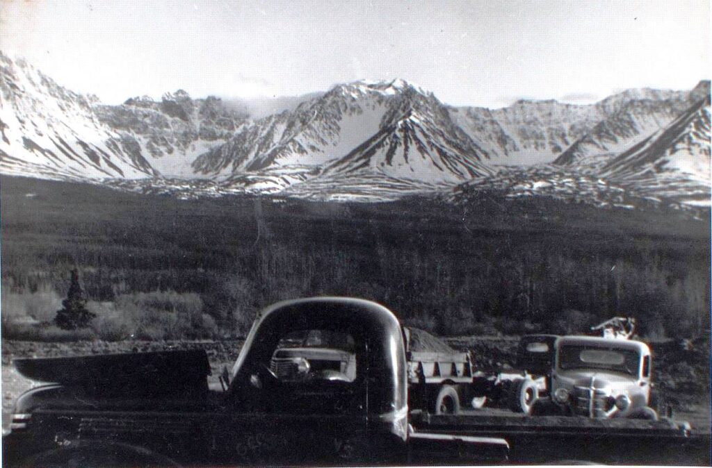
(Yukon Archives, Glen F. Chapman fonds, Acc. 2013/121, #152 – image has been cropped)
The Kluane Wagon Road of 1904 in the southwest Yukon provided a path for the ‘pioneer road’ construction in 1942 and its upgrade to the Alaska Highway in 1943. This path was through the future site of Haines Junction, but that fact alone did not determine that a town would grow at this location.
A potential place for development was where the Haines Road, also built in 1943, would connect with the Alaska Highway, but where this connection would be was in question for many months during that year. It would take a couple of hastily-made highway routing decisions to determine where this junction and the community that was to follow would finally be located.
The Pioneer Road (1942)
The Alaska Highway was initially called the Alcan Military Highway, and “in 1942 the objective was to force through the wilderness with some sort of a passable trail during the short road-building season”. This was deemed necessary to get military vehicles through to Alaska as quickly as possible, but also to provide follow-up highway construction forces with an access for staging out their equipment and materials along the length of the road. This first phase of construction, known as the pioneer road, began in early March 1942, with haste as the driving force.
The pioneer road was built by seven regiments of the United States Army Corps of Engineers along with 47 road contractors working under the US Public Roads Administration (PRA). In monetary terms, these agencies contributed an equal effort to the building of the pioneer road with expenditures of about $9.5 Million each.
The US Army’s Eighteenth Engineers Regiment, consisting of over 1,500 men, was assigned the road-building task in the southwest Yukon, from Whitehorse to the Alaska border north of Beaver Creek. The Regiment consisted of six companies, each broken into three platoons that carried out the construction work, with an additional platoon for support functions such as administration, medical, mapping, and mechanical work.
Unlike most other areas that the pioneer road was to be built through, the Eighteenth Engineers were not going into a roadless wilderness, at least for the first 150 miles or so. They would begin their work by following and fixing roads that had seen automobile traffic for the previous 20 years and horse and wagon use for 20 years before that.
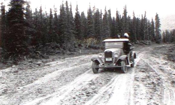
(Yukon Archives, Robert Cartter fonds, Acc. 82/281R, #1509 – image has been cropped)
In early April 1942 the regiment headed northwesterly from Whitehorse following the Whitehorse-Dawson Overland Trail, which had been built in 1902, and then at about the 32-mile mark branched off onto the Kluane Wagon Road of 1904. Fred Rust, the regimental historian for the Eighteenth, said that “the old wagon trail to Kluane provided a valuable access road for the group moving into new territory. It was two ruts to nowhere and a damned hard thing to ride over, but it served our purpose well”.
The companies were assigned a five to 15 mile section of road, which they built at an average rate of 2½ miles per day, and on completion they would leap-frog past the others to a new section further along. At any one time the regiment was working out of 10 to 15 camps spread out over 100 miles. They built camps and bivouacs (short-term camps) at sites such as Marshall Creek, Bear Creek, and a spot two miles east of the future Haines Junction, but no camps were put up at what would become the site of Haines Junction.
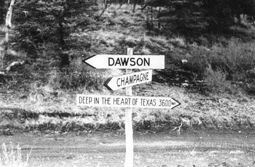
(Yukon Archives, Robert Cartter fonds, Acc. 82/281R, #1506 – image has been cropped)
Rust wrote that the southwest Yukon was “like building a road in any rolling, wooded country with streams, [and] just enough trouble spots to broaden our experience without overwhelming our innocence”. He described their experience with permafrost this way: “small muddy spots … in otherwise perfectly dry road … developed from below, from the slow thaw of sub-surface frozen ground [and] long stretches of dry road slowly [turned] to mud under the summer sun”. He remarked that mud in other parts of the world is caused by rain, but in the Yukon it is produced by sunshine.
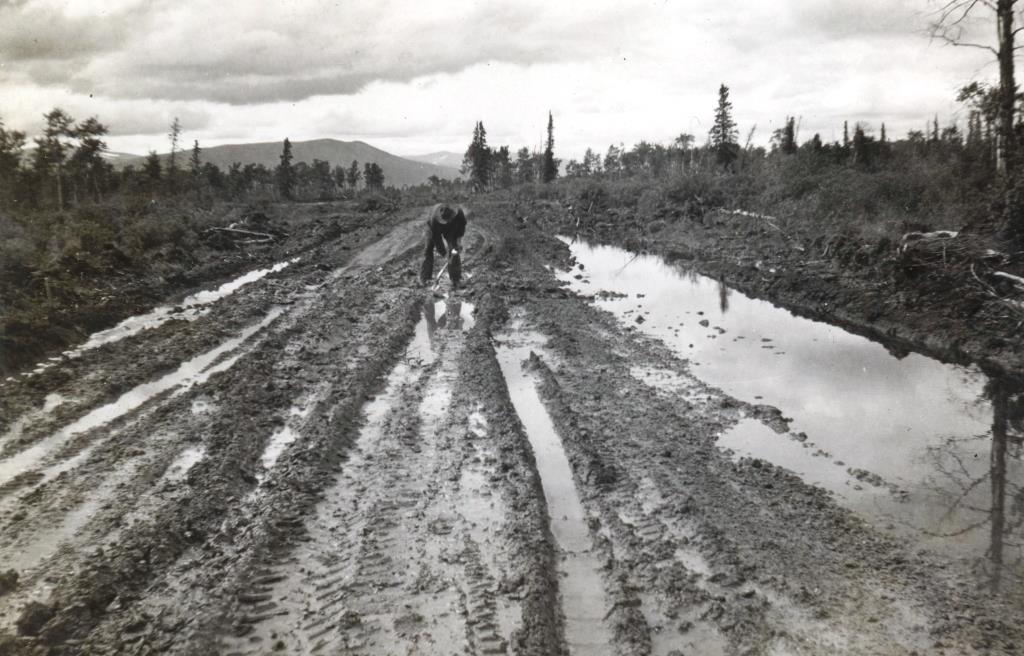
(Collection of Ian McPherson, US Army soldier from Michigan with 18th Engineers Regiment, #082)
Fred Rust said that the pioneer road “followed the line of least resistance and … had many curves [because] … it was faster to build around a hill than through it”. The bridges were temporary and made of local materials, with “not a piece of manufactured lumber [in] these structures” and built with “axes, saws and sledges, picks, shovels and muscle”.
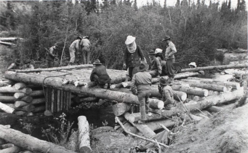
(Yukon Archives, Robert Hays collection, Acc. 82/305, #5702 – image has been cropped)
When the US Army began building the pioneer road, the US Public Roads Administration (PRA) became involved as well. Its initial role included laying out the road alignment ahead of the Army construction crews, and for that work they set up 16-man camps for themselves as they went. One of these was six miles to the northwest of the future Haines Junction site at Bear Creek, where they could enjoy the comfortable accommodation and home cooking at Dorothy Mackintosh’s roadhouse and trading post. (see link to related Mackintosh Trading Post article at end)
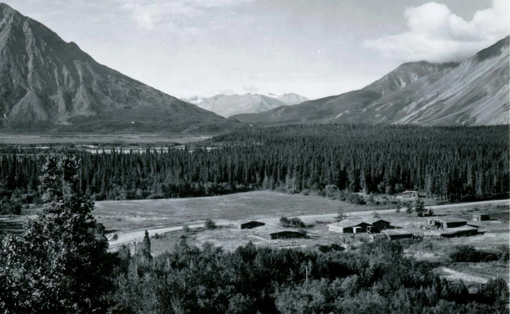
(National Archives & Records Administration, #44-859-A)
The PRA also established larger camps in preparation for its own contractor crews that would be following to improve the pioneer road to a higher standard. Camps such as this were built at Canyon Creek and Silver City, but not at the future site of Haines Junction, meaning that neither the Army Engineers nor the PRA selected this spot for a camp during the construction of the pioneer road.
The 1,422-mile pioneer road was completed in less than nine months and it was officially opened on November 20, 1942 in a ceremony at Soldiers Summit near the south end of Kluane Lake. The rough standard that resulted was passable only by four- and six-wheel drive military vehicles, and it took at least two weeks to travel from Dawson Creek to Whitehorse. The conclusion of a post-war US House of Representatives Committee looking back at the Alaska Highway construction was that “the pioneer roadway was of great assistance … and the Alaska Highway could not have been completed in 1943 but for the work done on the pioneer road”.
The Alaska Highway (1943)
1942 was the year of the pioneer road, and 1943 was the year it became the Alaska Highway. As the pioneer road was being pushed through, the Public Roads Administration was following it up using 77 civilian Canadian and American contractors with almost 16,000 employees to transform it into an all-weather, gravelled highway.
The PRA work was divided into six construction sections that each had a management contractor overseeing other contractors. One of these segments, called Section B, spanned 308 miles from Whitehorse to the Yukon-Alaska border, with the Dowell Construction Company of Seattle as the primary management contractor. Each section had its own mileage system, and Whitehorse was mile 0 for Section B.
A company called Haas-Royce-Johnson from San Francisco was the contractor assigned a 27-mile stretch of Section B that began at about Mile 96, 12 miles east of present-day Haines Junction. The company widened, graded and gravelled the pioneer road as it angled down toward and along the Dezadeash River to present-day Haines Junction. This part of the road, however, would be abandoned within the year.
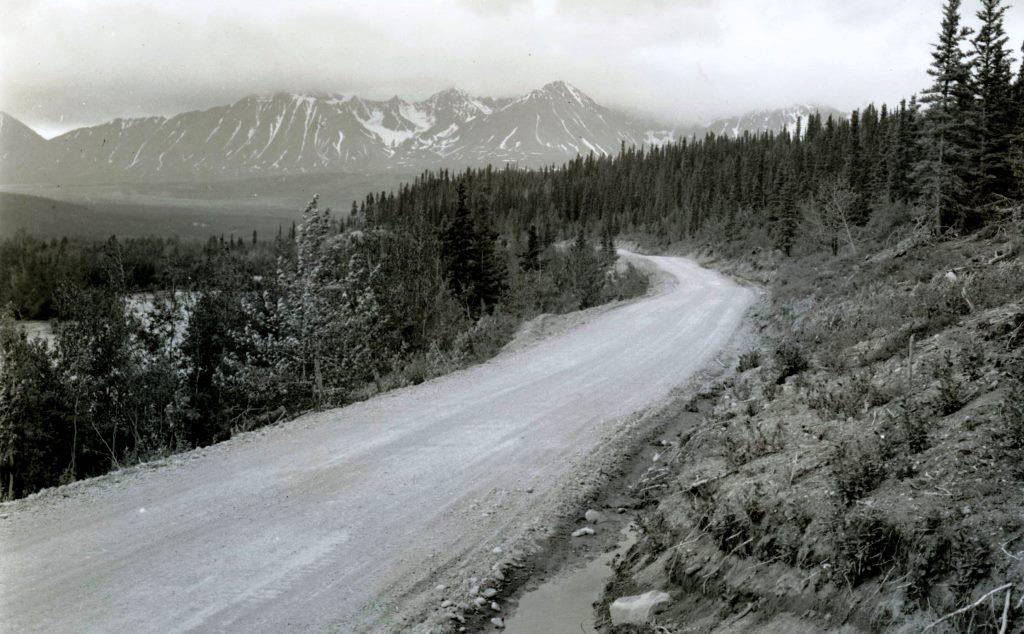
(National Archives & Records Administration, #44-0496)
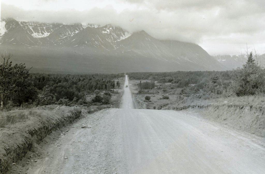
(National Archives & Records Administration, #44-0500)
Upgrading of the pioneer road by the Public Roads Administration carried on for most of the remainder of 1943, and it was officially named the ‘Alaska Highway’ on July 16, 1943. There was no grand opening of the Alaska Highway as there had been for the pioneer road the previous November.
The US House of Representatives Committee on Roads Interim Report on the Alaska Highway in March 1946 gave six conclusions, most of them negative. The only positive conclusion was the first one, that “the breaking through of the pioneer road (Alcan Highway) was an outstanding and praiseworthy performance”. The remaining five were not complimentary, and the final recommendations were for changes in leadership for whatever ongoing role the US government would have in connection with the Alaska Highway.
The Haines Road (1943)
At the same time the pioneer road to Alaska was being transformed into an all-weather highway, a connecting road from Haines, Alaska was also being built. This undertaking is not well known as a part of the overall Alaska Highway project, but the Haines Road played a role in the war effort and was an unplanned contributor to the founding of Haines Junction.
In the latter part of 1942 as the pioneer road was being completed, difficulties were brewing in the transport of equipment and supplies into the Yukon. It was all being handled by the White Pass & Yukon Route railroad from Skagway, Alaska to Whitehorse, but it was being overtaxed and creating a delivery bottleneck. This situation was affecting not only the highway construction project, but also Yukon people and businesses that depended on the railway for provisions and supplies.
The best solution to this problem was determined to be a road from the seaport at Haines, Alaska to connect with the pioneer road, soon to be called the Alaska Highway. This decision led to construction of a road and development of a town, both containing the Haines name. This name originated from Francina Haines, who was Secretary of an American church women’s society that funded the establishment of a Presbyterian mission and school in 1881 at what is now Haines.
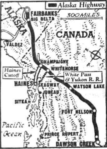
On October 29, 1942 a directive was issued to the Public Roads Administration “to construct a two-way road … from Haines, Alaska to Champagne, Yukon or some point west of Champagne where a satisfactory line intersects the Alcan Highway”. It was termed a ‘feeder road’ to the Alaska Highway, but was to be built to the same standard. The order specified that work was to start from each end, and as quickly as possible.
It is evident that when this directive was issued, possible routes for the road had not been studied and an assumption made that it could follow the old Tlingit trading trail north from Haines. Known more widely by then as the ‘Dalton Trail’, it intersected the pioneer road at the settlement of Champagne, established as a trading post in 1902 by Harry and Annie Chambers. It is interesting to speculate how the history of settlement and development in the southwest Yukon would be different if the ‘Haines-Champagne Cut-off’, as it was called for a short time, had actually been constructed.
(Chicago Tribune, September 17, 1946)
The planned road had a number of names for a while, most using the word ‘cut-off’. The ‘Haines Cut-off Road’ ended up being a name that stuck until the end of the 1970s, although long before then local people were calling it simply the ‘Haines Road’, and still are.
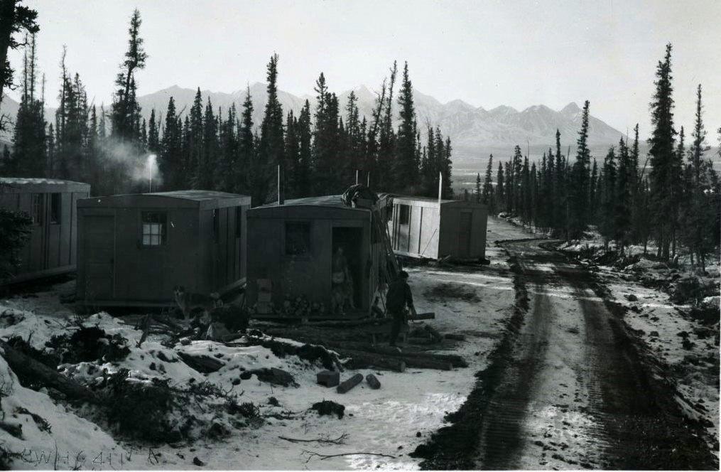
By early December 1942 there were three Public Roads Administration survey parties laying out the Haines Road route, one from each end and one in the Chilkat Pass area. Their reconnaissance surveys and perhaps some local knowledge soon showed that the terrain and route direction favored joining onto the pioneer road 42 road miles west of Champagne at Mile 108 from Whitehorse.
(National Archives & Records Administration, #43-1492)
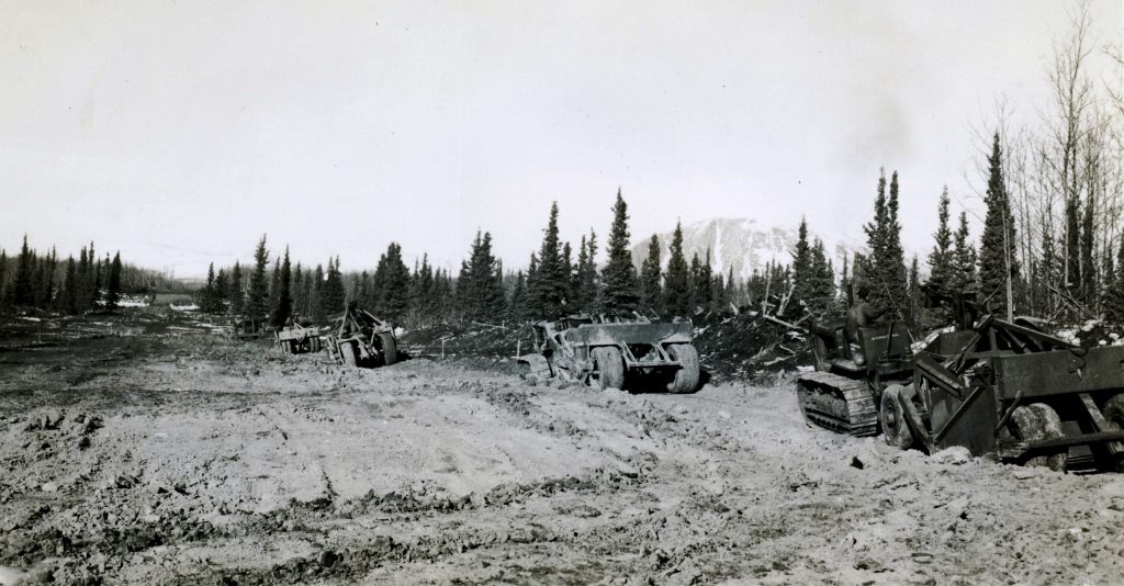
Similar to the Alaska Highway, a ‘pioneer trail’ was first built by the US Army Corps of Engineers, with the addition of PRA contractors taken from the Alaska Highway project to build bridges and perform grading work. The plan was to have the PRA personnel replaced early in 1943 by a new project management team with its own force of 2,000 employees. However, when it began to look like the Haines Road might not be completed during the 1943 season, it was given priority over the Alaska Highway and the PRA crews were directed to continue working on it before being returned to Alaska Highway work in the spring.
(National Archives & Records Administration, #43-1496)
By early May 1943 the roadwork from the north end had proceeded about 45 miles to south of Klukshu village, although it was not passable by highway vehicles. The final route beyond that point had not been marked out, so local First Nations men Dick Fraser, Oliver Jim and Dave Hume were hired as guides and packers to assist in finding and blazing the route southwards. This work on horseback took them until mid-June, when after 70 miles of route locating they linked up with the line that had been marked out from the Haines end.
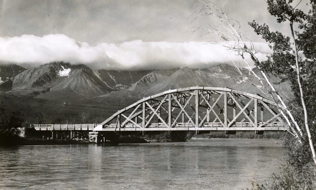
At the end of November 1943, the Haines Road met its targeted completion date as an all-weather gravelled highway connecting the coast with the Alaska Highway. The last link of this connection was forged by a new trestle bridge over the Dezadeash River at the site on the pioneer road (by then called the Alaska Highway) that was known as Mile 108.
Looking back at the building of the Haines Road, the US House of Representatives Committee’s review of the Alaska Highway construction said this: “the importance of the Haines lateral road as a feeder road to carry supplies to the Alaska Highway project, taking the load off the already overstrained White Pass & Yukon Route, cannot be overstated”.
The above statement appears to be meant to justify the hurried implementation of the Haines Road project. Following its completion, the road was not kept open that winter due to landslides and heavy snow, and neither was there a need for it because incoming freight was greatly reduced as the Alaska Highway construction was being completed. The road was used more for taking heavy equipment out than bringing anything in, and was not open to any other traffic. To this day the Haines Road has not met the expectations that were touted for it during its construction, and it remains a well-kept secret scenic drive with an expensive history.
Camp Mile 108 (1943)
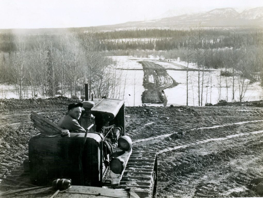
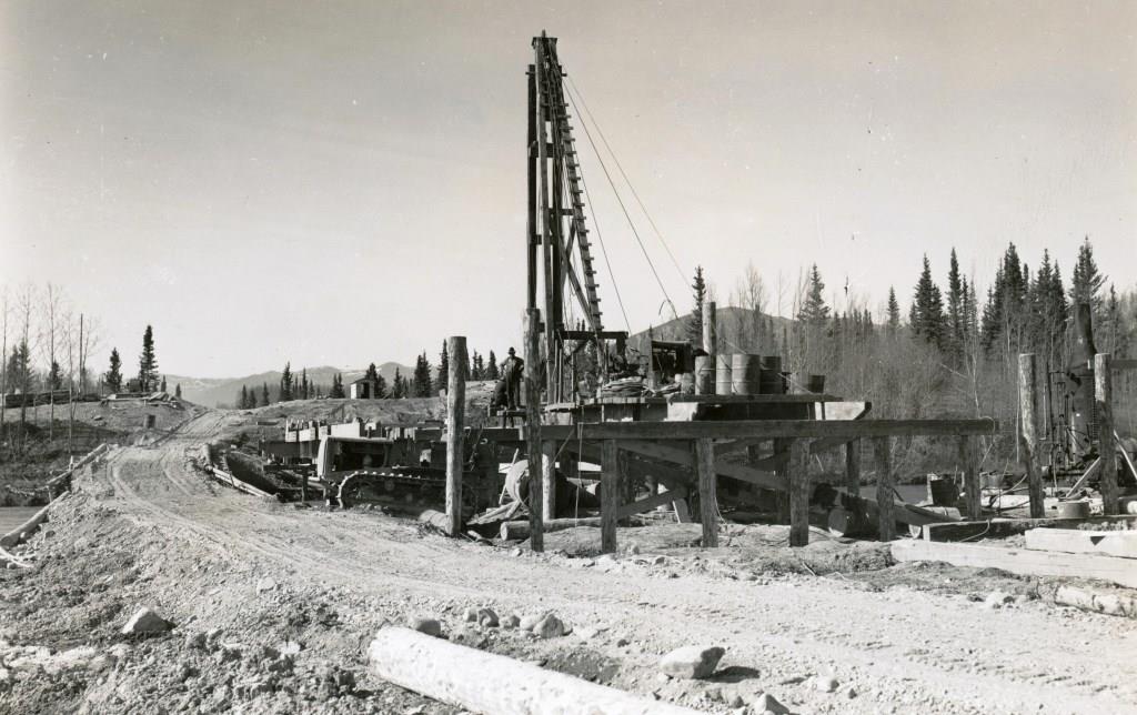
The decision about the routing of the Haines Road in late 1942 or early 1943 had determined that it would cross the Dezadeash River at Mile 108 of the pioneer road. Before the end of February 1943, a bridge site was already being prepared at this location.
(National Archives & Records Administration, # 43-1497)
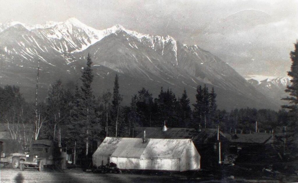
By May the bridge construction was well under way by the Angeles Gravel & Supply Company of Port Angeles, Washington. The decision to cross the Dezadeash River at Mile 108 would have led to the need for a camp at that point, particularly for the bridge workers. It is not known when Camp Mile 108 was established, only that it was sometime after January 1943 and on the north bank of the river near the bridge.
(National Archives & Records Administration, # 43-3933)
References to ‘Camp Mile 108’ (or Camp 108 or Mile 108) are few and photographs of it are even rarer. The photo below was taken in the summer of 1943 by Glen Chapman, a worker with the Dowell Construction Company, the management contractor for Section B. On the reverse of the photo is written “2:30 AM”, indicating it was taken sometime around the June 21 summer solstice.
(Yukon Archives, Glen F. Chapman fonds, Acc. 2013/121, #153 – image has been cropped)
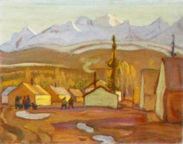
The establishment of this highway camp could rightly be called the beginning of Haines Junction, though at that time there was probably little thought of a town developing there. Camp Mile 108 is now a name long forgotten, but it is immortalized in a painting by the famous Group of Seven artist A.Y. Jackson, a unique record of a town’s beginning.
In October 1943 Jackson and another artist, Henry Glyde, were commissioned by the National Gallery of Canada to record the construction of the Alaska Highway in art form. One of A.Y. Jackson’s paintings from this trip is called Camp Mile 108, West of Whitehorse, a piece depicting a camp with a mountain backdrop that is easily recognizable as Haines Junction. (see link to related A.Y. Jackson & Haines Junction article at end)
(Gord Allison photo, 2020)
The site was called Camp Mile 108 when Jackson and Glyde visited in October 1943, but that name was nearing its end. Rerouting of sections of the highway between Whitehorse and Camp Mile 108 reduced the distance between these points to 98 miles, rendering the Mile 108 name irrelevant. While this name had come from the camp’s location on the pioneer road/Alaska Highway, the future name of the place would be derived instead from the Haines Road.
(National Archives & Records Administration, #43-3943)
The junction of the new Haines Road with the upgraded and newly-named Alaska Highway at Camp Mile 108 ended up determining the site of Haines Junction. This had not been the intent, however, as only a few months previously the plan was that the highway junction would be 3½ miles to the north at what locals have long called the ‘Pine Creek corner’ (or ‘Pine Lake corner’). This was because a new section of road called the ‘Bear Creek Cut-off’ was being constructed to provide a straighter route toward the northwest.
The Bear Creek Cut-off and Pine Creek Corner (1943)
The Alaska Highway runs more east-west through the Yukon than north-south, but there was a time when Haines Junction people and others living along the highway west of Whitehorse were said to be on the ‘North Highway’. This term, along with the similarly termed ‘South Highway’ east of Whitehorse, has faded away for the most part, perhaps to avoid confusion when the North and South Klondike Highways were named.
Looking from this North and South Alaska Highway perspective, an interesting quirk at Haines Junction is that to travel south on the highway, you drive north out of the community. Residents rarely or never give this a thought; it’s just the way the road goes.
(GeoYukon)
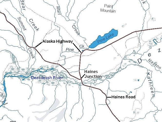
The above map view of this situation shows that while the Alaska Highway is generally oriented east-west through this area, it makes an awkward jog to the south to pass through Haines Junction. It also shows that the highway makes a sharp turn in the town, while the section of it that comes from Whitehorse is in a straight line with the Haines Road. For decades until the highway signage was substantially improved, many travellers bound for greater Alaska breezed through Haines Junction and found themselves heading down the Haines Road.
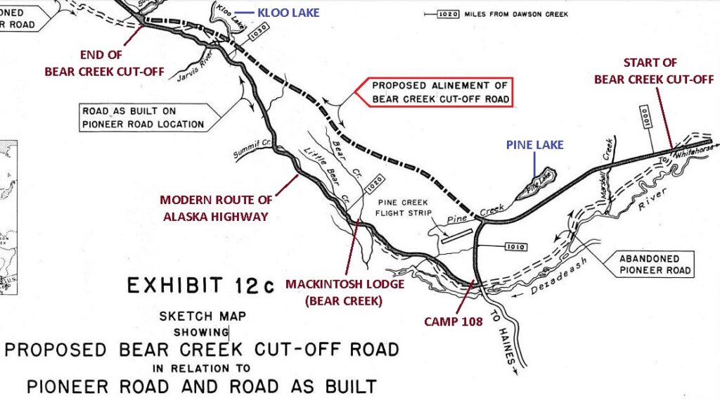
This routing oddity at Haines Junction is due to the abandonment of most of a planned section of Alaska Highway called the ‘Bear Creek Cut-off’. As early as August 1942, it was determined that the future path of the permanent highway through this area would be a few miles to the north of the pioneer road that ran through Camp Mile 108 and northwestward to the Kloo Lake area.
(US House of Representatives Report #1705 – Committee on Roads Interim Report on The Alaska Highway, 13 March 1946, Exhibit 12c)
The Bear Creek Cut-off if completed would have been almost 30 miles long and a more direct route than that of the pioneer road. The cut-off started at a point about 13 road miles east of Camp 108 near km. 1557 of the present highway and went west, paralleling Pine Lake and curving around its west end. It then headed northwest toward Kloo Lake to rejoin the existing road near there. This route would go around (north of) the Bear Creek drainage, rather than across the creek as the pioneer road did, presumably giving rise to its name.
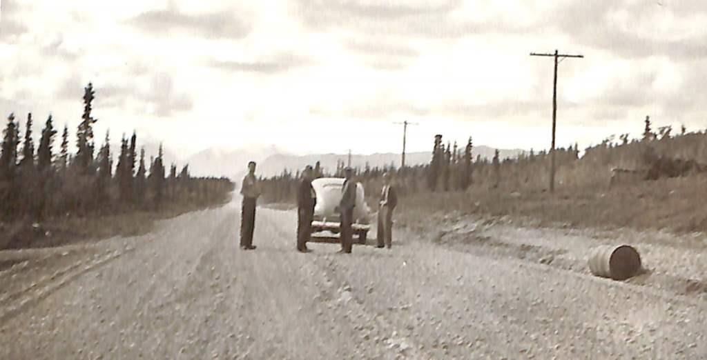
A photo taken on August 18, 1943 shows the cut-off road from its starting point east of Marshall Creek where it deviated from the pioneer road. The photo is labelled as “section of completed highway on Bear Creek Cut-off”, and while this section remained as part of the present highway, construction further along had already ceased, long before being completed to its planned end near Kloo Lake.
(National Archives & Records Administration, #43-3060)
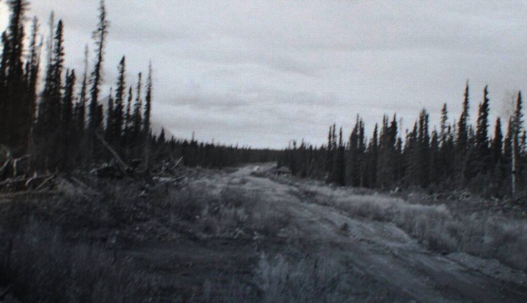
By early May of 1943 the cut-off construction had progressed at least 10 miles to the west end of Pine Lake. At this point it was bypassing Camp 108 by more than three miles and was swinging around Pine Lake to take a course toward the northwest.
(Yukon Archives, MacBride Museum collection, Acc. 82/59, #12 – image has been cropped)
A section of a 1948 air photo below shows a completed portion of the Bear Creek Cut-off with a beautifully engineered curve around the west end of Pine Lake, indicating it was intended to be the permanent highway. The road was planned to go for another 13 miles beyond the end of the road in the upper left of the photo.
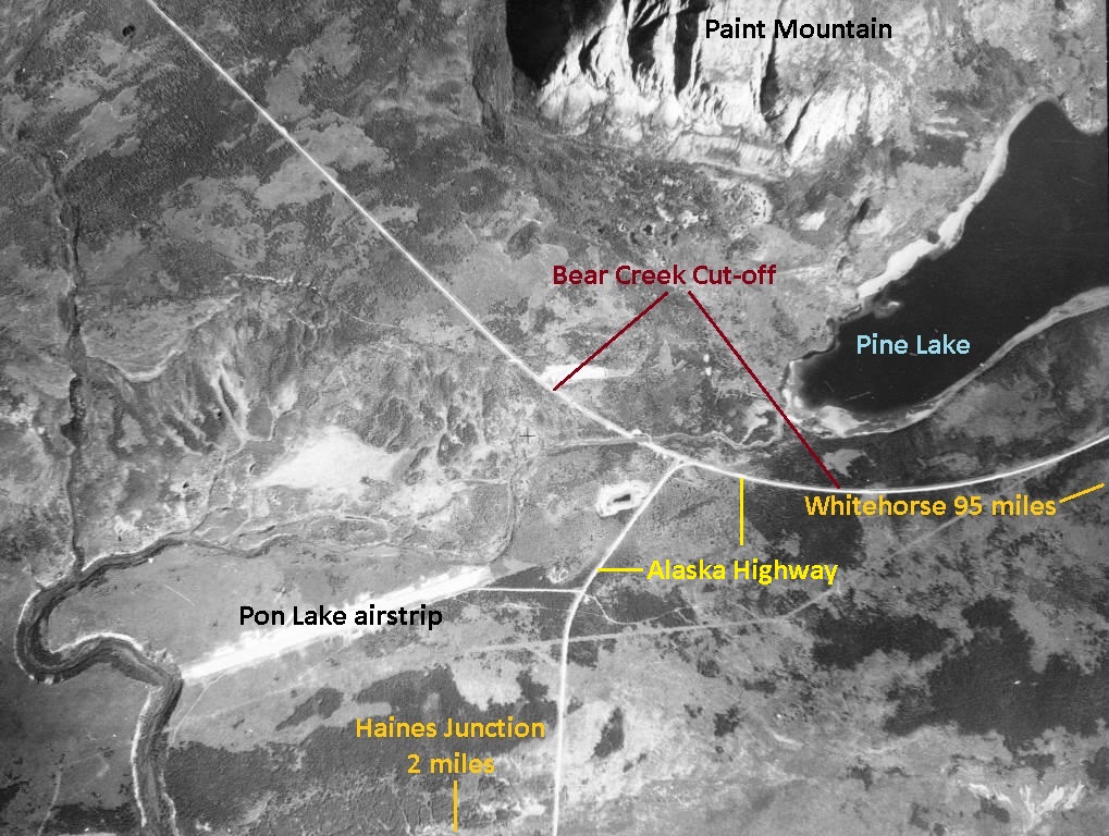
(National Air Photo Library, A11539, #64)
Photos taken on June 26, 1943 of equipment working on the cut-off construction west of Paint Mountain show that the road had advanced about 14 miles from its starting point, almost halfway to the planned end of it. Evidence that this road was a serious endeavor can still be seen in the large amounts of fill placed in some sections to build up the grade. However, construction ceased soon after this, having gone not much further other than clearing the vegetation ahead for about another mile and a half and some apparent exploratory wandering with a bulldozer for a few miles more.
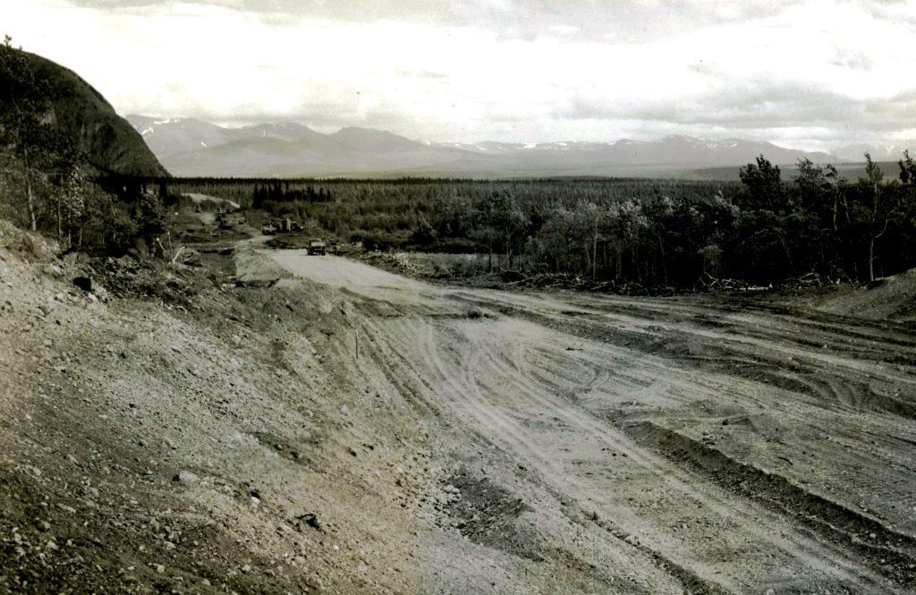
(National Archives & Records Administration, #44-0522)
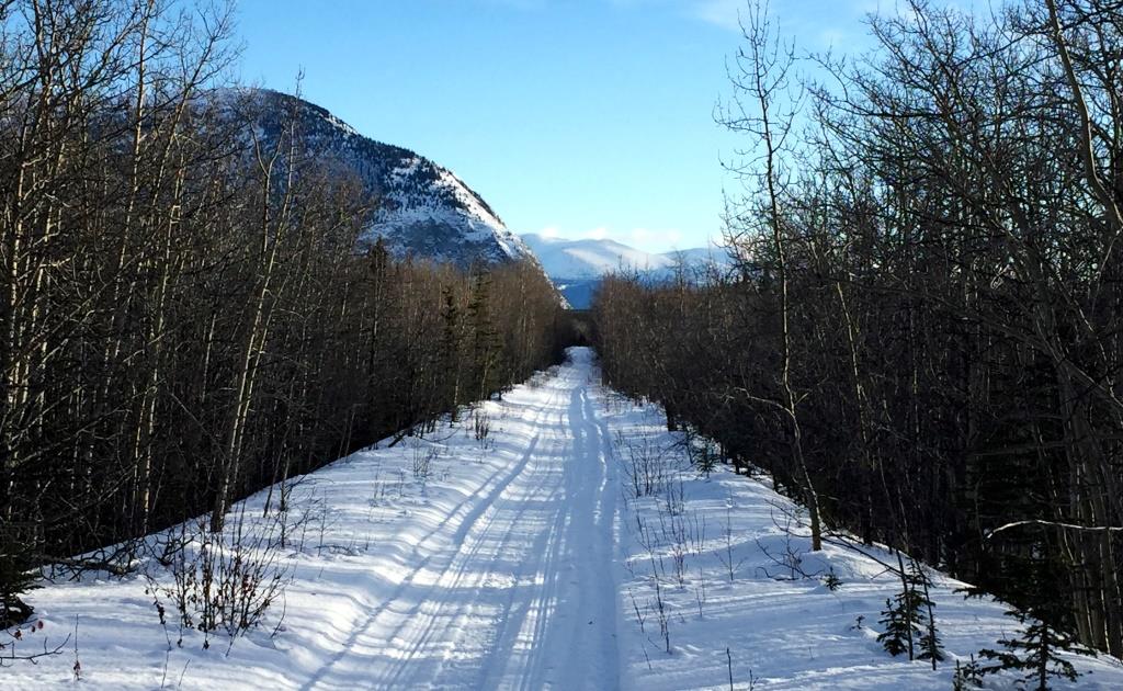
(Gord Allison photo)
At some point a 3½-mile piece of new road was built to connect the pioneer road at Camp 108 to the Bear Creek Cut-off road near the west end of Pine Lake. This likely occurred not long after the cut-off construction started to provide shorter access for workers and equipment to and from the camp. This connection created the relatively sharp ‘Pine Creek corner’, as it became known by locals and truckers, but it is now a much gentler corner than the original.
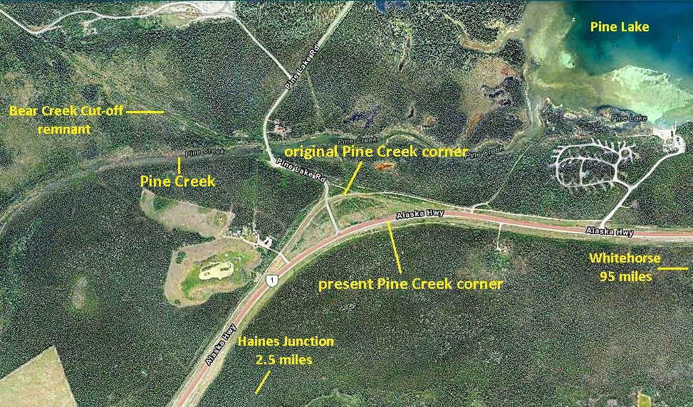
(Yukon Land Viewer)
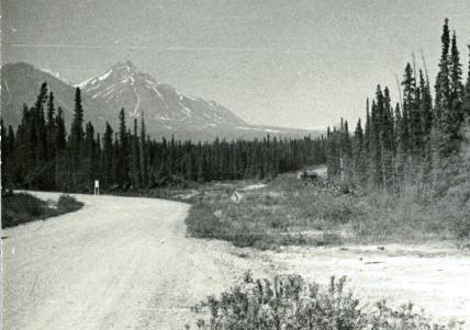
(The Robert S. Peabody Institute of Archaeology, Andover-Harvard Yukon Expedition, #2018.0.0549)
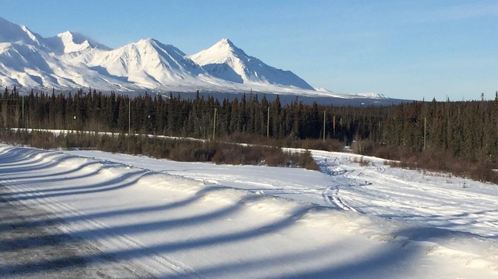
(Gord Allison photo)
For a short time at least, the Pine Creek corner was where the Haines Road was planned to end, and would therefore become the highway junction. In a Royal Canadian Mounted Police report from May 1943, a constable sent from Whitehorse to investigate a death near Dalton Post was driven to “Pine Creek, YT”, which was undoubtedly the Pine Creek corner. He then caught a ride on a US Army truck “four miles down the Haines Road” to an Army Engineers camp, which would have been Camp 108. This shows that for a few months in 1943, the section of highway from the Dezadeash River to Pine Creek was part of the Haines Road.
There is also mapped evidence that the planned terminus of the Haines Road was to be at the Bear Creek Cut-off. It is contained in an undated Public Roads Administration highway route map that shows the proposed route at the time the map was produced. The map has the Haines Road as staying on the east side of the Kathleen River, rather than crossing it near its outlet from Kathleen Lake as actually happened. It also shows the Haines Road crossing over the pioneer road before connecting to the Alaska Highway, rather than terminating at the pioneer road as it actually did. On the map this junction appears to be somewhere in the vicinity of Marshall Creek, which may account for it being indicated as 100 miles from Whitehorse rather than 108 miles.
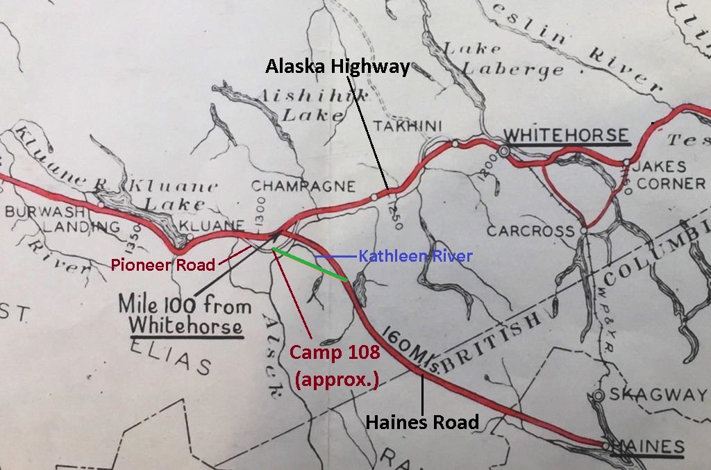
(Yukon Archives, Map H-1179, Alaska Highway Route Map)
This concept map would have been produced very early in the Haines Road planning process and was obsolete soon afterwards. The planned route shown for the northern end of the Haines Road did not come to fruition once the final routing was determined in late 1942 or very early 1943. By February 1943 the crossing of the Dezadeash River at Mile 108 was already being prepared for construction of a bridge. This location was probably chosen over the one shown on the map due to difficult terrain on the east side of the Kathleen River and/or lack of a suitable crossing point of the Dezadeash River in that area.
The Bear Creek Cut-off was planned to bypass Camp 108 as well as the long-established trading post, store and roadhouse run by Dorothy Mackintosh at Bear Creek, six miles to the west. This was a popular place amongst the highway workers and its bypassing may have given another meaning to the term ‘cut-off’.
The previous year Mrs. Mackintosh had not been keen on the idea of a new highway running past her door, but she evidently came to the realization that she would lose all her business if it was to miss her by several miles. She told a newspaper in July 1943 that she would “be worse off than I was before … because then I was on a [First Nations] trail, at least … but now [the First Nations people] won’t come here anymore”. It is not known if she voiced her objections to any authorities.
A letter dated April 18, 1944 in the Mackintosh land file at the Yukon Archives states that the Bear Creek Cut-off route had been abandoned by then, but includes no information about when and why this was done. Dorothy Mackintosh may have made her concerns known, but it is hard to imagine the American war road machine changing its plan back to the longer pioneer road route to appease her. A photo from August 14, 1943 shows a quarrying operation in a pit on the hill just above Dorothy’s place for highway construction work now being carried out past her door.
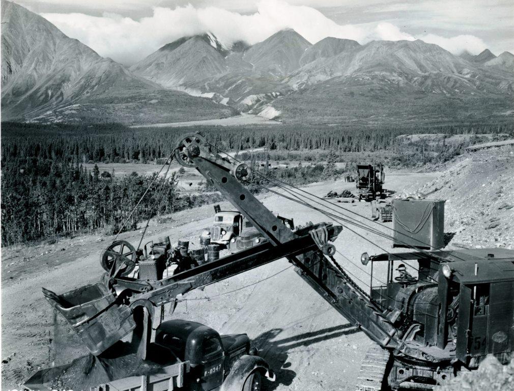
(National Archives & Records Administration, #44-0860)
I have not found details about the decision to abandon the Bear Creek Cut-off after the investment that had been put into it. Perhaps when the engineers studied the terrain ahead, they realized there would be a significant amount of wet country to deal with in the wide, flat valley bottom on the way to Kloo Lake. This reality combined with already having the upgraded pioneer road in place along higher, solid ground on the west side of the valley as a fallback may have contributed to the decision.
The only part of the Bear Creek Cut-off that became permanent is the 10-mile section from where it started and went west to the Pine Creek corner. The abandonment of the remainder resulted in the Haines Road junction with the Alaska Highway being where it is today, rather than where it might have ended up more than three miles north at the Pine Creek corner.
Other Related Projects in 1943
The Alaska Highway was the centerpiece project in the Yukon in the American response to the Japanese attacks in the Pacific, but other projects associated with it came to the Haines Junction area. In addition to the Haines Road, these included the Canol #4 pipeline, the highway telecommunications system, and a new airstrip, all of which were built near or paralleling the highway.
An American Army major-general, in being questioned about the costs of all these projects, explained and defended them this way: “[they] were forced by the war situation … and war projects cannot be compared to other projects undertaken during periods of normal activity. All the projects in [northwestern Canada and Alaska] … are interdependent and serve one common war effort”.
The Canol project was comprised of four components all or partially within the Yukon and referred to as Canol #1 through #4. Canol #1 was a huge and well-known project unto itself, consisting of the development of the following: the oilfield near Norman Wells, NT; the 499-mile Canol Road; a 577-mile crude oil pipeline from Norman Wells to Whitehorse; and a refinery at Whitehorse. Three distribution pipelines from Whitehorse called Canol #2, 3 and 4 were also constructed, with Canol #4 being a 3-inch line (inside diameter) that followed along the Alaska Highway for 596 miles to Fairbanks.
The Canol #4 pipeline was laid on top of the ground adjacent to the pioneer road/Alaska Highway in 1943 and came into the Haines Junction area along the south side of the road. It passed through where the center of the town would be in a few years, and a number of residences and other buildings now overlie where the pipe had been. The pipeline also had pumping stations, with the nearest ones to Haines Junction being located 17 miles to the east near Canyon Creek and 20 miles to the west near the Jarvis River. The line carried petroleum products to points along the Alaska Highway until the Canol project ceased operations in March 1945, less than a year after crude oil started flowing from Norman Wells.
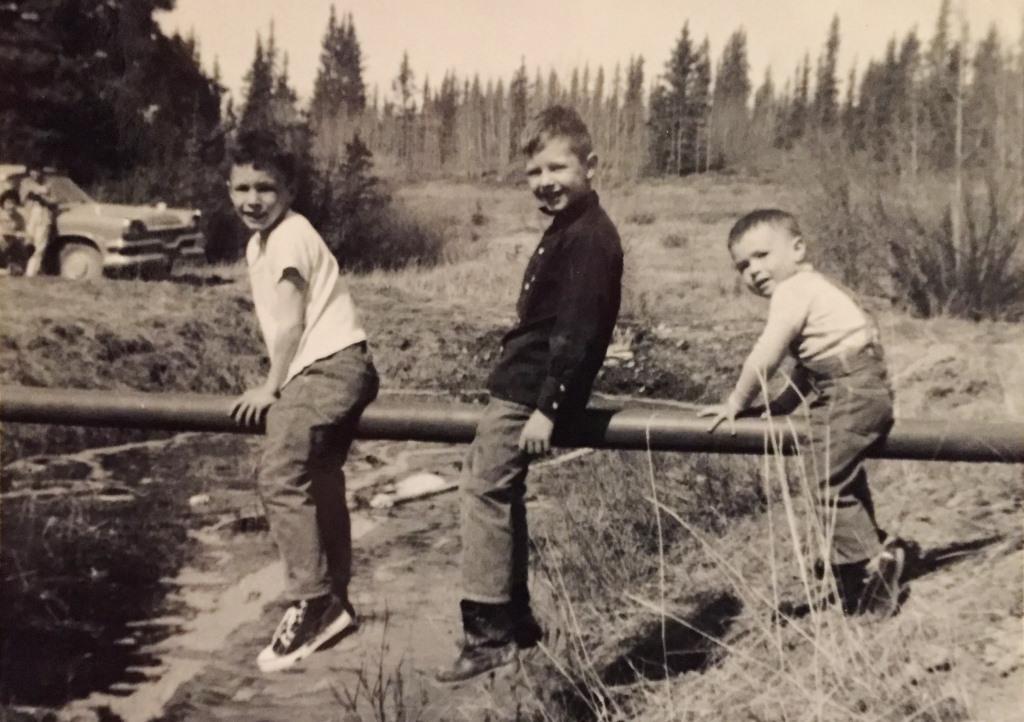
(Gord Allison collection)
A second project along the Alaska Highway that came through the highway junction area in the busy summer of 1943 was the Northwest Communication System (NCS), an inland communication link to Alaska. Built in 11 months from Edmonton to Fairbanks, it involved the installation of 95,000 telephone poles and more than 14,000 miles of wires, “the longest open-wire communications line in the world”. The line was generally built close beside the highway, but took shortcuts through the bush where feasible, requiring a new path to be cleared. This was the situation near the highway junction, where the line passed by about 2½ miles to the north and a spur line was put in to Camp 108.
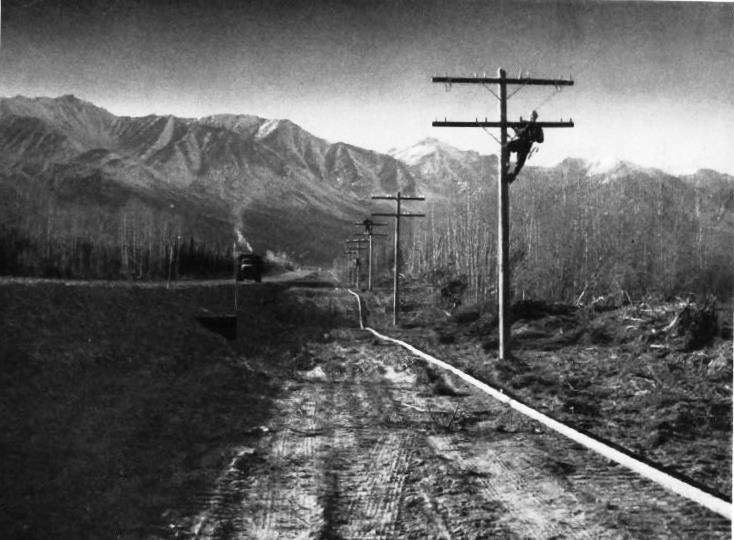
(Canol – The Sub-Arctic Pipeline and Refinery Project 1942-1944 by Richard Finnie, 1945, p. 87)
The telecommunications system had a series of repeater stations at approximately 100-mile intervals to boost the communication signal. These were also known as booster or relay stations and the nearest one was at Canyon Creek, 20 miles to the east. This station along with the First Nation settlement there and the Canyon Creek Lodge that was soon established became part of the greater Haines Junction community.
Another project associated with the Alaska Highway was a series of small local airstrips constructed in 1943 at points between the larger airfields of the Northwest Staging Route. Known as intermediate or emergency landing strips, they were built to provide safety and support for aircraft along the flight corridor to Alaska. One of these airstrips, now the Haines Junction airport, was built in the fall of 1943 at a location three miles north of Camp 108 and west of Pine Lake. The strip was called Pon Lake, the origin of this name not known, but perhaps to distinguish it from a Pine Lake airstrip that was along the highway between Teslin and Watson Lake.
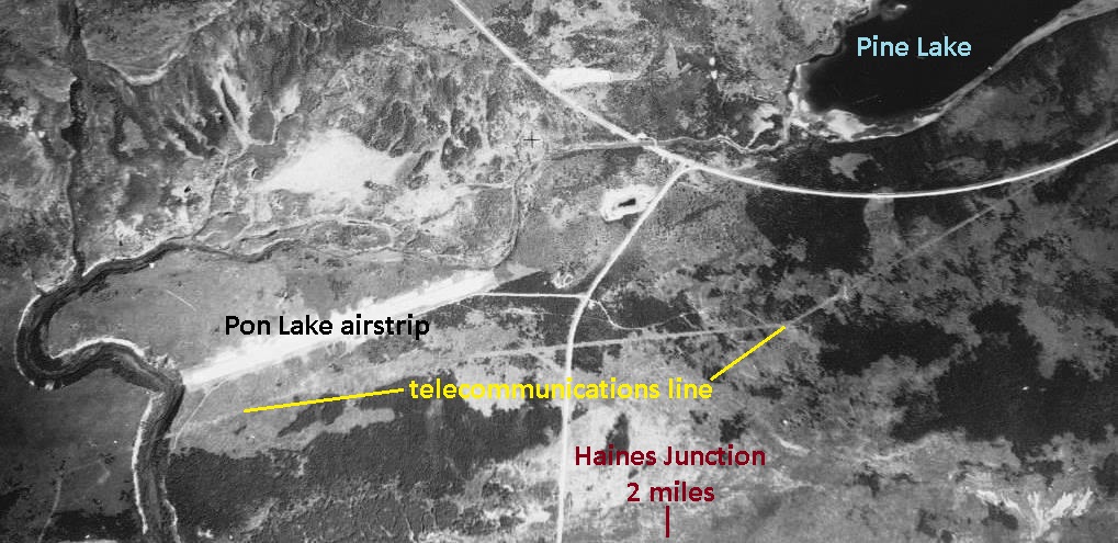
(National Air Photo Library, A11539, #64)
Summary
The spot along the Dezadeash River on the pioneer road of 1942 that was to become Haines Junction was never chosen as a site for a camp during the road construction. It only became one because of two decisions, to bridge the river at that point and to abandon the Bear Creek Cut-off route that had been partially completed. These had the effect of the Camp Mile 108 location becoming the highway junction and a permanent camp at an attractive site for future development.
It is interesting to consider what might have transpired at a highway junction near Pine Lake if the Bear Creek Cut-off had been completed. A settlement probably would have grown there, with some advantages such as higher land and proximity to the recreational values that Pine Lake, Pine Creek and Paint Mountain have to offer. The mountain views would be equally spectacular, a little more distant but broader in scope, and there would be more winter sunshine. What would be missing from this location, though, is the feeling of coming around the last corner near the airport and the familiar mountain panorama opens up to welcome you home.
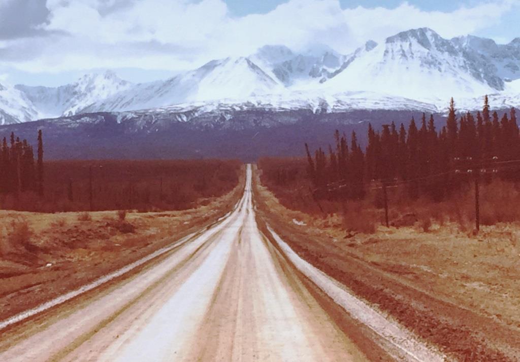
(Gord Allison photo)
Link to Part 3: The Beginning of Haines Junction
Link to related article: Mackintosh Trading Post
Link to related article: A.Y. Jackson and Haines Junction
This is an amazing account Gord. I can only imagine how many historical events re-live themselves in the theatre of your mind as you travel the roads & trails of Kluane. Thank you for sharing the wealth of your knowledge and research, making it come alive in my imagination.
Very nice comment, Elaine, thank you for taking the time. I’m glad you get something out of these stories. Researching and learning more about these things fires my imagination too.